A hands-on lab to explore Superfund, Toxics Release Inventory and TOXMAP online …
A hands-on lab to explore Superfund, Toxics Release Inventory and TOXMAP online data to examine geographies of hazardous waste, toxic releases into the environment and their connections with socio-economic, environmental and health impacts. The lab includes directed and self-directed components.
(Note: this resource was added to OER Commons as part of a batch upload of over 2,200 records. If you notice an issue with the quality of the metadata, please let us know by using the 'report' button and we will flag it for consideration.)
This is a great activity for class sizes ranging from small seminars …
This is a great activity for class sizes ranging from small seminars to lecture classes. It's particularly appropriate for courses that relate hazards/volcanism to culture, society, and human interest subjects like risk management. I designed it for a Volcanoes and Society class.
(Note: this resource was added to OER Commons as part of a batch upload of over 2,200 records. If you notice an issue with the quality of the metadata, please let us know by using the 'report' button and we will flag it for consideration.)
Students are asked to respond in a way they choose (as a …
Students are asked to respond in a way they choose (as a class) to a geologic or weather related hazard. They begin with a study of the event, its causes and local effects. They then research the needs of the people affected. They research charities that serve the population affected. They choose a response (again, as a class). They educate the campus community about the geology/geography of the event, the needs and solicit donations.
(Note: this resource was added to OER Commons as part of a batch upload of over 2,200 records. If you notice an issue with the quality of the metadata, please let us know by using the 'report' button and we will flag it for consideration.)
In this activity, students investigate data from Hurricane Ivan, the September 2004 …
In this activity, students investigate data from Hurricane Ivan, the September 2004 storm that devastated the Caribbean Islands and the Alabama Gulf Coast before looping across Florida and back into the Gulf of Mexico, where it regenerated into a new storm system. They will analyze data on the storm's location, windspeed, and barometric pressure, develop study questions, and map the hurricane's position at selected intervals.
The EERC at the University of Bristol has developed an Earthquake Engineering …
The EERC at the University of Bristol has developed an Earthquake Engineering Competition that challenges secondary school students to design and make small scale models of buildings that can withstand strong earthquakes. Provided on the website are tips for model design and construction, load testing advice, and a gallery of models organized by various characteristics.
Students continue their introduction to Excel by building spreadsheets that estimate the …
Students continue their introduction to Excel by building spreadsheets that estimate the risk of a major earthquake along the Cascadia Subduction Zone to Benton County, Oregon.
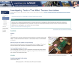
Learners modify elements of a tsunami wave tank to investigate the affect …
Learners modify elements of a tsunami wave tank to investigate the affect that near-coast bathymetry (submarine topography) and coastal landforms have on how far a tsunami can travel inland. Damaging tsunami are most commonly produced by subduction zone earthquakes, such as those that occur in Alaska.
(Note: this resource was added to OER Commons as part of a batch upload of over 2,200 records. If you notice an issue with the quality of the metadata, please let us know by using the 'report' button and we will flag it for consideration.)
Bonnie Magura (Portland Public Schools), Roger Groom (Mt Tabor Middle School), and CEETEP (Cascadia EarthScope Earthquake and Tsunami Education Program)
Students learn about the weighted mean by building spreadsheets that apply this …
Students learn about the weighted mean by building spreadsheets that apply this concept to the average density of the oceanic lithosphere.
(Note: this resource was added to OER Commons as part of a batch upload of over 2,200 records. If you notice an issue with the quality of the metadata, please let us know by using the 'report' button and we will flag it for consideration.)
Freshmen enrolled in the Spaceship Earth Living Learning Community conduct research on …
Freshmen enrolled in the Spaceship Earth Living Learning Community conduct research on a real project that is formulated and conducted during a 2-semester academic year.
(Note: this resource was added to OER Commons as part of a batch upload of over 2,200 records. If you notice an issue with the quality of the metadata, please let us know by using the 'report' button and we will flag it for consideration.)
This activity introduces students to the interdisciplinary field of geoarchaeology through a …
This activity introduces students to the interdisciplinary field of geoarchaeology through a case study of the eruption of Mt. Vesuvius in 79 CE. It combines short lectures with questions requiring analyses of a variety of data sets relating to volcanic hazards. It requires no background in geoscience or archaeology and is aimed at students from both the physical sciences and the humanities, from high school through freshman year.
(Note: this resource was added to OER Commons as part of a batch upload of over 2,200 records. If you notice an issue with the quality of the metadata, please let us know by using the 'report' button and we will flag it for consideration.)
Many people live in regions prone to earthquakes, tsunamis and volcanic eruptions, …
Many people live in regions prone to earthquakes, tsunamis and volcanic eruptions, but the hazards and risks inherent in our communities may be very different. Making connections with learners from another location is a great way to share knowledge and practice science communication skills. Video conferencing applications like Zoom and Skype make it possible to connect with learners anywhere in the world. This activity provides a simple protocol, and a form for submitting a request to connect with a classroom teacher in Anchorage, Alaska.
(Note: this resource was added to OER Commons as part of a batch upload of over 2,200 records. If you notice an issue with the quality of the metadata, please let us know by using the 'report' button and we will flag it for consideration.)
This lesson teaches middle and high school students to understand the architecture …
This lesson teaches middle and high school students to understand the architecture of GPS -- from satellites to research quality stations on the ground. This is done with physical models and a presentation. Then students learn to interpret data for the station's position through time ("time series plots"). Students represent time series data as velocity vectors and add the vectors to create a total horizontal velocity vector. They apply their skills to discover that the Mid-Atlantic Ridge is rifting Iceland. They cement and expand their understanding of GPS data with an abstraction using cars and maps. Finally, they explore GPS vectors in the context of global plate tectonics.
(Note: this resource was added to OER Commons as part of a batch upload of over 2,200 records. If you notice an issue with the quality of the metadata, please let us know by using the 'report' button and we will flag it for consideration.)
This activity spans two in-class sessions of 1-1.5 hours each, and includes …
This activity spans two in-class sessions of 1-1.5 hours each, and includes both a small group activity focused on a set of volcanic case studies and a full-class role-playing activity where the class must decide, as a fictional town, how to respond to a nearby volcano exhibiting increased activity.
(Note: this resource was added to OER Commons as part of a batch upload of over 2,200 records. If you notice an issue with the quality of the metadata, please let us know by using the 'report' button and we will flag it for consideration.)
This video segment adapted from NOVA relates the dramatic story of vulcanologists …
This video segment adapted from NOVA relates the dramatic story of vulcanologists trying to predict the timing of the cataclysmic eruption of Mount Pinatubo in the Philippines.
In this lesson, students will be amateur mycologists--collecting and analyzing various mushrooms. …
In this lesson, students will be amateur mycologists--collecting and analyzing various mushrooms. Through observation and discussion, students will gain knowledge of the basic anatomy of mushrooms, their life cycle, and their method of reproduction through spores. Students will learn to create spore prints of mushrooms and label and preserve their spore prints, just like a mycologist. Students also will learn that by comparing spore prints, they can identify different mushroom species.
Students characterize how climate change impacts natural hazards and pose research-based solutions …
Students characterize how climate change impacts natural hazards and pose research-based solutions to the county Emergency Management Agency. Presentations require the use of local data, created figures, and reliable sources. This activity builds from an assignment which has students identify and describe projected local climate trends using the USGS National Climate Change Viewer followed by Unit 1 and 2 of the Map Your Hazards InTeGrate Module.
(Note: this resource was added to OER Commons as part of a batch upload of over 2,200 records. If you notice an issue with the quality of the metadata, please let us know by using the 'report' button and we will flag it for consideration.)
No restrictions on your remixing, redistributing, or making derivative works. Give credit to the author, as required.
Your remixing, redistributing, or making derivatives works comes with some restrictions, including how it is shared.
Your redistributing comes with some restrictions. Do not remix or make derivative works.
Most restrictive license type. Prohibits most uses, sharing, and any changes.
Copyrighted materials, available under Fair Use and the TEACH Act for US-based educators, or other custom arrangements. Go to the resource provider to see their individual restrictions.