Several new content pieces invite you to do hands-on work with web …
Several new content pieces invite you to do hands-on work with web GIS technology:
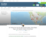
[1] 10 Things you can do with ArcGIS Online in education. These include: (1) Use web mapping applications. (2) Make your own map. (3) Get a school, club, or university organizational account in ArcGIS Online. (4) Use and modify existing curricular resources. (5) Explore the Living Atlas of the World. (6) Modify and ask questions of maps. (7) Conduct spatial analysis on mapped data. (8) Add multimedia to maps. (9) Explore your world in 3D, and (10) Map and analyze field-collected data.
[2] Introduction and Advanced Work with Story Maps: Slides and hands-on exercises. These include how to build a story map from a web map, and how to build map tours, map journals, swipe, series, and other types of story maps.
[3] Teaching with Web Apps. Set of resources and activities. These include examining Pacific typhoons in 3D, demographics of Zip Codes, creating viewsheds and buffers, and much more.
[4] Spatial Analysis in Human Geography. These include the 1854 cholera epidemic in London (activity), a Boulder County hazards analysis (map), and an examination of the Human Development Index around the world (map).
I created this content for the Esri mapping lab for the 2017 National Conference on Geography Education, but it can also be used to support your own professional development or for your own instruction.
Twelve Stones portrays the heart of Heifer's work - Passing on the …
Twelve Stones portrays the heart of Heifer's work - Passing on the Gift ÂŽ - and shows the transformation of a community of women in Nepal from helplessness to hope through Heifer International. This is a preview clip of a documentary produced by Sandy Smolen.
This page from the Volcano World website contains a summary account of …
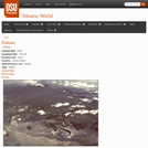
This page from the Volcano World website contains a summary account of the 1959 eruption at Kilauea Iki which is illustrated by photographs and videos.
This video adapted from the Valdez Museum & Historical Archive, explores what …
This video adapted from the Valdez Museum & Historical Archive, explores what happened during the Great Alaska Earthquake of 1964 through original footage, first-person accounts, and animations illustrating plate tectonics.
An exercise on the effects of flooding that took place in the …
An exercise on the effects of flooding that took place in the upper Mississippi River drainage basin in 1993, using before and after satellite images.
(Note: this resource was added to OER Commons as part of a batch upload of over 2,200 records. If you notice an issue with the quality of the metadata, please let us know by using the 'report' button and we will flag it for consideration.)
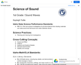
This is a task neutral proficiency scale for 1-ESS1-1. Resources used to …
This is a task neutral proficiency scale for 1-ESS1-1. Resources used to make this: NGSS.NSTA.org, Appendix E from the NextGenScience site and the actual performance expectations. This scale was created through collaboration with five elementary teachers.
Chemistry is the study of matter. Our understanding of chemical processes thus …
Chemistry is the study of matter. Our understanding of chemical processes thus depends on our ability to acquire accurate information about matter. Often, this information is quantitative, in the form of measurements. In this lab, you will be introduced to some common measuring devices, and learn how to use them to obtain correct measurements, each with correct precision. A metric ruler will be used to measure length in centimeters (cm).
Os painéis elaborados e disponibilizados para implantação no geossítio Vila Pedra, são …
Os painéis elaborados e disponibilizados para implantação no geossítio Vila Pedra, são produtos geodidáticos de geoeducação a serem utilizados por professores e alunos de ensino básico do município de Irituia e visitantes do local. Eles contêm informações e interpretações geocientíficas e de curiosidades presentes na formação geológica do geossítio, em uma linguagem acessível, dando suporte a sua utilização como espaço de ensino não formal e à visitação turística mais interessante e de forma sustentável, contribuindo para a divulgação e valorização do geossítio.
This is a problem-based learning (PBL) group jigsaw activity. The scenario is: …
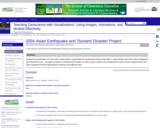
This is a problem-based learning (PBL) group jigsaw activity. The scenario is: Students are employees of a unit of the United Nations responsible for coordinating disaster relief after a major disaster (the 2004 Asian Earthquake and Tsunami) occurs. The agency needs to understand the situation in each country so that it can coordinate the work of various governments and nongovernmental organizations (NGOs) working in the affected area.
Students are divided into Expert Groups (related to academic specialties such as Economics, Medicine, Political Science, Earth Science, etc.) and spend several days researching their topics. Students are then reassigned to one of seven or eight Country Groups, based on the countries most affected by the disaster. Each country group needs someone representing each expert group. In the scenario, these groups correspond to task forces that must determine what the situation is in each country and try to assess the current need for international assistance.
Students research their country, using internet resources, especially the CIA World Factbook and ReliefWeb, the information coordination website of the United Nations. At a large-group roundtable discussion, each group presents what it has found about its assigned country. As a final product, each student writes an individual report summarizing findings and making recommendations for disaster assistance.
(Note: this resource was added to OER Commons as part of a batch upload of over 2,200 records. If you notice an issue with the quality of the metadata, please let us know by using the 'report' button and we will flag it for consideration.)
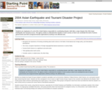
Students are employees of a unit of the United Nations responsible for …
Students are employees of a unit of the United Nations responsible for coordinating disaster relief after a major disaster (the 2004 Asian Earthquake and Tsunami) occurs. The agency needs to understand the situation in each country so that it can coordinate the work of various governments and NGO (nongovernmental organizations) working in the affected area.
(Note: this resource was added to OER Commons as part of a batch upload of over 2,200 records. If you notice an issue with the quality of the metadata, please let us know by using the 'report' button and we will flag it for consideration.)
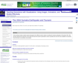
In this multi-part activity, students study seismograms from 3 different seismic stations …
In this multi-part activity, students study seismograms from 3 different seismic stations recording the magnitude 9.0 Sumatra earthquake of December 26th, 2004. By comparing the arrival times of the P and S waves on each seismogram, students determine the distance from the epicenter to each station. Using that data, they can accurately map the location of the epicenter and the precise time of the earthquake. After locating the epicenter, students calculate the position of the tsunami generated by the quake at one hour intervals. From those determinations, predictions are made about how much time people had before the tsunami crashed onto their shores. Finally, students investigate some of the ways people can lessen the impact of the next great tsunami.
(Note: this resource was added to OER Commons as part of a batch upload of over 2,200 records. If you notice an issue with the quality of the metadata, please let us know by using the 'report' button and we will flag it for consideration.)
Deze vraagstukkenbundel is bedoeld als oefenmateriaal bij het bestuderen van de basiscolleges …
Deze vraagstukkenbundel is bedoeld als oefenmateriaal bij het bestuderen van de basiscolleges Fysische Transportverschijnselen, zoals die aan de TU Delft worden gegeven. De vraagstukken zijn afkomstig uit oude vraagstukkenbundels en uit recente tentamens. Wij hebben de formulering van veel van deze vraagstukken herzien. Vooral door de vraagstukken in meerdere onderdelen te splitsen, hopen we aan te geven dat een stapsgewijze aanpak, veelal gebaseerd op één of meer balansen, een bruikbaar recept voor het oplossen van de opgaven is. Overigens is deze splitsing bij lang niet alle opgaven doorgevoerd om aan studenten de gelegenheid te geven juist dit moeilijke facet zelf te oefenen.
This activity uses data collected from DART (Deep-ocean Assessment and Reporting of …
This activity uses data collected from DART (Deep-ocean Assessment and Reporting of Tsunamis) stations in the Pacific following the 2011 tsunami generated off the coast of Japan. Students are required to map the wave front after 5, 10, and 15 hours to better understand the speed and propagation of the tsunami wave.
(Note: this resource was added to OER Commons as part of a batch upload of over 2,200 records. If you notice an issue with the quality of the metadata, please let us know by using the 'report' button and we will flag it for consideration.)
This exercise uses the example of the March 28, 2014 M5.1 La …
This exercise uses the example of the March 28, 2014 M5.1 La Habra earthquake to teach about earthquake risk and resilience in southern California. Students will examine seismic waveforms recording during the earthquake, as well as read reports from scientific agencies and news outlets to answer basic questions regarding earthquake risk and resilience.
(Note: this resource was added to OER Commons as part of a batch upload of over 2,200 records. If you notice an issue with the quality of the metadata, please let us know by using the 'report' button and we will flag it for consideration.)
Short Description: The textbook provides an important opportunity for students to learn …
Short Description: The textbook provides an important opportunity for students to learn the core concepts of chemistry and understand how those concepts apply to their lives and the world around them. The book also includes a number of innovative features, including interactive exercises and real-world applications, designed to enhance student learning.
Word Count: 113253
Included H5P activities: 42
(Note: This resource's metadata has been created automatically by reformatting and/or combining the information that the author initially provided as part of a bulk import process.)
This resource is a video abstract of a research paper created by …
This resource is a video abstract of a research paper created by Research Square on behalf of its authors. It provides a synopsis that's easy to understand, and can be used to introduce the topics it covers to students, researchers, and the general public. The video's transcript is also provided in full, with a portion provided below for preview:
"The Journal of Materials Research is proud to announce the 2019 Gordon E. Pike JMR Paper of the Year Award. This award recognizes excellence in advancing materials knowledge through written scholarship. This year’s honors go to a team of researchers from China and the US for their report on a new form of flexible and rechargeable supercapacitor wire, which was published in the September 14, 2019 issue of Journal of Materials Research. With the rapid growth of portable and wearable electronics, researchers face many important challenges. They’re tasked with fabricating devices that are smaller, lighter, and more flexible than ever—all while delivering the same or higher levels of performance. Wire-shaped supercapacitors are among the most promising technologies developed to address these challenges. These flexible devices store and deliver energy in the form of tightly wound fibers of electrochemically active materials, such as carbon nanotubes..."
The rest of the transcript, along with a link to the research itself, is available on the resource itself.
This interactive addresses the question if we can reduce CO2 emissions by …
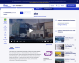
This interactive addresses the question if we can reduce CO2 emissions by 20% of 1990 levels and help avoid dangerous climate change? Users of this interactive can manipulate changes to various sources and uses (supply and demand) of energy with the goal of reducing C02 emissions in Great Britain by 80% in the year 2050.
No restrictions on your remixing, redistributing, or making derivative works. Give credit to the author, as required.
Your remixing, redistributing, or making derivatives works comes with some restrictions, including how it is shared.
Your redistributing comes with some restrictions. Do not remix or make derivative works.
Most restrictive license type. Prohibits most uses, sharing, and any changes.
Copyrighted materials, available under Fair Use and the TEACH Act for US-based educators, or other custom arrangements. Go to the resource provider to see their individual restrictions.