Students will be introduced to different species of macroinvertebrates. They will hypothesize …
Students will be introduced to different species of macroinvertebrates. They will hypothesize why each insect looks the way it does. Then students will make observations of macroinvertebrates. in an aquarium in their classroom. For an optional extension, teachers can take students to a local stream or pond to conduct field observations. The purpose of this activity is to introduce students to hydrology and the study of macroinvertebrates. and to understand how macroinvertebrates. help scientists understand water quality. After completing this activity, students will have an understanding of what macroinvertebrates. are and why scientists study them.
Increasingly volatile climate and weather; vulnerable drinking water supplies; shrinking wildlife habitats; …
Increasingly volatile climate and weather; vulnerable drinking water supplies; shrinking wildlife habitats; widespread deforestation due to energy and food production. These are examples of environmental challenges that are of critical importance in our world, both in far away places and close to home, and are particularly well suited to inquiry using geographic information systems. In GEOG 487 you will explore topics like these and learn about data and spatial analysis techniques commonly employed in environmental applications. After taking this course you will be equipped with relevant analytical approaches and tools that you can readily apply to your own environmental contexts.
This graduate seminar is taught in a lecture and lab exercise format. …
This graduate seminar is taught in a lecture and lab exercise format. The subject matter is tailored to introduce Environmental Engineering students to the use and potential of Geographic Information Systems in their discipline. Lectures will cover the general concepts of GIS use and introduce the material in the exercises that demonstrate the practical application of GIS.
This class is one of the core requirements for the Environmental Masters …
This class is one of the core requirements for the Environmental Masters of Engineering program. It is designed to teach about environmental engineering through the use of case studies, computer software tools, and seminars from industrial experts. Case studies provide the basis for group projects as well as individual theses. Past case studies have included the MMR Superfund site on Cape Cod; restoration of the Florida Everglades; dredging of Boston Harbor; local watershed trading programs; appropriate wastewater treatment technology for Brazil; point-of-use water treatment for Nepal, Brownfields Development in Providence, RI, and water resource planning for the island of Cyprus. This class spans the entire academic year: students must register for the Fall term, IAP, and the Spring term.
This class is one of the core requirements for the Environmental Masters …
This class is one of the core requirements for the Environmental Masters of Engineering program, in conjunction with 1.133 Masters of Engineering Concepts of Engineering Practice. It is designed to teach about environmental engineering through the use of case studies, computer software tools, and seminars from industrial experts. Case studies provide the basis for group projects as well as individual theses. Recent 1.782 projects include the MMR Superfund site on Cape Cod, appropriate wastewater treatment technology for Brazil and Honduras, point-of-use water treatment and safe storage procedures for Nepal and Ghana, Brownfields Development in Providence, RI, and water resource planning for the island of Cyprus and refugee settlements in Thailand. This class spans the entire academic year; students must register for the Fall and Spring terms.
A great variety of processes affect the surface of the Earth. Topics …
A great variety of processes affect the surface of the Earth. Topics to be covered are production and movement of surficial materials; soils and soil erosion; precipitation; streams and lakes; groundwater flow; glaciers and their deposits. The course combines aspects of geology, climatology, hydrology, and soil science to present a coherent introduction to the surface of the Earth, with emphasis on both fundamental concepts and practical applications, as a basis for understanding and intelligent management of the Earth's physical and chemical environment.
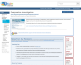
Students observe the process of evaporation, make comparisons about the process, then …
Students observe the process of evaporation, make comparisons about the process, then construct a diagram and use it to describe the process of evaporation.
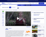
In this adapted video segment, ZOOM guest Tommy takes us on a …
In this adapted video segment, ZOOM guest Tommy takes us on a tour of the Florida Everglades. He describes what makes a wetland biome unique, including the soil, precipitation, and biodiversity.
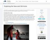
In this middle school and high school unit, students compare and constrast …
In this middle school and high school unit, students compare and constrast Arctic expeditions of the past (1893-1896 Fram expedition) and the present (2019-2020 MOSAiC expedition) to prepare for the Arctic of the future.
In this activity, students use a National Weather Service flood forecast, USGS …
In this activity, students use a National Weather Service flood forecast, USGS gauging data, and other reports to estimate the maximum storm discharge from the New River and Wolf Creek, two streams in the Southeast U.S. which experienced flooding in November 2003. Topographic and urban maps are used to predict where flooding would occur and to evaluate strategies for reducing flood risk for the residents of the region.
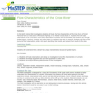
This activity is a field investigation where students make observations, formulate a …
This activity is a field investigation where students make observations, formulate a question, construct and collect data on that question on stream flow on the Crow River in Central Minnesota
This six-week curriculum unit is designed for students in the second grade …
This six-week curriculum unit is designed for students in the second grade as they follow a water molecule through a watershed. The unit begins with Follow the Water from Brook to Ocean , a picture book by Arthur Dorros that introduces to primary-level students how water moves and how it has shaped our earth over time. The young scientists will use their skills of inquiry to understand the structure of a watershed, investigate human impact, and participate in activities and experiments throughout. Students will use journals to document their learning as they build vocabulary, identify stream order, discover how materials dissolve or not in our waters, create an aquifer, and design a game that simulates the pollution entering our watershed.
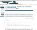
This is one component of the Source to Sink Mini Lesson Set …
This is one component of the Source to Sink Mini Lesson Set Continental margins are phenomenal places to study the modern sedimentary cycle because sediment in margin regions has been routed from mountains (source) through river systems to the sea (sink); in some cases, sediment has continued across continental shelves and been delivered to the deep sea. The goal of this mini-lesson is to let students explore the characteristics of some key regions in the modern sedimentary cycle to identify and relate the variables that control source-to-sink systems. Which areas are eroding most rapidly and why? Which systems are responsible for the most rapid transfer of sediments from continents to the oceans? How do the characteristics of river systems affect the properties of the sediments they discharge? How can we apply our knowledge of these modern source-to-sink systems to the ancient sedimentary rock record?
The GLOBE Cave Protocol Field Guide utilizes existing GLOBE protocols to explore …
The GLOBE Cave Protocol Field Guide utilizes existing GLOBE protocols to explore an extreme environment. Caves provide an opportunity to utilize GLOBE protocols to investigate underground environments and compare them to surface environments. Outside the cave, students record elevation, MUC, latitude and longitude, air temperature, relative humidity and air pressure. Inside the cave, students record air temperature, relative humidity and air pressure as well as observe and describe cave features in each room. Students also note evidence of biological activity and human impact. If water is present inside the cave, students record water temperature and pH. Follow up questions are included in the Field Guide.
Focusing on air, water, land and life, this video describes how these …
Focusing on air, water, land and life, this video describes how these components are connected in the Earth system through the flow of energy, cycles of water and biogeochemistry. Methods of studying the Earth system, ranging from field observations to analysis of satellite images are discussed. This video is one of the 24-part instructional video series describing scientific protocols used by GLOBE (Global Learning and Observation to Benefit the Environment), a worldwide, hands-on, K-12 school-based science education program.
This video highlights students taking scientific measurements to support investigations in atmospheric …
This video highlights students taking scientific measurements to support investigations in atmospheric science, hydrology, soils, and land cover. It shows students reporting data through the Web, creating scientific visualizations for analysis, and collaborating with students and scientists around the world. This is one two introductory videos in the 24-part GLOBE video series. GLOBE (Global Learning and Observation to Benefit the Environment) is a worldwide, hands-on, K-12 school-based science education program.
This video highlights students taking scientific measurements to support investigations in atmospheric …
This video highlights students taking scientific measurements to support investigations in atmospheric science, hydrology, soils, and land cover. It shows students reporting data through the Web, creating scientific visualizations for analysis, and collaborating with students and scientists around the world. This is one of two introductory videos in the 24-part GLOBE video series. GLOBE (Global Learning and Observation to Benefit the Environment) is a worldwide, hands-on, K-12 school-based science education program.
No restrictions on your remixing, redistributing, or making derivative works. Give credit to the author, as required.
Your remixing, redistributing, or making derivatives works comes with some restrictions, including how it is shared.
Your redistributing comes with some restrictions. Do not remix or make derivative works.
Most restrictive license type. Prohibits most uses, sharing, and any changes.
Copyrighted materials, available under Fair Use and the TEACH Act for US-based educators, or other custom arrangements. Go to the resource provider to see their individual restrictions.