Short Description: In essay format, this textbook considers examples of various sub-categories …
Short Description: In essay format, this textbook considers examples of various sub-categories of Geography in combination with five regions of the Western World. To utilize this compelling format, click on READ BOOK or simply scroll down.
Word Count: 174885
(Note: This resource's metadata has been created automatically by reformatting and/or combining the information that the author initially provided as part of a bulk import process.)
This module considers sustainability with respect to water, food, agriculture, forestry and …
This module considers sustainability with respect to water, food, agriculture, forestry and energy. For each of these elements of sustainability, the module illustrates why their sustainable management is important, given that we are living within finite environmental limits. A novel aspect of the module is that in most sessions you update your own personal blog (or offline document), which can be used to provide a record of your opinions on sustainability, details on your awareness of sustainability, and specific examples of sustainability. The module is assessed by means of producing and presenting a poster at an internal “Sustainability Conference”.
Dr Simon Gosling, University of Nottingham.
My main interests are in understanding the impacts of climate change on natural and human systems, and bridging the boundary between physical science and impact and policy-related areas.
Much of my current research investigates the potential impact of climate change on global- and catchment-scale hydrology and water resources. I am interested in understanding how average conditions and extremes (floods and droughts) might be affected by climate change. I apply a variety of climate and hydrological numerical models to achieve this. I also have strong interests in modelling the relationship between climate and human health; specifically, on the association between extreme temperature events (heat waves and cold snaps) and temperature-related mortality.
This course introduces students to modern world history and geography. It provides …
This course introduces students to modern world history and geography. It provides an opportunity for students to learn and further develop foundational research and writing skills by incorporating practice into every class session. Early in the course, students select a country to study, then all research and writing activities are focused on that country. It also utilizes the United Nations Sustainable Development Goals to help students explore their country.The course utilizes openly licensed textbooks and publicly available materials as course materials.This survey course is intended for freshmen and sophomore-level students who are interested in exploring historical, political and social contexts beyond their own. Students will have ample opportunities to practice foundational skills including writing, research, source citation, critical thinking and public speaking.It was originally taught over 13 weeks as part of a Fulbright US Scholar grant in the International College at Tunghai University in Taichung Taiwan. It was developed with support from the Open Education for a Better World Program.
This lesson introduces basic map-reading skills and directional vocabulary. It orients the …
This lesson introduces basic map-reading skills and directional vocabulary. It orients the students to the geography of the United States in comparison to their native country. The students learn vocabulary to discuss geographic features while practicing the answers to Civics Test questions about rivers, oceans, border states, territories, and capitals. There are suggested teaching strategies for small group and whole class activities to practice the new vocabulary using U.S. wall maps and category games with file folders and sticky notes. For the Civics Test, applicants do not need to locate these places on a map, but they do need to understand their existence and be able to correctly answer questions about them. Lastly, the handout Map Directions for the Literacy Level Writing Practice helps beginners practice spelling and handwriting while using key vocabulary from the lesson. Covers civics test items 44, 88, 89, 90, 91, 92, 93, 94.
The unit is focused on the examination of geography in terms of …
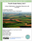
The unit is focused on the examination of geography in terms of “place.” Students dive into inquiry to answer the compelling question, What is unique about living in Washington? Through this question students will understand where and why people live in Washington State. Students will dive into the regions of Washington State and define it through many characteristics. Students will ultimately choose a region to become an expert on and communicate what makes that region unique. Each student’s performance task product will reflect choice and build upon student strengths according to their skill set.
Human Geography: An open textbook for Advanced Placement is aligned to the …
Human Geography: An open textbook for Advanced Placement is aligned to the 2015 College Board course articulation for AP Human Geography. The purpose of AP Human Geography is to introduce students to the systematic study of patterns and processes that have shaped human understanding, use, and alteration of Earth's surface. Students employ spatial concepts and landscape analysis to examine human social organization and its environmental consequences. They also learn about the methods and tools geographers use in their science and practice.
Word Count: 204289 (Note: This resource's metadata has been created automatically by …
Word Count: 204289
(Note: This resource's metadata has been created automatically by reformatting and/or combining the information that the author initially provided as part of a bulk import process.)
Estuarine Geography utilizes an ecological approach to understanding physical and biological parameters …
Estuarine Geography utilizes an ecological approach to understanding physical and biological parameters to estuarine evolution.. Superimposed upon that spatial site and situation are social, human, cultural and political activities. Humans role in estuarine evolution is discussed at length.
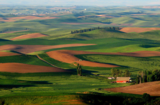
Geography 431 is designed to further understanding of the natural processes of …
Geography 431 is designed to further understanding of the natural processes of aquatic ecosystems, management of water resources, and threats to sustaining water quantity. Develop awareness and appreciation of the perspectives about water as a precious resource, commodity, and sometimes hazard. Learn how and why water is distributed unevenly around the Earth. Examine how resource management decisions are strongly related to water availability, quantity, and quality. The course examines water resources management; dams and dam removal; provision of safe potable water; threats to water quantity and quality; land use changes; the water economy; water laws and policy; institutions for water management at the global, national, regional, and local scale; and issues of water security and climate change.
DESCRIPTION Introduces students to the theory and methods of remote sensing through use of satellite imagery. Practical exercises involve use of SPOT, LANDSAT and Quickbird images with ArcGIS/Imagine Analysis software. Digital analysis is discussed and performed including preprocessing, image classification and image evaluation. Intended for students enrolled in the second year of GIS or UAS programs, or similar academic preparation (see program director for details).
LEARNING OUTCOMES 1. Demonstrate knowledge and apply skills essential to the discipline. 2. Apply GIS skills necessary to provide geospatial and thematic data. 3. Apply critical thinking and problem solving skill that reflect best practice. 4. Coordinate and manage the delivery of reliable, valid, GIS data including analysis and specialized user needs products. 5. Communicate effectively and appropriately within a professional setting in both written and oral form.
The unit from Central Valley School District in Washington, is focused on …
The unit from Central Valley School District in Washington, is focused on the examination of geography in terms of “place.” Students dive into inquiry to answer the compelling question, What is unique about living in Washington? Through this question students will understand where and why people live in Washington State. Students will dive into the regions of Washington State and define it through many characteristics. Students will ultimately choose a region to become an expert on and communicate what makes that region unique. Each student’s performance task product will reflect choice and build upon student strengths according to their skill set.
This Remote Learning Plan was created by (Aaron Leibel) in collaboration with …
This Remote Learning Plan was created by (Aaron Leibel) in collaboration with (Lori Broady) as part of the 2020 ESU-NDE Remote Learning Plan Project. Educators worked with coaches to create Remote Learning Plans as a result of the COVID-19 pandemic.The attached Remote Learning Plan is designed for (10th Grade) (Social Studies) students. Students will (Create a law of supply chart for a concession stand item). This Remote Learning Plan addresses the following NDE Standard: (NDE Standard)Geography 7.3.3.a Explain the impact of natural processes on human and physical environments.Economics 7.2.5.a Define the government’s role in various economic systems. It is expected that this Remote Learning Plan will take students (45 minutes) to complete.Here is the direct link to the Google Doc: https://docs.google.com/presentation/d/1MCc6jnB8hb9NslpjmMpNIy6kMHyGDPKcnWBsnsZYRyQ/edit?usp=sharing
Latin America covers part of North America, South America and the West …
Latin America covers part of North America, South America and the West Indies. It stretches from Atacama desert to rugged highlands and Alpine glaciers of the Andes mountains, from the Rio Grande to Tierra del Fuego.The fertile plains of the Pampas is one of the world's richest agricultural regions. The Amazon Basin is the largest and wettest lowland in the world. Culturally, Latin America is a great mixture of European, indigenous and African cultures.
In this course, we will examine the peoples and places of Latin America from a geographical perspective. We will explore the geographical dimensions of economic, cultural, political, and physical forces influencing Latin America as a region. We will have a mixture of thematic and regional approaches to study the concepts and look into various physical and historical processes that have shaped dynamic and diverse cultural landscapes. We will study contemporary environmental and developmental issues, trends in migration, agricultural change, and globalization to understand Latin America's position in the global economy.
Learning Outcomes: *Analyze and articulate geographic concepts related to the geography of Latin America, its physical environment, peoples, cultures, and history. *Analyze changing political and economic relationships between the United States and countries in Latin America in order to be a more informed and engaged global citizen. *Interpret maps, graphs, and visuals as tools for analyzing the distribution patterns of phenomena and understanding their importance. *Evaluate how changing cultural, social, political, and economic characteristics of Latin American countries influence internal strife and external intervention. *Understand the complexities that contribute to the social inequality, political conflict, and environmental concerns prevalent in some Latin American countries and discuss possible solutions.
IntroductionThis lesson seed includes lesson plans and resources to assist Social Studies …
IntroductionThis lesson seed includes lesson plans and resources to assist Social Studies teachers in elementary classrooms. These is a section dedicated to grades 1-3 that focuses on map skills, modes of transportation, how goods are transported and how people change the earth. There is also a section dedicated to grades 4-5 that focuses on the physical features and grography of Maryland and the United States. At the bottom of the resources is an academic vocabulary word list for key concepts to consider providing visual support to assist you in tailoring your lessons to ELL students within your classroom, along with link to WIDA CAN DO Descriptors.Lesson Seeds:Lesson seeds are ideas for the standards that can be used to build a lesson. Lesson seeds are not meant to be all-inclusive, nor are they substitutes for instruction. This lesson seed provides a compelling question and a bank of sources to use to drive an inquiry based lesson or a potential Evidence Based Argument Set (EBAS). When developing lessons from these seeds, teachers must consider the needs of all learners. Once you have built your lesson from the lesson seed, teachers are encouraged to post the lesson that has emerged from this lesson seed and share with others.
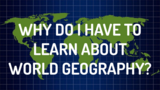
Many students want to know the WHY before the WHAT. Often my …
Many students want to know the WHY before the WHAT. Often my students will ask, "Why do I have to learn about World Geography?" I will respond, "You don't have to learn about World Geography; you get to learn about World Geography. Some don't realize how valuable a free education is, and how so many others would do anything to have access to education. Many students often also mistake World Geography as dealing only with the physical environment, when the cultural environment is just as important. This short slide show introduces students to the subject: Why we get to learn about World Geography; What the five themes of geography are and how to go about examining them; How people are the same and how are they different, and How the environment shapes our political, economic, and social lives. The lesson includes links to a resource from Curriculum Pathways that examines each of the five themes of geography, as well as a resource from OER Commons titled 100 People: A World Portrait, that includes additional resources, videos, personal stories and inspiration.
No restrictions on your remixing, redistributing, or making derivative works. Give credit to the author, as required.
Your remixing, redistributing, or making derivatives works comes with some restrictions, including how it is shared.
Your redistributing comes with some restrictions. Do not remix or make derivative works.
Most restrictive license type. Prohibits most uses, sharing, and any changes.
Copyrighted materials, available under Fair Use and the TEACH Act for US-based educators, or other custom arrangements. Go to the resource provider to see their individual restrictions.