Updating search results...

Search Resources

263 Results

View
Selected filters:
  • Physical Geography
  • Community College / Lower Division
  • College / Upper Division
Cloud and Server GIS
Conditional Remix & Share Permitted
CC BY-NC-SA
Rating
0.0 stars

Is your understanding of Cloud GIS a bit hazy? Does thinking about it leave you in a fog? We've designed GEOG 865, Cloud and Server GIS, to help you understand how all of the various pieces of architecture fit together. By the end of the class you'll have a clear understanding of esri's and others' offerings in the space, how to implement ArcGIS Enterprise on Amazon EC2, make online maps with Carto and Mapbox, and engage in some blue sky thinking of your own in our weekly discussions about trends and directions.

Subject:
Applied Science
Computer Science
Physical Geography
Physical Science
Material Type:
Full Course
Provider:
Penn State College of Earth and Mineral Sciences
Author:
Sterling Quinn
Date Added:
10/07/2019
Coastal Processes, Hazards and Society
Conditional Remix & Share Permitted
CC BY-NC-SA
Rating
0.0 stars

Has your attention recently been caught by news of coastal catastrophes such as hurricanes and tsunamis? Do you wonder why so many coastal communities in the world are vulnerable to flooding and other coastal hazards? Have you considered what coastal flood protections cities like Houston and Miami will need in the future to protect their residents? This course will provide a better understanding of these phenomena. We present a global perspective of coastal landscapes, the geologic processes responsible for their formation, and ways that society responds to hazards like sea level rise and catastrophic weather events. You will participate in active learning exercises such as analyzing real-world datasets and applying critical thinking to real-world societal problems while investigating a coastal community.

Subject:
Applied Science
Biology
Career and Technical Education
Ecology
Environmental Science
Environmental Studies
Life Science
Oceanography
Physical Geography
Physical Science
Material Type:
Full Course
Provider:
Penn State College of Earth and Mineral Sciences
Author:
Brent Yarnal
Dinah Maygarden
Tim Bralower
Date Added:
10/07/2019
Comparative Planetary Geomorphology
Conditional Remix & Share Permitted
CC BY-NC-SA
Rating
0.0 stars

Prior to this lab exercise, students discuss general physical differences between the planets Earth, Moon and Mars, and why these physical differences exist. They use globes and global data sets in lecture to investigate large-scale patters, similarities and differences between these bodies. They discuss methods by which planetary geologists study the surfaces of other planets. While working on this laboratory exercise, they use maps of the Earth, Moon and Mars (both geologic and topographic) as well as data from missions such as Clementine, MOLA, and HRSC, which they obtain online. The investigate impact crater morphology between the Earth and Moon; comparative planetary geology in the form of fluvial, tectonic, and volcanologic comparisons of Earth and Mars; and complete a geologic map and history of a region of Mars using only orbital images and data sets.

(Note: this resource was added to OER Commons as part of a batch upload of over 2,200 records. If you notice an issue with the quality of the metadata, please let us know by using the 'report' button and we will flag it for consideration.)

Subject:
Biology
Life Science
Mathematics
Measurement and Data
Physical Geography
Physical Science
Material Type:
Activity/Lab
Provider:
Science Education Resource Center (SERC) at Carleton College
Provider Set:
Teach the Earth
Author:
Jennifer Anderson
Date Added:
08/10/2019
Comparing subsidence rates in different tectonic settings
Conditional Remix & Share Permitted
CC BY-NC-SA
Rating
0.0 stars

Think-pair-share and jig-saw activity asking students to study and compare subsidence curves from different tectonic settings.

Subject:
Geology
Physical Geography
Physical Science
Material Type:
Activity/Lab
Provider:
Science Education Resource Center (SERC) at Carleton College
Provider Set:
Teach the Earth
Author:
Liz Hajek
Date Added:
01/20/2023
Computer Cartography course plan
Conditional Remix & Share Permitted
CC BY-NC
Rating
0.0 stars

To address the cost of resources for exercise manuals in GIS, I have developed a series of class exercises that can be used with QGIS, a free and open source software.
In addition, some class activities address more general ideas associated with cartography, such as color theory. To make these resources fully accessible to students, I have recorded publicly available videos documenting how these class activities can be completed. There is one video for each classroom lesson in this course offering, and links to all of the videos on the website Vimeo are linked to.

DESCRIPTION
Develops skills needed to produce maps using ArcGIS Desktop software. Outlines cartographic principles and map use. Emphasis on mapping techniques within a GIS. Intended for students enrolled in GIS or UAS programs.

LEARNING OUTCOMES
1. Demonstrate knowledge and apply skills essential to the discipline.
2. Coordinate and manage the delivery of reliable, valid, GIS data including analysis and specialized user needs products.
3. Communicate effectively and appropriately within a professional setting in both written and oral form.
4. Utilize professional communication skills to achieve project outcomes in collaboration with GIS users across disciplines.
5. Research, interpret and apply data/information in the professional setting.
6. Develop and implement GIS services for users who may or may not be GIS knowledgeable.

Subject:
Physical Geography
Physical Science
Material Type:
Lesson Plan
Author:
Patrick Kennelly
Date Added:
03/09/2020
Cool Cores Capture Climate Change
Unrestricted Use
CC BY
Rating
0.0 stars

This Earth Exploration Toolbook chapter is a detailed computer-based exploration in which students learn how various climatic conditions impact the formations of sediment layers on the ocean floor. They analyze sediment core data from the Ross Ice Shelf in Antarctica for evidence of climate changes over time. In addition, they interact with various tools and animations throughout the activity, in particular the Paleontological Stratigraphic Interval Construction and Analysis Tool (PSICAT) that is used to construct a climate change model of a sediment core from core images.

Subject:
Archaeology
Career and Technical Education
Environmental Studies
Oceanography
Physical Geography
Physical Science
Social Science
Material Type:
Activity/Lab
Provider:
CLEAN: Climate Literacy and Energy Awareness Network
Provider Set:
CLEAN: Climate Literacy and Energy Awareness Network
Author:
Earth Exploration Toolbook/TERC
Jean Pennycook
Date Added:
06/19/2012
Copper Production in the High Peruvian Andes: Geology, Economics and Politics
Conditional Remix & Share Permitted
CC BY-NC-SA
Rating
0.0 stars

This is a multi-component case study on copper and Peru. It attemps to look at a specific mineral resource through multiple lenses, e.g. geology, economics, regulation and political process.

Subject:
Career and Technical Education
Economics
Environmental Studies
Physical Geography
Physical Science
Political Science
Social Science
Material Type:
Activity/Lab
Provider:
Science Education Resource Center (SERC) at Carleton College
Provider Set:
Teach the Earth
Author:
James Myers
Date Added:
01/20/2023
Country Movers – Visualizing Spatial Scales in Planetary and Earth Sciences
Unrestricted Use
CC BY
Rating
0.0 stars

Students learn about local and planetary physical geography / geology, toponymy, planetary landing site selection and cartography. The students learn a complex process of landscape evaluation and city planning, based on the interpretation of photomaps or digital terrain models.

Subject:
Astronomy
Physical Geography
Physical Science
Material Type:
Activity/Lab
Provider:
International Astronomical Union
Provider Set:
astroEDU
Author:
Henrik Hargitai
Mátyás Gede
Date Added:
02/06/2018
Describing Countries in Economic Terms
Unrestricted Use
CC BY
Rating
0.0 stars

 Describe different sociological models for understanding global stratificationUnderstand how studies of global stratification identify worldwide inequalities

Subject:
Economics
Physical Geography
Social Science
Sociology
World Cultures
Material Type:
Reading
Author:
Rebecca Burley
Date Added:
07/31/2020
Designing a Biological Community
Conditional Remix & Share Permitted
CC BY-NC-SA
Rating
0.0 stars

In this Physical Geography Lab, students are responsible for designing a simple biological community.

(Note: this resource was added to OER Commons as part of a batch upload of over 2,200 records. If you notice an issue with the quality of the metadata, please let us know by using the 'report' button and we will flag it for consideration.)

Subject:
Biology
Life Science
Physical Geography
Physical Science
Material Type:
Activity/Lab
Provider:
Science Education Resource Center (SERC) at Carleton College
Provider Set:
Teach the Earth
Author:
Charles Dodd
Date Added:
04/03/2018
Developing a Sense of Place with Pre-service Science Teachers
Conditional Remix & Share Permitted
CC BY-NC-SA
Rating
0.0 stars

The lesson content focuses on designing investigations concerning the notion of scale through a series of investigations on their campus. The overarching goal is to foster a connection to the earth through an investigation of the local environment.

Subject:
Geology
Physical Geography
Physical Science
Material Type:
Activity/Lab
Provider:
Science Education Resource Center (SERC) at Carleton College
Provider Set:
Teach the Earth
Author:
Andrew Gilbert
Date Added:
01/20/2023
Did it Rain on Mars? Analysis of Valley Networks on Mars in an Intro Geo Course
Conditional Remix & Share Permitted
CC BY-NC-SA
Rating
0.0 stars

Some of the Viking images sent back from Mars in the 1970s show tantalizing evidence of dendritic valley networks in some of the oldest terrains on the planet. One of the big questions ever since has been whether it might have rained early in Mars history.

One of the ways of deciding whether the Mars valley networks might have been produced by rainfall is to find out how similar they are to valley networks on Earth, which we know are produced by rainfall. The standard method for analyzing drainage basins is comparison of the number of drainage segments per square kilometer (drainage density) and how extensively branched the network is (stream order).

In this exercise, students calculate stream order for valley segments mapped by Hynek and Phillips (2003) using MOC/MOLA data. Students then use data on valley segment length and drainage basin area from Hynek and Phillips (2003) to calculate drainage density. They compare stream order and drainage density for the Mars site with similar calculations for areas on Earth and evaluate the question of whether valley networks on Mars might be consistent with rainfall on an early Mars, and what the uncertainties and limitations are in their conclusions.

(Note: this resource was added to OER Commons as part of a batch upload of over 2,200 records. If you notice an issue with the quality of the metadata, please let us know by using the 'report' button and we will flag it for consideration.)

Subject:
Applied Science
Biology
Environmental Science
Hydrology
Life Science
Physical Geography
Physical Science
Material Type:
Activity/Lab
Provider:
Science Education Resource Center (SERC) at Carleton College
Provider Set:
Teach the Earth
Author:
Barb Tewksbury
Date Added:
12/11/2020
Digging into Canadian Soils
Conditional Remix & Share Permitted
CC BY-NC
Rating
0.0 stars

An Introduction to Soil Science

Short Description:
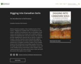
Written entirely by members of the Canadian Society of Soil Science, "Digging into Canadian Soils: An Introduction to Soil Science" provides an introduction to the core disciplines of soil science, and introduces the concepts and vocabulary needed by students just beginning their soil science journey. The textbook provides supplementary materials that are specific to regions in Canada, or may be of specific interest beyond what might be considered introductory soil science material. Importantly, the textbook also is intended to introduce students to the Canadian System of Soil Classification by providing examples from across the length and breadth of the world’s second largest country, and to the Canadian Society of Soil Science, whose members share a common passion for soil science and are keen to share and instill this passion with students across Canada.

Long Description:
Written, reviewed and edited by members of the Canadian Society of Soil Science, Digging into Canadian Soils: An Introduction to Soil Science provides an introduction to the core disciplines of soil science (pedology, soil biology and microbiology, physics, chemistry, fertility and nutrient cycling, and management), and introduces the concepts and vocabulary needed by students just beginning their soil science journey. The textbook is appropriate for use in a number of disciplines, including environmental and agricultural sciences, as well as related geology, geography and natural resources engineering disciplines.

Chapters within the textbook are presented in three sections according to the content and level of the complexity. The first section of the book, Digging In, introduces core disciplines in a series of chapters written by authors whose research expertise informs the chapter content. Supplementary materials that are specific to regions in Canada are presented in chapters within a second section, Digging Across Canada. The third section, Digging Deeper, provides in-depth overview of some topics beyond what is considered core soil science disciplinary material, and may be appropriate for upper level soil science or related discipline courses. The textbook includes an extensive glossary that is accessible via in-text links. Importantly, the textbook is intended also to introduce students to the Canadian System of Soil Classification by providing examples from across the length and breadth of the world’s second largest country, and to the Canadian Society of Soil Science, whose members share a common passion for soil science and are keen to share and instill this passion with students across Canada.

Word Count: 182572

ISBN: 978-0-88880-668-0

(Note: This resource's metadata has been created automatically by reformatting and/or combining the information that the author initially provided as part of a bulk import process.)

Subject:
Agriculture
Applied Science
Career and Technical Education
Engineering
Environmental Science
Environmental Studies
Physical Geography
Physical Science
Material Type:
Textbook
Provider:
Canadian Society of Soil Science
Author:
Canadian Society of Soil Science
Date Added:
08/12/2021
Drawing Structural and Isopachous Maps
Conditional Remix & Share Permitted
CC BY-NC-SA
Rating
0.0 stars

This activity has 3 maps with real stratigraphic data recorded adjacent to drill holes in the Illinois Basin. Students contour the structural data. They may also contour the associated thickness data or they can just look at the trends of the thickness data relative to the structures on their completed structure map.

Subject:
Geology
Physical Geography
Physical Science
Material Type:
Activity/Lab
Homework/Assignment
Provider:
Science Education Resource Center (SERC) at Carleton College
Provider Set:
Teach the Earth
Author:
Janis Treworgy
Date Added:
01/20/2023
Drilling Back to the Future: Climate Clues from Ancient Ice on Greenland
Read the Fine Print
Educational Use
Rating
0.0 stars

This video, from ClimateCentral, features a team of scientists from the Northern Greenland Eemian Ice Drilling Project who study atmospheric air bubbles trapped in an ice core. This work highlights a period in Greenland's ice sheet which began about 130,000 years ago and lasted about 10,000 years; a period known as the Eemian. The air bubbles from the ancient atmosphere reveal what happened with climate change over that period of time.

Subject:
Archaeology
Career and Technical Education
Environmental Studies
Physical Geography
Physical Science
Social Science
Material Type:
Diagram/Illustration
Reading
Provider:
CLEAN: Climate Literacy and Energy Awareness Network
Provider Set:
CLEAN: Climate Literacy and Energy Awareness Network
Author:
Climate Central
Date Added:
08/29/2012
Du soleil pour tous
Unrestricted Use
CC BY
Rating
0.0 stars

L’énergie solaire au Sénégal : un droit, des droits, une histoire

Long Description:
L’énergie solaire est une promesse de développement et de prospérité pour l’Afrique. Elle a été annoncée et expérimentée sur le continent dans un esprit de science ouverte et de « communs » technologiques et énergétiques il y a déjà près de soixante ans. Séchoirs et chauffe-eaux, pompes solaires et centrales électriques thermodynamiques : des pionniers ont développé et installé, dès la fin des années 1950, des techniques et des matériels en Afrique de l’Ouest et en particulier au Sénégal.

Le présent ouvrage, issu de deux journées d’études organisées à Dakar en mai 2016, rend compte pour la première fois, de manière particulièrement symbolique, de cette histoire et du futur de l’énergie solaire en Afrique. Il rassemble, dans une première partie, des témoignages d’acteurs et une mise en perspective sociohistorique large des politiques de l’énergie solaire en Afrique de l’Ouest sur un demi-siècle. Ce regard est complété par la réédition d’un texte de référence du professeur Abdou Moumouni Dioffo, pionnier nigérien de l’énergie solaire dès 1964.

Dans une seconde partie, cet ouvrage interroge également les prolongements actuels de l’énergie solaire en France et au Sénégal, en particulier son encadrement juridique et réglementaire. L’énergie solaire peut-elle ou doit-elle être considérée comme un « commun » ou un droit humain fondamental? Quels sont aujourd’hui les droits associés à l’énergie solaire au Sénégal? Quels enseignements tirer d’une comparaison avec le corpus juridique en la matière tel qu’il existe en France?

Associant juristes français et sénégalais, et spécialistes de la sociologie et des politiques de l’énergie, cet ouvrage se veut au final une invitation et un outil pour poursuivre les recherches sur l’histoire et le droit de l’énergie solaire en Afrique.

(Compléments vidéos, entretiens et témoignages sur le blog de recherche : https://afrisol.hypotheses.org)

Word Count: 96883

ISBN: 978-2-924661-34-5

(Note: This resource's metadata has been created automatically by reformatting and/or combining the information that the author initially provided as part of a bulk import process.)
Subject:
Applied Science
Engineering
Physical Geography
Physical Science
Material Type:
Textbook
Provider:
Éditions science et bien commun
Author:
Mamadou Badji
Sous la direction de Frédéric Caille
Date Added:
10/25/2021
Dɔnko
Conditional Remix & Share Permitted
CC BY-SA
Rating
0.0 stars

Études culturelles africaines

Short Description:
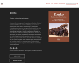
Comment lire et comprendre les pratiques culturelles africaines? Comment mobiliser les savoirs sur l’Afrique, ses arts et ses cultures sans verser dans la réification ou le folklorisme? Profondément novateur, cet ouvrage collectif mobilise les outils théoriques des cultural studies pour proposer un généreux panorama de l’étude de la culture en Afrique. Il rassemble des textes d’auteurs et d’autrices d’Afrique de l'Ouest, théoriques ou descriptifs, qui mettent en lumière la réévaluation passionnante des modes d’appréhension des pratiques et objets en contexte africain que proposent les études culturelles africaines. L’épilogue qui clôt le livre n’est donc point fermeture, mais plutôt ouverture sur les enjeux relatifs à ce nouveau champ d’études, plein de promesses pour rendre compte de l’extraordinaire créativité des cultures africaines.

Long Description:
Comment lire et comprendre les pratiques culturelles africaines? Comment mobiliser les savoirs sur l’Afrique, ses arts et ses cultures sans verser dans la réification ou le folklorisme? Profondément novateur, cet ouvrage collectif mobilise les outils théoriques des cultural studies pour proposer un généreux panorama de l’étude de la culture en Afrique. Il rassemble des textes d’auteurs et d’autrices d’Afrique de l’ouest, théoriques ou descriptifs, qui mettent en lumière la réévaluation passionnante des modes d’appréhension des pratiques et objets en contexte africain que proposent les études culturelles africaines. L’épilogue qui clôt le livre n’est donc point fermeture, mais plutôt ouverture sur les enjeux relatifs à ce nouveau champ d’études, plein de promesses pour rendre compte de l’extraordinaire créativité des cultures africaines.

Word Count: 78460

ISBN: 978-2-924661-82-6

(Note: This resource's metadata has been created automatically by reformatting and/or combining the information that the author initially provided as part of a bulk import process.)

Subject:
Anthropology
Arts and Humanities
Performing Arts
Physical Geography
Physical Science
Social Science
Material Type:
Textbook
Provider:
Éditions science et bien commun
Author:
Salaka Sanou
Sous la direction d'Isaac Bazié
Date Added:
06/08/2019
EARTH
Only Sharing Permitted
CC BY-NC-ND
Rating
0.0 stars

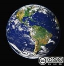
Earth is the third planet from the Sun and the only astronomical object known to harbor life. According to radiometric dating estimation and other evidence, Earth formed over 4.5 billion years ago. Earth's gravity interacts with other objects in space, especially the Sun and the Moon, which is Earth's only natural satellite. Earth orbits around the Sun in 365.256 solar days, a period known as an Earth sidereal year. During this time, Earth rotates about its axis 366.256 times, that is, a sidereal year has 366.256 sidereal days. Earth's axis of rotation is tilted with respect to its orbital plane, producing seasons on Earth. The gravitational interaction between Earth and the Moon causes tides, stabilizes Earth's orientation on its axis, and gradually slows its rotation. Earth is the densest planet in the Solar System and the largest and most massive of the four rocky planets.

Subject:
Physical Geography
Material Type:
Assessment
Author:
Santosh Upreliya
Date Added:
05/29/2020
Earth Science in the News Investigation
Conditional Remix & Share Permitted
CC BY-NC-SA
Rating
0.0 stars

This is a writing assignment intended to get to students to think about the relevance of Earth Science to their everyday lives. Students are asked to read a short news article, selecting 1 of 3 articles provided as choices, that discusses a specific earth science topic. Students write a 1-page report summarizing the article and use the write-up to summarize their familiarity with the topics presented. Students will re-evaluate their understanding of the article and associated earth science topic at the end of the course.

Subject:
Geology
Physical Geography
Physical Science
Material Type:
Homework/Assignment
Provider:
Science Education Resource Center (SERC) at Carleton College
Provider Set:
Teach the Earth
Author:
Alex Lechler
Date Added:
01/20/2023
Earthquake Case Studies: Scientific Details and Societal Impacts
Conditional Remix & Share Permitted
CC BY-NC-SA
Rating
0.0 stars

Learning outcomes for this activity include learning earthquake basics. The larger context of the inequity of earthquake impacts provides a social/environmental justice lens that encourages students to examine earthquake hazards with a broader perspective.

Subject:
Geology
Physical Geography
Physical Science
Social Science
Material Type:
Activity/Lab
Provider:
Science Education Resource Center (SERC) at Carleton College
Provider Set:
Teach the Earth
Author:
Matthew Nyman
Date Added:
01/20/2023