Facies models are often abstract and difficult for undergraduate students to fully …
Facies models are often abstract and difficult for undergraduate students to fully understand. As a result, they tend to memorize idealized diagrams from text books that can be reproduced for an exam, then forgotten.
The purpose of this exercise is to help students understand a model by "building" it "piece by piece" and relating the various components to concepts they learned earlier in the semester, such as energy relationships, base level, facies, facies associations, and Walther's Law. It is designed to begin as an in-class discussion led by the instructor using a black or white board, followed by group collaboration, out-of-class exercises, and concluding with a formal examination.
The example provided here is for a prograding shoreface system; however, the same approach can be applied to any depositional system.
The purpose of this exercise is to guide students through the process …
The purpose of this exercise is to guide students through the process of constructing a stratigraphic sequence based on understanding relationships between the production of space and filling that space with sediment.
In this activity, students look at how sediments compact as they are …
In this activity, students look at how sediments compact as they are buried in a subduction zone and explore how rapid burial can lead to increased water pressure.
(Note: this resource was added to OER Commons as part of a batch upload of over 2,200 records. If you notice an issue with the quality of the metadata, please let us know by using the 'report' button and we will flag it for consideration.)
O caderno de geoeducação foi desenvolvido como um material paradidático de apoio …
O caderno de geoeducação foi desenvolvido como um material paradidático de apoio ao trabalho dos professores da rede pública de ensino fundamental do município de Irituia, para auxiliar na difusão de conhecimento sobre a geodiversidade e valorização do patrimônio geológico do município, representado pelo geossítio Vila Pedra. O caderno aborda os conteúdos relacionados à fundamentação teórica sobre geodiversidade e a caracterização e valorização do geossítio Vila Pedra, com linguagem adequada à consulta por parte dos professores. Com relação a geodiversidade são abordados seus conceitos e definições, elementos que a constituem (rocha, mineral, fóssil, solo, paisagens e processos geológicos), os geossítios como locais com valores da geodiversidade, o patrimônio geológico como conjunto de geossítios, ações de geoconservação e a geoeducação como estratégia de conservação da geodiversidade.
In this lab exercise, students examine one or more metamorphic rocks and …
In this lab exercise, students examine one or more metamorphic rocks and use various approaches to estimating and calculating the pressure-temperature conditions at which the rocks equilibrated. The exercise involves hand sample description, petrography, interpretation of phase diagrams, and calculations of a phase diagram or P-T conditions from given equations.
Science students often have difficulty thinking about large spatial scales. The purpose …
Science students often have difficulty thinking about large spatial scales. The purpose of the exercise is to redo Eratosthenes' calculation of the radius of the Earth using data from to sites in ancient Egypt. The excercise teaches about the methodology of science - how Eratothenes figured it out - rather than worried about what the "right" answer is. It can also be used to discuss the role of models in geological thinking.
(Note: this resource was added to OER Commons as part of a batch upload of over 2,200 records. If you notice an issue with the quality of the metadata, please let us know by using the 'report' button and we will flag it for consideration.)
An activity where students make a geologic timeline from calculator tape. (Note: …
An activity where students make a geologic timeline from calculator tape.
(Note: this resource was added to OER Commons as part of a batch upload of over 2,200 records. If you notice an issue with the quality of the metadata, please let us know by using the 'report' button and we will flag it for consideration.)
Reading and constructing geologic maps is one skill that every geologists has …
Reading and constructing geologic maps is one skill that every geologists has to master. Initially, this means that we have to understand the symbols that are used on geologic maps. Once we know the general meaning of these symbols, we will have to learn how to measure and plot them. The measuring is generally done using a magnetic compass. Finally, we have to plot the data on a map so that others understand the geology based on our mapping.
(Note: this resource was added to OER Commons as part of a batch upload of over 2,200 records. If you notice an issue with the quality of the metadata, please let us know by using the 'report' button and we will flag it for consideration.)
This learning video uses a simple analog setup to explore why earthquakes …
This learning video uses a simple analog setup to explore why earthquakes are so unpredictable. The setup is simple enough that students should be able to assemble and operate it on their own with a teacher's supervision. The teaching approach used in this module is known as the 5E approach, which stands for Engagement, Exploration, Explanation, Elaboration, and Evaluation. Over the course of this lesson, the basic mechanisms that give rise to the behavior of the simple analog system are explained, and further elaboration helps the students to apply their understanding of the analog system to complex fault systems that cause earthquakes
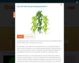
Our agricultural system is made up of interconnected resources. The availability of …
Our agricultural system is made up of interconnected resources. The availability of these resources affects how much food we can produce. In this module, you will explore the resources that make up our agricultural system in order to answer the question: can we feed the growing population? Food production is faced with an ever-growing number of challenges. Growing enough food depends on the availability of resources such as arable land, sunlight, rain, and organic matter. Throughout this activity, you will explore land uses and soil quality through graphs of land use and crop production. You will run experiments with computational models to compare the effect of different management strategies on the land. You will not be able to answer the module's framing question at the end of the module, but you will be able to describe how humans can maintain and replenish important resources to be able to produce food long into the future.
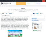
This interactive animation focuses on the carbon cycle and includes embedded videos …
This interactive animation focuses on the carbon cycle and includes embedded videos and captioned images to provide greater clarification and detail of the cycle than would be available by a single static visual alone.
In this activity, students develop concept maps of the carbon cycle through …
In this activity, students develop concept maps of the carbon cycle through a die-rolling game that simulates carbon reservoirs and fluxes. By the end of this activity, students should be able to describe and explain how the carbon cycle has changed in the last 250 years.
This module provides an overview of the biogeochemical carbon cycle. Major sources …
This module provides an overview of the biogeochemical carbon cycle. Major sources and sinks of carbon are discussed as well as the impact of human activities on global carbon levels.
In this experiment, students investigate the importance of carbon dioxide to the …
In this experiment, students investigate the importance of carbon dioxide to the reproductive growth of a marine microalga, Dunalliela sp. (Note that the directions are for teachers and that students protocol sheets will need to be created by teachers.)
Interactive visualization that provides a basic overview of the Earth's carbon reservoirs …
Interactive visualization that provides a basic overview of the Earth's carbon reservoirs and amount of carbon stored in each, CO2 transport among atmosphere, hydrosphere, geosphere, and biosphere, and a graph comparing global temp (deg C) and atmospheric CO2 levels (ppm) over the past 1000 years.
Students collect and analyze geological and biological materials for carbon content in …
Students collect and analyze geological and biological materials for carbon content in order to investigate carbon through time. Implications for energy production now and in the future are explored in the context of carbon cycling in the oceans, the atmosphere, and the geosphere.
In this 3-part lab activity, students investigate how carbon moves through the …
In this 3-part lab activity, students investigate how carbon moves through the global carbon cycle and study the effects of specific feedback loops on the carbon cycle.
Students consider the Earth's major types of landforms such as mountains, rivers, …
Students consider the Earth's major types of landforms such as mountains, rivers, plains, hills, canyons, oceans and plateaus. Student teams build three-dimensional models of landscapes, depicting several of these landforms. Once the models are built, they act as civil and transportation engineers to design and build roads through the landscapes they have created. The worksheet is provided in English and Spanish.
No restrictions on your remixing, redistributing, or making derivative works. Give credit to the author, as required.
Your remixing, redistributing, or making derivatives works comes with some restrictions, including how it is shared.
Your redistributing comes with some restrictions. Do not remix or make derivative works.
Most restrictive license type. Prohibits most uses, sharing, and any changes.
Copyrighted materials, available under Fair Use and the TEACH Act for US-based educators, or other custom arrangements. Go to the resource provider to see their individual restrictions.