The past decade has seen an explosion of new mechanisms for understanding …
The past decade has seen an explosion of new mechanisms for understanding and using location information in widely-accessible technologies. This Geospatial Revolution has resulted in the development of consumer GPS tools, interactive web maps, and location-aware mobile devices. This course brings together core concepts in cartography, geographic information systems, and spatial thinking with real-world examples to provide the fundamentals necessary to engage with Geographic Information Science. We explore what makes spatial information special, how spatial data is created, how spatial analysis is conducted, and how to design maps so that they're effective at telling the stories we wish to share. To gain experience using this knowledge, we work with the latest mapping and analysis software to explore geographic problems.
This collection of Liberia maps includes twenty examples from the American Colonization …
This collection of Liberia maps includes twenty examples from the American Colonization Society (ACS), organized in 1817 to resettle free black Americans in West Africa. These maps show early settlements in Liberia, indigenous political subdivisions, and some of the building lots that were assigned to settlers. This on-line presentation also includes other nineteenth-century maps of Liberia.
This Arabic-only website is an effort to record and preserve information on …
This Arabic-only website is an effort to record and preserve information on the culture and history of modern Egypt from the reign of Muhammad 'Ali starting in 1805 to the end of Sadat's presidency in 1981. Materials on this site include pictures of coins from this era, maps, stamps, medals, books, documents, photos, recordings, information on movies, speeches, newspaper articles, magazine covers, and more.
In this activity, students explore the importance of charts to navigation on …
In this activity, students explore the importance of charts to navigation on bodies of water. Using one worksheet, students learn to read the major map features found on a real nautical chart. Using another worksheet, students draw their own nautical chart using the symbols and identifying information learned.
The purpose of this resource is to familiarize students with the importance …
The purpose of this resource is to familiarize students with the importance of perspective and various scales of remotely sensed data. Students create a 3-D model of an area and develop a classification system for the landforms in their model. The maps can then be used to answer certain questions about the environment.
This is a digitalized collection of this once popular cartographic form used …
This is a digitalized collection of this once popular cartographic form used to depict U.S. and Canadian cities and towns during the late nineteenth and early twentieth centuries. Known also as bird's-eye views, perspective maps, and aero views, panoramic maps are non-photographic representations of cities portrayed as if viewed from above at an oblique angle. Although not generally drawn to scale, they show street patterns, individual buildings, and major landscape features in perspective.
In this project, you will explore a real-world problem, and then work …
In this project, you will explore a real-world problem, and then work through a series of steps to analyze that problem, research ways the problem could be solved, then propose a possible solution to that problem. Often, there is no specific right or wrong solutions, but sometimes one particular solution may be better than others. The key is making sure you fully understand the problem, have researched some possible solutions, and have proposed the solution that you can support with information / evidence.Begin by reading the problem statement in Step 1. Take the time to review all of the information provided in the statement, including exploring the websites, videos and / or and articles that are linked. Then work on steps 2 through 8 to complete this problem-based learning experience.
The lessons in the Colonial Unit introduce students to many of the …
The lessons in the Colonial Unit introduce students to many of the themes in the curriculum. In the Pocahontas lesson, students question Disney's account of Pocahontas's encounter with John Smith. Students engage in three additional inquiries: one about the Puritans, one about the causes of King Philip's War, and one about the causes of the Salem Witch trials. The Colonial Unit is unique in that it introduces students to different types of historical evidence such as maps and passenger lists, and asks students to consider what claims can be made on the basis of these special documents.
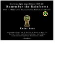
An Eco ed resource based on the rainforest explorers of the 19th …
An Eco ed resource based on the rainforest explorers of the 19th C. They went to the forest to record and classify the plants, animals and people. The site has lessons for Eco events like Earth Day as well as 10,000 rare images and the explorers' journals. Within the 700 pages of text, all locations, plant and animal names are linked to their images. Exploring even one page of the text will raise Eco awareness. There is an extensive index for reports and projects. This is a family project that was approved by the British govt. for Curriculum OnLine, by the National Wildlife Federation and the Da Vinci Science Center.
Comments about Remember the Rainforest: Rob Fox, education director Da Vinci Science Center : “ Fantastic !”
Ken Higgins, regional director and founder of Green Schools Alliance : “I did open the link, and it is very impressive. I passed it along to our lower school and middle school science teachers, and have posted it with my sustainability educators group in New York.”
This activity is based on a reduced-scale model of the Solar System …
This activity is based on a reduced-scale model of the Solar System built on a map of a city students are familiar with. This provides them with an understanding of the great distances between the different bodies of the Solar System and their relative size. Students will investigate the characteristics that are required from these bodies to build a scale model using common objects.
In this activity, students will be going over preposiciones by playing a …
In this activity, students will be going over preposiciones by playing a game of Kahoot and identifying places on a map of the Boise State University campus.
This activity is revised for a face-to-face K-12 classroom, although it is …
This activity is revised for a face-to-face K-12 classroom, although it is most appropriate for secondary (middle school and high school) levels. I added layers to the warm-up and cool-down and the entirety of the activity could easily last one full (50 minute) class period or be divided into two classes. The entire activity is contextualized as an authentic performance task where prospective students go on a virtual “university campus tour”.
This subject examines some of the many ways that contemporary historians interpret …
This subject examines some of the many ways that contemporary historians interpret the past, as well as the multiple types of sources on which they rely for evidence. It is by no means an exhaustive survey, but the topics and readings have been chosen to give a sense of the diversity of work that is encompassed in the discipline of history.
In this activity, students will review and evaluate the ways land is …
In this activity, students will review and evaluate the ways land is covered and used in their local community. They will also consider the environmental effects of the different types of land use. Students will act as community planning engineers to determine where to place a new structure that will have the least effect on the environment.
No restrictions on your remixing, redistributing, or making derivative works. Give credit to the author, as required.
Your remixing, redistributing, or making derivatives works comes with some restrictions, including how it is shared.
Your redistributing comes with some restrictions. Do not remix or make derivative works.
Most restrictive license type. Prohibits most uses, sharing, and any changes.
Copyrighted materials, available under Fair Use and the TEACH Act for US-based educators, or other custom arrangements. Go to the resource provider to see their individual restrictions.


![Surely You Will Fight for Your [portrait of King George V] and [map of Great Britain]. Come Along, Boys, Before it is too Late](https://img.oercommons.org/160x134/oercommons/media/upload/materials/screenshots/materials-course-92913.png)