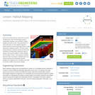
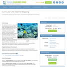
The marine environment is unique and requires technologies that can use sound …
The marine environment is unique and requires technologies that can use sound to gather information since there is little light underwater. The sea-floor is characterized using underwater sound and acoustical systems. Current technological innovations are allowing scientists to further understand and apply information about animal locations and habitat. Remote sensing and exploration with underwater vehicles allows scientists to map and understand the sea floor, and in some cases, the water column. In this lesson, the students will be shown benthic habitat images produced by GIS. These imaged will lead to a class discussion on why habitat mapping is useful and how current technology works to make bathymetry mapping possible. The teacher will then ask inquiry-based questions to have students brainstorm about the importance of bathymetry mapping.
This course provides an understanding of how geospatial perspectives and technologies support …
This course provides an understanding of how geospatial perspectives and technologies support all stages of emergency management activities, from small scale emergency management efforts to large scale disaster/humanitarian efforts. This includes learning about commonly used and emerging geospatial tools. It also includes an exploration of advancements in data collection, processing and analysis capabilities, such as unmanned aerial systems, geospatial artificial intelligence, volunteered geographic information, social media, and many more.
This practicum subject integrates theory and practice through the design, implementation, and …
This practicum subject integrates theory and practice through the design, implementation, and evaluation of a comprehensive community information infrastructure that promotes democratic involvement and informs community development projects. Students work with Lawrence Community Works, Inc. to involve constituents and generate solutions to an important planning problem in the City of Lawrence, Massachusetts. Final project presentations take place in a public forum, and serve to inform future development of the information infrastructure. Subject begins with an overview of the digital divide, e-government, public participation GIS, and neighborhood information systems. Subject includes a reflection component and a deliberate investigation of race, class, and gender dynamics.
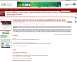
To learn ArcExplorer GIS, students perform these four exercises using data sets …
To learn ArcExplorer GIS, students perform these four exercises using data sets of Brooklyn and water quality data collected at various locations in Prospect Park, Brooklyn. Through these exercises, the students gain an understanding of how GIS works and what can be done. Ideally, the students should collect the water data and locate the sampling sites using a GPS. If lab time is limited, water data and site locations can be provided. Combining field data with existing data sets helps make the GIS applications more understandable and relevant to the students. As a final product, students create a map using a variety of GIS data layers. They also examine spatial patterns and use GIS to generate questions and hypotheses. Uses online and/or real-time data Addresses student fear of quantitative aspect and/or inadequate quantitative skills
Geographic Information System (GIS) software manages data that represent the location of …
Geographic Information System (GIS) software manages data that represent the location of features (geographic coordinate data) and what they are like (attribute data); it also provides the ability to query, manipulate, and analyze those data. Because GIS allows one to represent social and environmental data on maps, it is a powerful tool for analysis and planning in various fields. This course is meant to introduce students to the basic capabilities of GIS.
This seminar is an introduction to the usage and impacts of information …
This seminar is an introduction to the usage and impacts of information and communication technologies (ICTs) on urban planning, the urban environment and communities. Students will explore how social relationships, our sense of community, the urban infrastructure, and planning practice have been affected by technological change. Literature reviews, guest speakers, and web surfing will provide examples and issues that are debated in class and homework exercises. We will examine metropolitan information infrastructures, urban modeling and visualization, e-government, collaborative planning, and cyber communities. Students will attend a regular Tuesday seminar and occasional seminars of invited speakers during lunchtime on Fridays or Mondays. During the past two decades, ICTs have become so pervasive and disruptive that their impact on urban planning and social relationships has begun to reach far beyond their immediate use as efficient bookkeeping and automation tools. This seminar will examine ICT impacts on our sense of community, urban planning practice, the meaning of 'place', and the nature of metropolitan governance. In each of the four areas, we will utilize readings, class discussion, guest lectures, and homework exercises to identify and critique key trends, relevant theories, and promising directions for research and professional practice.
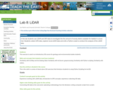
In this lab students use LiDAR and GPS data to investigate the …
In this lab students use LiDAR and GPS data to investigate the the amount of woody debris available for habitat in a local river. Students collect GPS data, explorer local LiDAR data and write a Python script to conduct the analysis of the LiDAR data.
In this lab, modified from Barbara and David Tewksbury's sea level rise …
In this lab, modified from Barbara and David Tewksbury's sea level rise lab, students use bathy/topo DEMs from NOAA to predict the location of shorelines after certain amounts of sea level rise and tsunami inundation. This is then combined with TIGER census data to get estimates of the number of people affected by the change in shoreline. Students then display their results with data driven map pages.
Historically, seafloor mapping occurred with a simple data collection method: soundings. Soundings …
Historically, seafloor mapping occurred with a simple data collection method: soundings. Soundings are taken by dropping a weight with a pre-measured rope off the side of a boat and noting the measurement on the rope when the weight hits the bottom. In this activity, student teams replicate the creation of seafloor bathymetry by taking a simplified form of soundings of an unseen seafloor model inside a shoebox and translating their collected data into a visualization of the topography, enabling them to better understand and appreciate modern remote sensing.
User-friendly Geographic Information Systems (GIS) is the common thread of this collection …
User-friendly Geographic Information Systems (GIS) is the common thread of this collection of presentations, and activities with full lesson plans. The first section of the site contains an overview of cartography, the art of creating maps, and then looks at historical mapping platforms like Hypercities and Donald Rumsey Historical Mapping Project. In the next section Google Earth Desktop Pro is introduced, with lessons and activities on the basics of GE such as pins, paths, and kml files, as well as a more complex activity on "georeferencing" an historic map over Google Earth imagery. The final section deals with ARCGIS Online and StoryMaps with tutorials, basic exercises on pins, paths, and CSV import, and a lesson plan for creating a research project presentation on an historic building in StoryMaps. In addition to an xml file that has been uploaded here to Academic Works, the module is also a live website at https://libguides.brooklyn.cuny.edu/cs-x. The site was created with Libguides software, and is a Community Libguide that can be reused and imported into other LibGuides sites. The website also contains links to two live StoryMaps, one on an Introduction to ARCGIS StoryMaps (https://arcg.is/1SX1zH), and the second, a model assignment on the history of the Fairway building in Red Hook, Brooklyn (https://arcg.is/1nbHP).
Whether you realize it or not, when you carry a smart phone, …
Whether you realize it or not, when you carry a smart phone, use a navigation system in your car, or look up the nearest coffee shop on your computer, you are using geographic information. Geographic data and technologies are embedded in almost all aspects of our lives. GEOG 160, Mapping Our Changing World, explores what geographic information and data are, what makes them unique, how they are created, and how we use them. You'll explore how geographic technologies like geographic information systems (GIS), remote sensing from satellites, and global positioning systems (GPS) work together to provide us with information we rely on. You'll also become an informed consumer of the geographic content in your life.
The past decade has seen an explosion of new mechanisms for understanding …
The past decade has seen an explosion of new mechanisms for understanding and using location information in widely-accessible technologies. This Geospatial Revolution has resulted in the development of consumer GPS tools, interactive web maps, and location-aware mobile devices. This course brings together core concepts in cartography, geographic information systems, and spatial thinking with real-world examples to provide the fundamentals necessary to engage with Geographic Information Science. We explore what makes spatial information special, how spatial data is created, how spatial analysis is conducted, and how to design maps so that they're effective at telling the stories we wish to share. To gain experience using this knowledge, we work with the latest mapping and analysis software to explore geographic problems.
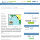
The marine environment is unique and because little light penetrates under water, …
The marine environment is unique and because little light penetrates under water, technologies that use sound are required to gather information. The seafloor is characterized using underwater sound and acoustical systems. Current technological innovations enable scientists to further understand and apply information about animal locations and habitat. Remote sensing and exploration with underwater vehicles enables researchers to map and understand the sea floor. Similar technologies also aid in animal tracking, a method used within science and commercial industries. Through inquiry-based learning techniques, students learn the importance of habitat mapping and animal tracking.
The following lesson is an introduction to the ideas and implications of …
The following lesson is an introduction to the ideas and implications of animal tracking. Animal tracking is a useful method used within science and commercial industries. For instance, when planning the development coastal areas, animal presence and movement should be taken into consideration. The lesson engages students in an activity to monitor animal foraging behavior on a spatial scale. The students will break into groups and track each other's movements as they move through a pre-determined course. The results will be recorded both individually and collaboratively in an attempt to understand animal movement regarding foraging behavior. Students will also engage in a creative design activity, focusing on how they would design a tag for a marine animal of their choice. In conclusion, instructors will query the class on data interpretation and how spatial information is important in relation to commercial, conservation, and scientific research decisions.
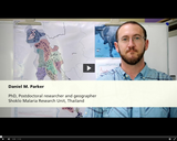
The focus of this presentation is to expand the students’ knowledge about …
The focus of this presentation is to expand the students’ knowledge about the geographic information systems, GIS for the malaria Elimination project. In continuation of this we will discuss mass drug administration and health infrastructure.
One lecture for GEOG 265 – Introduction to GIS with video resources …
One lecture for GEOG 265 – Introduction to GIS with video resources and edited auto-generated captions. Revised text has been published in these videos as new subtitles in English and Spanish.
The purpose of this text is to promote understanding of the Geographic …
The purpose of this text is to promote understanding of the Geographic Information Science and Technology enterprise (GIS&T, also known as “geospatial”).
The purpose of this text is to promote understanding of the Geographic …
The purpose of this text is to promote understanding of the Geographic Information Science and Technology enterprise (GIS&T, also known as “geospatial”).
Everyone can make a web map now, but what are the best …
Everyone can make a web map now, but what are the best tools to do so? Maybe you have already created web maps with ArcGIS or Google Maps but never taken time to have a closer look at open source software alternatives such as QGIS, GeoServer and Leaflet? Or, are you new to web mapping and looking for the best way to create a web application for spatial data from your job or hobby? If so, GEOG 585, Open Web Mapping, is the right course for you. Learn about FOSS vs. proprietary GIS software, open data and standards for web mapping, and how to create beautiful and interactive web maps with Javascript and Leaflet.
This book is designed to be used as a class text but …
This book is designed to be used as a class text but should be easily accessible to programmers interested in Web Programming. It should even be accessible to an advanced hobbyist.
The original goal behind this text was to help students doing research with me in Web based mapping applications, generally using Open Layers. The idea was to provide persistent storage using REST and simple http request from JavaScript to store the data on a server.
No restrictions on your remixing, redistributing, or making derivative works. Give credit to the author, as required.
Your remixing, redistributing, or making derivatives works comes with some restrictions, including how it is shared.
Your redistributing comes with some restrictions. Do not remix or make derivative works.
Most restrictive license type. Prohibits most uses, sharing, and any changes.
Copyrighted materials, available under Fair Use and the TEACH Act for US-based educators, or other custom arrangements. Go to the resource provider to see their individual restrictions.