Updating search results...

Search Resources

229 Results

View
Selected filters:
  • Physical Geography
  • Community College / Lower Division
Designing a Biological Community
Conditional Remix & Share Permitted
CC BY-NC-SA
Rating
0.0 stars

In this Physical Geography Lab, students are responsible for designing a simple biological community.

(Note: this resource was added to OER Commons as part of a batch upload of over 2,200 records. If you notice an issue with the quality of the metadata, please let us know by using the 'report' button and we will flag it for consideration.)

Subject:
Biology
Life Science
Physical Geography
Physical Science
Material Type:
Activity/Lab
Provider:
Science Education Resource Center (SERC) at Carleton College
Provider Set:
Teach the Earth
Author:
Charles Dodd
Date Added:
04/03/2018
Developing a Sense of Place with Pre-service Science Teachers
Conditional Remix & Share Permitted
CC BY-NC-SA
Rating
0.0 stars

The lesson content focuses on designing investigations concerning the notion of scale through a series of investigations on their campus. The overarching goal is to foster a connection to the earth through an investigation of the local environment.

Subject:
Geology
Physical Geography
Physical Science
Material Type:
Activity/Lab
Provider:
Science Education Resource Center (SERC) at Carleton College
Provider Set:
Teach the Earth
Author:
Andrew Gilbert
Date Added:
01/20/2023
Did it Rain on Mars? Analysis of Valley Networks on Mars in an Intro Geo Course
Conditional Remix & Share Permitted
CC BY-NC-SA
Rating
0.0 stars

Some of the Viking images sent back from Mars in the 1970s show tantalizing evidence of dendritic valley networks in some of the oldest terrains on the planet. One of the big questions ever since has been whether it might have rained early in Mars history.

One of the ways of deciding whether the Mars valley networks might have been produced by rainfall is to find out how similar they are to valley networks on Earth, which we know are produced by rainfall. The standard method for analyzing drainage basins is comparison of the number of drainage segments per square kilometer (drainage density) and how extensively branched the network is (stream order).

In this exercise, students calculate stream order for valley segments mapped by Hynek and Phillips (2003) using MOC/MOLA data. Students then use data on valley segment length and drainage basin area from Hynek and Phillips (2003) to calculate drainage density. They compare stream order and drainage density for the Mars site with similar calculations for areas on Earth and evaluate the question of whether valley networks on Mars might be consistent with rainfall on an early Mars, and what the uncertainties and limitations are in their conclusions.

(Note: this resource was added to OER Commons as part of a batch upload of over 2,200 records. If you notice an issue with the quality of the metadata, please let us know by using the 'report' button and we will flag it for consideration.)

Subject:
Applied Science
Biology
Environmental Science
Hydrology
Life Science
Physical Geography
Physical Science
Material Type:
Activity/Lab
Provider:
Science Education Resource Center (SERC) at Carleton College
Provider Set:
Teach the Earth
Author:
Barb Tewksbury
Date Added:
12/11/2020
Digging into Canadian Soils
Conditional Remix & Share Permitted
CC BY-NC
Rating
0.0 stars

An Introduction to Soil Science

Short Description:
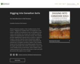
Written entirely by members of the Canadian Society of Soil Science, "Digging into Canadian Soils: An Introduction to Soil Science" provides an introduction to the core disciplines of soil science, and introduces the concepts and vocabulary needed by students just beginning their soil science journey. The textbook provides supplementary materials that are specific to regions in Canada, or may be of specific interest beyond what might be considered introductory soil science material. Importantly, the textbook also is intended to introduce students to the Canadian System of Soil Classification by providing examples from across the length and breadth of the world’s second largest country, and to the Canadian Society of Soil Science, whose members share a common passion for soil science and are keen to share and instill this passion with students across Canada.

Long Description:
Written, reviewed and edited by members of the Canadian Society of Soil Science, Digging into Canadian Soils: An Introduction to Soil Science provides an introduction to the core disciplines of soil science (pedology, soil biology and microbiology, physics, chemistry, fertility and nutrient cycling, and management), and introduces the concepts and vocabulary needed by students just beginning their soil science journey. The textbook is appropriate for use in a number of disciplines, including environmental and agricultural sciences, as well as related geology, geography and natural resources engineering disciplines.

Chapters within the textbook are presented in three sections according to the content and level of the complexity. The first section of the book, Digging In, introduces core disciplines in a series of chapters written by authors whose research expertise informs the chapter content. Supplementary materials that are specific to regions in Canada are presented in chapters within a second section, Digging Across Canada. The third section, Digging Deeper, provides in-depth overview of some topics beyond what is considered core soil science disciplinary material, and may be appropriate for upper level soil science or related discipline courses. The textbook includes an extensive glossary that is accessible via in-text links. Importantly, the textbook is intended also to introduce students to the Canadian System of Soil Classification by providing examples from across the length and breadth of the world’s second largest country, and to the Canadian Society of Soil Science, whose members share a common passion for soil science and are keen to share and instill this passion with students across Canada.

Word Count: 182572

ISBN: 978-0-88880-668-0

(Note: This resource's metadata has been created automatically by reformatting and/or combining the information that the author initially provided as part of a bulk import process.)
Subject:
Agriculture
Applied Science
Career and Technical Education
Engineering
Environmental Science
Environmental Studies
Physical Geography
Physical Science
Material Type:
Textbook
Provider:
Canadian Society of Soil Science
Author:
Canadian Society of Soil Science
Date Added:
08/12/2021
Drawing Structural and Isopachous Maps
Conditional Remix & Share Permitted
CC BY-NC-SA
Rating
0.0 stars

This activity has 3 maps with real stratigraphic data recorded adjacent to drill holes in the Illinois Basin. Students contour the structural data. They may also contour the associated thickness data or they can just look at the trends of the thickness data relative to the structures on their completed structure map.

Subject:
Geology
Physical Geography
Physical Science
Material Type:
Activity/Lab
Homework/Assignment
Provider:
Science Education Resource Center (SERC) at Carleton College
Provider Set:
Teach the Earth
Author:
Janis Treworgy
Date Added:
01/20/2023
Drilling Back to the Future: Climate Clues from Ancient Ice on Greenland
Read the Fine Print
Educational Use
Rating
0.0 stars

This video, from ClimateCentral, features a team of scientists from the Northern Greenland Eemian Ice Drilling Project who study atmospheric air bubbles trapped in an ice core. This work highlights a period in Greenland's ice sheet which began about 130,000 years ago and lasted about 10,000 years; a period known as the Eemian. The air bubbles from the ancient atmosphere reveal what happened with climate change over that period of time.

Subject:
Archaeology
Career and Technical Education
Environmental Studies
Physical Geography
Physical Science
Social Science
Material Type:
Diagram/Illustration
Reading
Provider:
CLEAN: Climate Literacy and Energy Awareness Network
Provider Set:
CLEAN: Climate Literacy and Energy Awareness Network
Author:
Climate Central
Date Added:
08/29/2012
Du soleil pour tous
Unrestricted Use
CC BY
Rating
0.0 stars

L’énergie solaire au Sénégal : un droit, des droits, une histoire

Long Description:
L’énergie solaire est une promesse de développement et de prospérité pour l’Afrique. Elle a été annoncée et expérimentée sur le continent dans un esprit de science ouverte et de « communs » technologiques et énergétiques il y a déjà près de soixante ans. Séchoirs et chauffe-eaux, pompes solaires et centrales électriques thermodynamiques : des pionniers ont développé et installé, dès la fin des années 1950, des techniques et des matériels en Afrique de l’Ouest et en particulier au Sénégal.

Le présent ouvrage, issu de deux journées d’études organisées à Dakar en mai 2016, rend compte pour la première fois, de manière particulièrement symbolique, de cette histoire et du futur de l’énergie solaire en Afrique. Il rassemble, dans une première partie, des témoignages d’acteurs et une mise en perspective sociohistorique large des politiques de l’énergie solaire en Afrique de l’Ouest sur un demi-siècle. Ce regard est complété par la réédition d’un texte de référence du professeur Abdou Moumouni Dioffo, pionnier nigérien de l’énergie solaire dès 1964.

Dans une seconde partie, cet ouvrage interroge également les prolongements actuels de l’énergie solaire en France et au Sénégal, en particulier son encadrement juridique et réglementaire. L’énergie solaire peut-elle ou doit-elle être considérée comme un « commun » ou un droit humain fondamental? Quels sont aujourd’hui les droits associés à l’énergie solaire au Sénégal? Quels enseignements tirer d’une comparaison avec le corpus juridique en la matière tel qu’il existe en France?

Associant juristes français et sénégalais, et spécialistes de la sociologie et des politiques de l’énergie, cet ouvrage se veut au final une invitation et un outil pour poursuivre les recherches sur l’histoire et le droit de l’énergie solaire en Afrique.

(Compléments vidéos, entretiens et témoignages sur le blog de recherche : https://afrisol.hypotheses.org)

Word Count: 96883

ISBN: 978-2-924661-34-5

(Note: This resource's metadata has been created automatically by reformatting and/or combining the information that the author initially provided as part of a bulk import process.)

Subject:
Applied Science
Engineering
Physical Geography
Physical Science
Material Type:
Textbook
Provider:
Éditions science et bien commun
Author:
Mamadou Badji
Sous la direction de Frédéric Caille
Date Added:
10/25/2021
Dɔnko
Conditional Remix & Share Permitted
CC BY-SA
Rating
0.0 stars

Études culturelles africaines

Short Description:
Comment lire et comprendre les pratiques culturelles africaines? Comment mobiliser les savoirs sur l’Afrique, ses arts et ses cultures sans verser dans la réification ou le folklorisme? Profondément novateur, cet ouvrage collectif mobilise les outils théoriques des cultural studies pour proposer un généreux panorama de l’étude de la culture en Afrique. Il rassemble des textes d’auteurs et d’autrices d’Afrique de l'Ouest, théoriques ou descriptifs, qui mettent en lumière la réévaluation passionnante des modes d’appréhension des pratiques et objets en contexte africain que proposent les études culturelles africaines. L’épilogue qui clôt le livre n’est donc point fermeture, mais plutôt ouverture sur les enjeux relatifs à ce nouveau champ d’études, plein de promesses pour rendre compte de l’extraordinaire créativité des cultures africaines.

Long Description:
Comment lire et comprendre les pratiques culturelles africaines? Comment mobiliser les savoirs sur l’Afrique, ses arts et ses cultures sans verser dans la réification ou le folklorisme? Profondément novateur, cet ouvrage collectif mobilise les outils théoriques des cultural studies pour proposer un généreux panorama de l’étude de la culture en Afrique. Il rassemble des textes d’auteurs et d’autrices d’Afrique de l’ouest, théoriques ou descriptifs, qui mettent en lumière la réévaluation passionnante des modes d’appréhension des pratiques et objets en contexte africain que proposent les études culturelles africaines. L’épilogue qui clôt le livre n’est donc point fermeture, mais plutôt ouverture sur les enjeux relatifs à ce nouveau champ d’études, plein de promesses pour rendre compte de l’extraordinaire créativité des cultures africaines.

Word Count: 78460

ISBN: 978-2-924661-82-6

(Note: This resource's metadata has been created automatically by reformatting and/or combining the information that the author initially provided as part of a bulk import process.)
Subject:
Anthropology
Arts and Humanities
Performing Arts
Physical Geography
Physical Science
Social Science
Material Type:
Textbook
Provider:
Éditions science et bien commun
Author:
Salaka Sanou
Sous la direction d'Isaac Bazié
Date Added:
06/08/2019
EARTH
Only Sharing Permitted
CC BY-NC-ND
Rating
0.0 stars

Earth is the third planet from the Sun and the only astronomical object known to harbor life. According to radiometric dating estimation and other evidence, Earth formed over 4.5 billion years ago. Earth's gravity interacts with other objects in space, especially the Sun and the Moon, which is Earth's only natural satellite. Earth orbits around the Sun in 365.256 solar days, a period known as an Earth sidereal year. During this time, Earth rotates about its axis 366.256 times, that is, a sidereal year has 366.256 sidereal days. Earth's axis of rotation is tilted with respect to its orbital plane, producing seasons on Earth. The gravitational interaction between Earth and the Moon causes tides, stabilizes Earth's orientation on its axis, and gradually slows its rotation. Earth is the densest planet in the Solar System and the largest and most massive of the four rocky planets.

Subject:
Physical Geography
Material Type:
Assessment
Author:
Santosh Upreliya
Date Added:
05/29/2020
Earth Science in the News Investigation
Conditional Remix & Share Permitted
CC BY-NC-SA
Rating
0.0 stars

This is a writing assignment intended to get to students to think about the relevance of Earth Science to their everyday lives. Students are asked to read a short news article, selecting 1 of 3 articles provided as choices, that discusses a specific earth science topic. Students write a 1-page report summarizing the article and use the write-up to summarize their familiarity with the topics presented. Students will re-evaluate their understanding of the article and associated earth science topic at the end of the course.

Subject:
Geology
Physical Geography
Physical Science
Material Type:
Homework/Assignment
Provider:
Science Education Resource Center (SERC) at Carleton College
Provider Set:
Teach the Earth
Author:
Alex Lechler
Date Added:
01/20/2023
Earthquake Case Studies: Scientific Details and Societal Impacts
Conditional Remix & Share Permitted
CC BY-NC-SA
Rating
0.0 stars

Learning outcomes for this activity include learning earthquake basics. The larger context of the inequity of earthquake impacts provides a social/environmental justice lens that encourages students to examine earthquake hazards with a broader perspective.

Subject:
Geology
Physical Geography
Physical Science
Social Science
Material Type:
Activity/Lab
Provider:
Science Education Resource Center (SERC) at Carleton College
Provider Set:
Teach the Earth
Author:
Matthew Nyman
Date Added:
01/20/2023
Earth's Changing Climates
Read the Fine Print
Rating
0.0 stars

In this activity, students are guided through graphs of surface air temperature anomaly data and Vostok ice core data to illustrate how scientists use these data to develop the basis for modeling how climate is likely to change in the future.

Subject:
Applied Science
Archaeology
Career and Technical Education
Environmental Science
Environmental Studies
Physical Geography
Physical Science
Social Science
Material Type:
Activity/Lab
Provider:
CLEAN: Climate Literacy and Energy Awareness Network
Provider Set:
CLEAN: Climate Literacy and Energy Awareness Network
Author:
Concord Consortium
Date Added:
09/24/2018
The Eastern World: Daily Readings on Geography
Conditional Remix & Share Permitted
CC BY-NC-SA
Rating
0.0 stars

In essay format, this textbook considers examples of various sub-categories of Geography in combination with five regions of the Eastern World.

Created for GEOGR 1105 - Eastern World Geography at the College of DuPage. This resource will be updated as needed. For the most recent version, visit: https://cod.pressbooks.pub/easternworlddailyreadingsgeography/

Subject:
Cultural Geography
Physical Geography
Physical Science
Social Science
Material Type:
Textbook
Provider:
College of DuPage
Author:
Joel Quam
Scott Campbell
Date Added:
08/03/2022
Energy Industry Applications of GIS
Conditional Remix & Share Permitted
CC BY-NC-SA
Rating
0.0 stars

Is Energy and GIS your passion? If so, Energy Industry Applications of GIS provides students with an in-depth exploration of the complexities of siting decisions in the electricity market. The course introduces a variety of siting challenges that confront the energy industry and its customers and neighbors but focuses on the siting of electrical transmission lines. The course also provides hands-on experience with a common decision support technology, ArcGIS, and considers how the technology may be used to facilitate public participation in siting decisions.

Subject:
Physical Geography
Physical Science
Material Type:
Full Course
Provider:
Penn State College of Earth and Mineral Sciences
Author:
Ron Santini
Date Added:
10/07/2019
Environmental Applications of GIS
Conditional Remix & Share Permitted
CC BY-NC-SA
Rating
0.0 stars

Increasingly volatile climate and weather; vulnerable drinking water supplies; shrinking wildlife habitats; widespread deforestation due to energy and food production. These are examples of environmental challenges that are of critical importance in our world, both in far away places and close to home, and are particularly well suited to inquiry using geographic information systems. In GEOG 487 you will explore topics like these and learn about data and spatial analysis techniques commonly employed in environmental applications. After taking this course you will be equipped with relevant analytical approaches and tools that you can readily apply to your own environmental contexts.

Subject:
Applied Science
Environmental Science
Information Science
Physical Geography
Physical Science
Material Type:
Full Course
Provider:
Penn State College of Earth and Mineral Sciences
Author:
Rachel Kornak
Date Added:
10/07/2019
Essentials of Geographic Information Systems
Conditional Remix & Share Permitted
CC BY-NC-SA
Rating
0.0 stars

Essentials of Geographic Information Systems integrates key concepts behind the technology with practical concerns and real-world applications. Recognizing that many potential GIS users are nonspecialists or may only need a few maps, this book is designed to be accessible, pragmatic, and concise. Essentials of Geographic Information Systems also illustrates how GIS is used to ask questions, inform choices, and guide policy. From the melting of the polar ice caps to privacy issues associated with mapping, this book provides a gentle, yet substantive, introduction to the use and application of digital maps, mapping, and GIS.

Subject:
Physical Geography
Physical Science
Material Type:
Textbook
Provider:
The Saylor Foundation
Author:
Jonathan Campbell
Michael Shin
Date Added:
01/01/2011
Estimating Greenhouse Gas Offsets as Part of Shoreline Community College's Greenhouse Gas Inventory
Conditional Remix & Share Permitted
CC BY-NC-SA
Rating
0.0 stars

This is a service-learning project for students in Geography 204 (Weather, Climate and Ecosystems). Students will assess prior estimates of carbon offsets associated with plant and soil biomass on their college campus; and as a result, they will understand the complexity of measuring the complex sources of carbon emissions and offsets; address the challenges of coordinating data collection and field measurement; and realize importance of estimation in public policy contexts.

(Note: this resource was added to OER Commons as part of a batch upload of over 2,200 records. If you notice an issue with the quality of the metadata, please let us know by using the 'report' button and we will flag it for consideration.)

Subject:
Applied Science
Biology
Environmental Science
Life Science
Mathematics
Physical Geography
Physical Science
Material Type:
Activity/Lab
Provider:
Science Education Resource Center (SERC) at Carleton College
Provider Set:
Teach the Earth
Author:
Charles Dodd, Shoreline Community College
Date Added:
11/14/2018
Estimating flow through an earthen dam
Conditional Remix & Share Permitted
CC BY-NC-SA
Rating
0.0 stars

Students make measurements of dam dimensions and water levels above and below a small, accessible earthen dam. They assess the soil texture in the field. They follow up by developing a simple flow net and estimating seepage rate as part of a problem set. They discuss their assumptions and the likely sources and magnitude of error.

(Note: this resource was added to OER Commons as part of a batch upload of over 2,200 records. If you notice an issue with the quality of the metadata, please let us know by using the 'report' button and we will flag it for consideration.)

Subject:
Biology
Hydrology
Life Science
Physical Geography
Physical Science
Material Type:
Activity/Lab
Provider:
Science Education Resource Center (SERC) at Carleton College
Provider Set:
Teach the Earth
Author:
Kaye Savage
Date Added:
08/06/2019
Estuarine Geography E & G SCI
Only Sharing Permitted
CC BY-NC-ND
Rating
0.0 stars

Estuarine Geography utilizes an ecological approach to understanding physical and biological parameters to estuarine evolution.. Superimposed upon that spatial site and situation are social, human, cultural and political activities. Humans role in estuarine evolution is discussed at length.

Subject:
Ecology
Life Science
Physical Geography
Physical Science
Material Type:
Full Course
Provider:
UMass Boston
Provider Set:
UMass Boston OpenCourseWare
Author:
John Looney
Date Added:
10/14/2015
Explore Real Data from an Ice Core
Conditional Remix & Share Permitted
CC BY-NC-SA
Rating
0.0 stars

Ice core data allow students to explore a number of patterns while learning that researchers need to gather and interpret evidence to understand Earth's past. Students will explore core data collected in Western Greenland that document a few decades of Earth's atmosphere. Students are challenged to identify patterns and then use those patterns and background information to answer a few key questions. The data include measurements of temperature, dust, and atmospheric gases.
Downloadable files are provided for those who intend to run the activity in person. For those running the activity with an online or virtual class, a separate page includes all of the necessary information for students to complete the activity, including an interactive graph and background readings. Support videos are provided.

Subject:
Applied Science
Environmental Science
Mathematics
Measurement and Data
Physical Geography
Physical Science
Material Type:
Activity/Lab
Provider:
Science Education Resource Center (SERC) at Carleton College
Provider Set:
Teach the Earth
Author:
Jason Cervenec
Stacy Porter
Date Added:
01/20/2023