Some of the Viking images sent back from Mars in the 1970s …
Some of the Viking images sent back from Mars in the 1970s show tantalizing evidence of dendritic valley networks in some of the oldest terrains on the planet. One of the big questions ever since has been whether it might have rained early in Mars history.
One of the ways of deciding whether the Mars valley networks might have been produced by rainfall is to find out how similar they are to valley networks on Earth, which we know are produced by rainfall. The standard method for analyzing drainage basins is comparison of the number of drainage segments per square kilometer (drainage density) and how extensively branched the network is (stream order).
In this exercise, students calculate stream order for valley segments mapped by Hynek and Phillips (2003) using MOC/MOLA data. Students then use data on valley segment length and drainage basin area from Hynek and Phillips (2003) to calculate drainage density. They compare stream order and drainage density for the Mars site with similar calculations for areas on Earth and evaluate the question of whether valley networks on Mars might be consistent with rainfall on an early Mars, and what the uncertainties and limitations are in their conclusions.
(Note: this resource was added to OER Commons as part of a batch upload of over 2,200 records. If you notice an issue with the quality of the metadata, please let us know by using the 'report' button and we will flag it for consideration.)
Is Energy and GIS your passion? If so, Energy Industry Applications of …
Is Energy and GIS your passion? If so, Energy Industry Applications of GIS provides students with an in-depth exploration of the complexities of siting decisions in the electricity market. The course introduces a variety of siting challenges that confront the energy industry and its customers and neighbors but focuses on the siting of electrical transmission lines. The course also provides hands-on experience with a common decision support technology, ArcGIS, and considers how the technology may be used to facilitate public participation in siting decisions.
Increasingly volatile climate and weather; vulnerable drinking water supplies; shrinking wildlife habitats; …
Increasingly volatile climate and weather; vulnerable drinking water supplies; shrinking wildlife habitats; widespread deforestation due to energy and food production. These are examples of environmental challenges that are of critical importance in our world, both in far away places and close to home, and are particularly well suited to inquiry using geographic information systems. In GEOG 487 you will explore topics like these and learn about data and spatial analysis techniques commonly employed in environmental applications. After taking this course you will be equipped with relevant analytical approaches and tools that you can readily apply to your own environmental contexts.
This resource is a video abstract of a research paper created by …
This resource is a video abstract of a research paper created by Research Square on behalf of its authors. It provides a synopsis that's easy to understand, and can be used to introduce the topics it covers to students, researchers, and the general public. The video's transcript is also provided in full, with a portion provided below for preview:
"Scientists can’t easily peer into the distant past for patterns of evolution. That makes it hard to understand the laws by which species form, transform, and nestle themselves along the tree of life. But studying how species are branched throughout the globe today can provide critical clues. In a recent study, scientists from Japan examined how the diversity of woody plant species varies across continents and across the entire planet. It’s the first study of its kind to find patterns on a global-scale data set. And the findings appear to confirm long-standing hypotheses about the roles of climate and geography in the evolution of life on earth. Climate and geography are important constraints that drive patterns of diversity among different species. They act as evolutionary filters. Harsh climates, for example, can create an ecological bottleneck that keeps certain families of organisms from dispersing into colder habitats..."
The rest of the transcript, along with a link to the research itself, is available on the resource itself.
Essentials of Geographic Information Systems integrates key concepts behind the technology with …
Essentials of Geographic Information Systems integrates key concepts behind the technology with practical concerns and real-world applications. Recognizing that many potential GIS users are nonspecialists or may only need a few maps, this book is designed to be accessible, pragmatic, and concise. Essentials of Geographic Information Systems also illustrates how GIS is used to ask questions, inform choices, and guide policy. From the melting of the polar ice caps to privacy issues associated with mapping, this book provides a gentle, yet substantive, introduction to the use and application of digital maps, mapping, and GIS.
Students make measurements of dam dimensions and water levels above and below …
Students make measurements of dam dimensions and water levels above and below a small, accessible earthen dam. They assess the soil texture in the field. They follow up by developing a simple flow net and estimating seepage rate as part of a problem set. They discuss their assumptions and the likely sources and magnitude of error.
(Note: this resource was added to OER Commons as part of a batch upload of over 2,200 records. If you notice an issue with the quality of the metadata, please let us know by using the 'report' button and we will flag it for consideration.)
Estuarine Geography utilizes an ecological approach to understanding physical and biological parameters …
Estuarine Geography utilizes an ecological approach to understanding physical and biological parameters to estuarine evolution.. Superimposed upon that spatial site and situation are social, human, cultural and political activities. Humans role in estuarine evolution is discussed at length.
Ice core data allow students to explore a number of patterns while …
Ice core data allow students to explore a number of patterns while learning that researchers need to gather and interpret evidence to understand Earth's past. Students will explore core data collected in Western Greenland that document a few decades of Earth's atmosphere. Students are challenged to identify patterns and then use those patterns and background information to answer a few key questions. The data include measurements of temperature, dust, and atmospheric gases. Downloadable files are provided for those who intend to run the activity in person. For those running the activity with an online or virtual class, a separate page includes all of the necessary information for students to complete the activity, including an interactive graph and background readings. Support videos are provided.
This assignment allows students to utilize real soil data/information presented online to …
This assignment allows students to utilize real soil data/information presented online to learn how the some of the physical properties of the soil influence the chemistry of the soil and health of the ecosystem.
(Note: this resource was added to OER Commons as part of a batch upload of over 2,200 records. If you notice an issue with the quality of the metadata, please let us know by using the 'report' button and we will flag it for consideration.)
ìExploring Imagery and Elevation Data in GIS Applicationsî (GEOG 480) focuses on …
ìExploring Imagery and Elevation Data in GIS Applicationsî (GEOG 480) focuses on the use of remotely sensed imagery and elevation data in GIS applications. Students enrolling in GEOG 480 should have a solid conceptual foundation in geospatial information science and technology. GEOG 480 is appropriate for those who are already working in the geospatial profession and wish to use imagery and elevation data in visualization and spatial analysis. Throughout the course, students confront realistic remote sensing problem scenarios that incorporate such skills and concepts as definition of data needs, metadata content standards, data formats and types, and analysis methods.
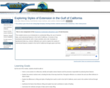
An introduction to processes associated with continental rifting, and resulting fault geometries …
An introduction to processes associated with continental rifting, and resulting fault geometries and distributions, and lithospheric responses, using seismic data examples from the Gulf of California.
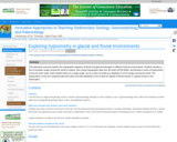
This laboratory exercise explores the topographic signature of fluvial and glacial landscapes …
This laboratory exercise explores the topographic signature of fluvial and glacial landscapes in different tectonic environments. Students develop a list of mountain ranges around the world to explore, then extract topographic data from 90-meter SRTM DEMs, and develop a series of hypsometric curves for each range. Each student works on a single range, but as a class we build up a database of 10-15 ranges around the world. The hypsometric curves are compared with each other and with published curves to look for signals of fluvial incision vs. glacial erosion in the landscapes.
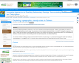
This activity is designed as both an introduction to GIS and an …
This activity is designed as both an introduction to GIS and an exploration of topographic steady-state. Students analyze DEMs from Taiwan to extract topographic profiles across the range. They reconstruct a series of datasets presented in Stolar et al., (2007), showing the progression of the range to steady-state as a space-for-time substitution from south to north. Students are expected to relate their observations from the topography to theoretical concepts discussed in class including accretion and uplift, steady-state, and critical wedge theory.
An extension involves developing a simple numerical model in Excel of a mountain range as it progresses to topographic steady-state landscape, allowing students to investigate the rise of a mountain range to steady-state both from Taiwan data and from their numerical model.
The course provides students with (1) an introduction to the geologic history …
The course provides students with (1) an introduction to the geologic history of western North America, with particular emphasis on our field camp location and (2) an introduction to both digital and traditional techniques of geological field study. The weather permitting, several weekend field exercises provide practical experience in preparation for Field Geology II (12.115). It presents introductory material on the regional geology of the locale of 12.115.
The assignments consists of three essay questions, of which the students were …
The assignments consists of three essay questions, of which the students were required to complete two of their choice. During a trip to the Field Museum, Chicago, the students were required to use the museum exhibits to explore the questions posed in the assignment. The main goal was to familiarize the students with using museums as a resource, as well as use observation-based techniques of specimens to answer scientific questions.
In this activity, students will use oxygen isotope values of two species …
In this activity, students will use oxygen isotope values of two species of modern coral to reconstruct ambient water temperature over a four-year period. They use Microsoft Excel, or similar application, to create a spreadsheet of temperature values calculated from the isotope values of the corals by means of an algebraic equation. Students then use correlation and regression techniques to determine whether isotope records can be considered to be good proxies for records of past temperatures.
Course Description:GEO 212. Introduction to Meteorology (4 credit hour). Physical and chemical …
Course Description:GEO 212. Introduction to Meteorology (4 credit hour). Physical and chemical conditions that regulate global weather phenomena. Includes structure of the atmosphere, temperature, humidity, air pressure and winds, the development of weather systems, tornadoes and hurricanes, and the parameters that affect local and global climate. Laboratory includes image interpretation, field observation and prediction. This is formatted as an 8 week/module course.Learning Outcomes:1. Describe the origin and structure of the earth and its atmosphere. (1, 7)2. Use scientific reasoning to explain the relationship between the earth and sun and how solarand terrestrial radiation affects temperature, air pressure and wind patterns. (1, 2, 7, 8)3. Explain the role of heat, moisture and winds in generating clouds, precipitation and severeweather. (2-6, 8)4. Model major atmospheric circulation systems and oscillations. (1-8)5. Describe climatic regions and assess climate change predictions. (1-8)6. Interpret meteorological data to predict weather conditions. (1-8)
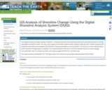
The Digital Shoreline Analysis System (DSAS) is a software extension for ArcGIS …
The Digital Shoreline Analysis System (DSAS) is a software extension for ArcGIS that allows for automated shoreline change calculations along the coast. The user must supply the shoreline data and the software helps the user create measurement locations (transects) and completes the shoreline change calculations at each location. The result is a visual representation of the shoreline change along a coastline. This representation is far more useful for analysis that one overall average. Unusually high rates of erosion/accretion are easily recognized from the resulting map. The study location is Rodanthe, NC. The data used in this exercise is the sample data provided by the USGS.
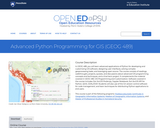
In GEOG 489, you will learn advanced applications of Python for developing …
In GEOG 489, you will learn advanced applications of Python for developing and customizing GIS software, designing user interfaces, solving complex geoprocessing tasks, and leveraging open source. The course consists of readings, walkthroughs, projects, quizzes, and discussions about advanced GIS programming concepts and techniques, and a final term project. It complements the material covered in GEOG 485: GIS Programming and Customization. Software covered in the course includes: Esri ArcGIS Pro/arcpy, Jupyter Notebook, Esri ArcGIS API for Python, QGIS, GDAL/OGR. Students will also use of the Git version control software for code management, and learn techniques for distributing Python applications to end users.
No restrictions on your remixing, redistributing, or making derivative works. Give credit to the author, as required.
Your remixing, redistributing, or making derivatives works comes with some restrictions, including how it is shared.
Your redistributing comes with some restrictions. Do not remix or make derivative works.
Most restrictive license type. Prohibits most uses, sharing, and any changes.
Copyrighted materials, available under Fair Use and the TEACH Act for US-based educators, or other custom arrangements. Go to the resource provider to see their individual restrictions.