Updating search results...

Search Resources

204 Results

View
Selected filters:
  • Physical Geography
  • Community College / Lower Division
  • College / Upper Division
  • Teacher
  • Student
  • English
  • Conditional Remix & Share Permitted
  • Unrestricted Use
  • CC Noncommercial-Share Alike
  • CC Attribution-Noncommercial-Share Alike
  • GNU FDL
  • CC Attribution
  • CC Attribution-Share Alike
  • CC Attribution-Noncommercial
  • Public Domain
Developing a Sense of Place with Pre-service Science Teachers
Conditional Remix & Share Permitted
CC BY-NC-SA
Rating
0.0 stars

The lesson content focuses on designing investigations concerning the notion of scale through a series of investigations on their campus. The overarching goal is to foster a connection to the earth through an investigation of the local environment.

Subject:
Geology
Physical Geography
Physical Science
Material Type:
Activity/Lab
Provider:
Science Education Resource Center (SERC) at Carleton College
Provider Set:
Teach the Earth
Author:
Andrew Gilbert
Date Added:
01/20/2023
Did it Rain on Mars? Analysis of Valley Networks on Mars in an Intro Geo Course
Conditional Remix & Share Permitted
CC BY-NC-SA
Rating
0.0 stars

Some of the Viking images sent back from Mars in the 1970s show tantalizing evidence of dendritic valley networks in some of the oldest terrains on the planet. One of the big questions ever since has been whether it might have rained early in Mars history.

One of the ways of deciding whether the Mars valley networks might have been produced by rainfall is to find out how similar they are to valley networks on Earth, which we know are produced by rainfall. The standard method for analyzing drainage basins is comparison of the number of drainage segments per square kilometer (drainage density) and how extensively branched the network is (stream order).

In this exercise, students calculate stream order for valley segments mapped by Hynek and Phillips (2003) using MOC/MOLA data. Students then use data on valley segment length and drainage basin area from Hynek and Phillips (2003) to calculate drainage density. They compare stream order and drainage density for the Mars site with similar calculations for areas on Earth and evaluate the question of whether valley networks on Mars might be consistent with rainfall on an early Mars, and what the uncertainties and limitations are in their conclusions.

(Note: this resource was added to OER Commons as part of a batch upload of over 2,200 records. If you notice an issue with the quality of the metadata, please let us know by using the 'report' button and we will flag it for consideration.)

Subject:
Applied Science
Biology
Environmental Science
Hydrology
Life Science
Physical Geography
Physical Science
Material Type:
Activity/Lab
Provider:
Science Education Resource Center (SERC) at Carleton College
Provider Set:
Teach the Earth
Author:
Barb Tewksbury
Date Added:
12/11/2020
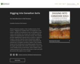
Digging into Canadian Soils
Conditional Remix & Share Permitted
CC BY-NC
Rating
0.0 stars

An Introduction to Soil Science

Short Description:
Written entirely by members of the Canadian Society of Soil Science, "Digging into Canadian Soils: An Introduction to Soil Science" provides an introduction to the core disciplines of soil science, and introduces the concepts and vocabulary needed by students just beginning their soil science journey. The textbook provides supplementary materials that are specific to regions in Canada, or may be of specific interest beyond what might be considered introductory soil science material. Importantly, the textbook also is intended to introduce students to the Canadian System of Soil Classification by providing examples from across the length and breadth of the world’s second largest country, and to the Canadian Society of Soil Science, whose members share a common passion for soil science and are keen to share and instill this passion with students across Canada.

Long Description:
Written, reviewed and edited by members of the Canadian Society of Soil Science, Digging into Canadian Soils: An Introduction to Soil Science provides an introduction to the core disciplines of soil science (pedology, soil biology and microbiology, physics, chemistry, fertility and nutrient cycling, and management), and introduces the concepts and vocabulary needed by students just beginning their soil science journey. The textbook is appropriate for use in a number of disciplines, including environmental and agricultural sciences, as well as related geology, geography and natural resources engineering disciplines.

Chapters within the textbook are presented in three sections according to the content and level of the complexity. The first section of the book, Digging In, introduces core disciplines in a series of chapters written by authors whose research expertise informs the chapter content. Supplementary materials that are specific to regions in Canada are presented in chapters within a second section, Digging Across Canada. The third section, Digging Deeper, provides in-depth overview of some topics beyond what is considered core soil science disciplinary material, and may be appropriate for upper level soil science or related discipline courses. The textbook includes an extensive glossary that is accessible via in-text links. Importantly, the textbook is intended also to introduce students to the Canadian System of Soil Classification by providing examples from across the length and breadth of the world’s second largest country, and to the Canadian Society of Soil Science, whose members share a common passion for soil science and are keen to share and instill this passion with students across Canada.

Word Count: 182572

ISBN: 978-0-88880-668-0

(Note: This resource's metadata has been created automatically by reformatting and/or combining the information that the author initially provided as part of a bulk import process.)

Subject:
Agriculture
Applied Science
Career and Technical Education
Engineering
Environmental Science
Environmental Studies
Physical Geography
Physical Science
Material Type:
Textbook
Provider:
Canadian Society of Soil Science
Author:
Canadian Society of Soil Science
Date Added:
08/12/2021
Drawing Structural and Isopachous Maps
Conditional Remix & Share Permitted
CC BY-NC-SA
Rating
0.0 stars

This activity has 3 maps with real stratigraphic data recorded adjacent to drill holes in the Illinois Basin. Students contour the structural data. They may also contour the associated thickness data or they can just look at the trends of the thickness data relative to the structures on their completed structure map.

Subject:
Geology
Physical Geography
Physical Science
Material Type:
Activity/Lab
Homework/Assignment
Provider:
Science Education Resource Center (SERC) at Carleton College
Provider Set:
Teach the Earth
Author:
Janis Treworgy
Date Added:
01/20/2023
Earth Science in the News Investigation
Conditional Remix & Share Permitted
CC BY-NC-SA
Rating
0.0 stars

This is a writing assignment intended to get to students to think about the relevance of Earth Science to their everyday lives. Students are asked to read a short news article, selecting 1 of 3 articles provided as choices, that discusses a specific earth science topic. Students write a 1-page report summarizing the article and use the write-up to summarize their familiarity with the topics presented. Students will re-evaluate their understanding of the article and associated earth science topic at the end of the course.

Subject:
Geology
Physical Geography
Physical Science
Material Type:
Homework/Assignment
Provider:
Science Education Resource Center (SERC) at Carleton College
Provider Set:
Teach the Earth
Author:
Alex Lechler
Date Added:
01/20/2023
Earthquake Case Studies: Scientific Details and Societal Impacts
Conditional Remix & Share Permitted
CC BY-NC-SA
Rating
0.0 stars

Learning outcomes for this activity include learning earthquake basics. The larger context of the inequity of earthquake impacts provides a social/environmental justice lens that encourages students to examine earthquake hazards with a broader perspective.

Subject:
Geology
Physical Geography
Physical Science
Social Science
Material Type:
Activity/Lab
Provider:
Science Education Resource Center (SERC) at Carleton College
Provider Set:
Teach the Earth
Author:
Matthew Nyman
Date Added:
01/20/2023
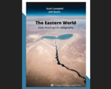
The Eastern World: Daily Readings on Geography
Conditional Remix & Share Permitted
CC BY-NC-SA
Rating
0.0 stars

In essay format, this textbook considers examples of various sub-categories of Geography in combination with five regions of the Eastern World.

Created for GEOGR 1105 - Eastern World Geography at the College of DuPage. This resource will be updated as needed. For the most recent version, visit: https://cod.pressbooks.pub/easternworlddailyreadingsgeography/

Subject:
Cultural Geography
Physical Geography
Physical Science
Social Science
Material Type:
Textbook
Provider:
College of DuPage
Author:
Joel Quam
Scott Campbell
Date Added:
08/03/2022
Energy Industry Applications of GIS
Conditional Remix & Share Permitted
CC BY-NC-SA
Rating
0.0 stars

Is Energy and GIS your passion? If so, Energy Industry Applications of GIS provides students with an in-depth exploration of the complexities of siting decisions in the electricity market. The course introduces a variety of siting challenges that confront the energy industry and its customers and neighbors but focuses on the siting of electrical transmission lines. The course also provides hands-on experience with a common decision support technology, ArcGIS, and considers how the technology may be used to facilitate public participation in siting decisions.

Subject:
Physical Geography
Physical Science
Material Type:
Full Course
Provider:
Penn State College of Earth and Mineral Sciences
Author:
Ron Santini
Date Added:
10/07/2019
Environmental Applications of GIS
Conditional Remix & Share Permitted
CC BY-NC-SA
Rating
0.0 stars

Increasingly volatile climate and weather; vulnerable drinking water supplies; shrinking wildlife habitats; widespread deforestation due to energy and food production. These are examples of environmental challenges that are of critical importance in our world, both in far away places and close to home, and are particularly well suited to inquiry using geographic information systems. In GEOG 487 you will explore topics like these and learn about data and spatial analysis techniques commonly employed in environmental applications. After taking this course you will be equipped with relevant analytical approaches and tools that you can readily apply to your own environmental contexts.

Subject:
Applied Science
Environmental Science
Information Science
Physical Geography
Physical Science
Material Type:
Full Course
Provider:
Penn State College of Earth and Mineral Sciences
Author:
Rachel Kornak
Date Added:
10/07/2019
Essentials of Geographic Information Systems
Conditional Remix & Share Permitted
CC BY-NC-SA
Rating
0.0 stars

Essentials of Geographic Information Systems integrates key concepts behind the technology with practical concerns and real-world applications. Recognizing that many potential GIS users are nonspecialists or may only need a few maps, this book is designed to be accessible, pragmatic, and concise. Essentials of Geographic Information Systems also illustrates how GIS is used to ask questions, inform choices, and guide policy. From the melting of the polar ice caps to privacy issues associated with mapping, this book provides a gentle, yet substantive, introduction to the use and application of digital maps, mapping, and GIS.

Subject:
Physical Geography
Physical Science
Material Type:
Textbook
Provider:
The Saylor Foundation
Author:
Jonathan Campbell
Michael Shin
Date Added:
01/01/2011
Estimating Greenhouse Gas Offsets as Part of Shoreline Community College's Greenhouse Gas Inventory
Conditional Remix & Share Permitted
CC BY-NC-SA
Rating
0.0 stars

This is a service-learning project for students in Geography 204 (Weather, Climate and Ecosystems). Students will assess prior estimates of carbon offsets associated with plant and soil biomass on their college campus; and as a result, they will understand the complexity of measuring the complex sources of carbon emissions and offsets; address the challenges of coordinating data collection and field measurement; and realize importance of estimation in public policy contexts.

(Note: this resource was added to OER Commons as part of a batch upload of over 2,200 records. If you notice an issue with the quality of the metadata, please let us know by using the 'report' button and we will flag it for consideration.)

Subject:
Applied Science
Biology
Environmental Science
Life Science
Mathematics
Physical Geography
Physical Science
Material Type:
Activity/Lab
Provider:
Science Education Resource Center (SERC) at Carleton College
Provider Set:
Teach the Earth
Author:
Charles Dodd, Shoreline Community College
Date Added:
11/14/2018
Estimating flow through an earthen dam
Conditional Remix & Share Permitted
CC BY-NC-SA
Rating
0.0 stars

Students make measurements of dam dimensions and water levels above and below a small, accessible earthen dam. They assess the soil texture in the field. They follow up by developing a simple flow net and estimating seepage rate as part of a problem set. They discuss their assumptions and the likely sources and magnitude of error.

(Note: this resource was added to OER Commons as part of a batch upload of over 2,200 records. If you notice an issue with the quality of the metadata, please let us know by using the 'report' button and we will flag it for consideration.)

Subject:
Biology
Hydrology
Life Science
Physical Geography
Physical Science
Material Type:
Activity/Lab
Provider:
Science Education Resource Center (SERC) at Carleton College
Provider Set:
Teach the Earth
Author:
Kaye Savage
Date Added:
08/06/2019
Explore Real Data from an Ice Core
Conditional Remix & Share Permitted
CC BY-NC-SA
Rating
0.0 stars

Ice core data allow students to explore a number of patterns while learning that researchers need to gather and interpret evidence to understand Earth's past. Students will explore core data collected in Western Greenland that document a few decades of Earth's atmosphere. Students are challenged to identify patterns and then use those patterns and background information to answer a few key questions. The data include measurements of temperature, dust, and atmospheric gases.
Downloadable files are provided for those who intend to run the activity in person. For those running the activity with an online or virtual class, a separate page includes all of the necessary information for students to complete the activity, including an interactive graph and background readings. Support videos are provided.

Subject:
Applied Science
Environmental Science
Mathematics
Measurement and Data
Physical Geography
Physical Science
Material Type:
Activity/Lab
Provider:
Science Education Resource Center (SERC) at Carleton College
Provider Set:
Teach the Earth
Author:
Jason Cervenec
Stacy Porter
Date Added:
01/20/2023
Exploring Barrier Islands in Google Earth
Conditional Remix & Share Permitted
CC BY-NC-SA
Rating
0.0 stars

This is an exploration in Google Earth of the links between barrier island morphology and wave and tidal energy.

Subject:
Geology
Oceanography
Physical Geography
Physical Science
Material Type:
Activity/Lab
Provider:
Science Education Resource Center (SERC) at Carleton College
Provider Set:
Teach the Earth
Author:
Lonnie Leithold
Date Added:
01/20/2023
Exploring Cation Exchange Capacity through the use of the Soil Survey
Conditional Remix & Share Permitted
CC BY-NC-SA
Rating
0.0 stars

This assignment allows students to utilize real soil data/information presented online to learn how the some of the physical properties of the soil influence the chemistry of the soil and health of the ecosystem.

(Note: this resource was added to OER Commons as part of a batch upload of over 2,200 records. If you notice an issue with the quality of the metadata, please let us know by using the 'report' button and we will flag it for consideration.)

Subject:
Career and Technical Education
Chemistry
Environmental Studies
Physical Geography
Physical Science
Material Type:
Activity/Lab
Provider:
Science Education Resource Center (SERC) at Carleton College
Provider Set:
Teach the Earth
Author:
Scott Werts
Date Added:
05/04/2021
Exploring Imagery and Elevation Data in GIS Applications
Conditional Remix & Share Permitted
CC BY-NC-SA
Rating
0.0 stars

ìExploring Imagery and Elevation Data in GIS Applicationsî (GEOG 480) focuses on the use of remotely sensed imagery and elevation data in GIS applications. Students enrolling in GEOG 480 should have a solid conceptual foundation in geospatial information science and technology. GEOG 480 is appropriate for those who are already working in the geospatial profession and wish to use imagery and elevation data in visualization and spatial analysis. Throughout the course, students confront realistic remote sensing problem scenarios that incorporate such skills and concepts as definition of data needs, metadata content standards, data formats and types, and analysis methods.

Subject:
Physical Geography
Physical Science
Material Type:
Full Course
Provider:
Penn State College of Earth and Mineral Sciences
Author:
Karen Schuckman
Date Added:
10/07/2019
Exploring Styles of Extension in the Gulf of California
Conditional Remix & Share Permitted
CC BY-NC-SA
Rating
0.0 stars

An introduction to processes associated with continental rifting, and resulting fault geometries and distributions, and lithospheric responses, using seismic data examples from the Gulf of California.

Subject:
Geology
Physical Geography
Physical Science
Material Type:
Activity/Lab
Provider:
Science Education Resource Center (SERC) at Carleton College
Provider Set:
Teach the Earth
Author:
Andrew Goodliffe
Jack Loveless
Lisa Lamb
Rebecca Dorsey
Scott Bennett
Sue Cashman
Date Added:
01/20/2023
Exploring hypsometry in glacial and fluvial environments
Conditional Remix & Share Permitted
CC BY-NC-SA
Rating
0.0 stars

This laboratory exercise explores the topographic signature of fluvial and glacial landscapes in different tectonic environments. Students develop a list of mountain ranges around the world to explore, then extract topographic data from 90-meter SRTM DEMs, and develop a series of hypsometric curves for each range. Each student works on a single range, but as a class we build up a database of 10-15 ranges around the world. The hypsometric curves are compared with each other and with published curves to look for signals of fluvial incision vs. glacial erosion in the landscapes.

Subject:
Geology
Physical Geography
Physical Science
Material Type:
Activity/Lab
Provider:
Science Education Resource Center (SERC) at Carleton College
Provider Set:
Teach the Earth
Author:
Karen Gran
Date Added:
01/20/2023
Exploring sea level change in Google Earth
Conditional Remix & Share Permitted
CC BY-NC-SA
Rating
0.0 stars

This is a short activity that uses Google Earth to explore sea-level change as measured by tidal gauges around the world

Subject:
Geology
Oceanography
Physical Geography
Physical Science
Material Type:
Activity/Lab
Provider:
Science Education Resource Center (SERC) at Carleton College
Provider Set:
Teach the Earth
Author:
Lonnie Leithold
Date Added:
01/20/2023
Exploring topographic steady-state in Taiwan
Conditional Remix & Share Permitted
CC BY-NC-SA
Rating
0.0 stars

This activity is designed as both an introduction to GIS and an exploration of topographic steady-state. Students analyze DEMs from Taiwan to extract topographic profiles across the range. They reconstruct a series of datasets presented in Stolar et al., (2007), showing the progression of the range to steady-state as a space-for-time substitution from south to north. Students are expected to relate their observations from the topography to theoretical concepts discussed in class including accretion and uplift, steady-state, and critical wedge theory.

An extension involves developing a simple numerical model in Excel of a mountain range as it progresses to topographic steady-state landscape, allowing students to investigate the rise of a mountain range to steady-state both from Taiwan data and from their numerical model.

Subject:
Applied Science
Computer Science
Geology
Physical Geography
Physical Science
Material Type:
Activity/Lab
Provider:
Science Education Resource Center (SERC) at Carleton College
Provider Set:
Teach the Earth
Author:
Karen Gran
Date Added:
01/20/2023