In 6.635, topics covered include: special relativity, electrodynamics of moving media, waves …
In 6.635, topics covered include: special relativity, electrodynamics of moving media, waves in dispersive media, microstrip integrated circuits, quantum optics, remote sensing, radiative transfer theory, scattering by rough surfaces, effective permittivities, random media, Green's functions for planarly layered media, integral equations in electromagnetics, method of moments, time domain method of moments, EM waves in periodic structures: photonic crystals and negative refraction.
O aplicativo GeoSensor é o produto técnico da dissertação de mestrado intitulada: …
O aplicativo GeoSensor é o produto técnico da dissertação de mestrado intitulada: App GeoSensor, Geotecnologias Aplicadas ao Ensino das Ciências Ambientais, apresentada ao Programa de Pós-Graduação em Rede Nacional para Ensino das Ciências Ambientais – Profciamb, núcleo UFPA. O app foi concebido como uma forma de disseminar conhecimentos em Geotecnologias, de maneira didática e acessível, além de fazer paralelo com conhecimentos de disciplinas curriculares, como matemática, física e química, de modo a servir como incentivo ao Ensino de Ciências Ambientais, despertando o interesse dos alunos, utilizando exemplos de aplicações práticas de conceitos vistos em sala de aula, além de possibilitar aos educadores demonstrar as aplicações do conhecimento obtido em sala na vida de todos. O aplicativo foi desenvolvido tendo como público-alvo discentes e docentes do ensino médio, com possibilidades de aplicação também a partir do ensino fundamental 2, bem como em níveis técnico e superior.
This is an introduction to the physics of atmospheric radiation and remote …
This is an introduction to the physics of atmospheric radiation and remote sensing including use of computer codes. Subjects covered include: radiative transfer equation including emission and scattering, spectroscopy, Mie theory, and numerical solutions. We examine the solution of inverse problems in remote sensing of atmospheric temperature and composition.
When we look at the night sky, we see stars and the …
When we look at the night sky, we see stars and the nearby planets of our own solar system. Many of those stars are actually distant galaxies and glowing clouds of dust and gases called nebulae. The universe is an immense space with distances measured in light years. The more we learn about the universe beyond our solar system, the more we realize we do not know. Students are introduced to the basic known facts about the universe, and how engineers help us explore the many mysteries of space.
BRIGHT Girls was a project to build broader participation in the sciences, …
BRIGHT Girls was a project to build broader participation in the sciences, led by the University of Alaska Fairbanks and funded by the National Science Foundation. We sought to increase students' motivation and capacity to pursue careers in STEM by engaging them in studies of nearby natural environments. The developed lesson plans may be used in formal or informal educational settings, e.g., in a summer academy or across multiple class periods. These investigations help students explore the relationships among life history and ecosystems, connecting biology to geology and remote sensing.
This activity requires students to process, interpret and integrate a wide variety …
This activity requires students to process, interpret and integrate a wide variety of remote sensing and other data as they investigate a complex, open-ended research question. It is hands-on, collaborative, and manageable for a variety of class sizes. The problem addressed has geological, hydrological, biological and political implications, and is thus of interest to a wide array of undergraduates.
Increasingly volatile climate and weather; vulnerable drinking water supplies; shrinking wildlife habitats; …
Increasingly volatile climate and weather; vulnerable drinking water supplies; shrinking wildlife habitats; widespread deforestation due to energy and food production. These are examples of environmental challenges that are of critical importance in our world, both in far away places and close to home, and are particularly well suited to inquiry using geographic information systems. In GEOG 487 you will explore topics like these and learn about data and spatial analysis techniques commonly employed in environmental applications. After taking this course you will be equipped with relevant analytical approaches and tools that you can readily apply to your own environmental contexts.
ìExploring Imagery and Elevation Data in GIS Applicationsî (GEOG 480) focuses on …
ìExploring Imagery and Elevation Data in GIS Applicationsî (GEOG 480) focuses on the use of remotely sensed imagery and elevation data in GIS applications. Students enrolling in GEOG 480 should have a solid conceptual foundation in geospatial information science and technology. GEOG 480 is appropriate for those who are already working in the geospatial profession and wish to use imagery and elevation data in visualization and spatial analysis. Throughout the course, students confront realistic remote sensing problem scenarios that incorporate such skills and concepts as definition of data needs, metadata content standards, data formats and types, and analysis methods.
This resource was created as part of a project to develop open-access …
This resource was created as part of a project to develop open-access lab notes for the University of Ottawa's "GIS and the Digital Earth" course and its French counterpart "SIG et la Terre numérique". It contains lab notes for five labs with exercises for this introductory course, as well as the data needed for students to work through the labs. All labs are based on ArcGIS Pro, and requires students to have access to this software.
DESCRIPTION Introduces students to the theory and methods of remote sensing through use of satellite imagery. Practical exercises involve use of SPOT, LANDSAT and Quickbird images with ArcGIS/Imagine Analysis software. Digital analysis is discussed and performed including preprocessing, image classification and image evaluation. Intended for students enrolled in the second year of GIS or UAS programs, or similar academic preparation (see program director for details).
LEARNING OUTCOMES 1. Demonstrate knowledge and apply skills essential to the discipline. 2. Apply GIS skills necessary to provide geospatial and thematic data. 3. Apply critical thinking and problem solving skill that reflect best practice. 4. Coordinate and manage the delivery of reliable, valid, GIS data including analysis and specialized user needs products. 5. Communicate effectively and appropriately within a professional setting in both written and oral form.
Geographic Intelligence (GEOINT) is more than people working with computers in a …
Geographic Intelligence (GEOINT) is more than people working with computers in a secure intelligence facility. Join us for this exciting journey to learn about GEOINT's application in business, law enforcement, and defense. Advances in satellites, GPS, unmanned aerial systems, wireless communications, handheld computing, and the ability to automate laborious map analysis processes has transformed what used to be called geographic intelligence, or GEOINT, and the nature of the insights provided to managers and leaders. We have gone from mountains of hardcopy maps to amazing automated systems that provide previously unavailable understanding. GEOINT combines geographic information science and technologies with an analytic tradecraft. You will experience the value of GEOINT. We welcome you to the Revolution.
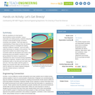
The marine environment is unique and requires technologies that can use sound …
The marine environment is unique and requires technologies that can use sound to gather information since there is little light underwater. The sea-floor is characterized using underwater sound and acoustical systems. Current technological innovations are allowing scientists to further understand and apply information about animal locations and habitat. Remote sensing and exploration with underwater vehicles allows scientists to map and understand the sea floor, and in some cases, the water column. In this lesson, the students will be shown benthic habitat images produced by GIS. These imaged will lead to a class discussion on why habitat mapping is useful and how current technology works to make bathymetry mapping possible. The teacher will then ask inquiry-based questions to have students brainstorm about the importance of bathymetry mapping.
This article highlights science lessons and activities that can help elementary students …
This article highlights science lessons and activities that can help elementary students gain an understanding of the tools and technology involved in polar research. Suggestions for literacy integration are provided, and activities are aligned to national standards.
Benjamin Franklin is credited with saying, “Some people are weatherwise, but most …
Benjamin Franklin is credited with saying, “Some people are weatherwise, but most are otherwise.” Ol’ Ben understood that weather can have a great effect on our everyday lives, and he knew the importance of having an understanding of what makes the atmosphere work (and not just knowing when it’s safe to fly a kite). In Meteo 3, we will examine all aspects of the weather. You’ll learn the fundamental processes that drive the atmosphere, along with some of the tools we use to measure those processes. You’ll also learn about large-scale weather systems, severe convection, tropical weather, and climate change. As a result, you’ll be a better consumer of weather information and forecasts. So… do you want to be weatherwise?
With the assistance of a few teacher demonstrations (online animation, using a …
With the assistance of a few teacher demonstrations (online animation, using a radiometer and rubbing hands), students review the concept of heat transfer through convection, conduction and radiation. Then they apply an understanding of these ideas as they use wireless temperature probes to investigate the heating capacity of different materials sand and water under heat lamps (or outside in full sunshine). The experiment models how radiant energy drives convection within the atmosphere and oceans, thus producing winds and weather conditions, while giving students the hands-on opportunity to understand the value of remote-sensing capabilities designed by engineers. Students collect and record temperature data on how fast sand and water heat and cool. Then they create multi-line graphs to display and compare their data, and discuss the need for efficient and reliable engineer-designed tools like wireless sensors in real-world applications.
The Nature of Geographic Information is an orientation to the properties of …
The Nature of Geographic Information is an orientation to the properties of geographic data and the practice of distance learning. The purpose of this course is to promote understanding of the Geographic Information Science and Technology (GIS&T) enterprise. GIS&T is the intersection of professions, institutions, and technologies that produce geographic data and render information from it. It is a rapidly growing and evolving field. Learning is a way of life for all GIS&T professionals. With this in mind, I hope that this text may contribute to your lifelong exploration of how geospatial technologies can be used to improve the quality of life-yours and your neighbors', locally and globally, now and in the future.
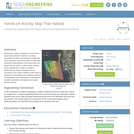
Historically, seafloor mapping occurred with a simple data collection method: soundings. Soundings …
Historically, seafloor mapping occurred with a simple data collection method: soundings. Soundings are taken by dropping a weight with a pre-measured rope off the side of a boat and noting the measurement on the rope when the weight hits the bottom. In this activity, student teams replicate the creation of seafloor bathymetry by taking a simplified form of soundings of an unseen seafloor model inside a shoebox and translating their collected data into a visualization of the topography, enabling them to better understand and appreciate modern remote sensing.
Whether you realize it or not, when you carry a smart phone, …
Whether you realize it or not, when you carry a smart phone, use a navigation system in your car, or look up the nearest coffee shop on your computer, you are using geographic information. Geographic data and technologies are embedded in almost all aspects of our lives. GEOG 160, Mapping Our Changing World, explores what geographic information and data are, what makes them unique, how they are created, and how we use them. You'll explore how geographic technologies like geographic information systems (GIS), remote sensing from satellites, and global positioning systems (GPS) work together to provide us with information we rely on. You'll also become an informed consumer of the geographic content in your life.
The marine environment is unique and because little light penetrates under water, …
The marine environment is unique and because little light penetrates under water, technologies that use sound are required to gather information. The seafloor is characterized using underwater sound and acoustical systems. Current technological innovations enable scientists to further understand and apply information about animal locations and habitat. Remote sensing and exploration with underwater vehicles enables researchers to map and understand the sea floor. Similar technologies also aid in animal tracking, a method used within science and commercial industries. Through inquiry-based learning techniques, students learn the importance of habitat mapping and animal tracking.
No restrictions on your remixing, redistributing, or making derivative works. Give credit to the author, as required.
Your remixing, redistributing, or making derivatives works comes with some restrictions, including how it is shared.
Your redistributing comes with some restrictions. Do not remix or make derivative works.
Most restrictive license type. Prohibits most uses, sharing, and any changes.
Copyrighted materials, available under Fair Use and the TEACH Act for US-based educators, or other custom arrangements. Go to the resource provider to see their individual restrictions.