Students are assigned a client who has an option to buy a …
Students are assigned a client who has an option to buy a very large tract of land in western Virginia. On this land she plans to build a large residence with a scenic view, a full basement, a septic system, and a paved driveway for access. For that site, students must use maps, aerial images, and soil survey reports to evaluate the geologic setting and the geomorphic processes, both active and ancient. Their goal is to warn the client of problems and alert her to resources on the property.
Designed for a geomorphology course
Has minimal/no quantitative component
Uses geomorphology to solve problems in other fields
(Note: this resource was added to OER Commons as part of a batch upload of over 2,200 records. If you notice an issue with the quality of the metadata, please let us know by using the 'report' button and we will flag it for consideration.)
This activity utilizes kinestetic learning by having students make models of geologic …
This activity utilizes kinestetic learning by having students make models of geologic concepts, landscapes and processes using playdough in the classroom.
Key words: kinestetic learning, playdough
(Note: this resource was added to OER Commons as part of a batch upload of over 2,200 records. If you notice an issue with the quality of the metadata, please let us know by using the 'report' button and we will flag it for consideration.)
In this activity, students replicate the slope failure experiment presented by Densmore …
In this activity, students replicate the slope failure experiment presented by Densmore et al. (1997) in the journal Science. They are given the original article and the slope failure apparatus (along with all associated materials) and then they need to figure out how to replicate the experiment. Once they have completed an experimental run of sufficient length, they compile and analyze their data and compare it to the article's results.
After completing this portion of the lab, the students read the discussion and reply (Aalto et al., 1998; Densmore et al., 1998) and critically evaluate they results of the experiment and its applicability to the real world and landscape evolution.
(Note: this resource was added to OER Commons as part of a batch upload of over 2,200 records. If you notice an issue with the quality of the metadata, please let us know by using the 'report' button and we will flag it for consideration.)
This is a large-scale participatory activity used to prompt students to review …
This is a large-scale participatory activity used to prompt students to review what they have learned and to think actively and cooperatively about the connections between the systems we have discussed prior to the activity. It produces a large, visual product students can reflect on.
(Note: this resource was added to OER Commons as part of a batch upload of over 2,200 records. If you notice an issue with the quality of the metadata, please let us know by using the 'report' button and we will flag it for consideration.)
Familiarize students with the morphology of passive continental margins and their associated …
Familiarize students with the morphology of passive continental margins and their associated shelf valleys, submarine canyons and estuaries, and assess the anthropogenic impact.
(Note: this resource was added to OER Commons as part of a batch upload of over 2,200 records. If you notice an issue with the quality of the metadata, please let us know by using the 'report' button and we will flag it for consideration.)
This activity is a field investigation where students will make stream observations …
This activity is a field investigation where students will make stream observations to determine its geologic processes and influence to our local topography.
Over the course of the semester, the course covers many earth science …
Over the course of the semester, the course covers many earth science topics that are easily observable on a casual but attentive walk through a natural area. Because the course does not have linked labs or field trips, this assignment attempts to get students to put their observation skills and content knowledge to the test by taking a hike and describing four Earth Science features or processes that they observe. These features and processes might include things like weather, streams, hillslope erosion, soil horizons, habitats or ecological succession.
When I introduce the assignment I spend 15 minutes discussing different places students might choose to take their hike. I make sure to highlight places near campus that can be reached without a car, as well as county parks that freshmen new to the area might not be aware of. Many students also choose to do the assignment on a weekend visit home to their parents and a favorite park or trail.
(Note: this resource was added to OER Commons as part of a batch upload of over 2,200 records. If you notice an issue with the quality of the metadata, please let us know by using the 'report' button and we will flag it for consideration.)
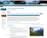
How do geologic, hydrologic, biologic, and built-landscape features manifest themselves on maps? …
How do geologic, hydrologic, biologic, and built-landscape features manifest themselves on maps? In this unit, students will use topographic maps, hillshade maps, and aerial imagery to learn to recognize a variety of landscape features and subsequently identify as many of these features as they can on a map of a new study area. They will also construct a topographic profile from their map data and use their profiles to understand the concepts of slope, aspect, and relief and how these landscape characteristics are important in hazard assessment and land-use planning.
Show more about Online Teaching suggestions Hide Online-adaptable: Part 1 (lecture) and Part 3 (individual or small-group exercise) are particularly straight forward to adapt to online. The landscape scavenger hunt exercise, Part 2, is typically done with printed maps but can be successfully adapted to online by having synchronous groups of students work together to annotate digital map files using: 1) PDF annotation tools in Adobe or 2) putting the map images into a Google Slides file and using the scribble tool. Google Earth files are also provided as an additional option.
(Note: this resource was added to OER Commons as part of a batch upload of over 2,200 records. If you notice an issue with the quality of the metadata, please let us know by using the 'report' button and we will flag it for consideration.)
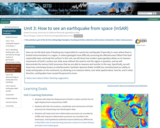
How can we tell what style of faulting was responsible for a …
How can we tell what style of faulting was responsible for a particular earthquake? Especially in cases where there is limited instrumentation in a region, or where geologists have difficulty accessing the affected areas? What if the fault responsible does not break the surface? In this unit, we will show how modern space geodesy allows us to measure movements of Earth's surface over wide areas without the need to visit the region in question, and we will demonstrate the various Earth processes that we are able to measure and monitor in this way. Specifically, we will show how a technique known as Interferometric Synthetic Aperture Radar (InSAR) has revolutionized our ability to study earthquakes on the continents, by allowing us to measure where, over what spatial extent, how far, and in what direction, earthquakes have caused the ground to move.
Show more about Online Teaching suggestions Hide Online-ready: The exercise is electronic and could be done individually or in small online groups. Lecture can be done in an online format. A synchronous session is recommended.
(Note: this resource was added to OER Commons as part of a batch upload of over 2,200 records. If you notice an issue with the quality of the metadata, please let us know by using the 'report' button and we will flag it for consideration.)
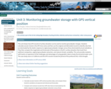
This unit shows how GPS records of surface elevation can be used …
This unit shows how GPS records of surface elevation can be used to monitor groundwater changes. Students calculate secular trends in the GPS time series and then use the original and detrended records to identify sites that are dominated by the elastic response to regional groundwater changes versus those dominated by local subsidence. They then compare the magnitude and timescales of fluctuations in Earth's surface elevation that result from sediment compaction, regional groundwater extraction, and natural climatic variability. This unit provides students with hands-on experience of the challenges and advantages of using geodetic data to study the terrestrial water cycle. The case study area is in California and the GPS records include the period of the profound 2012 -- 2016 drought.
Show more information on GPS versus GNSS Hide Note: Although the term GPS (Global Positioning System) is more commonly used in everyday language, it officially refers only to the USA's constellation of satellites. GNSS (Global Navigation Satellite System) is a universal term that refers to all satellite navigation systems including those from the USA (GPS), Russia (GLONASS), European Union (Galileo), China (BeiDou), and others. In this module, we use the term GPS even though, technically, some of the data may be coming from satellites in other systems.
Show more about Online Teaching suggestions Hide Online-ready: The exercise is electronic and could be done individually or in small online groups. Lecture is best done synchronously due to the technical nature. Discussion would be better that way too.
(Note: this resource was added to OER Commons as part of a batch upload of over 2,200 records. If you notice an issue with the quality of the metadata, please let us know by using the 'report' button and we will flag it for consideration.)
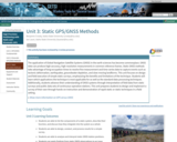
The application of Global Navigation Satellite Systems (GNSS) in the earth sciences …
The application of Global Navigation Satellite Systems (GNSS) in the earth sciences has become commonplace. GNSS data can produce high-accuracy, high-resolution measurements in common reference frames. Static GNSS methods take advantage of long occupation times to resolve fine measurement and time-series data to capture events such as tectonic deformation, earthquakes, groundwater depletion, and slow-moving landforms. This unit focuses on design and field execution of simple static surveys, emphasizing the benefits and limitations of the technique. Students will learn which applications the technique is most applicable for as well as the standard data-processing techniques. Additionally, students advance their understanding of GNSS systems through interpretation of field data from static surveys and public data sets of continuous-operation stations. This unit prepares students to design and implement a survey of their own through hands-on instruction and demonstration of rapid-static or static techniques in a field setting.
Show more information on GPS versus GNSS Hide Note: Although the term GPS (Global Positioning System) is more commonly used in everyday language, it officially refers only to the USA's constellation of satellites. GNSS (Global Navigation Satellite System) is a universal term that refers to all satellite navigation systems including those from the USA (GPS), Russia (GLONASS), European Union (Galileo), China (BeiDou), and others. In this module, we use the term GNSS to refer generically to the use of one or more satellite constellations to determine position.
(Note: this resource was added to OER Commons as part of a batch upload of over 2,200 records. If you notice an issue with the quality of the metadata, please let us know by using the 'report' button and we will flag it for consideration.)
How do slope characteristics and magnitude of forces dictate whether or not …
How do slope characteristics and magnitude of forces dictate whether or not a slope will fail? Can environmental and built characteristics change the magnitude of these forces? In this unit, students qualitatively and quantitatively consider the impact of slope angle, driving force, and frictional force on mass-wasting potential. A map activity prompts students to think about how climatic, tectonic, and geologic factors, as well as population and land use characteristics can influence mass-wasting potential.
Show more about Online Teaching suggestions Hide Online-adaptable: Part 1 (lecture) and Part 3 (discussion) are particularly straight forward to adapt to online. Part 2 student exercise is typically done with printed maps but can be successfully adapted to online by having synchronous groups of students work together to annotate digital map files using: 1) PDF annotation tools in Adobe or 2) putting the map images into a Google Slides file and using the scribble tool. Google Earth files are also provided as an additional option.
(Note: this resource was added to OER Commons as part of a batch upload of over 2,200 records. If you notice an issue with the quality of the metadata, please let us know by using the 'report' button and we will flag it for consideration.)
How are different types of earthquakes represented in InSAR data? How can …
How are different types of earthquakes represented in InSAR data? How can we obtain detailed information on the earthquake source from InSAR data? How well can we resolve those details? In this unit, students investigate how simple elastic dislocation models can be matched to interferograms of earthquakes, and the various geometrical and surficial factors that can affect that process.
Notice Oct 5, 2020: the Visible Earthquakes tool was unavailable for the last couple weeks but is now online again at https://visible-earthquakes.appspot.com. Thank you for your patience.
Show more about Online Teaching suggestions Hide Online-ready: The exercise is electronic and could be done individually or in small online groups. Lecture can be done in an online format. A synchronous session is recommended.
(Note: this resource was added to OER Commons as part of a batch upload of over 2,200 records. If you notice an issue with the quality of the metadata, please let us know by using the 'report' button and we will flag it for consideration.)
Unit 5 is the summative assessment for the module. This final exercise …
Unit 5 is the summative assessment for the module. This final exercise takes eight to ten hours. The exercise evaluates students' developed skills in survey design, execution of a geodetic survey, and simple data exploration and analysis. This summative assessment is written flexibly so that it can be applied to a variety of potential field sites and associated geoscience research questions. The unit has two parts, like most of the units in the module: Part 1, Geodetic Survey; and Part 2, Data Exploration. In addition, there is an optional Part 3, Data Processing, for students who have done Unit 4. This unit also has a number of prepared data sets for courses not able to collect field data.
(Note: this resource was added to OER Commons as part of a batch upload of over 2,200 records. If you notice an issue with the quality of the metadata, please let us know by using the 'report' button and we will flag it for consideration.)
For the assignment, the students are given a series of placemarks in …
For the assignment, the students are given a series of placemarks in Google Earth. Using Google Earth, the students 'fly' to various areas around the world. They examine the landforms at each placemark and answer questions regarding the formation of these features. Designed for a geomorphology course Uses online and/or real-time data Has minimal/no quantitative component
(Note: this resource was added to OER Commons as part of a batch upload of over 2,200 records. If you notice an issue with the quality of the metadata, please let us know by using the 'report' button and we will flag it for consideration.)
This is a take-home exercise for junior or senior-level students in a …
This is a take-home exercise for junior or senior-level students in a Sedimentation/Stratigraphy course. It may be used to bridge topics of geomorphology, depositional environments and clastic sedimentology. The exercise focuses on visualizing journal article data in a meaningful way. In addition to defining technical terms, students are asked to use background knowledge of Walther's Law to complete a series of vertical sections. Approximate time to complete the exercise is 4-5 hours. Individual assignment (as opposed to group work) is recommended.
(Note: this resource was added to OER Commons as part of a batch upload of over 2,200 records. If you notice an issue with the quality of the metadata, please let us know by using the 'report' button and we will flag it for consideration.)
The first lab exercise was preceded by an all day field trip …
The first lab exercise was preceded by an all day field trip that introduced the surficial and bedrock geology, geological history and the hydrologic and meteorologic instrumentation in the watershed. In the first lab meeting students were introduced to the research question (i.e. What hydrogeological conditions contributed to the failure of the W.H. Miner hydroeletric dam?) and to the specific goals and objectives of the first exercise. The series of exercises introduced geomorphic and hydrogeologic methods of analysis, provided experience with field and laboratory instrumentation and technologies, reinforced quantitative and communication skills and gave students the opportunity to collect and analyze their own data to solve a real-world problem. Addresses student fear of quantitative aspect and/or inadequate quantitative skills Uses geomorphology to solve problems in other fields
(Note: this resource was added to OER Commons as part of a batch upload of over 2,200 records. If you notice an issue with the quality of the metadata, please let us know by using the 'report' button and we will flag it for consideration.)
Google Streetview image of Monument Valley. Image by Khashea N. Alnasrallah. Provenance: …
Google Streetview image of Monument Valley. Image by Khashea N. Alnasrallah.
Provenance: Photo by Khashea N. Alnasrallah, accessed at https://www.google.com/maps/@37.0080155,-110.1880364,3a,90y,65.73h,76.64t/data=!3m8!1e1!3m6!1sAF1QipPAABHveLP_NZYyuXecNQ7yrcPXESv24W8ttQ_b!2e10!3e11!6shttps:%2F%2Flh5.googleusercontent.com%2Fp%2FAF1QipPAABHveLP_NZYyuXecNQ7yrcPXESv24W8ttQ_b%3Dw203-h100-k-no-pi0-ya298.5-ro-0-fo100!7i7168!8i3584?hl=en Reuse: This item is offered under a Creative Commons Attribution-NonCommercial-ShareAlike license http://creativecommons.org/licenses/by-nc-sa/3.0/ You may reuse this item for non-commercial purposes as long as you provide attribution and offer any derivative works under a similar license.
This exercise uses Google Streetview, in combination with 360 degree immersive photographs, to show students real-world examples of the sedimentary rocks, sedimentary structures, and weathering processes that they are learning about in class. Examples are taken from Parfrey's Glen (WI); Zion National Park; Glacier National Park; Starved Rock State Park (IL); Monument Valley; and Grand Staircase - Escalante National Monument.
(Note: this resource was added to OER Commons as part of a batch upload of over 2,200 records. If you notice an issue with the quality of the metadata, please let us know by using the 'report' button and we will flag it for consideration.)
This class exercise is an opportunity for students to apply textbook information …
This class exercise is an opportunity for students to apply textbook information about weathering and mass wasting to local and nationally-recognized surface features, such as Stone Mountain (GA), Half Dome (CA), and others. It also serves as an introduction to the use of Google Earth as an analytical tool for calculating distances, slopes, and evaluating landforms. Designed for a geomorphology course
(Note: this resource was added to OER Commons as part of a batch upload of over 2,200 records. If you notice an issue with the quality of the metadata, please let us know by using the 'report' button and we will flag it for consideration.)
No restrictions on your remixing, redistributing, or making derivative works. Give credit to the author, as required.
Your remixing, redistributing, or making derivatives works comes with some restrictions, including how it is shared.
Your redistributing comes with some restrictions. Do not remix or make derivative works.
Most restrictive license type. Prohibits most uses, sharing, and any changes.
Copyrighted materials, available under Fair Use and the TEACH Act for US-based educators, or other custom arrangements. Go to the resource provider to see their individual restrictions.