Students will learn about the water cycle, watersheds, and specifically, the watershed …
Students will learn about the water cycle, watersheds, and specifically, the watershed that feeds Springfield, Oregon. After analyzing drought maps, reading news reports, and seeing images and videos, students will realize that drought is a real life concern. Students, as concerned citizens, will create a water collection device, at first on a small scale, and then a true to life water collection system to help re- purpose rainwater in our garden area.
As global population grows, so does the demand for water. Yet less …
As global population grows, so does the demand for water. Yet less than one percent of the planet’s supply is potable, and estimates suggest that 40% of humanity will not have access to clean water by 2025. Explore the complex issues surrounding this precious resource in this episode of America Abroad.
America Abroad is an award-winning documentary radio program distributed by Public Radio International (PRI) and broadcast on public radio stations nationwide. Each month, we take an in-depth look at a critical issue in international affairs and U.S. foreign policy.
In this lesson, students analyze and synthesize data about how drought is …
In this lesson, students analyze and synthesize data about how drought is measured, how scientists expect drought to change in the future, and how we can mitigate the impacts of drought in our communities.
In this lesson, students build an understanding of drought in Colorado through …
In this lesson, students build an understanding of drought in Colorado through exploring case studies, authentic data, and online resources. After completing this lesson, students will be able to understand the basic causes and impacts of droughts, analyze a case study and current drought data in Colorado, and summarize the main preparedness steps and response strategies for drought events.
In this interactive game, students solve challenges that their community faces during …
In this interactive game, students solve challenges that their community faces during the course of an extreme drought event by using available individual and community resources. Students work in three resilience teams to determine the strategies that they will invest in as a community as the drought situation evolves.
In this three lesson series, students will analyze the effects of the …
In this three lesson series, students will analyze the effects of the drought in California. Students will analyze rainfall data and graph the annual rainfall for California. Students will understand the water cycle and explain how a drought affects the water cycle. Students will research methods to conserve water and write a persuasive argument.
This short video illustrates how warming ocean temperature is a major factor …
This short video illustrates how warming ocean temperature is a major factor in climate change, particularly the increase in severity of extreme weather (notably storms and drought).
This video is an episode of Above the Noise from PBS Digital …
This video is an episode of Above the Noise from PBS Digital Studios that engages students in thinking about drought and water shortages worldwide. Supporting materials include background reading on water shortages, a transcript of the video, a handout for viewing Above the Noise episodes (not specific to water shortages), teaching tips, activities, and discussion questions. The video is an engaging introduction to the topic and is best used as part of a larger lesson plan.
In this activity students explore how to reduce vulnerability to drought risk …
In this activity students explore how to reduce vulnerability to drought risk through mitigation strategies. Students investigate one or more of four technology-based mitigation strategies by reading articles or viewing short podcasts and completing hands-on activities. Students make a presentation or poster to communicate their findings to the class.
(Note: this resource was added to OER Commons as part of a batch upload of over 2,200 records. If you notice an issue with the quality of the metadata, please let us know by using the 'report' button and we will flag it for consideration.)
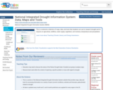
This is a extensive collection of maps, data, and tools that students …
This is a extensive collection of maps, data, and tools that students can use to research drought and its impacts on agriculture, wildfires, water supply, vegetation, soil moisture, temperature and precipitation.
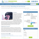
Students learn about soil properties and the effect biochar—charcoal used as a …
Students learn about soil properties and the effect biochar—charcoal used as a soil amendment—has on three soil types, sand, loam and clay. They test the soils’ water retention capability before and after the addition of biochar. During the activity, student teams prepare soil mixtures, make observations (including microscopic examinations), compare soil properties, conduct water retention tests, take and record measurements, and analyze their observations and data. They see how the physical properties of soils—color, texture, and particle size—can be indicators of nutrient content and water retention capabilities to support plant growth. From their findings, they consider biochar’s potential benefits for environmental and agricultural applications, especially in conditions of drought and depleted soils. An activity lab sheet is provided to guide experimental data collection and analysis.
This kit covers a historical overview of American representations of natural resources …
This kit covers a historical overview of American representations of natural resources from ancient Indian basketry to contemporary web sites. It compares conflicting media constructions about the Exxon Valdez oil spill, the damning of rivers, and Chukchi sea oil drilling. By showing the slow realization that natural resources are finite, students will learn valuable lessons in earth, natural and environmental sciences.
With climate change, some parts of the world will get more water, …
With climate change, some parts of the world will get more water, but others will experience droughts. Some will start seeing more mosquitoes, but some fewer. And some regions might actually benefit economically. What’s the deal? In this episode of TILclimate (Today I Learned: Climate), MIT professor Elfatih Eltahir joins host Laur Hesse Fisher to talk about how climate impacts will differ across the globe. Together, they do a quick world tour, exploring how climate change will affect malaria in Africa, water availability in the Nile, and heat waves in Southern Asia.
This video discusses impacts that the Midwestern US is experiencing due to …
This video discusses impacts that the Midwestern US is experiencing due to climate change. It describes how climate change is affecting agriculture, tourism, drought and flood, water cycles and freshwater availability, the spread of invasive species and disease, as well as other topics.
This course considers how the visual and material world of "nature" has …
This course considers how the visual and material world of "nature" has been reshaped by industrial practices, ideologies, and institutions, particularly in nineteenth- and twentieth-century America. Topics include land-use patterns; the changing shape of cities and farms; the redesign of water systems; the construction of roads, dams, bridges, irrigation systems; the creation of national parks; ideas about wilderness; and the role of nature in an industrial world. From small farms to suburbia, Walden Pond to Yosemite, we will ask how technological and natural forces have interacted, and whether there is a place for nature in a technological world. Acknowledgement This class is based on one originally designed and taught by Prof. Deborah Fitzgerald. Her Fall 2004 version can be viewed by following the link under Archived Courses on the right side of this page.
This video describes the joint NASA-JAXA GPM (Global Precipitation Measurement) satellite mission …
This video describes the joint NASA-JAXA GPM (Global Precipitation Measurement) satellite mission and why it is necessary for monitoring precipitation around the Earth. It discusses the science around the hazards of extreme precipitation such as landslides and drought. It emphasizes the value of comprehensive datasets and their ability to help predict natural disasters.
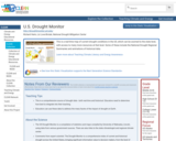
This is a real-time map of current drought conditions in the US, …
This is a real-time map of current drought conditions in the US, which can be zoomed to the state level, with access to many more resources at that level. Some of these include the National Drought Regional Summaries and animations of historical data.
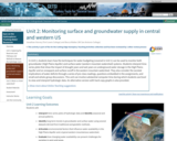
In Unit 2, students learn how the techniques for water budgeting (covered …
In Unit 2, students learn how the techniques for water budgeting (covered in Unit 1) can be used to monitor both groundwater (High Plains Aquifer) and surface water (western mountain watershed) systems. Students interpret time-series plots that show the impact of drought years and wet years on underground water storage in the High Plains Aquifer and on snowpack and surface runoff in the western mountain watershed. They also consider the societal implications of water deficits through a series of pre-class readings, questions embedded in the assignments, and small and whole-group discussions. This unit can involve substantial computer time during which students use Excel to view and interpret hydrologic data. An alternative version with hard-copy graphs is also provided.
Show more about Online Teaching suggestions Hide Online-adaptable: Both parts of this unit are completely digital and thus at a logistical level it can be switched to online fairly easily. However, due to the relative complexity of the data investigations, there will still be quite a bit of instructor support needed and/or extended small group that should be arranged.
(Note: this resource was added to OER Commons as part of a batch upload of over 2,200 records. If you notice an issue with the quality of the metadata, please let us know by using the 'report' button and we will flag it for consideration.)
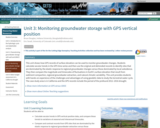
This unit shows how GPS records of surface elevation can be used …
This unit shows how GPS records of surface elevation can be used to monitor groundwater changes. Students calculate secular trends in the GPS time series and then use the original and detrended records to identify sites that are dominated by the elastic response to regional groundwater changes versus those dominated by local subsidence. They then compare the magnitude and timescales of fluctuations in Earth's surface elevation that result from sediment compaction, regional groundwater extraction, and natural climatic variability. This unit provides students with hands-on experience of the challenges and advantages of using geodetic data to study the terrestrial water cycle. The case study area is in California and the GPS records include the period of the profound 2012 -- 2016 drought.
Show more information on GPS versus GNSS Hide Note: Although the term GPS (Global Positioning System) is more commonly used in everyday language, it officially refers only to the USA's constellation of satellites. GNSS (Global Navigation Satellite System) is a universal term that refers to all satellite navigation systems including those from the USA (GPS), Russia (GLONASS), European Union (Galileo), China (BeiDou), and others. In this module, we use the term GPS even though, technically, some of the data may be coming from satellites in other systems.
Show more about Online Teaching suggestions Hide Online-ready: The exercise is electronic and could be done individually or in small online groups. Lecture is best done synchronously due to the technical nature. Discussion would be better that way too.
(Note: this resource was added to OER Commons as part of a batch upload of over 2,200 records. If you notice an issue with the quality of the metadata, please let us know by using the 'report' button and we will flag it for consideration.)
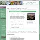
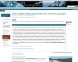
The California Drought of 2012 -- 2016 had significant social and economic …
The California Drought of 2012 -- 2016 had significant social and economic consequences. This final unit focuses on this drought as a case study for measuring the hydrologic system so that we can better understand fluxes, variability, uncertainties, and methods to measure them. Students analyze a variety of data that are relevant to basin-scale water budget: precipitation, terrestrial water storage, and snow pack. Traditional monitoring systems used are precipitation and snow pillow sensors. The newer geodetic methods are GRACE (Gravity Recovery and Climate Experiment satellite) and Reflection GPS. The students then use these data to consider water storage changes during the drought and how these changes compare in magnitude to human consumption. The work can start during a lab period and carry over into work outside of the lab time. The student exercise takes the form of responses to questions and tasks that tests a student's abilities to synthesize information and identify challenges in monitoring the terrestrial water cycle. Students then take the step-by-step exercise results and synthesize it into a report for California water policy makers to highlight the findings and pro/cons/uncertainties for the different methods. Unit 4 is the summative assessment for the module.
Show more information on GPS versus GNSS Hide Note: Although the term GPS (Global Positioning System) is more commonly used in everyday language, it officially refers only to the USA's constellation of satellites. GNSS (Global Navigation Satellite System) is a universal term that refers to all satellite navigation systems including those from the USA (GPS), Russia (GLONASS), European Union (Galileo), China (BeiDou), and others. In this module, we use the term GPS even though, technically, some of the data may be coming from satellites in other systems.
Show more about Online Teaching suggestions Hide Online-ready: The exercise is electronic and could be done individually or in small online groups. Lecture is best done synchronously due to the technical nature.
(Note: this resource was added to OER Commons as part of a batch upload of over 2,200 records. If you notice an issue with the quality of the metadata, please let us know by using the 'report' button and we will flag it for consideration.)
No restrictions on your remixing, redistributing, or making derivative works. Give credit to the author, as required.
Your remixing, redistributing, or making derivatives works comes with some restrictions, including how it is shared.
Your redistributing comes with some restrictions. Do not remix or make derivative works.
Most restrictive license type. Prohibits most uses, sharing, and any changes.
Copyrighted materials, available under Fair Use and the TEACH Act for US-based educators, or other custom arrangements. Go to the resource provider to see their individual restrictions.