In this unit, students learn the very basics of navigation, including the …
In this unit, students learn the very basics of navigation, including the different kinds of navigation and their purposes. The concepts of relative and absolute location, latitude, longitude and cardinal directions are explored, as well as the use and principles of maps and a compass. Students discover the history of navigation and learn the importance of math and how it ties into navigational techniques. Understanding how trilateration can determine one's location leads to a lesson on the global positioning system and how to use a GPS receiver. The unit concludes with an overview of orbits and spacecraft trajectories from Earth to other planets.
Students use their knowledge of scales and areas to determine the best …
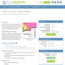
Students use their knowledge of scales and areas to determine the best locations in Alabraska for the underground caverns. They cut out rectangular paper pieces to represent caverns to scale with the maps and place the cut-outs on the maps to determine feasible locations.
This course provides students with the opportunity to develop a map of …
This course provides students with the opportunity to develop a map of contemporary architectural practice and discourse. The seminar examines six themes in terms of their recent history: city and global economy, urban plan and map of operations, program and performance, drawing and scripting, image and surface, and utopia and projection. Students will study buildings and read relevant texts in order to place recent architectural projects in disciplinary and cultural context.
This article describes Katy Farness' work with the Byrd Polar Research Center …
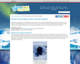
This article describes Katy Farness' work with the Byrd Polar Research Center at the Ohio State University. Farness used remote sensing images and computer technology to create detailed images of Antarctica and the ice sheets of Greenland.
In a simulation of potential future space missions to Europa, one of …
In a simulation of potential future space missions to Europa, one of Jupiter’s moons, student teams are challenged to direct a robot placed in an enclosed maze to search for and find the most “alien life.” The robot is equipped with a camera to send a live feed of its surroundings in the maze. Students control the robot from outside the maze by looking at the live feed on a smartphone and using the robot’s remote control, making a map as they go. The student teams compete as if they are space agencies creating their own exploratory systems to meet the challenge’s criteria and constraints and prove “in the field” that they have the best plan to win the mission contract and get the job. This activity simulates the real-world research of scientists and engineers developing a robot with the capabilities to explore under the ice-covered surface of Europa.
Siftr extends learning beyond your computer, books, classroom walls - preparing people …
Siftr extends learning beyond your computer, books, classroom walls - preparing people of all ages to learn in the wild. A tool for teachers and curious people. Siftr supports you as you explore the world.
Students learn how to determine map distances and areas using the map …
Students learn how to determine map distances and areas using the map scale. They get a feel for how much an area represents on the map in relation to the size they are suggesting for their underground caverns to shelter the Alabraska population.
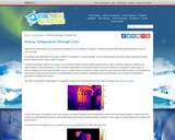
This article describes the basics of thermography or thermal imaging, and how …
This article describes the basics of thermography or thermal imaging, and how this technique can inspire a data collection activity to teach about heat transfer and energy efficiency.
Get ready to plan a trip to a Spanish-speaking country, but which …
Get ready to plan a trip to a Spanish-speaking country, but which one? There are over twenty Spanish-speaking countries around the world. In this seminar you will learn about these countries and as you find out where they are geographically, consider what country would you want to visit and why.ACTFL StandardsCommunication: Interpretive Communication and Presentational CommunicationConnections: Making ConnectionsCommunities: School and Global CommunitiesLearning TargetI can name countries on a map and provide directions.Habits of MindStriving for accuracyCritical Thinking SkillAnalyzing Perspectives
This nonfiction article, written for elementary students, discusses the unique characteristics of …
This nonfiction article, written for elementary students, discusses the unique characteristics of the North and South poles. The student article is available as a text-only document, illustrated book, and electronic book. Related lesson plans are included for teacher use.
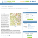
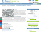
Maps are designed to allow people to travel to a new location …
Maps are designed to allow people to travel to a new location without a guide to show the way. They tell us information about areas to which we may or may not have ever been. There are many types of maps available for both recreational and professional use. A navigator uses a nautical map, while an engineer might use a surveyor's map. Maps are created by cartographers, and they can be very specific or very general, depending on their intended use. The focus of this lesson is on how to read and use topographical maps. Students will also learn to identify the common features of a map. Through the associated activities, students will learn how to use a compass to find bearing to an object on a map and in the classroom.
Students overlay USGS topographic maps into Google Earth’s satellite imagery. By analyzing …
Students overlay USGS topographic maps into Google Earth’s satellite imagery. By analyzing Denali, a mountain in Alaska, they discover how to use map scales as ratios to navigate maps, and use rates to make sense of contour lines and elevation changes in an integrated GIS software program. Students also problem solve to find potential pathways up a mountain by calculating gradients.
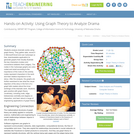
Students analyze dramatic works using graph theory. They gather data, record it …
Students analyze dramatic works using graph theory. They gather data, record it in Microsoft Excel and use Cytoscape (a free, downloadable application) to generate graphs that visually illustrate the key characters (nodes) and connections between them (edges). The nodes in the Cytoscape graphs are color-coded and sized according to the importance of the node (in this activity nodes represent characters in the work and their relative importance to the story). After the analysis, the graphs are further examined to see what the visual depiction of the story in the form of a graph tells readers about the inner workings of the dramatic work. Students gain practice with graph theory vocabulary, including node, edge, betweeness centrality and degree on interaction, and learn about a range of engineering applications of graph theory.
An interactive map containing computer generated 3D views of the Bowscale and …
An interactive map containing computer generated 3D views of the Bowscale and Bannerdale area overlain with geology, and also alternative map data layers for the two study site is available via the 'Virtual Tour' icon on the computer desktops.
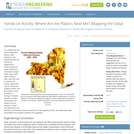
In a student-led and fairly independent fashion, data collected in the associated …
In a student-led and fairly independent fashion, data collected in the associated field trip activity are organized by student groups to create useful and informative Google Earth maps. Each team creates a map, uses that map to analyze the results, adjusts the map to include the analysis results, and then writes a brief summary of findings. Primarily, questions of fate-and-transport of plastics are are explored. If data was gathered in the field trip but the teacher does not desire to do the mapping activity, then alternative data presentation and analysis methods are suggested.
In this lesson, students are shown the very basics of navigation. The …
In this lesson, students are shown the very basics of navigation. The concepts of relative and absolute location, latitude, longitude and cardinal directions are discussed, as well as the use and principles of a map and compass.
The War of 1812 ensured the United States’ independence and created opportunities …
The War of 1812 ensured the United States’ independence and created opportunities for two future U.S. presidents to demonstrate their leadership qualities.
No restrictions on your remixing, redistributing, or making derivative works. Give credit to the author, as required.
Your remixing, redistributing, or making derivatives works comes with some restrictions, including how it is shared.
Your redistributing comes with some restrictions. Do not remix or make derivative works.
Most restrictive license type. Prohibits most uses, sharing, and any changes.
Copyrighted materials, available under Fair Use and the TEACH Act for US-based educators, or other custom arrangements. Go to the resource provider to see their individual restrictions.