For thousands of years, navigators have looked to the sky for direction. …
For thousands of years, navigators have looked to the sky for direction. Today, celestial navigation has simply switched from using natural objects to human-created satellites. A constellation of satellites, called the Global Positioning System, and hand-held receivers allow for very accurate navigation. In this lesson, students investigate the fundamental concepts of GPS technology trilateration and using the speed of light to calculate distances.
This course is broad, covering a wide range of topics that have …
This course is broad, covering a wide range of topics that have to do with the post-pc era of computing. It is a hands-on project course that also includes some foundational subjects. Students will program iPAQ handheld computers, cell phones (series 60 phones), speech processing, vision, Cricket location systems, GPS, and more. Most of the programming will be using Python®, but Python® can be learned and mastered during the course. This course was also taught as part of the Singapore-MIT Alliance (SMA) programme as course number SMA 5508 (Pervasive Computing).
In this unit, students learn the very basics of navigation, including the …
In this unit, students learn the very basics of navigation, including the different kinds of navigation and their purposes. The concepts of relative and absolute location, latitude, longitude and cardinal directions are explored, as well as the use and principles of maps and a compass. Students discover the history of navigation and learn the importance of math and how it ties into navigational techniques. Understanding how trilateration can determine one's location leads to a lesson on the global positioning system and how to use a GPS receiver. The unit concludes with an overview of orbits and spacecraft trajectories from Earth to other planets.
Projections and coordinates are key advancements in the geographic sciences that allow …
Projections and coordinates are key advancements in the geographic sciences that allow us to better understand the nature of the Earth and how to describe location. These innovations in describing the Earth are the basis for everything that is done in a GIS framework. Shape of the Earth is a critical starting point because in fact the Earth is not round but rather a more complex shape called a geoid. Coordinate systems are often referenced to a particular model shape of the Earth, but many different formats exist because not all coordinates work equally well in all areas. While projections and coordinates are abstract concepts in themselves, students eventually find them interesting because 1) it causes them to challenge their current ideas of the Earth's shape and 2) it is much easier to visualize these ideas for learning through interactive GIS such as Google Earth.
Students learn how and why engineers design satellites to benefit life on …
Students learn how and why engineers design satellites to benefit life on Earth, as well as explore motion, rockets and rocket motion. Through six lessons and 10 associated hands-on activities, students discover that the motion of all objects everything from the flight of a rocket to the movement of a canoe is governed by Newton's three laws of motion. This unit introduces students to the challenges of getting into space for the purpose of exploration. The ideas of thrust, weight and control are explored, helping students to fully understand what goes into the design of rockets and the value of understanding these scientific concepts. After learning how and why the experts make specific engineering choices, students also learn about the iterative engineering design process as they design and construct their own model rockets. Then students explore triangulation, a concept that is fundamental to the navigation of satellites and global positioning systems designed by engineers; by investigating these technologies, they learn how people can determine their positions and the locations of others.
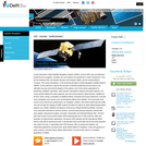
Satellite Engineering introduces students to subsystem design in engineering spacecraft. The course …
Satellite Engineering introduces students to subsystem design in engineering spacecraft. The course presents characteristic subsystems, such as power, structure, communication and control, and analyzes the engineering trades necessary to integrate subsystems successfully into a satellite. Discussions of spacecraft operating environment and orbital mechanics help students to understand the functional requirements and key design parameters for satellite systems.
Global Satellite Navigation Systems (GNSS), such as GPS, have revolutionized positioning and …
Global Satellite Navigation Systems (GNSS), such as GPS, have revolutionized positioning and navigation. Currently, four such systems are operational or under development. They are the American GPS, the Russian Glonass, the European Galileo, and the Chinese Beidou-Compass. This course will address: (1) the technical principles of Global Navigation Satellite Systems (GNSS), (2) the methods to improve the accuracy of standard positioning services down to the millimeter accuracy level and the integrity of the systems, and (3) the various applications for positioning, navigation, geomatics, earth sciences, atmospheric research and space missions. The course will first address the space segment, user and control segment, signal structure, satellite and receiver clocks, timing, computation of satellite positions, broadcast and precise ephemeris. It will also cover propagation error sources such as atmospheric effects and multipath. The second part of the course covers autonomous positioning for car navigation, aviation, and location based services (LBS). This part includes the integrity of GNSS systems provided for instance by Space Based Augmentation Systems (e.g. WAAS, EGNOS) and Receiver Autonomous Integrity Monitoring (RAIM). It will also cover parameter estimation in dynamic systems: recursive least-squares estimation, Kalman filter (time update, measurement update), innovation, linearization and Extended Kalman filter. The third part of the course covers precise relative GPS positioning with two or more receivers, static and kinematic, for high-precision applications. Permanent GPS networks and the International GNSS Service (IGS) will be discussed as well. In the last part of the course there will be two tracks (students only need to do one): (1) geomatics track: RTK services, LBS, surveying and mapping, civil engineering applications (2) space track: space based GNSS for navigation, control and guidance of space missions, formation flying, attitude determination The final lecture will be on (scientific) applications of GNSS.
The high school earth and physical science unit moves through an exploration …
The high school earth and physical science unit moves through an exploration of tectonic plates, why and how they move, and the earthquakes that they cause. As the final project, teams learn about Early Warning Systems for earthquakes and how they have saved millions of lives in other countries. Teams take on a population in Oregon and design a ShakeAlert system to give them the seconds required to prepare for a mega earthquake.
To navigate, you must know roughly where you stand relative to your …
To navigate, you must know roughly where you stand relative to your designation, so you can head in the right direction. In locations where landmarks are not available to help navigate (in deserts, on seas), objects in the sky are the only reference points. While celestial objects move fairly predictably, and rough longitude is not too difficult to find, it is not a simple matter to determine latitude and precise positions. In this activity, students investigate the uses and advantages of modern GPS for navigation.
This book provides an introduction, at academic level, into the field of …
This book provides an introduction, at academic level, into the field of surveying and mapping. The book has been compiled based on hand-outs and readers written for the third-year course Surveying and Mapping, in the bachelor program Civil Engineering at Delft University of Technology. This book covers a wide range of measurement techniques, from land surveying, GPS/GNSS and remote sensing to the associated data processing, the underlying coordinate reference systems, as well as the analysis and visualization of the acquired geospatial information.
This course provides an introduction to the transportation industry's major technical challenges …
This course provides an introduction to the transportation industry's major technical challenges and considerations. For upper level undergraduates interested in learning about the transportation field in a broad but quantitative manner. Topics include road vehicle engineering, internal combustion engines, batteries and motors, electric and hybrid powertrains, urban and high speed rail transportation, water vessels, aircraft types and aerodynamics, radar, navigation, GPS, GIS. Students will complete a project on a subject of their choosing.
Geographic information systems (GIS) are important technology that allows rapid study and …
Geographic information systems (GIS) are important technology that allows rapid study and use of spatial information. GIS have become increasingly prevalent in industry and the consumer/internet world in the last 20 years. Historically, the basis of GIS was in mapping, and so it is important to understand the basis of maps and how to use them as well as why they are different from GIS. In this lesson, students learn the value of maps, how to use maps, and the basic components of a GIS. They are also introduced to numerous GIS applications.
Maj. Ben Calhoon, Chief of the Positioning, Navigation and Timing Branch within …
Maj. Ben Calhoon, Chief of the Positioning, Navigation and Timing Branch within the Space Operations Division of Headquarters Air Force, will discuss the importance of GPS.
How do we know where we are? What happens if you are …
How do we know where we are? What happens if you are completely lost in the middle of nowhere? Does technology provide tools for people lost in their travels? A person cannot usually determine an accurate position just by looking out a window in the middle of the ocean or vast area of land, particularly if it has not been charted before. In this lesson, students explore the concept of triangulation that is used in navigation satellites and global positioning systems designed by engineers. Also, students learn how these technologies can help people determine their position or the location of someone else.
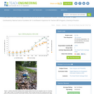
Through an adult-led field trip, students organized into investigation teams catalogue the …
Through an adult-led field trip, students organized into investigation teams catalogue the incidence of plastic debris in different environments. They investigate these plastics according to their type, age, location and other characteristics that might indicate what potential they have for becoming part of the Great Pacific Garbage Patch (GPGP). Students collect qualitative and quantitative data that may be used to create a Google Earth layer as part of a separate activity that can be completed at a computer lab at school or as homework. The activity is designed as a step on the way to student's creation of their own GIS Google Earth layer. It is, however, possible for the field trip to be a useful learning experience unto itself that does not require this last GIS step.
In this lesson, students are shown the very basics of navigation. The …
In this lesson, students are shown the very basics of navigation. The concepts of relative and absolute location, latitude, longitude and cardinal directions are discussed, as well as the use and principles of a map and compass.
No restrictions on your remixing, redistributing, or making derivative works. Give credit to the author, as required.
Your remixing, redistributing, or making derivatives works comes with some restrictions, including how it is shared.
Your redistributing comes with some restrictions. Do not remix or make derivative works.
Most restrictive license type. Prohibits most uses, sharing, and any changes.
Copyrighted materials, available under Fair Use and the TEACH Act for US-based educators, or other custom arrangements. Go to the resource provider to see their individual restrictions.