Lesson OverviewStudents will work on the final portion of their project which …
Lesson OverviewStudents will work on the final portion of their project which includes creating the nets for the sides, making a slice in one of their buildings, and putting their buildings together. Once their two model buildings are complete, they will find the surface area and volume for their models and the full-size buildings their models represent.Key ConceptsThe second part of the project is essentially a review of the second half of the unit, while still using scale drawings. Students will find the surface area of a prism as well as the surface area of a truncated prism. The second prism will require estimating and problem solving to figure out the net and find the surface area. Students will also be drawing the figure using scale to find actual surface area.GoalsRedraw a scale drawing at a different scale.Find measurements using a scale drawing.Find the surface area of a prism.SWD: Students with disabilities may have a more challenging time identifying areas of improvement to target in their projects. It may be helpful to model explicitly for students (using an example project or student sample) how to review a project using the rubric to assess and plan for revisions based on that assessment.Students with fine motor difficulties may require grid paper with a larger scale. Whenever motor tasks are required, consider adaptive tools or supplementary materials that may benefit students with disabilities.Students with disabilities may struggle to recall prerequisite skills as they move through the project. It may be necessary to check in with students to review and reinforce estimation skills.
This lesson unit is intended to help you assess how well students …
This lesson unit is intended to help you assess how well students are able to: Interpret a situation and represent the variables mathematically; select appropriate mathematical methods to use; explore the effects on the area of a rectangle of systematically varying the dimensions whilst keeping the perimeter constant; interpret and evaluate the data generated and identify the optimum case; and communicate their reasoning clearly.
See the attached document for the project to give to students. It's …
See the attached document for the project to give to students. It's meant to be submitted virtually, but you could likely have them submit in person as well.
In this activity, students explore the importance of charts to navigation on …
In this activity, students explore the importance of charts to navigation on bodies of water. Using one worksheet, students learn to read the major map features found on a real nautical chart. Using another worksheet, students draw their own nautical chart using the symbols and identifying information learned.
Students learn about two-axis rotations, and specifically how to rotate objects both …
Students learn about two-axis rotations, and specifically how to rotate objects both physically and mentally about two axes. A two-axis rotation is a rotation of an object about a combination of x, y or z-axes, as opposed to a single-axis rotation, which is about a single x, y or z-axis. Students practice drawing two-axis rotations through an exercise using simple cube blocks to create shapes, and then drawing on triangle-dot paper the shapes from various x-, y- and z-axis rotation perspectives. They use the right-hand rule to explore the rotations of objects. A worksheet is provided. This activity is part of a multi-activity series towards improving spatial visualization skills. At activity end, students re-take the 12-question quiz they took in the associated lesson (before conducting four associated activities) to measure how their spatial visualizations skills improved.
Normally we find things using landmark navigation. When you move to a …
Normally we find things using landmark navigation. When you move to a new place, it may take you awhile to explore the new streets and buildings, but eventually you recognize enough landmarks and remember where they are in relation to each other. However, another accurate method for locating places and things is using grids and coordinates. In this activity, students will come up with their own system of a grid and coordinates for their classroom and understand why it is important to have one common method of map-making.
This problem-based learning module is designed to engage students in solving a …
This problem-based learning module is designed to engage students in solving a real problem within the community. The question being “How can I help my community get digitally connected?” Students will choose to investigate one of three solutions of making wifi available in our school district to the most populated areas. They will either choose to put Wifi on bus, placing hotspots in the community or using kajeet. The students will be using Google Earth Pro to place circles on a map and calculating the area of these circles. Students will make a model of these circles onto a hard copy using scale factor. At the conclusion, the students will present findings to administration, the board of education, state and local leaders as well as their peers. These findings can be presented through the choice of a display board, flyer, video production or prezi.This blended module includes teacher-led discussion, group-led investigation and discussions along with technology integration.
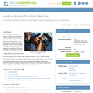
Celestial navigation is the art and science of finding one's geographic position …
Celestial navigation is the art and science of finding one's geographic position by means of astronomical observations, particularly by measuring altitudes of celestial objects sun, moon, planets or stars. This activity starts with a basic, but very important and useful, celestial measurement: measuring the altitude of Polaris (the North Star) or measuring the latitude.
The intent of clarifying statements is to provide additional guidance for educators …
The intent of clarifying statements is to provide additional guidance for educators to communicate the intent of the standard to support the future development of curricular resources and assessments aligned to the 2021 math standards. Clarifying statements can be in the form of succinct sentences or paragraphs that attend to one of four types of clarifications: (1) Student Experiences; (2) Examples; (3) Boundaries; and (4) Connection to Math Practices.
Two besotted rulers must embrace proportional units in order to unite their …
Two besotted rulers must embrace proportional units in order to unite their lands. It takes mathematical reasoning to identify the problem, and solution, when engineers from Queentopia and Kingopolis build a bridge to meet in the middle of the river.
In this unit, students learn the very basics of navigation, including the …
In this unit, students learn the very basics of navigation, including the different kinds of navigation and their purposes. The concepts of relative and absolute location, latitude, longitude and cardinal directions are explored, as well as the use and principles of maps and a compass. Students discover the history of navigation and learn the importance of math and how it ties into navigational techniques. Understanding how trilateration can determine one's location leads to a lesson on the global positioning system and how to use a GPS receiver. The unit concludes with an overview of orbits and spacecraft trajectories from Earth to other planets.
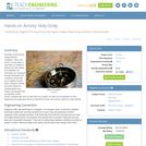
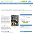
Students follow the steps of the engineering design process while learning more …
Students follow the steps of the engineering design process while learning more about assistive devices and biomedical engineering applied to basic structural engineering concepts. Their engineering challenge is to design, build and test small-scale portable wheelchair ramp prototypes for fictional clients. They identify suitable materials and demonstrate two methods of representing design solutions (scale drawings and simple models or classroom prototypes). Students test the ramp prototypes using a weighted bucket; successful prototypes meet all the student-generated design requirements, including support of a predetermined weight.
Students are introduced to renewable energy, including its relevance and importance to …
Students are introduced to renewable energy, including its relevance and importance to our current and future world. They learn the mechanics of how wind turbines convert wind energy into electrical energy and the concepts of lift and drag. Then they apply real-world technical tools and techniques to design their own aerodynamic wind turbines that efficiently harvest the most wind energy. Specifically, teams each design a wind turbine propeller attachment. They sketch rotor blade ideas, create CAD drawings (using Google SketchUp) of the best designs and make them come to life by fabricating them on a 3D printer. They attach, test and analyze different versions and/or configurations using a LEGO wind turbine, fan and an energy meter. At activity end, students discuss their results and the most successful designs, the aerodynamics characteristics affecting a wind turbine's ability to efficiently harvest wind energy, and ideas for improvement. The activity is suitable for a class/team competition. Example 3D rotor blade designs are provided.
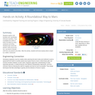
Students explore orbit transfers and, specifically, Hohmann transfers. They investigate the orbits …
Students explore orbit transfers and, specifically, Hohmann transfers. They investigate the orbits of Earth and Mars by using cardboard and string. Students learn about the planets' orbits around the sun, and about a transfer orbit from one planet to the other. After the activity, students will know exactly what is meant by a delta-v maneuver!
The evil Scaleo has escaped from prison and is transforming the length, …
The evil Scaleo has escaped from prison and is transforming the length, width, and height of objects until they become useless – or dangerous. Who can put things right? Superheroine Scale Ella uses the power of scale factor to foil the villain.
Students learn how different characteristics of shapes—side lengths, perimeter and area—change when …
Students learn how different characteristics of shapes—side lengths, perimeter and area—change when the shapes are scaled, either enlarged or reduced. Student pairs conduct a “scaling investigation” to measure and calculate shape dimensions (rectangle, quarter circle, triangle; lengths, perimeters, areas) from a bedroom floorplan provided at three scales. They analyze their data to notice the mathematical relationships that hold true during the scaling process. They see how this can be useful in real-world situations like when engineers design wearable or implantable biosensors. This prepares students for the associated activity in which they use this knowledge to help them reduce or enlarge their drawings as part of the process of designing their own wearables products. Pre/post-activity quizzes, a worksheet and wrap-up concepts handout are provided.
The goal of this task is to gather together knowledge and skills …
The goal of this task is to gather together knowledge and skills from the seventh grade in a context which prepares students for the important eighth grade notion of similarity.
Students learn how to create two-dimensional representations of three-dimensional objects by utilizing …
Students learn how to create two-dimensional representations of three-dimensional objects by utilizing orthographic projection techniques. They build shapes using cube blocks and then draw orthographic and isometric views of those shapes—which are the side views, such as top, front, right—with no depth indicated. Then working in pairs, one blindfolded partner describes a shape by feel alone as the other partner draws what is described. A worksheet is provided. This activity is part of a multi-activity series towards improving spatial visualization skills.
Students learn about the history of tangrams. They will learn about each …
Students learn about the history of tangrams. They will learn about each piece in the tangram puzzle and analyze the shapes to complete geometric puzzles and mathematics problems.
In this activity, students will learn how to read a topographical map …
In this activity, students will learn how to read a topographical map and how to triangulate with just a map. True triangulation requires both a map and compass, but to simplify the activity and make it possible indoors, the compass information is given. Students will practice converting a compass measurement to a protractor measurement, as well as reverse a bearing direction (i.e., if they know a tree's bearing is 100 degrees from you, they can determine what bearing they are from the tree). Students will use the accompanying worksheets to take a bearing of certain landmarks and then start at those landmarks to work backwards to figure out where they are.
No restrictions on your remixing, redistributing, or making derivative works. Give credit to the author, as required.
Your remixing, redistributing, or making derivatives works comes with some restrictions, including how it is shared.
Your redistributing comes with some restrictions. Do not remix or make derivative works.
Most restrictive license type. Prohibits most uses, sharing, and any changes.
Copyrighted materials, available under Fair Use and the TEACH Act for US-based educators, or other custom arrangements. Go to the resource provider to see their individual restrictions.