Widespread damage from flooding at the Texas Medical Center in Houston revealed …
Widespread damage from flooding at the Texas Medical Center in Houston revealed the complex's vulnerabilities. Implementing a long-term hazard mitigation plan is reducing future risks.
Do you want to think about ways to help solve New Orleans' …
Do you want to think about ways to help solve New Orleans' problems? CityScope is a project-based introduction to the contemporary city. “Problem solving in complex (urban) environments” is different than “solving complex problems.” As a member of a team, you will learn to assess scenarios for the purpose of formulating social, economic and design strategies to provide humane and sustainable solutions. A visit to New Orleans is planned for spring break 2007.
Do you want to think about ways to help solve New Orleans' …
Do you want to think about ways to help solve New Orleans' problems? CityScope is a project-based introduction to the contemporary city. "Problem solving in complex (urban) environments" is different than "solving complex problems." As a member of a team, you will learn to assess scenarios for the purpose of formulating social, economic and design strategies to provide humane and sustainable solutions. A visit to New Orleans is planned for spring break 2007.
While the creation of a dam provides many benefits, it can have …
While the creation of a dam provides many benefits, it can have negative impacts on local ecosystems. Students learn about the major environmental impacts of dams and the engineering solutions used to address them.
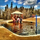
Phenomena: Flooded SchoolyardStorylineThis photograph was taken at an elementary school in Maryland …
Phenomena: Flooded SchoolyardStorylineThis photograph was taken at an elementary school in Maryland after a severe Summer rainstorm. The students are concerned about the impact of the increased rainfall in such a short period of time.PE Alignment:4-ESS2-1. Make observations and/or measurements to provide evidence of the effects of weathering or the rate of erosion by water, ice, wind or vegetation.4-ESS3-2. Generate and compare multiple solutions to reduce the impacts of natural Earth processes on humans. Image source: "Spring Runoff" by Walking With Scissors at https://www.flickr.com/photos/15582597@N06/5636129904/ CC BY-SA 2.0 (https://creativecommons.org/licenses/by-sa/2.0/)
This is a 21 day unit on the topic of floods. Students …
This is a 21 day unit on the topic of floods. Students will plan and prepare for what might happen in the event of a flood in our area. We have had floods in the past that have affected the Walterville School, its campus, and the surrounding areas. Using this as a springboard, students will discuss the effects of flooding, do research and interview family members who have experienced flooding, and then discuss possible ways to prevent significant damage on the buildings and surrounding areas. They will then design a barrier that could protect an area from damage for a period of time. Students will need materials to conduct experiments. We have listed these in the lesson plan. We have also included a trip to the Leaburg Dam so that students can learn about dams and their uses. We plan on teaching this unit in the fall.
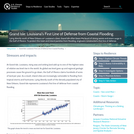
Lying directly south of New Orleans on Louisianas coast, Grand Isle often …
Lying directly south of New Orleans on Louisianas coast, Grand Isle often bears the brunt of strong waves and storm surge in the Gulf of Mexico. To protect this town and inland parishes from flooding, engineers constructed a first line of defense.
The flow or discharge value in a river does not mean much …
The flow or discharge value in a river does not mean much to a lay person or a decision maker because this flow can be insignificant on a big river or can be dangerous on a small creek. Thus, we must know how to translate this flow value into the water depth, velocity, and the corresponding extent to understand its impact. The objective of this unit is to perform hydraulic modeling on a reach of Wabash River near Lafayette, Indiana, to estimate water surface elevation and extent corresponding to a 100 year flow. Students will learn the basics of hydraulic modeling using HEC-RAS to simulate the flow hydraulics using one-dimensional steady state assumption. The outcome will be the inundation extent corresponding to the 100-year event along the reach of the Wabash River near Lafayette, IN. Make sure you have HEC-RAS available on school or personal computers prior to the start of the unit.
Several times per year, seawater floods some of the streets in Charleston, …
Several times per year, seawater floods some of the streets in Charleston, South Carolina. Taking steps to deal with this "nuisance" flooding can help the city prepare for sea level rise.
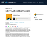
Scientists predict that hurricanes will hit us harder in the future -- …
Scientists predict that hurricanes will hit us harder in the future -- but why? And what can we expect to see? In this episode of #TILclimate (Today I Learned: Climate), MIT professor Kerry Emanuel joins host Laur Hesse Fisher to break down how these “heat engines” work and how a changing climate will increase hurricane intensity, storm surges, and flooding. They also explore how people around the world are adapting to growing hurricane risks.
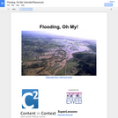
Faced with an increased chance for heavy precipitation and flooding, an emergency …
Faced with an increased chance for heavy precipitation and flooding, an emergency manager in Oregon spread the word, encouraging groups to be prepared.
Residents along the U.S. Gulf Coast are familiar with the flooding hazards …
Residents along the U.S. Gulf Coast are familiar with the flooding hazards associated with storms, yet many are unaware of the risk of sea level rise. Shoppers at a local mall had a chance to explore the potential impacts of sea level rise on their communities.
Based on their locations, many water and wastewater utilities face an inherent …
Based on their locations, many water and wastewater utilities face an inherent risk of flooding. Here’s how a small drinking water utility recognized its risk and took steps to reduce it.
In Unit 2, students apply and evaluate foundational concepts about storm hazards …
In Unit 2, students apply and evaluate foundational concepts about storm hazards and risk in the context of two cases studies: Superstorm Sandy (2012) and the Storm of the Century (1993). Through different activities and assignments, students develop skills for finding, evaluating, and relating data to case studies and build an understanding of preparedness, response, and resilience. The activities include: an analysis of hazard mitigation plans for their local community, examination of storm-related geophysical processes in the context of societal risks, preparation of a press release for community preparedness, and a peer review and revision opportunity for the press releases. Instructors may also end this unit by having students revise their concept maps from Unit 1, applying lessons learned in Units 1 and 2.
(Note: this resource was added to OER Commons as part of a batch upload of over 2,200 records. If you notice an issue with the quality of the metadata, please let us know by using the 'report' button and we will flag it for consideration.)
An extreme precipitation event in 2008 cost one town more than a …
An extreme precipitation event in 2008 cost one town more than a million dollars in infrastructure repairs. Now, other municipalities can simulate how their homes, businesses, and facilities might fare if they experienced a similar event.
This resource is a video abstract of a research paper created by …
This resource is a video abstract of a research paper created by Research Square on behalf of its authors. It provides a synopsis that's easy to understand, and can be used to introduce the topics it covers to students, researchers, and the general public. The video's transcript is also provided in full, with a portion provided below for preview:
"Monsoons impact millions of people every year --farmers rely on rain for their harvests, and lives are threatened by flooding or landslides. And yet, it remains very hard to predict monsoons early and accurately. European researchers have now devised a new way to estimate the monsoon season in India. This innovative approach uses a rare isotope, beryllium-seven.The forecasts are not only more accurate than traditional methods, but also available earlier, which could give governments and residents more time to prepare. This unusual weather-tracking approach works because of how air circulates on Earth. Each hemisphere features three large-scale patterns, or cells: the Hadley, Ferrel, and polar cells. Where two cells meet is a convergence zone. Monsoons --seasonal shifts in wind that trigger heavy rain --happen at the intertropical convergence zone, or ITCZ. Monsoons are seasonal because the Earth’s tilt affects the ITCZ’s location..."
The rest of the transcript, along with a link to the research itself, is available on the resource itself.
No restrictions on your remixing, redistributing, or making derivative works. Give credit to the author, as required.
Your remixing, redistributing, or making derivatives works comes with some restrictions, including how it is shared.
Your redistributing comes with some restrictions. Do not remix or make derivative works.
Most restrictive license type. Prohibits most uses, sharing, and any changes.
Copyrighted materials, available under Fair Use and the TEACH Act for US-based educators, or other custom arrangements. Go to the resource provider to see their individual restrictions.