Part 1 The SAGUARO Exploring GIS Investigations for Earth Science curriculum requries …
Part 1
The SAGUARO Exploring GIS Investigations for Earth Science curriculum requries the use of ESRI's ArcView GIS software version 3.0 for Macintosh or 3.2 and higher for PC. Use ArcGIS and data files from the SAGUARO Project's (http://pro.arcgis.com/en/pro-app/help/projects/supported-data-types-and-items.htm) Exploring Tropical Cyclones investigations. After the students are introduced to the program they are asked to determine what criteria are required for the formation of tropical cyclones. Exploring Tropical Cyclones Unit 1 has a great deal of data for the students to use. The data is presented as layers on a world map. Different features can be turned on and off at will, and layers can be brought in from other units if desired.
Features they can work with are:
August SST February SST tropical cyclone tracks locations of tropical cyclone formation for Jun-Sep locations of tropical cyclone formation for Dec-Mar
Part 2
Students are divided into small groups (3-4 students works well) where they compare their findings (including what evidence they used) with the findings of the other group members. Each group is then asked to determine the threshold temperature for tropical cyclone formation as well as to calculate the area of the ocean that has SST equal to or above this threshold temperature (you can have them calculate this for each season, or as a total area including both February and August data).
Part 3
Class discussion of what they have found so far. Introduce them to model predictions of SST for different atmospheric CO2 levels. Propose a 2 degree C increase in tropical SST and ask what they think that will mean. What other factors might influence the formation of tropical cyclones?
Part 4
Assign an article or two (ideally a published peer reviewed article - to introduce them to this type of scientific writing - that is if you can find one that you consider appropriate for your students) that introduces them to other factors required for tropical cyclone formation and predictions of how climate change might affect them. For example an article that discusses the role of wind speed near the surface of the ocean, or vertical wind shear, or one that shows that the threshold temperature is actually predicted to increase by the same magnitude as the SST increase. Have them write a report that summaries the criteria for cyclogenesis as well as explaining how they would go about predicting where tropical cyclones will form as a result of an increased SST. They do not need to perform all of the tests they propose! They should state what sort of information they would like to obtain and why.
(Note: this resource was added to OER Commons as part of a batch upload of over 2,200 records. If you notice an issue with the quality of the metadata, please let us know by using the 'report' button and we will flag it for consideration.)
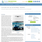
The airplanes unit begins with a lesson on how airplanes create lift, …
The airplanes unit begins with a lesson on how airplanes create lift, which involves a discussion of air pressure and how wings use Bernoulli's principle to change air pressure. Next, students explore the other three forces acting on airplanes thrust, weight and drag. Following these lessons, students learn how airplanes are controlled and use paper airplanes to demonstrate these principles. The final lessons addresses societal and technological impacts that airplanes have had on our world. Students learn about different kinds of airplanes and then design and build their own balsa wood airplanes based on what they have learned.
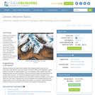
Students are introduced to the basics of the Earth's weather. Concepts include …
Students are introduced to the basics of the Earth's weather. Concepts include fundamental causes of common weather phenomena such as temperature changes, wind, clouds, rain and snow. The different factors that affect the weather and the instruments that measure weather data are also addressed.
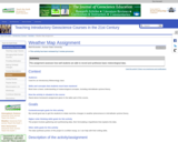
I gave this assignment so that students could relate real-time weather changes …
I gave this assignment so that students could relate real-time weather changes to mid-latitude cyclones and air mass movement. Basically, by the time I assigned the project, we have discussed all the necessary weather phenomena and this project gives the students a way to apply what we have discussed to "reality" by explaining why the weather occurred the way it did over a short time period. It also provides me with a way to assess how well they are able to tie all the major concepts together, which is one of the goals of the course.
(Note: this resource was added to OER Commons as part of a batch upload of over 2,200 records. If you notice an issue with the quality of the metadata, please let us know by using the 'report' button and we will flag it for consideration.)
In this unit, students learn the basics about weather and the atmosphere. …
In this unit, students learn the basics about weather and the atmosphere. They investigate materials engineering as it applies to weather and the choices available to us for clothing to counteract the effects of weather. Students have the opportunity to design and analyze combinations of materials for use in specific weather conditions. In the next lesson, students also are introduced to air masses and weather forecasting instrumentation and how engineers work to improve these instruments for atmospheric measurements on Earth and in space. Then, students learn the distinguishing features of the four main types of weather fronts that accompany high and low pressure air masses and how those fronts are depicted on a weather map. During this specific lesson, students learn different ways that engineers help with storm prediction, analysis and protection. In the final lesson, students consider how weather forecasting plays an important part in their daily lives by learning about the history of weather forecasting and how improvements in weather technology have saved lives by providing advance warning of natural disasters.
Students will learn the difference between global, prevailing and local winds. In …
Students will learn the difference between global, prevailing and local winds. In this activity, students will make a wind vane out of paper, a straw and a soda bottle and use it to measure wind direction over time. Finally, they will analyze their data to draw conclusions about the prevailing winds in their area.
No restrictions on your remixing, redistributing, or making derivative works. Give credit to the author, as required.
Your remixing, redistributing, or making derivatives works comes with some restrictions, including how it is shared.
Your redistributing comes with some restrictions. Do not remix or make derivative works.
Most restrictive license type. Prohibits most uses, sharing, and any changes.
Copyrighted materials, available under Fair Use and the TEACH Act for US-based educators, or other custom arrangements. Go to the resource provider to see their individual restrictions.