Armed with an overview of the complexity of issues associated with global …
Armed with an overview of the complexity of issues associated with global food security, this unit begins by contextualizing food security as an example of a wicked problem. Wicked problems are problems that are unsolvable in the traditional sense, and have complex multiscalar causal factors that contribute to the creation of new issues as old ones are addressed. Both global food security and climate change are examples of wicked problems. This unit presents systems thinking as a way to identify complex problems and explore solutions. Using a flipped classroom model, students complete a self study tutorial that presents system concepts in the context of Earth system science. The slide stack includes two guided activities related to the carbon cycle and soils. A short reading, "Why Systems Thinking?" and a video clip is included in the tutorial. Authentic assessment of the homework activity is an Earth system diagram connected to one of the issues of global food security from Unit 1 that they will bring to class. After a short class discussion that introduces concepts of sustainability and ecosystem services as related to food production, students are broken into groups and are asked to create their own systems diagram of the global food system, using the organizational systems concepts they examined as homework and the introduction activities of Unit 1. After completing the diagrams, students examine a food system diagram example, and identify the components of the system using standardized systems language. Students can photograph their diagrams or make quick sketches so they have a working copy to include with their notes.
(Note: this resource was added to OER Commons as part of a batch upload of over 2,200 records. If you notice an issue with the quality of the metadata, please let us know by using the 'report' button and we will flag it for consideration.)
Over the course of one week, students will apply and evaluate concepts …
Over the course of one week, students will apply and evaluate concepts in the context of their local community, culminating in the formulation and evaluation of Hazard Mitigation Plan recommendations presented in stakeholder position papers. These position papers, which will also serve as the summative assessment of the Major Storms and Community Resilience Module, will be presented and assessed during a Town Hall Meeting. In this role-playing activity, students apply and evaluate concepts in the context of assigned stakeholder positions from their local community. Over the course of the week, students formulate and evaluate Hazard Mitigation Plan recommendations for major storms, and then present those recommendations in a town hall-style meeting. These assignments demonstrate students' ability to develop strategies and recommendations to mitigate local community vulnerabilities to storms with specific emphasis on different sectors and/or stakeholders in that community. Instructors will assess student achievement of the learning goals through a formal oral presentation and a team policy position paper. As such, the culmination of Unit 3 in the Town Hall Meeting serves as the summative assessment for the Major Storms module.
(Note: this resource was added to OER Commons as part of a batch upload of over 2,200 records. If you notice an issue with the quality of the metadata, please let us know by using the 'report' button and we will flag it for consideration.)
In the capstone, Unit 3, students are provided a real-world example of …
In the capstone, Unit 3, students are provided a real-world example of local community action to address the challenge of "healthy food access." The 2015 Leon County (Florida) Sustainable Communities Summit highlights the results of communities working together to promote environmental and food justice. By the end of Unit 3, instructors can deliver a call to action to empower students to be participatory citizens in their communities. The summative assessment will evaluate the students' ability to synthesize the module learning objectives and demonstrate the use of science practices.
(Note: this resource was added to OER Commons as part of a batch upload of over 2,200 records. If you notice an issue with the quality of the metadata, please let us know by using the 'report' button and we will flag it for consideration.)
In this unit, students will develop protocols for the collection of sensory …
In this unit, students will develop protocols for the collection of sensory data (scents and/or sounds), plan and execute the field collection of sensory data using developed protocols, analyze collected data, and create a map that communicates findings and impacts on the local population. The advantage of using sensory data is that students are equipped with the analytical equipment (ears and nose) and are familiar with its use. However, students may not have taken the time to consider the variety of perceptions that occur within a group of people who are sharing a sensory experience and the impact that variation can have when collecting and analyzing data and subsequently communicating the results. In this unit, as in the entire module, sensory data is considered in two contexts: First, as an indicator of environmental conditions, and, in some instances, environmental disruption. Second, as a proxy for data that is not as easily collected or as readily analyzed such as air or water samples. One of the challenges of developing these protocols will be discerning individual components from a complex system and developing an approach for systematically recording these data. This, though, gives students important exposure to the challenges of understanding and characterizing today's societal problems, which tend to include many interrelated dynamic causes.
(Note: this resource was added to OER Commons as part of a batch upload of over 2,200 records. If you notice an issue with the quality of the metadata, please let us know by using the 'report' button and we will flag it for consideration.)
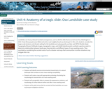
Landslides can have profound societal consequences, such as did the slide that …
Landslides can have profound societal consequences, such as did the slide that occurred near Oso, Washington in 2014. Forty-three people were killed and entire rural neighborhood was destroyed. In this unit, students consider the larger-scale tectonic and climatic setting for the landslide and subsequently use lidar and SRTM (Shuttle Radar Topography Mission) hillshade images, topographic maps, and InSAR (interferometric synthetic aperture radar) to determine relationships between landscape characteristics and different types of mass-wasting events. They conclude by considering the societal costs of such a disaster and ways that communities in similar situations may mitigate their risk.
Show more about Online Teaching suggestions Hide Online-adaptable: The exercises in unit are completely digital and thus at a logistical level it can be switched to online fairly easily. However, due to the relative complexity of the data investigations and group discussions, there will still be a fair bit of instructor support needed and/or extended small group that should be arranged.
(Note: this resource was added to OER Commons as part of a batch upload of over 2,200 records. If you notice an issue with the quality of the metadata, please let us know by using the 'report' button and we will flag it for consideration.)
In this unit, student groups will evaluate different environmental case studies to …
In this unit, student groups will evaluate different environmental case studies to critically investigate qualitative and quantitative data analysis, collection, and inquiry. Students will begin to consider different forms of sensory-related data collection and how experiential knowledge informs the ways in which one forms analytical, evaluative questions. Student expert groups are provided one case study (different expert groups will examine at least two different cases) that has a number of different kinds of resources that students will examine (e.g. journalistic, scientific, narrative, visual, auditory). Students will use cooperative learning methods to engage with problem-based inquiry rather than have the case study information delivered via instructor-based lecture. Given that students across disciplinary contexts may not have been exposed to scientific methods of investigation, this unit encourages systems thinking alongside other methods of investigation. As students consider the variety of perceptions that occur within a group of people sharing an environmental experience, students are able to consider the impact that different types of data have on one's perception of data collection and its analysis. This exercise also demonstrates the utility of interdisciplinary thinking -- by examining data sets from multiple academic disciplines, students gain a more complete understanding of the case study compared to what they would have understood by examining data from a single research approach. The activity also provides students with an opportunity to practice interdisciplinary thinking and collaboration skills. The cases address several key environmental challenges: soil contamination, water resources, and the impacts of industrial agriculture. A collaborative learning method is used in conjunction with guided class and group discussion to critically examine different types of data and encourage consistency of data analysis between student groups. This unit uses a group exploration and presentation activity to ensure equal distribution of materials and accountability among class participants. In essence, the students teach each other about the case studies with the instructor providing questions to elicit depth and synthesis between groups as well as to ensure that critical data analysis is undertaken.
(Note: this resource was added to OER Commons as part of a batch upload of over 2,200 records. If you notice an issue with the quality of the metadata, please let us know by using the 'report' button and we will flag it for consideration.)
Units 4, 5, and 6 provide the opportunity for students to delve …
Units 4, 5, and 6 provide the opportunity for students to delve into a greater examination of food security at a regional level in small teams selecting one of the following locations (Caribbean, New York City, or Nebraska) OR a new location of their choice (provided that information and datasets are easily available and students will work with the instructor prior to the start of the unit) to apply skills and concepts taught in Units 1-3. Unit 4 materials are designed to provide a place-based overview for students to prepare them for the summative assessment, to be submitted in Unit 6, a community-based action plan of how the selected community can increase food security and lessen vulnerability.
(Note: this resource was added to OER Commons as part of a batch upload of over 2,200 records. If you notice an issue with the quality of the metadata, please let us know by using the 'report' button and we will flag it for consideration.)
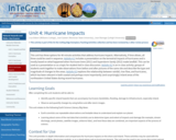
This unit has three options for 40-minute activities that address hurricane impacts. …
This unit has three options for 40-minute activities that address hurricane impacts. Alternatively, if time allows, all three could be used in sequence. Activity 4.1 includes a presentation on the terrestrial impacts of hurricanes and is mostly based on what happened when Hurricane Irene (2011) and Superstorm Sandy (2012) made landfall. This can be used as a presentation or as a topic for student-led in-class discussion. Activity 4.2 is an in-class activity: groups of students work together to make observations from before and after pictures of the same site and describe the type and magnitude of changes to the areas. Activity 4.3 explores the relationship between rainfall, river flow, and hurricanes, which has been relevant in both coastal and perhaps more importantly (and surprisingly) inland areas of the northeastern United States during recent hurricanes.
(Note: this resource was added to OER Commons as part of a batch upload of over 2,200 records. If you notice an issue with the quality of the metadata, please let us know by using the 'report' button and we will flag it for consideration.)
Students explore water quality and freshwater access issues around the globe. The …
Students explore water quality and freshwater access issues around the globe. The activities require students to investigate region-specific water problems in different parts of the world and analyze how those issues are sometimes remedied. The materials in this unit may be used as a stand-alone day of instruction or as part of the complete Environmental Justice and Freshwater Resources InTeGrate Module.
(Note: this resource was added to OER Commons as part of a batch upload of over 2,200 records. If you notice an issue with the quality of the metadata, please let us know by using the 'report' button and we will flag it for consideration.)
Unit 5 will delve more into an examination of food security using …
Unit 5 will delve more into an examination of food security using online ArcGIS. The class begins with a GIS-based exploration of data available for the three regions. The rest of the class period is provided for group work creating an action plan for a food insecurity issue teams have identified for their region. Students will utilize their maps from ArcGIS Online within their action plan. One component of the summative assessment, to be submitted in Unit 6, is a community-based action plan of how the selected community can increase food security and lessen vulnerability.
(Note: this resource was added to OER Commons as part of a batch upload of over 2,200 records. If you notice an issue with the quality of the metadata, please let us know by using the 'report' button and we will flag it for consideration.)
Students explore the classic case of Love Canal, New York, in which …
Students explore the classic case of Love Canal, New York, in which Lois Gibbs -- originally described as a "hysterical housewife" -- mobilized her community and called attention to the contamination of groundwater by buried hazardous waste and the resulting impact on the health of local residents. The activities require the students to investigate the history of events at Love Canal. The materials in this unit may be used as a stand-alone day of instruction or as part of the complete Environmental Justice and Freshwater Resources InTeGrate Module.
(Note: this resource was added to OER Commons as part of a batch upload of over 2,200 records. If you notice an issue with the quality of the metadata, please let us know by using the 'report' button and we will flag it for consideration.)
empty (Note: this resource was added to OER Commons as part of …
empty
(Note: this resource was added to OER Commons as part of a batch upload of over 2,200 records. If you notice an issue with the quality of the metadata, please let us know by using the 'report' button and we will flag it for consideration.)
In this unit, student groups will use sensory data (scents and/or sounds) …
In this unit, student groups will use sensory data (scents and/or sounds) collected in the field to create maps of the sensory environment and relate their findings to larger environmental problems identified in their guiding questions and hypotheses. This unit is designed to build upon prior units in which students develop guiding questions and hypotheses, field data collection protocols, and field investigation plans. The field investigation will require a base map on which to record data and a final map on which to display data and characterize the study area and environmental impact of the mapped data. The base map will be derived from aerial imagery if the investigation site is outside. The base map will be derived from a building schematic or floor map if an interior location is mapped. Class time will be devoted to developing maps on which students will display the data collected in the field. Students will use Google Earth or other online resources to obtain aerial (or other schematic) imagery of their study area. They may use an aerial image as a base map or they may draw their own maps based on the aerial imagery. If the site is indoors, a blueprint or floor plan can be the base map, or students can draw their own maps based on an existing image or schematic. Sensory mapping allows students to identify scent plumes as they migrate away from source locations. Odor plumes and sounds are analogous to plumes of contaminants that migrate through groundwater, surface water, and air. In many instances, the presence of unusual odors is an indicator of migrating contaminants and can lead to sampling by environmental professionals (including geoscientists) to confirm and quantify contaminant migration through the environment. These maps serve as representations of the complex odor or sound systems in the students' chosen geographical areas.
(Note: this resource was added to OER Commons as part of a batch upload of over 2,200 records. If you notice an issue with the quality of the metadata, please let us know by using the 'report' button and we will flag it for consideration.)
Students watch a video and read about past evacuations, including a premature …
Students watch a video and read about past evacuations, including a premature or unnecessary evacuation, a late or botched evacuation, and about people determined to stay put no matter what. Students participate in a role-playing exercise about making the decision to evacuate in the face of uncertain predictions.
(Note: this resource was added to OER Commons as part of a batch upload of over 2,200 records. If you notice an issue with the quality of the metadata, please let us know by using the 'report' button and we will flag it for consideration.)
In this classroom activity, students watch the movie "Dante's Peak" up to …
In this classroom activity, students watch the movie "Dante's Peak" up to the point where Harry Dalton's supervisor arrives and talks to the town council. Students then compare and contrast Harry's assessment and advice to that of his supervisor, discuss the reaction of the town council members, and develop their own recommendations for how the scientists and town should proceed.
(Note: this resource was added to OER Commons as part of a batch upload of over 2,200 records. If you notice an issue with the quality of the metadata, please let us know by using the 'report' button and we will flag it for consideration.)
What exactly is a vaccine? Can vaccines prevent outbreaks? How effective does …
What exactly is a vaccine? Can vaccines prevent outbreaks? How effective does a vaccine need to be to help a population during an outbreak? Students will explore these questions and more in this lesson plan by first learning the biology behind vaccines. They will then use Science Buddies' SimPandemic, a free online tool, to model different vaccine parameters to understand how vaccines affect both individuals and populations during a COVID-19 outbreak. KEY WORDS: Vaccines, Outbreaks, Vaccine Effectiveness, Disease Modeling, COVID-19, Coronavirus, Pandemic
(Note: this resource was added to OER Commons as part of a batch upload of over 2,200 records. If you notice an issue with the quality of the metadata, please let us know by using the 'report' button and we will flag it for consideration.)
Students are encouraged through writing and research activities to discover a greater …
Students are encouraged through writing and research activities to discover a greater sense of place and express their increased awareness of local ecosystems and cultural communities.
(Note: this resource was added to OER Commons as part of a batch upload of over 2,200 records. If you notice an issue with the quality of the metadata, please let us know by using the 'report' button and we will flag it for consideration.)
Through a hands-on examination of a nature preserve/park in a nearby urban …
Through a hands-on examination of a nature preserve/park in a nearby urban setting and with classroom discussions and activities, students become aware that individuals are affected differently by the preservation of nature or by development of natural resources.
(Note: this resource was added to OER Commons as part of a batch upload of over 2,200 records. If you notice an issue with the quality of the metadata, please let us know by using the 'report' button and we will flag it for consideration.)
This lesson guides students to examine the potential benefits, risks, and ethical …
This lesson guides students to examine the potential benefits, risks, and ethical concerns of designer drugs. Students begin by reading an article titled Ethical Issues in Pharmacogenetics by Carol Isaacson Barash, an ActionBioscience.org original article. Next they will read information on the National Human Genome Research Institute on Pharmacogenetics: Frequently Asked Questions about Pharmacogenomics. Instructors can then use the lesson to guide students through shorter activities and/or one main activity. The smaller activities involve students in describing the research behind the issue, making it accessible to a less-informed audience, and in exploring the ethical issues outlined in the article to support various points of view. The larger activity is for upper level students to gather evidence to support particular perspectives so that they can present different views about the ownership of human DNA information.
No restrictions on your remixing, redistributing, or making derivative works. Give credit to the author, as required.
Your remixing, redistributing, or making derivatives works comes with some restrictions, including how it is shared.
Your redistributing comes with some restrictions. Do not remix or make derivative works.
Most restrictive license type. Prohibits most uses, sharing, and any changes.
Copyrighted materials, available under Fair Use and the TEACH Act for US-based educators, or other custom arrangements. Go to the resource provider to see their individual restrictions.