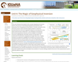
The concepts of forward modeling and inverse modeling Provenance: Lee Slater, Rutgers …
The concepts of forward modeling and inverse modeling
Provenance: Lee Slater, Rutgers University-Newark Reuse: If you wish to use this item outside this site in ways that exceed fair use (see http://fairuse.stanford.edu/) you must seek permission from its creator. This unit introduces the student to the concept of geophysical inversion, which is the process of estimating the geophysical properties of the subsurface from the geophysical observations. The basic mechanics of the inversion process used to estimate spatial variations in electrical conductivity from electrical imaging (EI) datasets are introduced in a way that avoids the heavy mathematics. The challenges of inverting two dimensional geophysical datasets and the strategies for limiting the inversion to geologically reasonable solutions are described. The unfortunate characteristics of geophysical images (blurriness, imaging artifacts) are explained to highlight the limitations of inversion and to emphasize that the inverted images never match with geological reality. Students use the Excel-based Scenario Evaluator for Electrical Resistivity (SEER) tool introduced in Unit 3, Field Geophysical Measurements, to investigate key inversion concepts associated with measurement errors and the benefits of adding boreholes to surface data using synthetic datasets. Students are then led through an inversion of the two-dimensional EI dataset acquired in Harrier Meadow using ResIPy, a Python-based graphical user interface developed for instructional use. Following the instructional video, students then perform the inversion in ResIPy themselves and explore how variations in inversion settings related to the errors in the measurements result in distinctly different images.
(Note: this resource was added to OER Commons as part of a batch upload of over 2,200 records. If you notice an issue with the quality of the metadata, please let us know by using the 'report' button and we will flag it for consideration.)
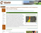
Screenshot of the slider tool used to relate geophysical images to vegetation …
Screenshot of the slider tool used to relate geophysical images to vegetation pattern
Provenance: Lee Slater, Rutgers University-Newark Reuse: This item is in the public domain and maybe reused freely without restriction. In this unit, students explore spatial associations between the three-dimensional electromagnetic (EM) conductivity inversions and the visible patterns of Salicornia (Pickleweed) introduced in Unit 1, Exploring Harrier Meadow. The Arcview Storymap started in Unit 1 allows students to overlay inverted electrical conductivity patterns for different depths on aerial photographs of Harrier Meadow that highlight the patches of Pickleweed. Students analyze how conductivity patterns vary with depth and explore for evidence for a relationship between electrical conductivity and Pickleweed patches based on the hypothesis introduced in Unit 1. Students then perform an integrated interpretation of both the EM and electrical imaging inversions along with the results of direct sampling (coring, pore water sampling, soil characterization) conducted at locations selected using the electrical conductivity patterns observed in the EM dataset. Students perform basic qualitative assessments of the correlation between physical and chemical properties of the sampled soils and soil electrical conductivity from the EM inversions. Students finish the module by evaluating the extent to which the geophysical dataset and supporting direct measurements support the hypothesis pertaining to the cause of the Salicornia clusters introduced in Unit 1.
(Note: this resource was added to OER Commons as part of a batch upload of over 2,200 records. If you notice an issue with the quality of the metadata, please let us know by using the 'report' button and we will flag it for consideration.)
This video segment adapted from Texas Parks and Wildlife Department explores the …
This video segment adapted from Texas Parks and Wildlife Department explores the role of the wetlands in our environment, including providing habitats for wildlife, acting as natural water filters, and playing a part in the greater water cycle.
Aquatic Ecology Studies: Exercises in Scientific Literacy is a collection of lessons …
Aquatic Ecology Studies: Exercises in Scientific Literacy is a collection of lessons designed primarily for earth science and biology classrooms. The lessons may be taught in a cluster as part of a water resources unit or they may be used individually to enrich any preparation with special focus on NCSCOS secondary science goal 1.05: analyze reports of investigations from an informed scientifically literate viewpoint. The aquatic ecology theme pays particular attention to aquatic environmental issues of eastern North Carolina and connects learners to authentic data and technology resources from the Center for Applied Aquatic Ecology at North Carolina State University. The lessons are created for collaborative group classrooms, promote technology integration and are formatted to enhance the development of project based learning frameworks. Diverse learning outcomes and contexts for skill development are addressed in each lesson and the overview document in depth.
The Wetlands Law Course Source can be used as the primary text …
The Wetlands Law Course Source can be used as the primary text for a two credit seminar or as a supplemental text to cover wetlands material in an environmental law, natural resources law, or water law course. In addition, the administrative law chapter can be used as a supplement in a range of administrative law-related courses, such as environmental law, health law, labor law, immigration law, and others, to introduce basic administrative law concepts.
Unlike traditional casebooks or coursebooks, a “course source” includes resources to train students in all three apprenticeships identified by the Carnegie Foundation in its influential report on legal education, Educating Lawyers: Preparation for the Profession of Law. To address the knowledge apprenticeship, the Wetlands Law Course Source includes all of the traditional elements of a casebook or coursebook (cases, commentary, notes and questions) and includes several hypotheticals and problem exercises that focus on reinforcing wetlands law. In addition, as one of the many forms of summative and formative assessment included in the book, every chapter includes one or more CALI exercise as a “quiz” to reinforce the material covered in the chapter. To address the skills apprenticeship, the Wetlands Law Course Source includes sixteen separate legal research exercises, several drafting exercises, a negotiation exercise, and an interviewing and counseling exercise. To address the values apprenticeship, the Course Source includes several professionalism scenarios, with questions related to the scenarios.
No restrictions on your remixing, redistributing, or making derivative works. Give credit to the author, as required.
Your remixing, redistributing, or making derivatives works comes with some restrictions, including how it is shared.
Your redistributing comes with some restrictions. Do not remix or make derivative works.
Most restrictive license type. Prohibits most uses, sharing, and any changes.
Copyrighted materials, available under Fair Use and the TEACH Act for US-based educators, or other custom arrangements. Go to the resource provider to see their individual restrictions.