This presentation offers resources and strategies to encourage the use of digital …
This presentation offers resources and strategies to encourage the use of digital and environmental approaches to teaching World History including the use of contemporary and historical maps to foster spatial reasoning skills; assigning students to create interactive maps and virtual globes; and using visualization tools that show environmental change over time.
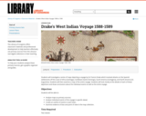
Students use Library of Congress primary sources to examine a series of …
Students use Library of Congress primary sources to examine a series of maps depicting a voyage by Sir Francis Drake involving attacks on Spanish settlements around the Atlantic.
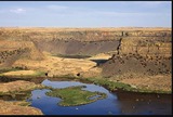
The Fourth Grade Elementary Framework for Science and Integrated Subjects, What Happened …
The Fourth Grade Elementary Framework for Science and Integrated Subjects, What Happened at Dry Falls?, uses the phenomena of a local Washington landform to explore erosion from the Ice Age Floods. It is part of Elementary Framework for Science and Integrated Subjects project, a statewide Clime Time collaboration among ESD 123, ESD 105, North Central ESD, and the Office of Superintendent of Public Instruction. Development of the resources is in response to a need for research- based science lessons for elementary teachers that are integrated with English language arts, mathematics and other subjects such as social studies. The template for Elementary Science and Integrated Subjects can serve as an organized, coherent and research-based roadmap for teachers in the development of their own NGSS aligned science lessons. Lessons can also be useful for classrooms that have no adopted curriculum as well as to serve as enhancements for current science curriculum. The EFSIS project brings together grade level teams of teachers to develop lessons or suites of lessons that are 1) pnenomena based, focused on grade level Performance Expectations, and 2) leverage ELA and Mathematics Washington State Learning Standards.
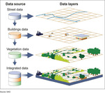
A geographic information system (GIS) is a computer system for capturing, storing, …
A geographic information system (GIS) is a computer system for capturing, storing, checking, and displaying data related to positions on Earth’s surface.
The podcast and map gallery are intended to prompt listeners to think broadly about …
The podcast and map gallery are intended to prompt listeners to think broadly about the kinds of documents that can be thought of as maps, and to help teachers think about how to use many kinds of maps critically in their classrooms. People all around the world create visual representations of spatial relationships and their worlds in ways that matter to them. This guide explores the diversity of these representations and the ways that spatial information travels between people, often in the context of imperialism and colonialism.
Students use Library of Congress primary sources to depict the motivations, expectations, …
Students use Library of Congress primary sources to depict the motivations, expectations, fears, and realizations of immigrants who settled California between 1849 and 1900.
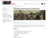
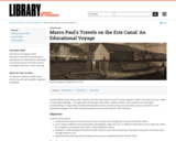
Students use Library of Congress primary sources to understand the impact of …
Students use Library of Congress primary sources to understand the impact of the Erie Canal on the economic and social growth of New York and the nation.
No restrictions on your remixing, redistributing, or making derivative works. Give credit to the author, as required.
Your remixing, redistributing, or making derivatives works comes with some restrictions, including how it is shared.
Your redistributing comes with some restrictions. Do not remix or make derivative works.
Most restrictive license type. Prohibits most uses, sharing, and any changes.
Copyrighted materials, available under Fair Use and the TEACH Act for US-based educators, or other custom arrangements. Go to the resource provider to see their individual restrictions.