In this field exercise, students examine the mystery mounds and patterned ground …
In this field exercise, students examine the mystery mounds and patterned ground on the top of Umptanum Ridge in central Washington. Groups of 3-4 students design and conduct a field investigation and write a single joint report. Each group formulates a testable hypothesis that addresses one of the proposed processes involved in forming or subsequently shaping the mounds. The groups design an experiment to test their hypothesis, collect the necessary field observations and measurements during a regular afternoon field lab period and write a scientific report that includes an introduction, statement of hypothesis, background information, methods, data, analysis and interpretations, discussion of uncertainties, conclusions, and references. One week later, reports are turned in and students form "jigsaw" discussion groups composed of one student from each field research group. Each student briefly summarizes their group's research hypothesis and results to the jigsaw group. The jigsaw groups then each develop a revised hypothesis based on these combined results and present that to the entire class. Designed for a geomorphology course Uses online and/or real-time data Has minimal/no quantitative component Addresses student fear of quantitative aspect and/or inadequate quantitative skills Addresses student misconceptions
(Note: this resource was added to OER Commons as part of a batch upload of over 2,200 records. If you notice an issue with the quality of the metadata, please let us know by using the 'report' button and we will flag it for consideration.)
This activity uses an assortment of digital resources relevant to exploring resource …
This activity uses an assortment of digital resources relevant to exploring resource development on Native American lands. The activity is based on a website that uses an Earth System approach to help students understand how Native American lands have been impacted by resource development. Students are assigned to investigate different aspects of the same problem or issue. For example, each team might analyze a different but related data set or read an article on different aspects or viewpoints on the same topic. Once each team member thoroughly understands his/her team's aspect of the problem, new groups are formed, with at least one representative from each original team. Each individual then explains her/his team's aspect of the problem to the new group. In this way, every student learns different aspects of the problem. Each group then uses combined information to create a complete summary of the issue. The jigsaw technique is based on work published by Barbara Tewksbury [Tewksbury, 1995] .
(Note: this resource was added to OER Commons as part of a batch upload of over 2,200 records. If you notice an issue with the quality of the metadata, please let us know by using the 'report' button and we will flag it for consideration.)
Students are assigned to read one of the three papers on tectonic …
Students are assigned to read one of the three papers on tectonic geomorphology (landscape evolution) published by Nature in 2003 (Burbank et al., Dadson et al., and Reiners et al.). All also read the editorial by Molnar from the same issue. They work with others who read the same paper to understand the paper and then jigsaw into new groups to discuss the similarities and differences between the papers and to see if they can come to any conclusions about major drivers on landscape evolution. This activity has them work on multiple levels of Blooms Taxonomy - they read and understand a paper, analyze the results of the paper, and then evaluate the paper in the context of two other papers presented by peers.
In this jigsaw activity, students of intermediate-level French will divide into five …
In this jigsaw activity, students of intermediate-level French will divide into five groups to become experts on each of the five biodiversity questions featured on the Curiosphere website. They will proceed to explain their assigned aspect of the issue to a small group of students.
In this lab students will explore first hand what sorts of processes …
In this lab students will explore first hand what sorts of processes occur when scientists and engineers try to identify a landing site for a mission to Mars. This will mimic the process used to select the MER rover landing sites, and what will be used for future missions. First, students briefly become a planetary geologist, engineer or astrobiologist. Second, from the point of view the students feel is appropriate for their new position, and using the same constraints employed by the scientific teams preparing for forthcoming Mars missions, students will identify their top list of candidate landing sites and submit a short report describing them to me by the following class period. Third, in the following class period, all three groups of experts will work together to narrow down the site selection to a top candidate. Where would you send the next lander if the choice was up to you? Each student group, constituted randomly, is provided with the appropriate role-playing sheet from the lab assignment.
(Note: this resource was added to OER Commons as part of a batch upload of over 2,200 records. If you notice an issue with the quality of the metadata, please let us know by using the 'report' button and we will flag it for consideration.)
Upon arrival in the lab, students are designated as an engineer, a …
Upon arrival in the lab, students are designated as an engineer, a biologist, or a geologist. Working in these groups, each group uses available Mars data (including, but not limited to, Mars geologic maps, topography, thermal inertia data) to identify their top three landing sites on the basis of provided criteria. In jig-saw fashion, new groups are generated consisting of one geologist, one engineer, and one geologist. These new groups must agree on their top three landing sites. Finally, the entire class must agree on a landing site.
(Note: this resource was added to OER Commons as part of a batch upload of over 2,200 records. If you notice an issue with the quality of the metadata, please let us know by using the 'report' button and we will flag it for consideration.)
This activity is an inquiry approach to term and concept introduction. Students …
This activity is an inquiry approach to term and concept introduction. Students will work in a jigsaw format to read through the descriptions of eyewitness accounts from earthquakes and assess a Mercalli value. In the jigsaw groups, they will compare the different Mercalli and Richter values and describe the basic events that occurred during different earthquakes. They will share this information in order to collaboratively assess the strengths and weaknesses of this scale relative to the Richter magnitudes provided. They will also begin to determine what types of hazards result from earthquakes.
(Note: this resource was added to OER Commons as part of a batch upload of over 2,200 records. If you notice an issue with the quality of the metadata, please let us know by using the 'report' button and we will flag it for consideration.)
Students in a learning community that includes classics and geology complete labs …
Students in a learning community that includes classics and geology complete labs involving rocks and minerals. The class meets at the Metropolitan Museum of Art on a weekend; in groups, the students document and describe the earth materials displayed in art halls of ancient cultures. The following week reformed groups meet in class to compare and contrast their museum-based findings and explore the geological concepts that underlie the use of materials by ancient cultures (jigsaw assignment). It is assumed that students have some prior knowledge of the ancient cultures being studied at the museum through a paired course, assigned reading, or introductory lecture.
(Note: this resource was added to OER Commons as part of a batch upload of over 2,200 records. If you notice an issue with the quality of the metadata, please let us know by using the 'report' button and we will flag it for consideration.)
This jigsaw exercise has students study national parks from different perspectives. Groups …
This jigsaw exercise has students study national parks from different perspectives. Groups can be divided up depending on the nature of the class: historian, meteorologist, geologist, and biologist.
(Note: this resource was added to OER Commons as part of a batch upload of over 2,200 records. If you notice an issue with the quality of the metadata, please let us know by using the 'report' button and we will flag it for consideration.)
In this jigsaw activity, students discover four different aspects of natural hazards …
In this jigsaw activity, students discover four different aspects of natural hazards on the Island of Hawaii. The goal for students is to design a hazard zone map that combines these four topics and that could be used for making land-use decisions before future natural hazards occur. Students will first be assigned to one of four Hazard Specialties (lava flows, explosive eruptions, earthquakes, tsunami), where they complete an exercise and make a preliminary hazard zone map with their specialty group from a single hazard map. Then the students will reorganize into Hazard Assessment Teams, with one student from each of the four Hazard Specialties, to develop a final hazard zone map based on information on all four hazards. Each Hazard Assessment Team will make a recommendation about the risks of natural hazards to existing and future development in Hilo, Kailua-Kona, and Kalapana on the Island of Hawaii.
(Note: this resource was added to OER Commons as part of a batch upload of over 2,200 records. If you notice an issue with the quality of the metadata, please let us know by using the 'report' button and we will flag it for consideration.)
In this jigsaw activity, students discover four different aspects of natural hazards …
In this jigsaw activity, students discover four different aspects of natural hazards on the Island of Hawaii. The goal for students is to design a hazard zone map that combines these four topics and that could be used for making land-use decisions before future natural hazards occur.
Students will first be assigned to one of four Hazard Specialties (lava flows, explosive eruptions, earthquakes, tsunami), where they complete an exercise and make a preliminary hazard zone map with their specialty group from a single hazard map. Then the students will reorganize into Hazard Assessment Teams, with one student from each of the four Hazard Specialties, to develop a final hazard zone map based on information on all four hazards. Each Hazard Assessment Team will make a recommendation about the risks of natural hazards to existing and future development in Hilo, Kailua-Kona, and Kalapana on the Island of Hawaii.
(Note: this resource was added to OER Commons as part of a batch upload of over 2,200 records. If you notice an issue with the quality of the metadata, please let us know by using the 'report' button and we will flag it for consideration.)
In this optional activity, students analyze maps of wind patterns from three …
In this optional activity, students analyze maps of wind patterns from three levels in the atmosphere in order to infer global atmospheric circulation patterns and their role in balancing the radiation budget they established in Units 4 and 5. The main activity is a jigsaw in which students explore a single map on their own prior to class, confer with their classmates in specialty groups, and then synthesize atmospheric circulation for an assigned latitudinal zone. In these synthesis groups, students create maps and cross-section concept sketches to use in a full class discussion at the end of class. A follow-up assignment asks students to infer the relationship between global atmospheric circulation patterns and precipitation and then predict possible consequences of changes in these patterns due to global warming.
(Note: this resource was added to OER Commons as part of a batch upload of over 2,200 records. If you notice an issue with the quality of the metadata, please let us know by using the 'report' button and we will flag it for consideration.)
This activity uses cooperative learning to identify minerals in hand sample based …
This activity uses cooperative learning to identify minerals in hand sample based on physical properties. The "Jigsaw" pedagogy upon which this lab is based provides the environment for four succeeding labs in which the students learn the megascopic characteristic properties, chemical composition, and a geologic significance for each of approximately 100 minerals.
(Note: this resource was added to OER Commons as part of a batch upload of over 2,200 records. If you notice an issue with the quality of the metadata, please let us know by using the 'report' button and we will flag it for consideration.)
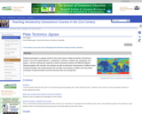
This activity is a slight variation on an original activity, Discovering Plate …
This activity is a slight variation on an original activity, Discovering Plate Boundaries, developed by Dale Sawyer at Rice University. I made different maps, including more detail in all of the datasets, and used a different map projection, but otherwise the general progression of the activity is the same. More information about jigsaw activities in general can be found in the Jigsaws module.
The activity occurs in several sections, which can be completed in one or multiple classes. In the first section, students are divided into "specialist" groups, and each group is given a global map with a single dataset: global seismicity, volcanoes, topography, age of the seafloor, and free-air gravity. Each student is also given a map of plate boundaries. Their task in the specialist group is to become familiar with their dataset and develop categories of plate boundaries based only on their dataset. Each group then presents their results to the class.
In the second section, students reorganize into groups with 1-2 of each type of specialist per group. Each new group is given a plate, and they combine their different datasets on that one plate and look for patterns. Again, each plate group presents to the class. The common patterns and connections between the different datasets quickly become apparent, and the final section of the activity involves a short lecture from the instructor about types of plate boundaries and why the common features are generated at those plate boundaries. A follow-up section or class involves using a problem-solving approach to explain the areas that don't "fit" into the typical boundary types - intra-plate volcanism, earthquakes in the Eastern California Shear Zone, etc.
(Note: this resource was added to OER Commons as part of a batch upload of over 2,200 records. If you notice an issue with the quality of the metadata, please let us know by using the 'report' button and we will flag it for consideration.)
To prepare for this exercise, students will read about the Earth's energy …
To prepare for this exercise, students will read about the Earth's energy balance, the electromagnetic spectrum (including visible solar and invisible infrared energy), the effect of the earth's atmosphere, and the earth's resulting general oceanic and atmospheric circulation. For this I like Chapters 3, 4, & 5 in "The Earth System" (2nd Ed.) by Kump, Kasting, & Crane. The students' first step is to estimate zonal averages of Incoming Solar (Shortwave), Absorbed Shortwave, and Outgoing Longwave Radiation from 11x17in color maps of Earth Radiation Budget Experiment (ERBE) data. Then I remix the groups and they create zonal averages of these data at particular longitudes (like Fig. 2-14 in Ruddiman, "Earth's Climate: Past & Future").
(Note: this resource was added to OER Commons as part of a batch upload of over 2,200 records. If you notice an issue with the quality of the metadata, please let us know by using the 'report' button and we will flag it for consideration.)
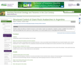
Jigsaw version: To prepare, students do background reading on landslides and rock …
Jigsaw version: To prepare, students do background reading on landslides and rock avalanches and read the introductory portion of Hermanns and Strecker's 1999 article on rock avalanches in Argentina. In class, students receive data (assembled from figures in the article) on bedrock geology and physiography, as well as stereonets showing orientations of prominent joint sets, bedding, and foliations in the bedrock. Their task is to answer the question of why gigantic rock avalanches occur is some places but not others in this part of Argentina. Each student receives one of four possible data sets and works with a team to analyze the data and solve the problem for the team's area. Each team member must then individually explain his/her analysis to a group of three other students, one from each of the other teams, and the group then compares the four locations for similarities and differences. The activity gives students practice in interpreting geologic maps, using stereonets, and peer teaching. The activity also connects structural geology to another geoscience discipline.Short case example version: This is an abbreviated version of the jigsaw activity described above and focuses on only one of the rock avalanche areas.
(Note: this resource was added to OER Commons as part of a batch upload of over 2,200 records. If you notice an issue with the quality of the metadata, please let us know by using the 'report' button and we will flag it for consideration.)
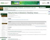
In this activity, students learn about volcanism in Yellowstone National Park, focusing …
In this activity, students learn about volcanism in Yellowstone National Park, focusing on its history of eruption, recent seismicity, hydrothermal events, and ground deformation. They learn how scientists monitor volcanoes (using Mount St. Helens as an example) and then apply that as an open-ended problem to Yellowstone; their problem is to identify a site for a research station.
(Note: this resource was added to OER Commons as part of a batch upload of over 2,200 records. If you notice an issue with the quality of the metadata, please let us know by using the 'report' button and we will flag it for consideration.)
In this Jigsaw activity, groups of four students are tasked with identifying …
In this Jigsaw activity, groups of four students are tasked with identifying 20 different minerals (or rocks).
(Note: this resource was added to OER Commons as part of a batch upload of over 2,200 records. If you notice an issue with the quality of the metadata, please let us know by using the 'report' button and we will flag it for consideration.)
Using a jigsaw approach, students investigate biogeochemical transformations of water as it …
Using a jigsaw approach, students investigate biogeochemical transformations of water as it moves through the hydrologic cycle. In the first phase, student groups are given a schematic representation of the hydrologic cycle with representative concentrations of a single variable (nitrate, silica, pH and conductivity) provided for oceans, precipitation, streams, and shallow and deep groundwater. After each group has achieved a satisfactory explanation of its own variable, students are recombined to explain and compare the processes that control each variable, and to look for common themes (e.g., weathering reactions in subsurface increase conductivity, silica and pH). The resulting conceptual framework facilitates use of water-quality variables as tracers to interpret runoff processes and stream-flow sources.
(Note: this resource was added to OER Commons as part of a batch upload of over 2,200 records. If you notice an issue with the quality of the metadata, please let us know by using the 'report' button and we will flag it for consideration.)
A jigsaw approach encourages collaboration, co-operation, and avoids a lecture-based approach to …
A jigsaw approach encourages collaboration, co-operation, and avoids a lecture-based approach to delivering content. Each student becomes an expert and also must rely on others to complete their understanding. Students recognize the importance of each individual process, and how each process fits into the rather complex integrated carbon cycle. Additional processes can be added for advanced classes including long-term processes such as sedimentation and burial in rocks.
Nuts and Bolts; There are five fundamental processes involved in the short-term terrestrial organic carbon cycle: photosynthesis, respiration, feeding, death, and decomposition. The objective of this exercise is to have each student become an expert in one of these five processes, and then explain to others in their small group the essentials of this process.
Before class, each student is asked to research and fully understand one aspect of the carbon cycle. They write one to two pages fully describing this process, including answering the following questions:
- Where does this process occur in the biosphere and geosphere? - What is the correct chemical equation to describe the process? - What is the rate of the process, with correct units? - What is the residence time of carbon in the reservoir that leads to this process? - How does this process affect or control atmospheric CO2?
In class, the now expert students first consult with other classmates who have studied the same process to strengthen and deepen their understanding. They then form teams of five students and explain to other students their particular process. In exchange, other students explain additional aspects of the carbon cycle. Finally, one or two groups presents to the entire class, with class discussion. At the end, all students develop a comprehensive understanding of the integrated organic C cycle.
No restrictions on your remixing, redistributing, or making derivative works. Give credit to the author, as required.
Your remixing, redistributing, or making derivatives works comes with some restrictions, including how it is shared.
Your redistributing comes with some restrictions. Do not remix or make derivative works.
Most restrictive license type. Prohibits most uses, sharing, and any changes.
Copyrighted materials, available under Fair Use and the TEACH Act for US-based educators, or other custom arrangements. Go to the resource provider to see their individual restrictions.