Through this set of lessons, students learn about the impacts of water …
Through this set of lessons, students learn about the impacts of water shortages due to drought, make connections to climate patterns, and explore community resiliency solutions. The lessons engage students in evaluating solutions for a particular case study community. Students will need to do additional research on solutions, but by the end of the lesson, students will be able to articulate how drought, although a localized problem, has far-reaching impacts, and to suggest solutions to a problem that is projected to intensify as the climate continues to change.
An engineering and design lesson for middle school (our 7th grade standards). …
An engineering and design lesson for middle school (our 7th grade standards).
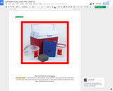
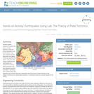
In the aftermath of a natural disaster, can you engineer a device that will keep medicine within a 40-60°F range using natural resources from the biome you live in, and/or debris created by the disaster for three days, until the Red Cross can arrive?
You are a team of relief workers in __________________after a major earthquake/tsunami has occurred. Your team lead as just told you about a young women with diabetes has been injured and needs insulin to be delivered __________ miles away (no open roads). Your team will need to research, design, and build a portable device to keep the insulin between _____ and ______ °(F/C) for _____ days. Once you return you will present the effectiveness of your device to your lead and a team other relief workers showing your both your design/device and explaining the process.
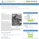
Students learn about the structure of the earth and how an earthquake …
Students learn about the structure of the earth and how an earthquake happens. In one activity, students make a model of the earth including all of its layers. In a teacher-led demonstration, students learn about continental drift. In another activity, students create models demonstrating the different types of faults.
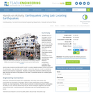
Students learn about factors that engineers take into consideration when designing buildings …
Students learn about factors that engineers take into consideration when designing buildings for earthquake-prone regions. Using online resources and simulations available through the Earthquakes Living Lab, students explore the consequences of subsurface ground type and building height on seismic destruction. Working in pairs, students think like engineers to apply what they have learned to sketches of their own building designs intended to withstand strong-magnitude earthquakes. A worksheet serves as a student guide for the activity.
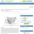
Students learn how engineers characterize earthquakes through seismic data. Then, acting as …
Students learn how engineers characterize earthquakes through seismic data. Then, acting as engineers, they use real-world seismograph data and a tutorial/simulation accessed through the Earthquakes Living Lab to locate earthquake epicenters via triangulation and determine earthquake magnitudes. Student pairs examine seismic waves, S waves and P waves recorded on seismograms, measuring the key S-P interval. Students then determine the maximum S wave amplitudes in order to determine earthquake magnitude, a measure of the amount of energy released. Students consider how engineers might use and implement seismic data in their design work. A worksheet serves as a student guide for the activity.
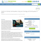
Students study how geology relates to the frequency of large-magnitude earthquakes in …
Students study how geology relates to the frequency of large-magnitude earthquakes in Japan. Using the online resources provided through the Earthquakes Living Lab, students investigate reasons why large earthquakes occur in this region, drawing conclusions from tectonic plate structures and the locations of fault lines. Working in pairs, students explore the 1995 Kobe earthquake, why it happened and the destruction it caused. Students also think like engineers to predict where other earthquakes are likely to occur and what precautions might be taken. A worksheet serves as a student guide for the activity.
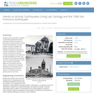
Students examine the effects of geology on earthquake magnitudes and how engineers …
Students examine the effects of geology on earthquake magnitudes and how engineers anticipate and prepare for these effects. Using information provided through the Earthquakes Living Lab interface, students investigate how geology, specifically soil type, can amplify the magnitude of earthquakes and their consequences. Students look in-depth at the historical 1906 San Francisco earthquake and its destruction thorough photographs and data. They compare the 1906 California earthquake to another historical earthquake in Kobe, Japan, looking at the geological differences and impacts in the two regions, and learning how engineers, geologists and seismologists work to predict earthquakes and minimize calamity. A worksheet serves as a student guide for the activity.
Students use U.S. Geological Survey (USGS) real-time, real-world seismic data from around …
Students use U.S. Geological Survey (USGS) real-time, real-world seismic data from around the planet to identify where earthquakes occur and look for trends in earthquake activity. They explore where and why earthquakes occur, learning about faults and how they influence earthquakes. Looking at the interactive maps and the data, students use Microsoft® Excel® to conduct detailed analysis of the most-recent 25 earthquakes; they calculate mean, median, mode of the data set, as well as identify the minimum and maximum magnitudes. Students compare their predictions with the physical data, and look for trends to and patterns in the data. A worksheet serves as a student guide for the activity.
Students gather evidence to explain the theory of plate tectonics. Using the …
Students gather evidence to explain the theory of plate tectonics. Using the online resources at the Earthquakes Living Lab, students examine information and gather evidence supporting the theory. They also look at how volcanoes and earthquakes are explained by tectonic plate movement, and how engineers use this information. Working in pairs, students think like engineers and connect what they understand about the theory of plate tectonics to the design of structures for earthquake-resistance. A worksheet serves as a student guide for the activity.
Students learn the two main methods to measure earthquakes, the Richter Scale …
Students learn the two main methods to measure earthquakes, the Richter Scale and the Mercalli Scale. They make a model of a seismograph a measuring device that records an earthquake on a seismogram. Students also investigate which structural designs are most likely to survive an earthquake. And, they illustrate an informational guide to the Mercalli Scale.
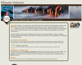
Public attention was captured in May 2018 when the Hawaiian volcano Kīlauea …
Public attention was captured in May 2018 when the Hawaiian volcano Kīlauea erupted with rivers of lava that flowed through Leilani Estates and other nearby neighborhoods. Your students may have seen videos of hot lava covering roads, destroying homes, or reaching the ocean with clouds of hot steam. You can capitalize on their interest by using data from this real-world event.
In these middle school lessons, students take on the role of volcanologists in order to analyze geologic data about the May 2018 eruption of Kīlauea and provide recommendations for mitigating its harmful effects.
In this activity, students are introduced to faults. They will learn about …
In this activity, students are introduced to faults. They will learn about different kinds of faults and understand their relationship to earthquakes. The students will build cardboard models of the three different types of faults as they learn about how earthquakes are formed.
In this lesson, students build an understanding of drought in Colorado through …
In this lesson, students build an understanding of drought in Colorado through exploring case studies, authentic data, and online resources. After completing this lesson, students will be able to understand the basic causes and impacts of droughts, analyze a case study and current drought data in Colorado, and summarize the main preparedness steps and response strategies for drought events.
In this hazard lesson, students build an understanding of flooding in Colorado …
In this hazard lesson, students build an understanding of flooding in Colorado by exploring case studies, authentic data, and online resources. After completing this lesson, students will be able to understand the basic causes and impacts of floods, analyze case study and current flood data in Colorado, and summarize the main preparedness steps and response strategies for flood events.
In this lesson, students investigate wildfires in Colorado by analyzing wildfire data …
In this lesson, students investigate wildfires in Colorado by analyzing wildfire data and information to create a local news story that educates community members about wildfire risk. In Part 1, students watch and discuss a short documentary about wildfires. In Part 2, students analyze wildfire data to build understanding of the causes, impacts, locations, and frequency of wildfires. In Part 3, students create a local news story for their community.
In this activity, students use Google Earth and team up with fictional …
In this activity, students use Google Earth and team up with fictional students in Chersky, Russia to investigate possible causes of thawing permafrost in Siberia and other Arctic regions. Students explore the nature of permafrost and what the effects of thawing permafrost mean both locally and globally. Next, students use a spreadsheet to explore soil temperature data from permafrost boreholes and surface air temperature datasets from in and around the Chersky region for a 50-year time span.
Students learn what causes hurricanes and what engineers do to help protect …
Students learn what causes hurricanes and what engineers do to help protect people from destruction caused by hurricane winds and rain. Research and data collection vessels allow for scientists and engineers to model and predict weather patterns and provide forecasts and storm warnings to the public. Engineers are also involved in the design and building of flood-prevention systems, such as levees and floodwalls. During the 2005 hurricane season, levees failed in the greater New Orleans area, contributing to the vast flooding and destruction of the historic city. In the associated activity, students learn how levees work, and they build their own levees and put them to the test!
In this activity, students use maps and data to learn about where …
In this activity, students use maps and data to learn about where and how hurricanes form and possible correlations with climate change affecting their strength.
This unit explores Performance Expectations MS- ESS3-2, ESS2-3 and ETS1-4 by engaging …
This unit explores Performance Expectations MS- ESS3-2, ESS2-3 and ETS1-4 by engaging students in Project-Based learning to develop a community presentation that examines whether your community is ready to respond to a major tectonic event.
In this activity, students will learn about the Richter Scale for measuring …
In this activity, students will learn about the Richter Scale for measuring earthquakes. The students will make a booklet with drawings that represent each rating of the Richter Scale.
No restrictions on your remixing, redistributing, or making derivative works. Give credit to the author, as required.
Your remixing, redistributing, or making derivatives works comes with some restrictions, including how it is shared.
Your redistributing comes with some restrictions. Do not remix or make derivative works.
Most restrictive license type. Prohibits most uses, sharing, and any changes.
Copyrighted materials, available under Fair Use and the TEACH Act for US-based educators, or other custom arrangements. Go to the resource provider to see their individual restrictions.