Students take on the role of geographers and civil engineers and use …
Students take on the role of geographers and civil engineers and use a device enabled with the global positioning system (GPS) to locate geocache locations via a number of waypoints. Teams save their data points, upload them to geographic information systems (GIS) software, such as Google Earth, and create scale drawings of their explorations while solving problems of area, perimeter and rates. The activity is unique in its integration of technology for solving mathematical problems and asks students to relate GPS and GIS to engineering.
Students design and build a mechanical arm that lifts and moves an …
Students design and build a mechanical arm that lifts and moves an empty 12-ounce soda can using hydraulics for power. Small design teams (1-2 students each) design and build a single axis for use in the completed mechanical arm. One team designs and builds the grasping hand, another team the lifting arm, and a third team the rotation base. The three groups must work to communicate effectively through written and verbal communication and sketches.
Why does the Moon not always look the same to us? Sometimes …
Why does the Moon not always look the same to us? Sometimes it is a big, bright, circle, but, other times, it is only a tiny sliver, if we can see it at all. The different shapes and sizes of the slivers of the Moon are referred to as its phases, and they change periodically over the course of a lunar month, which is twenty-eight days long. The phases are caused by the relative positions of the Earth, Sun, and Moon at different times during the month.
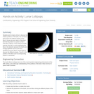
Students work in teams of two to discover the relative positions of …
Students work in teams of two to discover the relative positions of the Earth, Sun and Moon that produce the different phases of the Moon. Groups are each given a Styrofoam ball that they attach to a pencil so that it looks like a lollipop. In this acting-out model exercise, this ball on a stick represents the Moon, the students represent the Earth and a hanging lightbulb serves as the Sun. Students move the "Moon" around them to discover the different phases. They fill in the position of the Moon and its corresponding phase in a worksheet.
The purpose of this lesson is to teach students about the three …
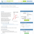
The purpose of this lesson is to teach students about the three dimensional Cartesian coordinate system. It is important for structural engineers to be confident graphing in 3D in order to be able to describe locations in space to fellow engineers.
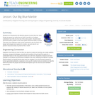
Students are introduced to the fabulous planet on which they live. Even …
Students are introduced to the fabulous planet on which they live. Even though we spend our entire lives on Earth, we still do not always understand how it fits into the rest of the solar system. Students learn about the Earth's position in the solar system and what makes it unique. They learn how engineers study human interactions with the Earth and design technologies and systems to monitor, use and care for our planet's resources wisely to preserve life on Earth.
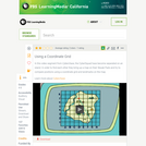
Student groups use a "real" 3D coordinate system to plot points in …
Student groups use a "real" 3D coordinate system to plot points in space. Made from balsa wood or wooden dowels, the system has three axes at right angles and a plane (the XY plane) that can slide up and down the Z axis. Students are given several coordinates and asked to find these points in space. Then they find the coordinates of the eight corners of a box/cube with given dimensions.
In this video from Cyberchase, the CyberSquad helps Ms. Fileshare realize that …
In this video from Cyberchase, the CyberSquad helps Ms. Fileshare realize that Hacker has been deceiving her as they take a look at the scale of a bar graph.
Students learn the concept of angular momentum and its correlation to mass, …
Students learn the concept of angular momentum and its correlation to mass, velocity and radius. They experiment with rotation and an object's mass distribution. In an associated literacy activity, students use basic methods of comparative mythology to consider why spinning and weaving are common motifs in creation myths and folktales.
Description: Build a model of the Earth, with its spin-axis, and a …
Description:
Build a model of the Earth, with its spin-axis, and a lamp as the Sun to demonstrate the concept of seasons.
Goals
--Understanding why we have seasons and the cause of seasonal variation in temperature. --Learning about how the Earth rotates on a tilted axis compared to its orbit around the Sun.
Learning Objectives
--Students learn about seasons by building a model of the Earth and the Sun, and investigating how sunlight hits the Northern and Southern Hemispheres during different seasons. --Students explain that the same amount of light hitting the ground heats up a small area more than a large area --Students show that the angle at which the sunlight hits the Earth influences how much the sunlight heats up the Earth. Students demonstrate that the angle at which the sunlight hits the Earth is related to the tilt of the Earth’s rotational axis compared to the Earth’s orbit around the Sun.
Students learn about the daily and annual cycles of solar angles used …
Students learn about the daily and annual cycles of solar angles used in power calculations to maximize photovoltaic power generation. They gain an overview of solar tracking systems that improve PV panel efficiency by following the sun through the sky.
Global wind patterns are dictated by the movement of the Earth on …
Global wind patterns are dictated by the movement of the Earth on its axis and are significant factors in determining the climate for regions of the planet. Students learn how the Coriolis effect and Hadley convection cells determine the location of deserts on Earth. They manipulate inflated plastic globes to discover how the Coriolis effect drives wind clockwise in the Northern Hemisphere and counterclockwise in the Southern Hemisphere. Then they incorporate latitudinal differences onto this modeling exercise to understand why deserts form at 30 degrees north and south of the equator. Once students understand the importance of global winds, they discuss hydropower in the desert. They compare and contrast two case studies: China’s Three Gorges Dam, and Chile’s proposed plant in the Atacama Desert that would creatively use solar power to move seawater up to the top of a mountain so that it can flow back down and generate power. Students note the economic, environmental, cultural and social impacts, issues and benefits of both power plants. Then they reflect, write, debate and discuss their ideas and opinions using evidence from the case studies and their own research.
No restrictions on your remixing, redistributing, or making derivative works. Give credit to the author, as required.
Your remixing, redistributing, or making derivatives works comes with some restrictions, including how it is shared.
Your redistributing comes with some restrictions. Do not remix or make derivative works.
Most restrictive license type. Prohibits most uses, sharing, and any changes.
Copyrighted materials, available under Fair Use and the TEACH Act for US-based educators, or other custom arrangements. Go to the resource provider to see their individual restrictions.