This lesson unit is intended to help you assess how well students …
This lesson unit is intended to help you assess how well students are able to: Interpret a situation and represent the variables mathematically; select appropriate mathematical methods to use; explore the effects on the area of a rectangle of systematically varying the dimensions whilst keeping the perimeter constant; interpret and evaluate the data generated and identify the optimum case; and communicate their reasoning clearly.
See the attached document for the project to give to students. It's …
See the attached document for the project to give to students. It's meant to be submitted virtually, but you could likely have them submit in person as well.
Celestial navigation is the art and science of finding one's geographic position …
Celestial navigation is the art and science of finding one's geographic position by means of astronomical observations, particularly by measuring altitudes of celestial objects sun, moon, planets or stars. This activity starts with a basic, but very important and useful, celestial measurement: measuring the altitude of Polaris (the North Star) or measuring the latitude.
The intent of clarifying statements is to provide additional guidance for educators …
The intent of clarifying statements is to provide additional guidance for educators to communicate the intent of the standard to support the future development of curricular resources and assessments aligned to the 2021 math standards. Clarifying statements can be in the form of succinct sentences or paragraphs that attend to one of four types of clarifications: (1) Student Experiences; (2) Examples; (3) Boundaries; and (4) Connection to Math Practices.
In this unit, students learn the very basics of navigation, including the …
In this unit, students learn the very basics of navigation, including the different kinds of navigation and their purposes. The concepts of relative and absolute location, latitude, longitude and cardinal directions are explored, as well as the use and principles of maps and a compass. Students discover the history of navigation and learn the importance of math and how it ties into navigational techniques. Understanding how trilateration can determine one's location leads to a lesson on the global positioning system and how to use a GPS receiver. The unit concludes with an overview of orbits and spacecraft trajectories from Earth to other planets.
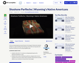
In the accompanying lesson plan (found in the Support Materials) students will …
In the accompanying lesson plan (found in the Support Materials) students will gain an understanding of the Shoshone tribe while learning about the Shoshone Parfleche from the WyomingPBS video.
LEARNING OBJECTIVES:
students will write 3-4 sentences stating/explaining how the Shoshone Parfleche is used. Students will create an individual parfleche, designed with a line of symmetry, the use of a meter stick for specific measurements and the ability to use creativity to choose their own designs.
In this activity, students will learn how to read a topographical map …
In this activity, students will learn how to read a topographical map and how to triangulate with just a map. True triangulation requires both a map and compass, but to simplify the activity and make it possible indoors, the compass information is given. Students will practice converting a compass measurement to a protractor measurement, as well as reverse a bearing direction (i.e., if they know a tree's bearing is 100 degrees from you, they can determine what bearing they are from the tree). Students will use the accompanying worksheets to take a bearing of certain landmarks and then start at those landmarks to work backwards to figure out where they are.
In this activity, students will learn how to actually triangulate using a …
In this activity, students will learn how to actually triangulate using a compass, topographical (topo) map and view of outside landmarks. It is best if a field trip to another location away from school is selected. The location should have easily discernable landmarks (like mountains or radio towers) and changes in elevation (to illustrate the topographical features) to enhance the activity. A national park is an ideal location, and visiting a number of parks, especially parks with hiking trails, is especially beneficial.
This lesson unit is intended to help you assess how well students …
This lesson unit is intended to help you assess how well students are able to: recognize and use common 2D representations of 3D objects and identify and use the appropriate formula for finding the circumference of a circle.
No restrictions on your remixing, redistributing, or making derivative works. Give credit to the author, as required.
Your remixing, redistributing, or making derivatives works comes with some restrictions, including how it is shared.
Your redistributing comes with some restrictions. Do not remix or make derivative works.
Most restrictive license type. Prohibits most uses, sharing, and any changes.
Copyrighted materials, available under Fair Use and the TEACH Act for US-based educators, or other custom arrangements. Go to the resource provider to see their individual restrictions.