In this unit, students learn the very basics of navigation, including the …
In this unit, students learn the very basics of navigation, including the different kinds of navigation and their purposes. The concepts of relative and absolute location, latitude, longitude and cardinal directions are explored, as well as the use and principles of maps and a compass. Students discover the history of navigation and learn the importance of math and how it ties into navigational techniques. Understanding how trilateration can determine one's location leads to a lesson on the global positioning system and how to use a GPS receiver. The unit concludes with an overview of orbits and spacecraft trajectories from Earth to other planets.
Students learn how and why engineers design satellites to benefit life on …
Students learn how and why engineers design satellites to benefit life on Earth, as well as explore motion, rockets and rocket motion. Through six lessons and 10 associated hands-on activities, students discover that the motion of all objects everything from the flight of a rocket to the movement of a canoe is governed by Newton's three laws of motion. This unit introduces students to the challenges of getting into space for the purpose of exploration. The ideas of thrust, weight and control are explored, helping students to fully understand what goes into the design of rockets and the value of understanding these scientific concepts. After learning how and why the experts make specific engineering choices, students also learn about the iterative engineering design process as they design and construct their own model rockets. Then students explore triangulation, a concept that is fundamental to the navigation of satellites and global positioning systems designed by engineers; by investigating these technologies, they learn how people can determine their positions and the locations of others.
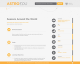
Description: Build a model of the Earth, with its spin-axis, and a …
Description:
Build a model of the Earth, with its spin-axis, and a lamp as the Sun to demonstrate the concept of seasons.
Goals
--Understanding why we have seasons and the cause of seasonal variation in temperature. --Learning about how the Earth rotates on a tilted axis compared to its orbit around the Sun.
Learning Objectives
--Students learn about seasons by building a model of the Earth and the Sun, and investigating how sunlight hits the Northern and Southern Hemispheres during different seasons. --Students explain that the same amount of light hitting the ground heats up a small area more than a large area --Students show that the angle at which the sunlight hits the Earth influences how much the sunlight heats up the Earth. Students demonstrate that the angle at which the sunlight hits the Earth is related to the tilt of the Earth’s rotational axis compared to the Earth’s orbit around the Sun.
The four seasons are familiar to most people: winter, spring, summer and …
The four seasons are familiar to most people: winter, spring, summer and fall. But why do we have the four seasons? What causes the change in weather throughout the year? In this seminar you will learn about the relationship between the seasons and the sun. You will apply your prior knowledge of the four seasons to come to an understanding of the sun’s effect on them. By the end of this seminar, you will be able to classify the four seasons based on the Earth’s position to the sun.Standards 3.3.4.A5Describe basic weather elements. Identify weather patterns over time.
This unit begins by introducing students to the historical motivation for space …
This unit begins by introducing students to the historical motivation for space exploration. They learn about the International Space Station, including current and futuristic ideas that engineers are designing to propel space research. Then they learn about the physical properties of the Moon, and think about what types of products engineers would need to design in order for humans to live on the Moon. Lastly, students learn some descriptive facts about asteroids, such as their sizes and how that relates to the potential danger of an asteroid colliding with the Earth.
Learn about the distance to the ISS using a simple scale modeling …
Learn about the distance to the ISS using a simple scale modeling activity, then challenge yourself and your students to build their own robotic arm with materials from home.
How do we know where we are? What happens if you are …
How do we know where we are? What happens if you are completely lost in the middle of nowhere? Does technology provide tools for people lost in their travels? A person cannot usually determine an accurate position just by looking out a window in the middle of the ocean or vast area of land, particularly if it has not been charted before. In this lesson, students explore the concept of triangulation that is used in navigation satellites and global positioning systems designed by engineers. Also, students learn how these technologies can help people determine their position or the location of someone else.
No restrictions on your remixing, redistributing, or making derivative works. Give credit to the author, as required.
Your remixing, redistributing, or making derivatives works comes with some restrictions, including how it is shared.
Your redistributing comes with some restrictions. Do not remix or make derivative works.
Most restrictive license type. Prohibits most uses, sharing, and any changes.
Copyrighted materials, available under Fair Use and the TEACH Act for US-based educators, or other custom arrangements. Go to the resource provider to see their individual restrictions.