In this activity, students calculate electricity use by state and determine, using …
In this activity, students calculate electricity use by state and determine, using Google Earth, how much land would be required to replace all sources of electricity with solar panels.
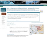
How can data from an impending volcanic dome-building event be used to …
How can data from an impending volcanic dome-building event be used to forecast the hazard to a surrounding community? In this activity, students will examine geodetic data (GPS and lidar) and seismic data in a modified gallery walk format (for either small and large enrollment courses) to assess volcanic activity and determine the USGS alert level for the volcano. In addition, students will use a hazard map for the Mount St. Helens area to determine which towns are at risk if a large eruption occurs. An optional post-class activity asks students to develop a way to communicate possible risks to local communities.
Show more about Online Teaching suggestions Hide Online-adaptable: This unit would take a bit more effort to move to online, but if one is teaching synchronously it could still be done with interactive online lecture/discussions. The gallery walk component can also be successfully done online with some preparation. For instance, the images and questions can be available for online viewing with space available for student comments. Online groups then rotate through the stations virtually.
(Note: this resource was added to OER Commons as part of a batch upload of over 2,200 records. If you notice an issue with the quality of the metadata, please let us know by using the 'report' button and we will flag it for consideration.)
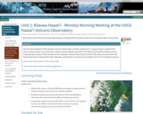
How do volcanologists at the Hawaiian Volcano Observatory monitor volcanoes? In a …
How do volcanologists at the Hawaiian Volcano Observatory monitor volcanoes? In a jigsaw format, students first work in teams to learn one of the four volcano monitoring data sets (GPS, Tilt, Seismic and InSAR) and then move to mixed groups acting as USGS scientists at the Hawaiian Volcano Observatory to share their data set, learn from their teammates how to interpret the other data sets, and develop a forecast for an eruption of Pu'u O'o at Kilauea volcano.
Show more information on GPS versus GNSS Hide Note: Although the term GPS (Global Positioning System) is more commonly used in everyday language, it officially refers only to the USA's constellation of satellites. GNSS (Global Navigation Satellite System) is a universal term that refers to all satellite navigation systems including those from the USA (GPS), Russia (GLONASS), European Union (Galileo), China (BeiDou), and others. In this module, we use the term GPS even though, technically, some of the data may be coming from satellites in other systems.
Show more about Online Teaching suggestions Hide Online-adaptable: This unit would take a bit more effort to move to online but if one is teaching synchronously it could still be done with interactive online lecture/discussions. The exercise could be modified away from the jigsaw format OR the jigsaw component can be successfully done online with some preparation. To do the exercise as a jigsaw, students will need to be arranged into two different breakout groupings as the lesson progresses.
(Note: this resource was added to OER Commons as part of a batch upload of over 2,200 records. If you notice an issue with the quality of the metadata, please let us know by using the 'report' button and we will flag it for consideration.)
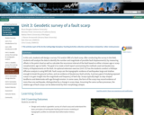
In this unit, students will design a survey (TLS and/or SfM) of …
In this unit, students will design a survey (TLS and/or SfM) of a fault scarp. After conducting the survey in the field, students will analyze the data to identify the number and magnitude of possible fault displacement(s) by measuring offsets in the point cloud as well as calculate the recurrence interval of the fault based on either a known age or scarp morphometric age (or both). The goal is to create a brief report summarizing the methods used and Quaternary history of displacements on the fault. An optional extension exercise (Unit 3.5) has the students conduct a hillslope diffusion analysis is using MATLAB. Fault scarps are the topographic evidence of earthquakes large and shallow enough to break the ground surface, and are evidence of Quaternary fault activity. A primary goal of studying exposed scarps is to gain insight into the magnitude and frequency of fault slip. Scarps typically begin as step-shaped landforms and deteriorate with age through erosion. In some cases, the form of the scarp may record evidence of more than one earthquake, distinguished by a change in scarp slope. Assuming the same surface processes, the relative age of fault scarps can be determined by their morphology (shape).
(Note: this resource was added to OER Commons as part of a batch upload of over 2,200 records. If you notice an issue with the quality of the metadata, please let us know by using the 'report' button and we will flag it for consideration.)
Bruce Douglas (Indiana University)
Nicholas Pinter (University of California Davis)
Nathan Niemi (University of Michigan)
J. Ramon Arrowsmith (Arizona State University)
Kate Shervais (UNAVCO)
Chris Crosby (UNAVCO)
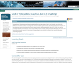
An eruption at Yellowstone could have devastating effects on large areas of …
An eruption at Yellowstone could have devastating effects on large areas of the US and Canada, but what is the likelihood of such an eruption occurring? This unit has students explore seismic data for the last several decades and calculate mean recurrence intervals of seismic swarm events. Additional geodetic data (GPS, InSAR) are used to investigate whether or not seismic swarm events reflect volcanic activity. Finally, students will explain the source and causes of earthquake swarms in the context of responding to non-scientists' concerns that swarms indicate an impending eruption.
Show more about Online Teaching suggestions Hide Online-adaptable: This unit would take a bit more effort to move to online but if one is teaching synchronously it could still be done with interactive online lecture/discussions. It is recommended to keep the students working in the same breakout groups throughout for simplicity.
(Note: this resource was added to OER Commons as part of a batch upload of over 2,200 records. If you notice an issue with the quality of the metadata, please let us know by using the 'report' button and we will flag it for consideration.)
Students assess the risks from three different volcanoes based on the Risk …
Students assess the risks from three different volcanoes based on the Risk Equation, Risk = Hazard x Value x Vulnerability. The three volcanoes--Fuego Guatemala, Rinjani Indonesia, and Moana Loa Hawaii--have varying characteristics, thus giving the opportunity for dynamic conversations and insights into different volcanoes and their affected communities. The final group product is a table that helps students to identify the volcano that poses the greatest risk and thus most needs monitoring. Students must present a clear rationale for why it is selected over other volcanoes, taking into consideration the volcanic hazards, population characteristics, and infrastructural vulnerabilities for each volcano. Students also complete a preparatory exercise on the characteristics of different Volcanic Explosivity Index (VEI) eruptions.
Show more about Online Teaching suggestions Hide Online-adaptable: This unit would take a bit more effort to move to online but if one is teaching synchronously it could still be done with interactive online lecture/discussions. The exercise could be modified away from the jigsaw format OR the jigsaw component can be successfully done online with some preparation. To do the exercise as a jigsaw, students will need to be arranged into two different breakout groupings as the lesson progresses.
(Note: this resource was added to OER Commons as part of a batch upload of over 2,200 records. If you notice an issue with the quality of the metadata, please let us know by using the 'report' button and we will flag it for consideration.)
No restrictions on your remixing, redistributing, or making derivative works. Give credit to the author, as required.
Your remixing, redistributing, or making derivatives works comes with some restrictions, including how it is shared.
Your redistributing comes with some restrictions. Do not remix or make derivative works.
Most restrictive license type. Prohibits most uses, sharing, and any changes.
Copyrighted materials, available under Fair Use and the TEACH Act for US-based educators, or other custom arrangements. Go to the resource provider to see their individual restrictions.