This article highlights science and literacy lessons to teach elementary students about …
This article highlights science and literacy lessons to teach elementary students about erosion, glaciers, volcanoes, and earthquakes. Links to national standards are included.
This nonfiction article, written for students in grades 4-5, explores the ways …
This nonfiction article, written for students in grades 4-5, explores the ways in which glaciers shape the Earth's land. Modified versions are available for students in younger grades.
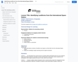
This lesson presents several images taken from the International Space Station and …
This lesson presents several images taken from the International Space Station and challenges students to identify the land forms and their locations on Earth.
This presentaton show multiple landforms from the ISS. It supports the Identifying …
This presentaton show multiple landforms from the ISS. It supports the Identifying Landforms from the International Space Station Lesson and Learning Lab
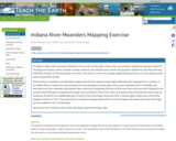
In Indiana, major rivers and their tributaries cross much of the state. …
In Indiana, major rivers and their tributaries cross much of the state. These rivers can produce significant hazards related to flooding and erosion, which threaten nearby residents and infrastructure. Rivers are dynamic landforms, and they naturally shift their position on the landscape over time. The path of a river may change rapidly during a flood, or it may slowly evolve over long periods of time. In this exercise, students use hillshade images derived from airborne lidar (light detection and ranging) from a section of the White River in Indiana to map how the river has changed over the span of five years. Students learn to identify and describe how river meanders and oxbow lakes evolve by comparing the form of the river from 2013 and 2018. Students also use the lidar hillshade to evaluate the longer-term evolution of the river's form and assess how local infrastructure may be impacted. Students are additionally given a plot of river discharge measured from a stream gage station just north of the mapped section of river. They learn how to evaluate changes and trends in river discharge and assess how river discharge can be related to river morphology.
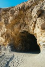
This laboratory exercise examines the linkages between ground and surface water hydrology …
This laboratory exercise examines the linkages between ground and surface water hydrology and landscape evolution in the Interior Low Plateaus Region of Kentucky. The exercise focuses upon the origin of Mammoth Cave.
Students use a small stream table in groups to investigate how channel …
Students use a small stream table in groups to investigate how channel form determines the shape of the hydrograph (including lag to peak). They use three channels: no channel (just sediment filling the table), a "concrete" channel (straight, no sediment on bottom), and a meandering channel. All channels get the same water input and students measure the amount of water that comes out to make a hydrograph. This gives students a chance to model a flood pulse moving through different channels to see how anthropogenic changes to rivers, such as channelizing them, alters flood hydrology. It specifically models an outburst flood from a dam release or burst, but is basically modeling any pulse of water moving through a system.
Students learn about landslides, discovering that there are different types of landslides …
Students learn about landslides, discovering that there are different types of landslides that occur at different speeds from very slow to very quick. All landslides are the result of gravity, friction and the materials involved. Both natural and human-made factors contribute to landslides. Students learn what makes landslides dangerous and what engineers are doing to prevent and avoid landslides.
Students learn the components of the rock cycle and how rocks can …
Students learn the components of the rock cycle and how rocks can change over time under the influence of weathering, erosion, pressure and heat. They learn about geotechnical engineering and the role these engineers play in the development of an area of land, the design and placement of new structures, and detection of natural disasters.
In this activity, learners use food to make simulated regolith (a fine …
In this activity, learners use food to make simulated regolith (a fine dust that covers the moon) and observe its properties. This activity can be enhanced by sharing the "Health Hazards of Lunar Dust" Podcast with learners (see related resource link). This resource includes background information, instructions, resources and handouts for learners.
Students explore Mercury and Venus, the first and second planets nearest the …
Students explore Mercury and Venus, the first and second planets nearest the Sun. They learn about the planets' characteristics, including their differences from Earth. Students also learn how engineers are involved in the study of planets by designing equipment and spacecraft to go where it is too dangerous for humans.
Many terrestrial sedimentary processes are not difficult to observe, describe, and interpret. …
Many terrestrial sedimentary processes are not difficult to observe, describe, and interpret. Yet many of these dynamic processes are not limited to the Earth. One example is the formation of mudcracks that provide critical evidence of the presence of liquid water saturating a fine-grained sediment and then evaporating. The documentation and analysis of this process can provide insight into geologic and environmental conditions on other planets (Mars?). Images and video snips are used to engage students who must attend to careful observation, description, and interpretation (qualitative and quantitative) from laboratory and field examples.
Using a digital elevation model, prehistoric drainage and modern drainage in google …
Using a digital elevation model, prehistoric drainage and modern drainage in google earth, students will locate abandoned valleys, interpret prehistoric drainage orientations, measure and compare valley and channel widths of "new" sections of the Ohio River with tributary valleys which have been used by both prehistoric and modern rivers.
What we see on Earth’s surface is a complex and dynamic set …
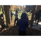
What we see on Earth’s surface is a complex and dynamic set of interconnected systems that include the geosphere, hydrosphere, atmosphere, cryosphere and biosphere. Earth’s processes are the result of energy flow and matter cycling within and among these systems. Understanding Earth’s systems is important for many decisions made in communities today such as where to build a road, where a salmon can successfully build a redd to lay eggs, and how to ensure air quality. Erosion involves all five spheres giving students an excellent example of the interconnectedness of these large systems. Students may begin the storyline by hearing a story about the relationship between the land and plants from an Indigenous perspective, a local tribe elder or expert if possible. This perspective can be woven throughout the storyline while students explore different types of erosion: wind, water and ice in sand and soil. For real life experiences, students visit their schoolyard or nearby area to find examples of erosion. They may find examples from very small to larger examples of places where soil has eroded. They may find places where human foot traffic has made pathways through a previously planted area.
No restrictions on your remixing, redistributing, or making derivative works. Give credit to the author, as required.
Your remixing, redistributing, or making derivatives works comes with some restrictions, including how it is shared.
Your redistributing comes with some restrictions. Do not remix or make derivative works.
Most restrictive license type. Prohibits most uses, sharing, and any changes.
Copyrighted materials, available under Fair Use and the TEACH Act for US-based educators, or other custom arrangements. Go to the resource provider to see their individual restrictions.