Through a study of the moon, students will be guided through an …
Through a study of the moon, students will be guided through an inquiry process using primary sources to learn how we shape our understanding of the past (history). They will also learn how new discoveries and observations change our perceptions over time, as each succeeding generation creates knowledge and adds new technology. Students will then pose their own questions to wonder how future discoveries or new technology might change our understanding of the world and our universe.
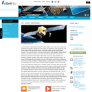
Global Satellite Navigation Systems (GNSS), such as GPS, have revolutionized positioning and …
Global Satellite Navigation Systems (GNSS), such as GPS, have revolutionized positioning and navigation. Currently, four such systems are operational or under development. They are the American GPS, the Russian Glonass, the European Galileo, and the Chinese Beidou-Compass. This course will address: (1) the technical principles of Global Navigation Satellite Systems (GNSS), (2) the methods to improve the accuracy of standard positioning services down to the millimeter accuracy level and the integrity of the systems, and (3) the various applications for positioning, navigation, geomatics, earth sciences, atmospheric research and space missions. The course will first address the space segment, user and control segment, signal structure, satellite and receiver clocks, timing, computation of satellite positions, broadcast and precise ephemeris. It will also cover propagation error sources such as atmospheric effects and multipath. The second part of the course covers autonomous positioning for car navigation, aviation, and location based services (LBS). This part includes the integrity of GNSS systems provided for instance by Space Based Augmentation Systems (e.g. WAAS, EGNOS) and Receiver Autonomous Integrity Monitoring (RAIM). It will also cover parameter estimation in dynamic systems: recursive least-squares estimation, Kalman filter (time update, measurement update), innovation, linearization and Extended Kalman filter. The third part of the course covers precise relative GPS positioning with two or more receivers, static and kinematic, for high-precision applications. Permanent GPS networks and the International GNSS Service (IGS) will be discussed as well. In the last part of the course there will be two tracks (students only need to do one): (1) geomatics track: RTK services, LBS, surveying and mapping, civil engineering applications (2) space track: space based GNSS for navigation, control and guidance of space missions, formation flying, attitude determination The final lecture will be on (scientific) applications of GNSS.
No restrictions on your remixing, redistributing, or making derivative works. Give credit to the author, as required.
Your remixing, redistributing, or making derivatives works comes with some restrictions, including how it is shared.
Your redistributing comes with some restrictions. Do not remix or make derivative works.
Most restrictive license type. Prohibits most uses, sharing, and any changes.
Copyrighted materials, available under Fair Use and the TEACH Act for US-based educators, or other custom arrangements. Go to the resource provider to see their individual restrictions.