In this unit, students learn the very basics of navigation, including the …
In this unit, students learn the very basics of navigation, including the different kinds of navigation and their purposes. The concepts of relative and absolute location, latitude, longitude and cardinal directions are explored, as well as the use and principles of maps and a compass. Students discover the history of navigation and learn the importance of math and how it ties into navigational techniques. Understanding how trilateration can determine one's location leads to a lesson on the global positioning system and how to use a GPS receiver. The unit concludes with an overview of orbits and spacecraft trajectories from Earth to other planets.
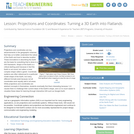
Projections and coordinates are key advancements in the geographic sciences that allow …
Projections and coordinates are key advancements in the geographic sciences that allow us to better understand the nature of the Earth and how to describe location. These innovations in describing the Earth are the basis for everything that is done in a GIS framework. Shape of the Earth is a critical starting point because in fact the Earth is not round but rather a more complex shape called a geoid. Coordinate systems are often referenced to a particular model shape of the Earth, but many different formats exist because not all coordinates work equally well in all areas. While projections and coordinates are abstract concepts in themselves, students eventually find them interesting because 1) it causes them to challenge their current ideas of the Earth's shape and 2) it is much easier to visualize these ideas for learning through interactive GIS such as Google Earth.
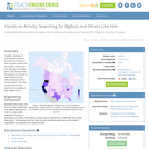
Cryptids, creatures of questionable existence, are used as a source of data …
Cryptids, creatures of questionable existence, are used as a source of data to guide students into the creation of their own GIS data layer in Google Earth. The activity serves the purpose of a tutorial to teach students how to make data layers with a simple subject. Then they use that skill on other topics such as plastics in their neighborhood.
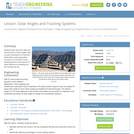
Students learn about the daily and annual cycles of solar angles used …
Students learn about the daily and annual cycles of solar angles used in power calculations to maximize photovoltaic power generation. They gain an overview of solar tracking systems that improve PV panel efficiency by following the sun through the sky.
Students complete a self-guided exercise in worksheet format combined with Google Earth …
Students complete a self-guided exercise in worksheet format combined with Google Earth that helps them explore practical and observable differences between different projection and coordinate systems. The activity improves their skills in using various Google Earth features.
How does our climate affect us? How do we decide what to …
How does our climate affect us? How do we decide what to wear each day? What factors determine if our clothing choices are comfortable? What is the source of our water? Students explore characteristics that define climatic regions. They learn how tropical, desert, coastal and alpine climates result in different lifestyle, clothing, water source and food options for the people who live there. They learn that a location's latitude, altitude, land features, weather conditions, and distance from large bodies of water, determines its climate. Students discuss how engineers help us adapt to all climates by designing clothing, shelters, weather technologies and clean water systems.
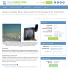
How do we know where we are? What happens if you are …
How do we know where we are? What happens if you are completely lost in the middle of nowhere? Does technology provide tools for people lost in their travels? A person cannot usually determine an accurate position just by looking out a window in the middle of the ocean or vast area of land, particularly if it has not been charted before. In this lesson, students explore the concept of triangulation that is used in navigation satellites and global positioning systems designed by engineers. Also, students learn how these technologies can help people determine their position or the location of someone else.
In this lesson, students are shown the very basics of navigation. The …
In this lesson, students are shown the very basics of navigation. The concepts of relative and absolute location, latitude, longitude and cardinal directions are discussed, as well as the use and principles of a map and compass.
Students learn about coordinate systems in general by considering questions concerning what …
Students learn about coordinate systems in general by considering questions concerning what it is that the systems are expected do, and who decided how they look. They attempt to make their own coordinate systems using a common area across all groups and compete to see who can make the best one. Then they analyze why it is that some systems work better than others and consider what those observations mean for evaluating and choosing geographic coordinate systems commonly available today.
No restrictions on your remixing, redistributing, or making derivative works. Give credit to the author, as required.
Your remixing, redistributing, or making derivatives works comes with some restrictions, including how it is shared.
Your redistributing comes with some restrictions. Do not remix or make derivative works.
Most restrictive license type. Prohibits most uses, sharing, and any changes.
Copyrighted materials, available under Fair Use and the TEACH Act for US-based educators, or other custom arrangements. Go to the resource provider to see their individual restrictions.