This earth systems field lab begins with an in-class guided inquiry experience …
This earth systems field lab begins with an in-class guided inquiry experience which uses Minnesota Geological Survey 3-D maps of the upper Midwest to determine where they believe glaciers may have had an influence. They will determine this by looking at landscapes and compiling their own evidence from the maps. They will also offer evidence for a hypothesis they generate which involves the direction that the glacier was traveling.
This activity is a lab investigation in which students make mass/volume measurements …
This activity is a lab investigation in which students make mass/volume measurements of several samples of the same mineral to determine the mineral's density. Students graph their data and make the connection between their qualitative understanding of what density is and the mathematical/graphical representation of density.
This outdoor investigation involves students observing, recording, comparing and pondering the differing …
This outdoor investigation involves students observing, recording, comparing and pondering the differing landscapes and rocks located along a river. Follow-up class sessions involve student generation of investigable questions, student-generated studies with required write-up and a mapping activity.
This activity is a field investigation where students reconstruct parts of Winona's …
This activity is a field investigation where students reconstruct parts of Winona's Paleozoic environment through observations of a local outcrop and the application of basic geologic principles.
While working in groups to facilitate peer tutoring, students manipulate a hands-on, …
While working in groups to facilitate peer tutoring, students manipulate a hands-on, physical model to better comprehend the dynamics of plate kinematics.
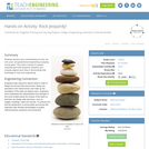
Through five lessons, students are introduced to all facets of the rock …
Through five lessons, students are introduced to all facets of the rock cycle. Topics include rock and mineral types, material stresses and weathering, geologic time and fossil formation, the Earth's crust and tectonic plates, and soil formation and composition. Lessons are presented in the context of the related impact on humans in the form of roadway and tunnel design and construction, natural disasters, environmental site assessment for building structures, and measurement instrumentation and tools. Hands-on activities include experiencing tensional, compressional and shear material stress by using only hand force to break bars of soap; preparing Jeopardy-type trivia questions/answers for a class game that reinforces students' understanding of rocks and the rock cycle; creating "fossils" using melted chocolate; working within design constraints to design and build a model tunnel through a clay mountain; and soil sampling by creating tools, obtaining soil cores, documenting a soil profile log, and analyzing the findings to make engineering predictions.
Students reinforce their understanding of rocks, the rock cycle, and geotechnical engineering …
Students reinforce their understanding of rocks, the rock cycle, and geotechnical engineering by playing a trivia game. They work in groups to prepare Jeopardy-type trivia questions (answers) and compete against each other to demonstrate their knowledge of rocks and engineering.
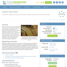
Rocks cover the earth's surface, including what is below or near human-made …
Rocks cover the earth's surface, including what is below or near human-made structures. With rocks everywhere, breaking rocks can be hazardous and potentially disastrous to people. Students are introduced to three types of material stress related to rocks: compressional, torsional and shear. They learn about rock types (sedimentary, igneous and metamorphic), and about the occurrence of stresses and weathering in nature, including physical, chemical and biological weathering.
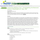
This is a guided inquiry field investigation in an urban setting. This …
This is a guided inquiry field investigation in an urban setting. This investigation focuses on making observations, recording information, asking questions, and identifying the types of rocks used on buildings in downtown St. Paul, MN.
Students test rocks to identify their physical properties (such as luster, hardness, …
Students test rocks to identify their physical properties (such as luster, hardness, color, etc.) and classify them as igneous, metamorphic or sedimentary. They complete a worksheet table to record all of the rock properties, and then answer worksheet questions to deepen their understanding of rock properties and relate them to the cavern design problem.
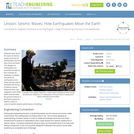
Students learn about the types of seismic waves produced by earthquakes and …
Students learn about the types of seismic waves produced by earthquakes and how they move the Earth. The dangers of earthquakes are presented as well as the necessity for engineers to design structures for earthquake-prone areas that are able to withstand the forces of seismic waves. Students learn how engineers build shake tables that simulate the ground motions of the Earth caused by seismic waves in order to test the seismic performance of buildings.
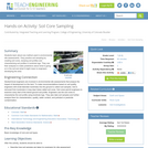
Students learn about one method used in environmental site assessments. They practice …
Students learn about one method used in environmental site assessments. They practice soil sampling by creating soil cores, studying soil profiles and characterizing soil profiles in borehole logs. They use their analysis to make predictions about what is going on in the soil and what it might mean to an engineer developing the area.
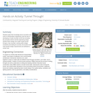
Students apply their knowledge about mountains and rocks to transportation engineering, with …
Students apply their knowledge about mountains and rocks to transportation engineering, with the task of developing a model mountain tunnel that simulates the principles behind real-life engineering design. Student teams design and create model tunnels through a clay mountain, working within design constraints and testing for success; the tunnels must meet specific design requirements and withstand a certain load.
This activity is a guided investigation into the process of plate tectonics …
This activity is a guided investigation into the process of plate tectonics and resulting features. It's a look at the resulting effects which we see as volcanoes, earthquakes, and mountains.
Spreadsheets Across the Curriculum module/Geology of National Parks course. Students use foundational …
Spreadsheets Across the Curriculum module/Geology of National Parks course. Students use foundational math to study the velocity of the North American Plate over the hot spot, the volume of eruptive materials from it, and the recurrence interval of the cataclysmic eruptions.
No restrictions on your remixing, redistributing, or making derivative works. Give credit to the author, as required.
Your remixing, redistributing, or making derivatives works comes with some restrictions, including how it is shared.
Your redistributing comes with some restrictions. Do not remix or make derivative works.
Most restrictive license type. Prohibits most uses, sharing, and any changes.
Copyrighted materials, available under Fair Use and the TEACH Act for US-based educators, or other custom arrangements. Go to the resource provider to see their individual restrictions.