A Software Carpentry lesson to learn how to use Make Make is …
A Software Carpentry lesson to learn how to use Make Make is a tool which can run commands to read files, process these files in some way, and write out the processed files. For example, in software development, Make is used to compile source code into executable programs or libraries, but Make can also be used to: run analysis scripts on raw data files to get data files that summarize the raw data; run visualization scripts on data files to produce plots; and to parse and combine text files and plots to create papers. Make is called a build tool - it builds data files, plots, papers, programs or libraries. It can also update existing files if desired. Make tracks the dependencies between the files it creates and the files used to create these. If one of the original files (e.g. a data file) is changed, then Make knows to recreate, or update, the files that depend upon this file (e.g. a plot). There are now many build tools available, all of which are based on the same concepts as Make.
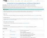
Data Carpentry lesson to open, work with, and plot vector and raster-format …
Data Carpentry lesson to open, work with, and plot vector and raster-format spatial data in R. The episodes in this lesson cover how to open, work with, and plot vector and raster-format spatial data in R. Additional topics include working with spatial metadata (extent and coordinate reference systems), reprojecting spatial data, and working with raster time series data.
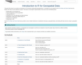
The goal of this lesson is to provide an introduction to R …
The goal of this lesson is to provide an introduction to R for learners working with geospatial data. It is intended as a pre-requisite for the R for Raster and Vector Data lesson for learners who have no prior experience using R. This lesson can be taught in approximately 4 hours and covers the following topics: Working with R in the RStudio GUI Project management and file organization Importing data into R Introduction to R’s core data types and data structures Manipulation of data frames (tabular data) in R Introduction to visualization Writing data to a file The the R for Raster and Vector Data lesson provides a more in-depth introduction to visualization (focusing on geospatial data), and working with data structures unique to geospatial data.
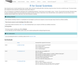
Data Carpentry lesson part of the Social Sciences curriculum. This lesson teaches …
Data Carpentry lesson part of the Social Sciences curriculum. This lesson teaches how to analyse and visualise data used by social scientists. Data Carpentry’s aim is to teach researchers basic concepts, skills, and tools for working with data so that they can get more done in less time, and with less pain. The lessons below were designed for those interested in working with social sciences data in R. This is an introduction to R designed for participants with no programming experience. These lessons can be taught in a day (~ 6 hours). They start with some basic information about R syntax, the RStudio interface, and move through how to import CSV files, the structure of data frames, how to deal with factors, how to add/remove rows and columns, how to calculate summary statistics from a data frame, and a brief introduction to plotting.
No restrictions on your remixing, redistributing, or making derivative works. Give credit to the author, as required.
Your remixing, redistributing, or making derivatives works comes with some restrictions, including how it is shared.
Your redistributing comes with some restrictions. Do not remix or make derivative works.
Most restrictive license type. Prohibits most uses, sharing, and any changes.
Copyrighted materials, available under Fair Use and the TEACH Act for US-based educators, or other custom arrangements. Go to the resource provider to see their individual restrictions.