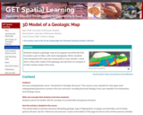
Play-Doh model of a geologic map Provenance: Carol Ormand Ph.D., Carleton College …
Play-Doh model of a geologic map
Provenance: Carol Ormand Ph.D., Carleton College Reuse: This item is offered under a Creative Commons Attribution-NonCommercial-ShareAlike license http://creativecommons.org/licenses/by-nc-sa/3.0/ You may reuse this item for non-commercial purposes as long as you provide attribution and offer any derivative works under a similar license. Students analyze a geologic map of an angular unconformity that truncates a pair of dikes, with some topography. When students have deciphered the map and constructed a cross-section, I show them a Play-Doh model of the geology and ask them to compare it to their mental model of the area.
(Note: this resource was added to OER Commons as part of a batch upload of over 2,200 records. If you notice an issue with the quality of the metadata, please let us know by using the 'report' button and we will flag it for consideration.)
Students compare the chemistry and structures of biotite, muscovite, and chlorite. (Note: …
Students compare the chemistry and structures of biotite, muscovite, and chlorite.
(Note: this resource was added to OER Commons as part of a batch upload of over 2,200 records. If you notice an issue with the quality of the metadata, please let us know by using the 'report' button and we will flag it for consideration.)
Students compare the structures of low-temperature and high-temperature polymorphs of quartz, relating …
Students compare the structures of low-temperature and high-temperature polymorphs of quartz, relating their differences to symmetry and crystal systems.
(Note: this resource was added to OER Commons as part of a batch upload of over 2,200 records. If you notice an issue with the quality of the metadata, please let us know by using the 'report' button and we will flag it for consideration.)
Students use gesture to describe the bulk deformation and local deformation apparent …
Students use gesture to describe the bulk deformation and local deformation apparent in images of a contractional analog experiment. Students then calculate bulk shortening and bulk thickening for the experiment and describe the structures accommodating that strain.
(Note: this resource was added to OER Commons as part of a batch upload of over 2,200 records. If you notice an issue with the quality of the metadata, please let us know by using the 'report' button and we will flag it for consideration.)
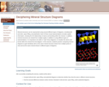
Students compare mineral structures shown in ball-and-stick, space filling, and polyhedral diagrams. …
Students compare mineral structures shown in ball-and-stick, space filling, and polyhedral diagrams.
(Note: this resource was added to OER Commons as part of a batch upload of over 2,200 records. If you notice an issue with the quality of the metadata, please let us know by using the 'report' button and we will flag it for consideration.)
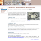
Students match microstructures to the deformation mechanisms by which they form; compare …
Students match microstructures to the deformation mechanisms by which they form; compare pairs of photomicrographs chosen to highlight key differences between some common microstructures; and complete a self-quiz in which they identify microstructures and infer deformation mechanisms from photomicrographs.
(Note: this resource was added to OER Commons as part of a batch upload of over 2,200 records. If you notice an issue with the quality of the metadata, please let us know by using the 'report' button and we will flag it for consideration.)
Students estimate the volume of the Grand Canyon to calculate the average …
Students estimate the volume of the Grand Canyon to calculate the average rate of erosion of the canyon, assuming the canyon began to form approximately 6 million years ago. They then find out how much sediment the Colorado River is actually carrying, in cubic feet per year, and compare that to their calculated value. In the process of calculating the rate of erosion, they face multiple unit conversions. I also challenge them to convert their answer into units they can visualize, such as Olympic swimming pools of sediment per day.
(Note: this resource was added to OER Commons as part of a batch upload of over 2,200 records. If you notice an issue with the quality of the metadata, please let us know by using the 'report' button and we will flag it for consideration.)
Students calculate recurrence intervals for various degrees of flooding based on historical …
Students calculate recurrence intervals for various degrees of flooding based on historical data. Students then do a risk assessment for the surrounding community.
(Note: this resource was added to OER Commons as part of a batch upload of over 2,200 records. If you notice an issue with the quality of the metadata, please let us know by using the 'report' button and we will flag it for consideration.)
Students explore the geometric relationship between bedding/cleavage intersections and fold axes for …
Students explore the geometric relationship between bedding/cleavage intersections and fold axes for axial planar, fanning, and transecting cleavage.
(Note: this resource was added to OER Commons as part of a batch upload of over 2,200 records. If you notice an issue with the quality of the metadata, please let us know by using the 'report' button and we will flag it for consideration.)
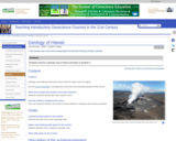
Students examine a geologic map of Hawaii and begin to decipher it. …
Students examine a geologic map of Hawaii and begin to decipher it. In particular, students are asked to examine the map and its legend, to answer some specific questions about them, and then to answer the overarching question, "What evidence is there on this map that the Hawaiian Islands formed over an oceanic hotspot?"
(Note: this resource was added to OER Commons as part of a batch upload of over 2,200 records. If you notice an issue with the quality of the metadata, please let us know by using the 'report' button and we will flag it for consideration.)
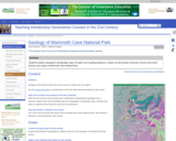
Students analyze topographic and geologic maps, through a set of guiding questions, …
Students analyze topographic and geologic maps, through a set of guiding questions, to figure out why western Kentucky is home to a world-famous cave system. They consider the effect of glaciation on the water table as well as the effects of stratigraphy.
(Note: this resource was added to OER Commons as part of a batch upload of over 2,200 records. If you notice an issue with the quality of the metadata, please let us know by using the 'report' button and we will flag it for consideration.)
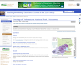
Students examine and describe samples of rhyolite, pumice, and tuff, having seen …
Students examine and describe samples of rhyolite, pumice, and tuff, having seen samples of mafic volcanic rocks in a previous lab exercise. They then answer a series of questions about the distribution of volcanic rocks on the geologic map of Yellowstone National Park. Finally, they synthesize what they've learned by answering the question, "In two or three sentences, what does this map show you about the volcanic activity of the Yellowstone hotspot?"
(Note: this resource was added to OER Commons as part of a batch upload of over 2,200 records. If you notice an issue with the quality of the metadata, please let us know by using the 'report' button and we will flag it for consideration.)
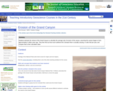
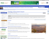
Students analyze topographic and geologic maps, through a set of guiding questions, …
Students analyze topographic and geologic maps, through a set of guiding questions, to decipher the geologic history recorded in the rocks of the Grand Canyon. This includes interpreting what each rock unit tells us about the regional environment at the time of its formation and interpreting the gaps in the rock record.
(Note: this resource was added to OER Commons as part of a batch upload of over 2,200 records. If you notice an issue with the quality of the metadata, please let us know by using the 'report' button and we will flag it for consideration.)
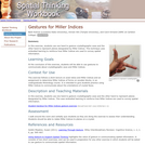
Students use one hand to gesture crystallographic axes and the other hand …
Students use one hand to gesture crystallographic axes and the other hand to represent planes designated by Miller Indices.
(Note: this resource was added to OER Commons as part of a batch upload of over 2,200 records. If you notice an issue with the quality of the metadata, please let us know by using the 'report' button and we will flag it for consideration.)
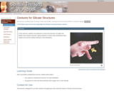
Students use gestures to show the structures of single and double chain …
Students use gestures to show the structures of single and double chain silicate minerals, paying attention to where silica tetrahedra share oxygen ions and the relative positions of the tetrahedra.
(Note: this resource was added to OER Commons as part of a batch upload of over 2,200 records. If you notice an issue with the quality of the metadata, please let us know by using the 'report' button and we will flag it for consideration.)
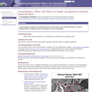
Students use historical data on the extent of the Grinnell Glacier in …
Students use historical data on the extent of the Grinnell Glacier in Glacier National Park to estimate when the glacier will melt completely.
(Note: this resource was added to OER Commons as part of a batch upload of over 2,200 records. If you notice an issue with the quality of the metadata, please let us know by using the 'report' button and we will flag it for consideration.)
This is a sequence of assignments for my Structural Geology course that …
This is a sequence of assignments for my Structural Geology course that guides students through the process of critically reading and analyzing scientific journal articles. For each article, I outline the general questions they should try to answer as they read any journal article, then give specific versions of each of those questions for the particular article assigned. For the last article, I leave it to the students to figure out what the specific versions of the questions would be for that article. The general questions are:
1. What basic research question are the authors trying to answer? 2. What makes that research question significant? (That is, why try to answer that question? Why does it matter?) 3. What data did the authors collect? 4. What is the authors' interpretation of their data? 5. Do you think that the data they collected supports their conclusions? Why or why not?
While the handouts below are specific to the articles we read in my class, these questions could be re-framed for any scientific journal articles that you would like your students to read and understand.
(Note: this resource was added to OER Commons as part of a batch upload of over 2,200 records. If you notice an issue with the quality of the metadata, please let us know by using the 'report' button and we will flag it for consideration.)
Students interpret a GIS map of surficial deposits in Glacier National Park …
Students interpret a GIS map of surficial deposits in Glacier National Park to unravel a bit of the glacial history of the park. In particular, they work to answer the following question: "What clues have the glaciers left behind as they melted, and what are those clues telling us?"
(Note: this resource was added to OER Commons as part of a batch upload of over 2,200 records. If you notice an issue with the quality of the metadata, please let us know by using the 'report' button and we will flag it for consideration.)
Play-Doh model of a fenster Provenance: Carol Ormand Ph.D., Carleton College Reuse: …
Play-Doh model of a fenster
Provenance: Carol Ormand Ph.D., Carleton College Reuse: This item is offered under a Creative Commons Attribution-NonCommercial-ShareAlike license http://creativecommons.org/licenses/by-nc-sa/3.0/ You may reuse this item for non-commercial purposes as long as you provide attribution and offer any derivative works under a similar license. Students use Play-Doh to explore the map patterns created by faulting + erosion. We begin with simple scenarios and progress to more complex possibilities.
(Note: this resource was added to OER Commons as part of a batch upload of over 2,200 records. If you notice an issue with the quality of the metadata, please let us know by using the 'report' button and we will flag it for consideration.)
Students gesture the orientations of linear and planar features. In the first …
Students gesture the orientations of linear and planar features. In the first part of the exercise, students can only see one surface of a wooden block, and are asked to speculate about how planar features penetrate through the interior. Later, they uncover the other faces of the block and gesture the actual orientations.
(Note: this resource was added to OER Commons as part of a batch upload of over 2,200 records. If you notice an issue with the quality of the metadata, please let us know by using the 'report' button and we will flag it for consideration.)
No restrictions on your remixing, redistributing, or making derivative works. Give credit to the author, as required.
Your remixing, redistributing, or making derivatives works comes with some restrictions, including how it is shared.
Your redistributing comes with some restrictions. Do not remix or make derivative works.
Most restrictive license type. Prohibits most uses, sharing, and any changes.
Copyrighted materials, available under Fair Use and the TEACH Act for US-based educators, or other custom arrangements. Go to the resource provider to see their individual restrictions.