Students apply economics, politics and sociology to better understand why cap and …
Students apply economics, politics and sociology to better understand why cap and trade is the preferred political approach, but also why it's potentially problematic.
This article describes six collaborative and real data projects that engage elementary …
This article describes six collaborative and real data projects that engage elementary students in collecting and sharing local data and communicating with students across the country and world.
Students will use map views and cross-sectional profiles across the Red Sea …
Students will use map views and cross-sectional profiles across the Red Sea to determine plate tectonic processes in the region. Google Earth is a technological tool used to facilitate the investigation.
(Note: this resource was added to OER Commons as part of a batch upload of over 2,200 records. If you notice an issue with the quality of the metadata, please let us know by using the 'report' button and we will flag it for consideration.)
The goal of this activity is to provide students an opportunity to …
The goal of this activity is to provide students an opportunity to connect soil science to surficial geology by using a Soil Surveys. By the end of the activity, students should be able to use a Soil Survey to identify and interpret landforms and surficial features. This activity can be adapted to variety of process (ex. eolian deposits, glacial deposits, bedrock weathering, etc.). County-level soil surveys are available in both paper and online formats for the majority of the United States. Designed for a geomorphology course Has minimal/no quantitative component
(Note: this resource was added to OER Commons as part of a batch upload of over 2,200 records. If you notice an issue with the quality of the metadata, please let us know by using the 'report' button and we will flag it for consideration.)
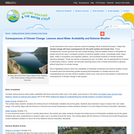
This article from the free online magazine Beyond Weather and the Water …
This article from the free online magazine Beyond Weather and the Water Cycle provides appropriate science lessons for Grades K-5. The focus is on acquainting young learners with climate-change concepts that are not too complex for their grade level and will not frighten them. In each issue, the magazine develops articles around one of the seven essential principles of climate science. The author believes early lessons about water availability and extreme weather events will prepare students for complex climate concepts they will encounter in later grades.
This laboratory activity takes place in a computer lab that is equipped …
This laboratory activity takes place in a computer lab that is equipped with ArcGIS (we are currently using ArcGIS 9.3). Students will go to NASA's oil spill gallery website and download the full size image of the Deepwater Horizon oil slick from July 14th, 2010 taken by the Moderate Resolution Imaging Spectroradiometer (MODIS) on NASA's Aqua satellite at 1:55 p.m. Central Daylight Time. Their task is to to analyze the satellite imagery as an RGB composite and to experiment with reclassification techniques to subdivide the continuous raster dataset into user-defined numbers of ranges that will help visualize the oil spill. The activity introduces students to GIS software, remote sensing analysis, and sets up questions on spatial patterns and consequences of energy use.
(Note: this resource was added to OER Commons as part of a batch upload of over 2,200 records. If you notice an issue with the quality of the metadata, please let us know by using the 'report' button and we will flag it for consideration.)
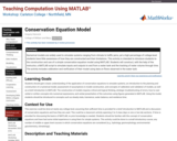
Numerical models are widely used to simulate systems ranging from climate to …
Numerical models are widely used to simulate systems ranging from climate to traffic jams, yet a high percentage of college-level students have little awareness of how they are constructed and their limitations. This activity is intended to introduce students to the construction and use of a simple conservation equation model using MATLAB. Students will construct, with the help of the instructor, a MATLAB script to simulate inputs and outputs to and from a water tank and the tracking of water volume through time. The activity includes calibration and verification of their model using data on flows observed in the water tank.
(Note: this resource was added to OER Commons as part of a batch upload of over 2,200 records. If you notice an issue with the quality of the metadata, please let us know by using the 'report' button and we will flag it for consideration.)
In order to be able to undertake this assignment, students will not …
In order to be able to undertake this assignment, students will not only have to follow and interact in class but also read and understand papers at home. After a first simple question on the tectonic style of the mountain range students will have to apply what they learn from the paper from DeCelles and Giles (1996) and Graham et al. (1986), assigned to read as homework, to answer the first set of examples. Consequently, I have developed a second-part exercise designed to help students understand the relationship between source and sediments; they will use data provided in the exercise to constrain the rates and patterns of source exhumation. In order to answer the second-part exercise students will have to read a suite of papers on detrital thermochronology (Bernet et al., 2002; Carrapa et al., 2003); this will enhance their capability of independently assess complex scientific issues. They will also have to apply simple equations to calculate the rate of source exhumation (through the concept of lag time).
(Note: this resource was added to OER Commons as part of a batch upload of over 2,200 records. If you notice an issue with the quality of the metadata, please let us know by using the 'report' button and we will flag it for consideration.)
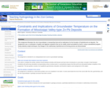
This assignment is meant to illustrate how the advection of heat by …
This assignment is meant to illustrate how the advection of heat by groundwater leads to the elevated temperatures at shallow sedimentary basin margins at which Mississippi Valley-type Zn-Pb hydrothermal ore deposits are formed. The assignment is based on analytical solutions for groundwater flow and heat transport published by Domenico & Palciauskas (1973). Students use a spreadsheet to calculate and plot the flow field and temperature in a sedimentary basin, and to investigate the conditions needed to produce ore-forming temperatures. These results have further implications for the length of time available for ore formation and the concentration of metals and pH of the groundwater, which are also explored in the assignment. The assignment provides an example of how groundwater plays a fundamental role in an important geologic process in the Earth's crust. The activity also shows the linkages of hydrology to other disciplines such as heat transport, geochemistry, and economic geology.
(Note: this resource was added to OER Commons as part of a batch upload of over 2,200 records. If you notice an issue with the quality of the metadata, please let us know by using the 'report' button and we will flag it for consideration.)
An interactive lecture in which students use data on feeding habits and …
An interactive lecture in which students use data on feeding habits and habitat, skeletons, and DNA sequences to draw phylogenetic trees.
(Note: this resource was added to OER Commons as part of a batch upload of over 2,200 records. If you notice an issue with the quality of the metadata, please let us know by using the 'report' button and we will flag it for consideration.)
To prepare for this lab, students read a section of the textbook …
To prepare for this lab, students read a section of the textbook about observational techniques to measure the seafloor bathymetry as well as the occurrence of common sea floor features, such as seamounts, coastal shelves, mid-ocean ridges, and trenches. In the first lab, groups of students are provided with a bathymetric map, cutting board, sharp edges, and plenty of cardboard. They trace some contours from the map onto tracing paper, and then cut those out of the cardboard to construct a scale model of their given sea floor feature. They attach the sheets of cardboard with double-sided tape, and affix it to the bottom of a rigid box. The box lid has a grid of holes drilled into it. They determine the scale of the map (cm of the model to km in the ocean, for example), and affix the scale to the outside of the box. This concludes the first lab session.
In the second lab session, each team of students is provided with a box from an unknown team. The box is closed, and they do not know what ocean feature lay inside. They use bamboo skewers to take "soundings" at each of the drilled holes in the box lid, and mark their measurements on a piece of graph paper. Then they construct a contour map from the soundings, and try to identify the sea floor feature in the box from a global seafloor topography map that is hanging on a wall.
Students complete guided questions about the process of constructing their 3D scaled model and exploring the unknown ocean.
This experimental activity is designed to develop a basic understanding of the …
This experimental activity is designed to develop a basic understanding of the relationship between temperature and pressure and that a barometer can be constructed to detect this relationship. Resources needed to build a simple barometer include a canning jar with metal lid ring, large balloon, a block of wood, ruler, a nail, wood glue, hammer and a screwdriver. The resource includes background information, teaching tips and questions to guide student discussion. This is chapter 6 of Meteorology: An Educator's Resource for Inquiry-Based Learning for Grades 5-9. The guide includes a discussion of learning science, the use of inquiry in the classroom, instructions for making simple weather instruments, and more than 20 weather investigations ranging from teacher-centered to guided and open inquiry investigations.
The purpose of this activity is to construct a model that will …
The purpose of this activity is to construct a model that will provide students with a visual representation of parts per billion. Students work in teams to construct cubes of different volumes and to compare them to get a feel for parts per million by volume and parts per billion by volume. The intended outcome is that students gain a feeling for the small quantities of gases, such as ozone, present in the Earth's atmosphere.
The objective of this lesson is to introduce students to rainfall-runoff modeling …
The objective of this lesson is to introduce students to rainfall-runoff modeling using machine learning algorithms. In this lesson, students will walk through the process of accessing data, visualizing the data, statistically analyzing the data and using machine learning software packages to construct rainfall-runoff models.
(Note: this resource was added to OER Commons as part of a batch upload of over 2,200 records. If you notice an issue with the quality of the metadata, please let us know by using the 'report' button and we will flag it for consideration.)
Students create a water table map and flow net using water level …
Students create a water table map and flow net using water level data from seepage lakes in the Sand Hills of Nebraska. They then are able to make hypotheses regarding the chemistry of the lakes.
(Note: this resource was added to OER Commons as part of a batch upload of over 2,200 records. If you notice an issue with the quality of the metadata, please let us know by using the 'report' button and we will flag it for consideration.)
This homework assignment is designed to give the students practice in developing …
This homework assignment is designed to give the students practice in developing a simple conceptual model using reservoirs, fluxes, and simple calculations of sediment, carbon and nutrient accumulation in a typical reservoir/river system. This assignment is typically used after an introductory lecture to biogeochemical cycles and gives the students a concrete example of nutrient and sediment issues in surface water systems.
(Note: this resource was added to OER Commons as part of a batch upload of over 2,200 records. If you notice an issue with the quality of the metadata, please let us know by using the 'report' button and we will flag it for consideration.)
This online quiz on sustainable development can be used in French language …
This online quiz on sustainable development can be used in French language classes to prepare intermediate-level students for discussions on environmental topics. The resource is excellent for immersion and content-based instruction.
The levels of contaminants found in particular animals vary widely depending on …
The levels of contaminants found in particular animals vary widely depending on where they fit into the Arctic food chain, as described in this video segment adapted from LOKE Films and the Arctic Monitoring and Assessment Programme.
In this video segment adapted from LOKE Films and the Arctic Monitoring …
In this video segment adapted from LOKE Films and the Arctic Monitoring and Assessment Programme, learn how human populations in the Arctic are affected by industrial contaminants in the food chain.
No restrictions on your remixing, redistributing, or making derivative works. Give credit to the author, as required.
Your remixing, redistributing, or making derivatives works comes with some restrictions, including how it is shared.
Your redistributing comes with some restrictions. Do not remix or make derivative works.
Most restrictive license type. Prohibits most uses, sharing, and any changes.
Copyrighted materials, available under Fair Use and the TEACH Act for US-based educators, or other custom arrangements. Go to the resource provider to see their individual restrictions.