A Reference for Creating Accessible Office Documents Short Description: With much of …
A Reference for Creating Accessible Office Documents
Short Description: With much of the world gone digital, learning to create documents that are accessible to everyone is becoming a necessary skill. Intended for a general audience, this free resource reviews a wide range of document authoring applications, including the tools they contain for creating accessible documents, and tests them to ensure they do not contain potential barriers. Learn how to create accessible word processed documents, spreadsheets, presentation slides, and PDF documents, among others, so they are accessible to everyone.
Long Description: With much of the world gone digital, learning to create documents that are accessible to everyone is becoming a necessary skill. Intended for a general audience, this free resource reviews a wide range of document authoring applications, including the tools they contain for creating accessible documents, and tests them to ensure they do not contain potential barriers. Learn how to create accessible word processed documents, spreadsheets, presentation slides, and PDF documents, among others, so they are accessible to everyone.
Word Count: 113386
(Note: This resource's metadata has been created automatically by reformatting and/or combining the information that the author initially provided as part of a bulk import process.)
The Maryland State Department of Education is working to prevent the misuse and …
The Maryland State Department of Education is working to prevent the misuse and abuse of opioids. This is a student-centered lesson for the 3-5 grade band. This lesson can be modified or remixed to meet the needs of the students you teach. The content of this lesson includes teaching students by definition what is prescription medicine and non-prescription medicine and emphasizing that medication, whether it is prescription or non-prescription, should be administered in the presence of a trusted adult. Students are also required to examine Drug Fact Labels and demonstrate understanding of the information found on the Drug Fact Labels.
An Introduction to Mass Communication Short Description: Understanding Media and Culture: An …
An Introduction to Mass Communication
Short Description: Understanding Media and Culture: An Introduction to Mass Communication, will support an engaging and interesting course experience for students that will not only show them the powerful social, political and economic forces will affect the future of media technology, but will challenge students to do their part in shaping that future. For questions about this textbook please contact textbookuse@umn.edu
Long Description: Understanding Media and Culture: An Introduction to Mass Communication is adapted from a work produced by a publisher who has requested that they and the original author not receive attribution. This adapted edition is produced by the University of Minnesota Libraries Publishing through the eLearning Support Initiative. Though the publisher has requested that they and the original author not receive attribution, this adapted edition reproduces all original text and sections of the book, except for publisher and author name attribution. For questions about this textbook please contact textbookuse@umn.edu
Word Count: 185227
ISBN: 978-1-946135-26-1
(Note: This resource's metadata has been created automatically as part of a bulk import process by reformatting and/or combining the information that the author initially provided. As a result, there may be errors in formatting.)
Understanding Open Access: When, Why & How to Make Your Work Openly …
Understanding Open Access: When, Why & How to Make Your Work Openly Accessible provides a scholarly author-oriented look at the ins and outs of open access publishing. The guide addresses common concerns about what “open access” means, how institutional and funder open access policies work, and why authors might consider making their works openly accessible online. It also provides information on how to openly license works, how to tailor licensing permissions, and where authors can consider making their open access works available. The guide includes real-life strategies that authors can use to work with publishers, institutions, and funders to make their works available on the terms most consistent with their dissemination goals.
This guide will help you determine whether open access is right for …
This guide will help you determine whether open access is right for you and your work and, if so, how to make your work openly accessible. This primer on open access explains what “open access” means, addresses common concerns and misconceptions you may have about open access, and provides you with practical steps to take if you wish to make your work openly accessible.
This module contains five activities, in increasing complexity, that focus on understanding …
This module contains five activities, in increasing complexity, that focus on understanding how to interpret and manipulate sea level data, using real data from NOAA. Students first need to understand how to access and interpret sea surface height and tide data. To understand how to interpret these data, students will review and practice computing mean values. Along the way, they will learn how different factors, such as storms, affect tide levels and how to measure them. The goal is for students to become experienced with these kinds of data and the tools for accessing them so that, by the end of the module, they can continue to explore data sets driven by their own inquiry.
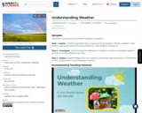
SYNOPSIS: This lesson introduces the concept of weather to students. SCIENTIST NOTES: …
SYNOPSIS: This lesson introduces the concept of weather to students.
SCIENTIST NOTES: Observing the weather to track changes is an important activity. This lesson allows students to understand the local weather and observe the patterns and their impact on their daily activities and the environment. All materials are suitable techniques for qualitative weather forecasting. On that account, this lesson has passed our scientific credibility process and is recommended for teaching.
POSITIVES: -This lesson creates a collaborative learning environment for students as they are introduced to weather and its importance. -This lesson features sensory learning as students use their five senses to make observations about the weather. -This lesson features excellent vocabulary development. -This lesson provides an introduction to the relationship between climate and weather.
ADDITIONAL PREREQUISITES: -You can place a thermometer in an easily accessed outside location (e.g., near the recess area) and check the temperature daily. -It is necessary to print the weather journal and weather wheel ahead of time.
DIFFERENTIATION: -You can have students think-pair-share during the read aloud. Students can make predictions or answer questions. -You can pause the read aloud before the text is read for students to make observations and predictions about the story. -Groups of students with mixed abilities can collaborate on their weather wheel and their future climate prediction. -Possible Extension: Work with the school administration to find a way for students to share a daily weather report with the school (e.g., live morning assembly, email blast, TV announcement, etc.).
The OER, consisting of an Instructor’s Guide and accompanying presentation Slide Deck …
The OER, consisting of an Instructor’s Guide and accompanying presentation Slide Deck with speaking notes, emphasizes three primary themes: - Principles and practices of community engagement for knowledge exchange; - Meaningful access to research for non-academic audiences; - Research ethics in historically marginalized underrepresented communities.
We have organized the OER to consist of a “core” module, “Community-based knowledge exchange and mitigating information privilege” and three pathways: 1) “Information access and alternative formats,” 2) “Supporting community led research,” and 3) “Community engagement and services.” Instructors can “mix and match” content from the pathways depending on available class time, course structure, and student interests. The core and pathway modules include learning objectives, a wide selection of open access academic and professional articles, books, blogs, websites, videos and multimedia, and active learning activities for in-person or online delivery.
This activity helps students navigate and make sense of the information available …
This activity helps students navigate and make sense of the information available in the Five Points census database. In the activity, students use the database to test hypotheses about life and residents in the Five Points. For this activity, students will need access to a computer with an internet connection. This activity can be followed up with the activity Telling the Whole Story: Irish Americans in Five Points.
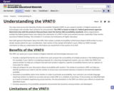
Understanding the VPAT® Share: You may come across the Voluntary Product Accessibility …
Understanding the VPAT® Share: You may come across the Voluntary Product Accessibility Template (VPAT) as you research vendors of digital materials and technologies and consider their products for procurement. The VPAT is meant to help U.S. federal government agencies determine how well the products they purchase meet the Section 508 accessibility standards. Many organizations outside the federal government now require the submission of a VPAT in their procurement process, especially if they receive any kind of federal funding. This includes K-12 schools and institutions of higher education.
Start with general information about the VPAT, then review a sample Accessibility Conformance Report (ACR) similar to one a vendor would submit for your consideration. Each section of the sample ACR (which is just a filled out VPAT) includes comments to help you understand the information you would find in that section of an ACR.
This course is a guide to the UniProt resource, including what kinds …
This course is a guide to the UniProt resource, including what kinds of information it provides and how to access the data using the UniProt website.
By the end of the course you will be able to: Evaluate what UniProt is and what you can do with it Explore the wide range of information provided by UniProt and understand where it comes from Be able to access, navigate and search on the UniProt website Evaluate the tools provided on the UniProt website Comprehend how to access completely sequenced proteomes
UniProt is a comprehensive, expert-led, publicly available database of protein sequence, function …
UniProt is a comprehensive, expert-led, publicly available database of protein sequence, function and variation information.
This webinar will give a brief introduction to the UniProt website and then highlight resources available that proteomics scientists or users with large protein datasets may find useful in analysing their data. This will encompass our proteomes service, how to convert and retrieve ID mappings, and how to carry out a peptide search.
The webinar will then go on to introduce the UniProt Proteins API which allows researchers to access and download UniProt data alongside large-scale genomic, proteomics and variation data without needing prior in-depth knowledge of programmatic languages. Data is available for download and querying in a range of formats; including XML, FASTA and PEFF. The API multi-query search functions will be demonstrated and useful features such as searching entries by peptide, and searching for proteomic peptides by protein entry will be explained.
The UniProt Proteins API is available at //www.ebi.ac.uk/proteins/api/doc
Who is this course for? This webinar is aimed at computational and wet-lab scientists, with no prior knowledge of programming required. An undergraduate level knowledge of protein biology will be useful.
For those already familiar with programming languages that require a more detailed explanation of accessing UniProt programmatically please see the webinar ‘Uniprot: programmatically’.
Outcomes By the end of the webinar you will be able to:
Recall the UniProt services useful for proteomics scientists or users with large protein datasets Know when and how to use the UniProt Proteins API
The purpose of Unified Arabic Braille Portal is to present the Arabic …
The purpose of Unified Arabic Braille Portal is to present the Arabic Braille table in math and science signs/ symbols, as well as to develop the first eight-dots Arabic computer braille table to take benefit of its multiple features, such as writing or reading a single code in a single cell and supporting some computer signs.
This unit introduces the hydrological cycle to provide context for the module …
This unit introduces the hydrological cycle to provide context for the module as a whole. It particularly focuses on those portions of the hydrological cycle that take place on land and that form the basis for water that is used by society. Students conduct a stakeholder analysis to better understand societal issues around water. Then the scientific exercise of the unit emphasizes quantitative approaches to describing the critical portions that humans have access to: surface water and shallow ground water. Students calculate residence times and fluxes between reservoirs and track water particles on an annual basis. They also explore available data sets for specific reservoirs such as snowpack and rivers.
Show more about Online Teaching suggestions Hide Online-adaptable: This exercise could be converted to online whole-class discussions/lectures and a breakout group activity. Would be best done synchronously.
(Note: this resource was added to OER Commons as part of a batch upload of over 2,200 records. If you notice an issue with the quality of the metadata, please let us know by using the 'report' button and we will flag it for consideration.)
This unit offers an alternative application for high-resolution topographic data from an …
This unit offers an alternative application for high-resolution topographic data from an outcrop. Using engineering geology methods and data collection from TLS and/or SfM, students design safe "road cuts" with low probability of failure for a proposed fictitious roadway along the side of a hill. Cut slopes or "road cuts" are constructed slopes along roadways in mountainous regions. The design of such slopes requires a safe slope angle, rockfall catchment ditch, and drainage provision. The decision of the slope angle is based on kinematic analysis for slope failures due to the orientation of discontinuities (bedding planes, joints, etc.) with respect to that of the proposed slope. Traditionally, discontinuity orientation data are collected from measurements directly on the outcrop. This can be dangerous and the accessible sites may not be fully representative of the cut as a whole. Remote methods such as TLS and SfM generate 3D models from which discontinuity data can be collected safely. In this unit students learn the workflow for designing safe cut slopes using discontinuity data collected from direct field observations and TLS or SfM and compare the methods and results.
(Note: this resource was added to OER Commons as part of a batch upload of over 2,200 records. If you notice an issue with the quality of the metadata, please let us know by using the 'report' button and we will flag it for consideration.)
The introduction and examination of the food, energy, and water connection -- …
The introduction and examination of the food, energy, and water connection -- as a system in Unit 1 -- established the dictates of human dependency on and human modification of the environment. We continue a logical progression of what this means in Unit 2, with a focus on how people see, confront, and solve their resource challenges in the light of their need for affordable, accessible, healthy, sustainably-grown food. This unit introduces and explores the concepts, themes, and practices of: urban agriculture, urban farming, local food, food insecurity, food deserts, health & wellness education, community food gardens, community food dialogue, public policy, civic engagement, volunteerism, expert technical assistance, land reclamation, grants and incentives, entrepreneurship, and community economic development.
(Note: this resource was added to OER Commons as part of a batch upload of over 2,200 records. If you notice an issue with the quality of the metadata, please let us know by using the 'report' button and we will flag it for consideration.)
Unit 2 opens a window into water accounting and reveals intensive water …
Unit 2 opens a window into water accounting and reveals intensive water use that few people think about. How much water goes into common commodities? Have you considered how much water it takes to support our modern American lifestyle and agricultural trade? Water that is embedded in products and services is called virtual water. Looking at the world through the lens of virtual water provides a watery focus to thorny discussions about water such as: the pros and cons of globalization and long distance trade; self sufficiency vs. reliance on other nations; ecosystem impacts of exports; and the impacts of relatively cheap imports on indigenous farming. Unit 2 also introduces the concept of a water footprint. A water footprint represents a calculation of the volume of water needed for the production of goods and services consumed by an individual or country. In this unit students will calculate their individual footprints and analyze how the water footprints of countries vary dramatically in terms of gross volumes and their components. As a result of these activities, students will learn of vast disparities in water access and application. They will also be challenged to consider mechanisms or policies that could foster greater equity in water footprints.
(Note: this resource was added to OER Commons as part of a batch upload of over 2,200 records. If you notice an issue with the quality of the metadata, please let us know by using the 'report' button and we will flag it for consideration.)
The basic concepts of geology will be considered to address the widely …
The basic concepts of geology will be considered to address the widely ranging textures and compositions of rocks and sediments formed in a wide range of environments. These variations in turn can affect soil formation and many related Critical Zone processes and architectures. This unit requires substantial reading to cover basic concepts of geology: the rock cycle, plate tectonics, geologic time, erosion, weathering, and deposition, so that students have a firm grasp on how geology relates to and controls CZ processes. This background knowledge is accessed through a review of web sites and a scientific papers. An in-class activity uses the U.S. Geological Survey's National Geologic Map Database to identify resources for understanding and classifying the geology of a region.
(Note: this resource was added to OER Commons as part of a batch upload of over 2,200 records. If you notice an issue with the quality of the metadata, please let us know by using the 'report' button and we will flag it for consideration.)
In the capstone, Unit 3, students are provided a real-world example of …
In the capstone, Unit 3, students are provided a real-world example of local community action to address the challenge of "healthy food access." The 2015 Leon County (Florida) Sustainable Communities Summit highlights the results of communities working together to promote environmental and food justice. By the end of Unit 3, instructors can deliver a call to action to empower students to be participatory citizens in their communities. The summative assessment will evaluate the students' ability to synthesize the module learning objectives and demonstrate the use of science practices.
(Note: this resource was added to OER Commons as part of a batch upload of over 2,200 records. If you notice an issue with the quality of the metadata, please let us know by using the 'report' button and we will flag it for consideration.)
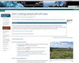
This unit provides essential background information on GPS (global positioning system) and …
This unit provides essential background information on GPS (global positioning system) and reference frames. Students learn how to access GPS location and velocity data from the Network of the Americas (NOTA). They calculate total horizontal motion graphically and mathematically and tie the observed motions to local strain.
Show more information on GPS versus GNSS Hide Note: Although the term GPS (Global Positioning System) is more commonly used in everyday language, it officially refers only to the USA's constellation of satellites. GNSS (Global Navigation Satellite System) is a universal term that refers to all satellite navigation systems including those from the USA (GPS), Russia (GLONASS), European Union (Galileo), China (BeiDou), and others. In this module, we use the term GPS even though, technically, some of the data may be coming from satellites in other systems.
Show more about Online Teaching suggestions Hide Online-ready: The exercise is electronic (including accessing an online data portal) and could be done individually or in small online groups. Lecture can be done in synchronous or asynchronous online format.
(Note: this resource was added to OER Commons as part of a batch upload of over 2,200 records. If you notice an issue with the quality of the metadata, please let us know by using the 'report' button and we will flag it for consideration.)
No restrictions on your remixing, redistributing, or making derivative works. Give credit to the author, as required.
Your remixing, redistributing, or making derivatives works comes with some restrictions, including how it is shared.
Your redistributing comes with some restrictions. Do not remix or make derivative works.
Most restrictive license type. Prohibits most uses, sharing, and any changes.
Copyrighted materials, available under Fair Use and the TEACH Act for US-based educators, or other custom arrangements. Go to the resource provider to see their individual restrictions.