In this web-based, interactive story, Tutangiaq (Too-tang-geye-ack - nicknamed 2T), a Canada Goose, flies across Alaska looking for his family. As he flies, he tells children about the fascinating 49th state. Children learn how Alaska was purchased from the Russians, and other facts about the state. They can also compare the size of Alaska to other states. 2T takes a flight across the volcanic chain in Alaska and helps the students to interactively explore how scientists monitor volcanoes from satellite images in near-real time. At the coast, the bird also meets his Walrus friend who shows him how the sea ice edge has receded and gives an example of an adverse effect on marine life. Finally, 2T arrives in Fairbanks where children use satellite imagery to help 2T find and unite with his family.
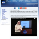
This video segment adapted from NOVA uses microwave images to reveal how sea ice doubles the size of Antarctica each winter. Rare footage shows how sea ice crushed the famous ship Endurance in 1914.
This site includes simulations of more than 40 phenomena: sea ice and CO2, climate change (230-year period), clouds and precipitation, coral reef evolution (starting 21,000 years ago), universal fire shape, fire twirl and burst behavior, tornadoes, thunderstorms, typhoons, El Niño events, greenhouse gases and sulfate aerosols, polar vortex breakdown, CO2 and temperature, CFCs in the ocean, cloud evolution (7-day period), daily weather in the U.S., and more.
The research-based Arctic Climate Modeling Program (ACMP) is funded by NSF ITEST. Curriculum based resources were designed with input from 21 scientists from the University of Alaska Fairbanks Geophysical Institute. Resources include K-12 inquiry-based classroom lessons, a student network for observing arctic weather, digital lectures, and an interactive multimedia learning system (on DVD).
This animation shows the daily sea ice surface temperature over the northern hemisphere from September 2002 through May 2003. The sea ice surface temperature was measured by the MODIS instrument on the Aqua satellite. Since this instrument cannot take measurements through clouds or in the dark, in dark or cloud-covered regions or areas with suspect data quality, the prior days value is retained until a valid data reading is obtained. The color of the sea ice indicates the sea ice surface temperature.
In this year's Geodynamics Seminar, we will explore the depth and breadth of scientific research related to Earth's present and past ice-sheets, glaciers and sea-ice, as well as extraterrestrial planetary ice. Invited speakers have been chosen from experts in the current frontiers in ice-related research, including planetary ice, climate records from polar and tropical ice cores, the Snowball Earth, subglacial volcanoes, ice rheology, ice sheet modeling, ice microkinetics, glacial erosion and tectonics, subglacial life and polar remote sensing. A field trip to Iceland in Summer 2006 will allow us to view some of the island's ice caps and glacial geology, the exposed mid Atlantic Ridge and evidence of ice-volcano interactions.
Iceberg B-15A, in Antarctica's McMurdo Sound, is as large as Long Island, NY (3,000 square kilometers or 1,200 square miles) and is the largest fragment of a much larger iceberg that broke away from the Ross Ice Shelf in March 2000. Iceberg B-15A has trapped sea ice in McMurdo Sound, and the ice build-up presents significant problems for Antarctic penguins, which must now swim great distances to reach open waters and food. These images were taken by the Moderate Resolution Imaging Spectroradiometer (MODIS) instrument on NASAs Aqua and Terra satellites between 2004-11-09 and 2005-01-17.
The Moderate Resolution Imaging Spectroradiometer (MODIS) provides data in 36 spectral bands, some of which are used in an algorithm to map global snow cover. The animation shows the dynamic behavior of the advance and retreat of continental snow cover in the Northern Hemisphere for the winter of 2001-02 from MODIS-derived 8-day composite snow maps with a spatial resolution of about 5 km. A time series of MODIS snow-cover maps of the Sierra Nevada Mountains in California, derived from MODIS-derived daily snow maps with 500-m resolution, is also shown for the winter and spring of 2001.
The IGBP Climate-Change Index brings together key indicators of global change: atmospheric carbon dioxide, temperature, sea level and sea ice. It will be released annually.
The index gives an annual snapshot of how the planet's complex systems - the ice, the oceans, the land surface and the atmosphere - are responding to the changing climate.
The index rises steadily from 1980 - the earliest date the index has been calculated.
The change is unequivocal, it is global, and it is in one direction.
The Larsen ice shelf at the northern end of the Antarctic Peninsula experienced a dramatic collapse between January 31 and March 7, 2002. First, melt ponds appeared on the ice shelf during these summer months (seen in blue on the shelf), then a minor collapse of about 800 square kilometers occurred. Finally, a 2600 square kilometer collapse took place, leaving thousands of sliver icebergs and berg fragments where the shelf formerly lay. Brownish streaks within the floating chunks mark areas where rocks and morainal debris are exposed from the former underside and interior of the shelf. These images were acquired by the MODIS instrument on the Terra satellite.
The Moderate Resolution Imaging Spectroradiometer (MODIS) provides data in 36 spectral bands, some of which are used in an algorithm to map global snow cover. The animation shows the dynamic behavior of the advance and retreat of continental snow cover over Asia for the winter of 2001-02 from MODIS-derived 8-day composite snow maps with a spatial resolution of about 5 km.
The Moderate Resolution Imaging Spectroradiometer (MODIS) provides data in 36 spectral bands, some of which are used in an algorithm to map global snow cover. The animation shows the dynamic behavior of the advance and retreat of continental snow cover over Europe for the winter of 2001-02 from MODIS-derived 8-day composite snow maps with a spatial resolution of about 5 km.
The Pine Island Glacier is the largest discharger of ice in Antarctica and the continents fastest moving glacier. Even so, when a large crack formed across the glacier in mid 2000, it was surprising how fast the crack expanded, 15 meters per day, and how soon the resulting iceberg broke off, mid-November, 2001. This iceberg, called B-21, is 42 kilometers by 17 kilometers and contains seven years of glacier outflow released to the sea in a single event. This series of images from the MISR instrument on the Terra satellite not only shows the crack expanding and the iceberg break off, but the seaward moving glacial flow in the parts of the Pine Island Glacier upstream of the crack.
This animation is a sequence showing the formation of the Pine Island iceberg and the glacial seaward flow upstream from the crack. It is a series of MISR images from the Terra satellite on top of the continental Radarsat view of Antarctica. The Pine Island Glacier is the largest discharger of ice in Antarctica and the continents fastest moving glacier. Even so, when a large crack formed across the glacier in mid 2000, it was surprising how fast the crack expanded, 15 meters per day, and how soon the resulting iceberg broke off, mid-November, 2001. This iceberg, called B-21, is 42 kilometers by 17 kilometers and contains seven years of glacier outflow released to the sea in a single event.
The sea ice around Antarctica grows dramatically from late February, when large parts of the coast are ice-free, to October, when the amount of sea ice effectively doubles the size of the continent. The SeaWinds Scatterometer instrument on the QuikSCAT satellite captures this dramatic ebb and flow and shows the sea ice as dynamic and always moving, even in areas that are ice-bound. This animation shows the sea ice around Antarctica from SeaWinds during 2004. SeaWinds can see individual icebergs if they are large enough, and a large iceberg can be seen for most of the year south of South America as it moves from the Antarctic Peninsula to the South Sandwich Islands. Also visible are the very convoluted and dynamic border between the sea ice and the open sea and holes in the sea ice created by the movement around fixed land features such as islands.
This animation shows the daily sea ice surface temperature over the northern hemisphere from September 2002 through May 2003. The sea ice surface temperature was measured by the MODIS instrument on the Aqua satellite. Since this instrument cannot take measurements through clouds, in cloud-covered regions or areas with suspect data quality, the prior days value is retained until a valid data reading is obtained. The satellite instruments are also unable to collect data in the dark, so the region around the pole is shown here with a grey cap that grows and shrinks, indicating the region in polar darkness. The color of the sea ice indicates the sea ice surface temperature.
C-19 iceberg that calved off the Ross Ice shelf and its companion B-15 iceberg, which is anchored near the coast. The two large bergs may have disrupted normal ocean circulation that clears the Ross Sea of seasonal ice during the first months of austral summer. The ice remained in the sea long past previous thaw dates, and created trouble for ships trying to bring in supplies to McMurdo research station on Ross Island. But after months of stillness, in mid-January C-19 changed position dramatically over just a few days, pivoting northward from its eastern end. The effect was like opening a floodgate, and the sea ice trapped between C-19 and B-15 poured out into the Southern Ocean.
Each two-week module in the Study of Place curriculum is framed by an historical event that makes a connection between the physical environment and human activity. The activities focus primarily on physical and earth science content, geography, and inquiry skills. Assessments and scoring rubrics, including a pre-assessment that can be used for both modules, are embedded in each module, providing opportunities for tracking student learning. The Antarctic Exploration module is framed by Sir Ernest Shackelton's expedition to Antarctica. It explores the relationship between the expanse of sea ice and seasonal change. Students: * examine satellite images of Antarctica, comparing and contrasting the information provided by the various types of technology; * explore seasonal changes in the expanse of sea ice and learn about the Sun's seasonal effect on the concentration of energy on Earth's surface; * explore the differences between fresh and salt water and salinity levels in the Antarctic Ocean; * study the effect of albedo and insulation on sea ice and heat transfer and apply these concepts to a discussion of global climate change.
No restrictions on your remixing, redistributing, or making derivative works.
Give credit to the author, as required.
Your remixing, redistributing, or making derivatives works comes with some
restrictions, including how it is shared.
Your redistributing comes with some restrictions. Do not remix or make
derivative works.
Copyrighted materials, available under Fair Use and the TEACH Act for US-based
educators, or other custom arrangements. Go to the resource provider to see
their individual restrictions.