Updating search results...

Search Resources

20 Results

View
Selected filters:
  • weathering-soils
Connecting Soils and Glacial Geology
Conditional Remix & Share Permitted
CC BY-NC-SA
Rating
0.0 stars

The goal of this activity is to provide students an opportunity to connect soil science to surficial geology by using a Soil Surveys. By the end of the activity, students should be able to use a Soil Survey to identify and interpret landforms and surficial features. This activity can be adapted to variety of process (ex. eolian deposits, glacial deposits, bedrock weathering, etc.). County-level soil surveys are available in both paper and online formats for the majority of the United States.
Designed for a geomorphology course
Has minimal/no quantitative component

(Note: this resource was added to OER Commons as part of a batch upload of over 2,200 records. If you notice an issue with the quality of the metadata, please let us know by using the 'report' button and we will flag it for consideration.)


Subject:
Biology
Life Science
Material Type:
Activity/Lab
Provider:
Science Education Resource Center (SERC) at Carleton College
Provider Set:
Teach the Earth
Author:
Holly Dolliver
Date Added:
09/02/2019
Controls on the Development of Rock Weathering Pits
Conditional Remix & Share Permitted
CC BY-NC-SA
Rating
0.0 stars

Weathering pits are well known from granite terrains and they also form in metaquartzite along the Blue Ridge Parkway in North Carolina. We will drive to Flat Rock Trail, along the Blue Ridge Parkway near Linville, NC. After a short hike up the trail we will observe the weathering pits exposed on the bedrock surface overlooking the Linville Valley. Each group of students will write down 3 hypotheses for how and why they form. Consider what factors control the size and shape of the pits. Collect data that can be used to test the hypotheses including orientation, size, and shape. Plot the data collected in the field. Present data on graphs and charts. Do trends in the data support one hypothesis over another?
Designed for a geomorphology course

(Note: this resource was added to OER Commons as part of a batch upload of over 2,200 records. If you notice an issue with the quality of the metadata, please let us know by using the 'report' button and we will flag it for consideration.)

Subject:
Biology
Life Science
Material Type:
Activity/Lab
Provider:
Science Education Resource Center (SERC) at Carleton College
Provider Set:
Teach the Earth
Author:
Ellen Cowan
Date Added:
08/24/2019
Exploring Soil Development & Conservation of Mass
Conditional Remix & Share Permitted
CC BY-NC-SA
Rating
0.0 stars

How do soils develop over time? Perhaps the best place to learn is a across a chrosequence of deposits that span a wide range in age (and appearance). If we can identify parent material and measure its chemical composition, it can be used as a benchmark for comparison with the chemical composition of soils that were formed from it. This enables us to quantify the degree of chemical depletion. In general we expect older soils to be more depleted, all else equal. But older soils might also be subject to greater physical erosion, in addition to chemical weathering. This complicates the assessment of soil development because the eroded material is no longer present.

Students are presented with two alternate hypotheses about the soils/deposits they visit:
a) the material has been weathering w/ little physical erosion since it was deposited
b) the material has been weathering and eroding since it was deposited
These hypotheses are developed in lectures before the activity and are based on principles of conservation of mass.

During their site visit, students coarsely characterize topography (@2 -- 5 m scale) for several "representative" cross sections. If time is limited this step could be done remotely (e.g., with topo maps and Google earth).

Students assess and discuss evidence for erosional (and depositional) processes since the deposits were created. They look for broad topographic signatures and measure (for example) the spatial density and material volume of tree throw and animal burrowing mounds, if present.

Students also assess and discuss evidence for in-situ weathering (e.g., development of rinds, soil texture, and mineral alteration). The idea is to train their eyes to observe and key in on any site-to-site differences.

Students dig (and discover!) at select sites. They sample soils at regular intervals from pits (with discussion of merits of different sampling approaches e.g., random vs. stratified random). Students discuss relationships in excavated pits.

A jigsaw approach would be an effective way to tackle the large number of field tasks outlined here.

Back in the lab, using literature values, students estimate weathering rates for each deposit. They compare their estimates with back-of-the-envelop estimates for physical erosion rates (based on tree throw/animal burrowing density) and literature values of diffusivity (which can be coupled with curvature measurements).

The instructor promotes discussion of the implications of differences in residence time on weathering rate estimates.

Students analyze samples by XRF; depending on the course's time constraints students are provided with geochemical data from previous year's field effort or other existing data (in this case Taylor and Blum, 1995).

Students are asked to prepare a final report focusing on the following questions: Are soils products of erosion and weathering, or are they being formed in place by weathering alone? Under what circumstances can we expect erosion to dominate over weathering and visa versa? Students first prepare figures and then use them to develop an an outline (reviewed by the instructor) for their report. Students prepare a draft and engage in peer review (one review each). Students revise their reports, based on the peer review comments, and submit their final report.
Designed for a geomorphology course

(Note: this resource was added to OER Commons as part of a batch upload of over 2,200 records. If you notice an issue with the quality of the metadata, please let us know by using the 'report' button and we will flag it for consideration.)
Subject:
Applied Science
Biology
Environmental Science
Life Science
Material Type:
Activity/Lab
Homework/Assignment
Provider:
Science Education Resource Center (SERC) at Carleton College
Provider Set:
Teach the Earth
Author:
Clifford Riebe
Date Added:
08/30/2019
Garden Science: Soil and Erosion
Conditional Remix & Share Permitted
CC BY-NC
Rating
0.0 stars

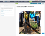
In this sixth grade science lesson, students will learn the main components of soil and discuss how soil is created in nature as well as how we can conserve it in the garden.

Material Type:
Activity/Lab
Date Added:
02/12/2014
Geomorphic Analysis of Soils
Conditional Remix & Share Permitted
CC BY-NC-SA
Rating
0.0 stars

Students are taken to a former plantation along a tidal river near Charleston, SC. The students are then shown how to sample and describe soils using an push-auger sampler, similar to those used in industry. After the demonstration, the students are taken to various locations on the plantation, including upland areas, wetlands, former agricultural areas, lowlands, and tidal marshes, to sample and make field descriptions of the various soils encountered. Students describe depths to horizons, soil color using Munsell Color Charts, soil texture, and any other pertinent properties. Students then prepare a formal technical write-up on the soils, their distribution, and how their sampling results compare to published soil data for the area.
Designed for a geomorphology course
Uses online and/or real-time data

(Note: this resource was added to OER Commons as part of a batch upload of over 2,200 records. If you notice an issue with the quality of the metadata, please let us know by using the 'report' button and we will flag it for consideration.)

Subject:
Biology
Life Science
Material Type:
Activity/Lab
Provider:
Science Education Resource Center (SERC) at Carleton College
Provider Set:
Teach the Earth
Author:
Briget Doyle
Date Added:
09/02/2019
Geomorphic Landscape Analysis Project
Conditional Remix & Share Permitted
CC BY-NC-SA
Rating
0.0 stars

Students chose a roughly one-quarter of one-half square mile area to analysize for geomorphic processes. Students must receive instructor approval of the site before proceeding with the project. Students gather information about the site through literature, previous maps, previous reports, previous surveys, and actual field site reconnaissance. Finding are synthesized into a report.
Designed for a geomorphology course
Uses geomorphology to solve problems in other fields

(Note: this resource was added to OER Commons as part of a batch upload of over 2,200 records. If you notice an issue with the quality of the metadata, please let us know by using the 'report' button and we will flag it for consideration.)

Subject:
Biology
Life Science
Material Type:
Activity/Lab
Provider:
Science Education Resource Center (SERC) at Carleton College
Provider Set:
Teach the Earth
Author:
Cathy Baker
Date Added:
09/02/2019
Geomorphology Field Research Project
Conditional Remix & Share Permitted
CC BY-NC-SA
Rating
0.0 stars

The goal of this research project is to allow students to integrate and apply their geomorphic knowledge in a comprehensive study of a local landscape system. In this project, students investigate the origin and significance of a series of flat-topped mesas and isolated hills that rise above the gently sloping surface of alluvial fans along the San Gabriel Mountain foothills. Students work as part of a research team of 3 or 4 members. Each team is assigned a different field area and conduct a comprehensive geomorphic investigation of landforms within that area. Team members are expected to work collaboratively to formulate a research plan, complete a background literature search, and conduct independent fieldwork outside of class time. Each team divides up responsibilities as they see fit. At the end of the quarter, each team presents the results of their research in an oral presentation in front of the class, and in a professional written report submitted to the professor.
Designed for a geomorphology course

(Note: this resource was added to OER Commons as part of a batch upload of over 2,200 records. If you notice an issue with the quality of the metadata, please let us know by using the 'report' button and we will flag it for consideration.)

Subject:
Applied Science
Biology
Environmental Science
Life Science
Material Type:
Activity/Lab
Homework/Assignment
Provider:
Science Education Resource Center (SERC) at Carleton College
Provider Set:
Teach the Earth
Author:
Jeff Marshall
Date Added:
09/02/2019
Paper: "Limitations and Hazards to Home Construction"
Conditional Remix & Share Permitted
CC BY-NC-SA
Rating
0.0 stars

Students are assigned a client who has an option to buy a very large
tract of land in western Virginia. On this land she plans to build a
large residence with a scenic view, a full basement, a septic system,
and a paved driveway for access. For that site, students must use maps,
aerial images, and soil survey reports to evaluate the geologic setting
and the geomorphic processes, both active and ancient. Their goal is to
warn the client of problems and alert her to resources on the property.

Designed for a geomorphology course

Has minimal/no quantitative component

Uses geomorphology to solve problems in other fields

(Note: this resource was added to OER Commons as part of a batch upload of over 2,200 records. If you notice an issue with the quality of the metadata, please let us know by using the 'report' button and we will flag it for consideration.)

Subject:
Biology
Life Science
Material Type:
Activity/Lab
Homework/Assignment
Provider:
Science Education Resource Center (SERC) at Carleton College
Provider Set:
Teach the Earth
Author:
Rich Whittecar
Date Added:
08/29/2020
Rain Erosion-Does the Rate of Water Effect Erosion?
Conditional Remix & Share Permitted
CC BY-NC-SA
Rating
0.0 stars

This activity is a guided inquiry investigation where students gather data on rate of water falling on erosion. Student will interpret their data, and develop a conclusion from the data. The data will lead to further questions, which can be developed by the students.

Subject:
Geology
Geoscience
Physical Science
Material Type:
Activity/Lab
Provider:
Science Education Resource Center (SERC) at Carleton College
Provider Set:
Pedagogy in Action
Author:
kyle johnson
Date Added:
08/16/2012
Resistance to Weathering
Conditional Remix & Share Permitted
CC BY-NC-SA
Rating
0.0 stars

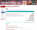
Stratigraphic profile

Provenance: Nicole LaDue
Reuse: This item is offered under a Creative Commons Attribution-NonCommercial-ShareAlike license http://creativecommons.org/licenses/by-nc-sa/3.0/ You may reuse this item for non-commercial purposes as long as you provide attribution and offer any derivative works under a similar license.

Formative assessment questions using a classroom response system ("clickers") can be used to reveal students' spatial understanding.
Students are shown this diagram and instructed to "Click on a layer within the red box that is more resistant to weathering than the other two layers."

(Note: this resource was added to OER Commons as part of a batch upload of over 2,200 records. If you notice an issue with the quality of the metadata, please let us know by using the 'report' button and we will flag it for consideration.)
Subject:
Biology
Life Science
Material Type:
Activity/Lab
Assessment
Provider:
Science Education Resource Center (SERC) at Carleton College
Provider Set:
Teach the Earth
Author:
Nicole LaDue
Date Added:
12/02/2021
Soil Field Descriptions and Soil Forming Processes
Conditional Remix & Share Permitted
CC BY-NC-SA
Rating
0.0 stars

In this field activity students break into small groups and dig soil pits. The pits are distributed among different vegetative covers and topographic positions allowing comparisons of soil profiles under different soil forming processes. Each group prepares a field description of their soil using a shortened version of the NRCS Field Book for Describing and Sampling Soils (2002). Before leaving the field the class takes a tour of the pits and each group gives a brief oral presentation of their profile. Samples from each horizon are later analyzed in the lab to determine the % soil moisture and organic matter. Data from each group is compiled on a share drive which is then utilized by the rest of the class for comparison.
Designed for a geomorphology course

(Note: this resource was added to OER Commons as part of a batch upload of over 2,200 records. If you notice an issue with the quality of the metadata, please let us know by using the 'report' button and we will flag it for consideration.)
Subject:
Biology
Life Science
Material Type:
Activity/Lab
Provider:
Science Education Resource Center (SERC) at Carleton College
Provider Set:
Teach the Earth
Author:
Jeff Clark
Date Added:
09/05/2019
Soil Properties
Conditional Remix & Share Permitted
CC BY-NC-SA
Rating
0.0 stars

In order to introduce soil properties, students will determine the texture and color of a variety of local soils brought in by their classmates. Each student will describe their soil to the class, indicating where the soil came from and any interesting features regarding the site. Students will group the soils based on this little bit of knowledge and then re-evaluate their groupings after texture and color have been determined. This activity concludes with a discussion of regional soils and variations in soils.

(Note: this resource was added to OER Commons as part of a batch upload of over 2,200 records. If you notice an issue with the quality of the metadata, please let us know by using the 'report' button and we will flag it for consideration.)

Subject:
Agriculture
Biology
Career and Technical Education
Life Science
Material Type:
Activity/Lab
Provider:
Science Education Resource Center (SERC) at Carleton College
Provider Set:
Teach the Earth
Author:
Carrie Davis Todd
Date Added:
08/15/2019
Soil Properties and Geomorphology
Conditional Remix & Share Permitted
CC BY-NC-SA
Rating
0.0 stars

To prepare for this exercise, the students have been lectured on soil formation and on a field trip, described a simple soil within loess. Here, the students use data collected from a chronosequence to compare the relative age and amount of soil formation on a series of fluvial terraces. The students are to insert the data into a graphic program and generate specific graphs of soil properties. The students then interpret the amount of soil formation compared to the relative age of the fluvial terraces. Finally, the students assess how the 5 soil forming factors (climate, organisms, relief, parent material, and time) influenced soil formation in this setting.
Designed for a geomorphology course

(Note: this resource was added to OER Commons as part of a batch upload of over 2,200 records. If you notice an issue with the quality of the metadata, please let us know by using the 'report' button and we will flag it for consideration.)

Subject:
Biology
Life Science
Material Type:
Activity/Lab
Provider:
Science Education Resource Center (SERC) at Carleton College
Provider Set:
Teach the Earth
Author:
Mark Sweeney
Date Added:
09/21/2022
Spring Break-Weathering Homework
Conditional Remix & Share Permitted
CC BY-NC-SA
Rating
0.0 stars

Students are asked to photograph something that shows either physical or chemical weathering. They must be in the photograph for purposes of scale. They must then write up their description of the weathering feature and explain the actual weathering processes. This assignment can also be expanded to include mass wasting and mass wasting prevention.

(Note: this resource was added to OER Commons as part of a batch upload of over 2,200 records. If you notice an issue with the quality of the metadata, please let us know by using the 'report' button and we will flag it for consideration.)

Subject:
Biology
Life Science
Material Type:
Activity/Lab
Homework/Assignment
Provider:
Science Education Resource Center (SERC) at Carleton College
Provider Set:
Teach the Earth
Author:
Dori Farthing
Date Added:
09/16/2020
Tombstone Weathering Lab
Conditional Remix & Share Permitted
CC BY-NC-SA
Rating
0.0 stars

Students work in groups in a cemetery to collect a quantitative and a qualitative measure of the extent of weathering of tombstones and their ages. The data are shared between all students, graphed as scatter plots, and the rate of weathering is estimated. Students write about and then discuss the results, the difference between the quantitative and qualitative measures, and speculate on factors in addition to time that may be important for weathering rate. The exercise ends with each students writing a hypothesis about a factor that influences weathering rate and describing a research project that could test that hypothesis. This activity is aimed at developing an understanding of the scatter in "real data", allowing for practice of team work, and hypothesis generation and testing. Designed for a geomorphology course
Has minimal/no quantitative component

(Note: this resource was added to OER Commons as part of a batch upload of over 2,200 records. If you notice an issue with the quality of the metadata, please let us know by using the 'report' button and we will flag it for consideration.)

Subject:
Biology
Life Science
Material Type:
Activity/Lab
Provider:
Science Education Resource Center (SERC) at Carleton College
Provider Set:
Teach the Earth
Author:
Alison Anders
Date Added:
09/02/2019
Unit 3.1 - Geology and Geomorphology
Conditional Remix & Share Permitted
CC BY-NC-SA
Rating
0.0 stars

The basic concepts of geology will be considered to address the widely ranging textures and compositions of rocks and sediments formed in a wide range of environments. These variations in turn can affect soil formation and many related Critical Zone processes and architectures.
This unit requires substantial reading to cover basic concepts of geology: the rock cycle, plate tectonics, geologic time, erosion, weathering, and deposition, so that students have a firm grasp on how geology relates to and controls CZ processes. This background knowledge is accessed through a review of web sites and a scientific papers. An in-class activity uses the U.S. Geological Survey's National Geologic Map Database to identify resources for understanding and classifying the geology of a region.

(Note: this resource was added to OER Commons as part of a batch upload of over 2,200 records. If you notice an issue with the quality of the metadata, please let us know by using the 'report' button and we will flag it for consideration.)

Subject:
Biology
Career and Technical Education
Environmental Studies
Life Science
Material Type:
Activity/Lab
Module
Provider:
Science Education Resource Center (SERC) at Carleton College
Provider Set:
Teach the Earth
Author:
Tim White
Date Added:
10/14/2021
Viewing geomorphic landforms with Google Earth
Conditional Remix & Share Permitted
CC BY-NC-SA
Rating
0.0 stars

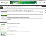
For the assignment, the students are given a series of placemarks in Google Earth. Using Google Earth, the students 'fly' to various areas around the world. They examine the landforms at each placemark and answer questions regarding the formation of these features.
Designed for a geomorphology course
Uses online and/or real-time data
Has minimal/no quantitative component

(Note: this resource was added to OER Commons as part of a batch upload of over 2,200 records. If you notice an issue with the quality of the metadata, please let us know by using the 'report' button and we will flag it for consideration.)

Subject:
Applied Science
Biology
Environmental Science
Life Science
Material Type:
Activity/Lab
Provider:
Science Education Resource Center (SERC) at Carleton College
Provider Set:
Teach the Earth
Author:
Amy Brock
Date Added:
08/25/2019
Weathering Experiment
Conditional Remix & Share Permitted
CC BY-NC-SA
Rating
0.0 stars

After discussing weathering and erosion in class, students are asked to do a small amount of research on different types of chemical weathering, physical weathering, and erosion processes (mostly out of their textbook). Outside of class students then dirty at least four similar dishes with the same type, thickness and aerial extent of food, preferably baked on to ensure maximum stick. One dish is set aside as a control (no weathering or erosion will occur for that dish). For each of the remaining three dishes, students devise an experiment that mimics some sort of chemical weathering, physical weathering, or erosion process (freeze/thaw, sand abrasion, oxidation, etc.). Prior to the experiments, the thickness of food is measured. Experiments are timed, and at the end of the experiment each plate is turned over to determine how much which method removed the greatest aerial extent of food. Experimental results are compared to the control plate to determine the actual effectiveness. Erosion/weathering rates are determined by dividing the thickness of food removed by the experimental time. Students then calculate how long it would take to remove a pile of food the size of the Geology building (assume a 50 m radius sphere), and to remove an amount of food equivalent to the depth of the Grand Canyon. Students then compare these results to rock erosion and weathering rates, performing similar calculations using these "real" rates (see the full project description for details). Photos of each step and the scientists are encouraged in their 2-3 page writeup.

(Note: this resource was added to OER Commons as part of a batch upload of over 2,200 records. If you notice an issue with the quality of the metadata, please let us know by using the 'report' button and we will flag it for consideration.)
Subject:
Biology
Life Science
Mathematics
Measurement and Data
Statistics and Probability
Material Type:
Activity/Lab
Simulation
Provider:
Science Education Resource Center (SERC) at Carleton College
Provider Set:
Teach the Earth
Author:
Pete Stelling
Date Added:
09/01/2020
Weathering and Sedimentary Processes in Google Streetview
Conditional Remix & Share Permitted
CC BY-NC-SA
Rating
0.0 stars

Google Streetview image of Monument Valley. Image by Khashea N. Alnasrallah.

Provenance: Photo by Khashea N. Alnasrallah, accessed at https://www.google.com/maps/@37.0080155,-110.1880364,3a,90y,65.73h,76.64t/data=!3m8!1e1!3m6!1sAF1QipPAABHveLP_NZYyuXecNQ7yrcPXESv24W8ttQ_b!2e10!3e11!6shttps:%2F%2Flh5.googleusercontent.com%2Fp%2FAF1QipPAABHveLP_NZYyuXecNQ7yrcPXESv24W8ttQ_b%3Dw203-h100-k-no-pi0-ya298.5-ro-0-fo100!7i7168!8i3584?hl=en
Reuse: This item is offered under a Creative Commons Attribution-NonCommercial-ShareAlike license http://creativecommons.org/licenses/by-nc-sa/3.0/ You may reuse this item for non-commercial purposes as long as you provide attribution and offer any derivative works under a similar license.

This exercise uses Google Streetview, in combination with 360 degree immersive photographs, to show students real-world examples of the sedimentary rocks, sedimentary structures, and weathering processes that they are learning about in class.
Examples are taken from Parfrey's Glen (WI); Zion National Park; Glacier National Park; Starved Rock State Park (IL); Monument Valley; and Grand Staircase - Escalante National Monument.

(Note: this resource was added to OER Commons as part of a batch upload of over 2,200 records. If you notice an issue with the quality of the metadata, please let us know by using the 'report' button and we will flag it for consideration.)

Subject:
Biology
Life Science
Material Type:
Activity/Lab
Assessment
Diagram/Illustration
Reading
Simulation
Provider:
Science Education Resource Center (SERC) at Carleton College
Provider Set:
Teach the Earth
Author:
Nicole LaDue
Date Added:
12/02/2021
Weathering and mass wasting
Conditional Remix & Share Permitted
CC BY-NC-SA
Rating
0.0 stars

This class exercise is an opportunity for students to apply textbook information about weathering and mass wasting to local and nationally-recognized surface features, such as Stone Mountain (GA), Half Dome (CA), and others. It also serves as an introduction to the use of Google Earth as an analytical tool for calculating distances, slopes, and evaluating landforms.
Designed for a geomorphology course

(Note: this resource was added to OER Commons as part of a batch upload of over 2,200 records. If you notice an issue with the quality of the metadata, please let us know by using the 'report' button and we will flag it for consideration.)
Subject:
Biology
Life Science
Material Type:
Activity/Lab
Provider:
Science Education Resource Center (SERC) at Carleton College
Provider Set:
Teach the Earth
Author:
Jordan Clayton
Date Added:
09/02/2019