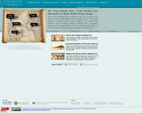
The Hotchkiss Map Collection contains cartographic items made by Major Jedediah Hotchkiss …
The Hotchkiss Map Collection contains cartographic items made by Major Jedediah Hotchkiss (1828-1899), a topographic engineer in the Confederate Army. Hotchkiss made detailed battle maps primarily of the Shenandoah Valley, some of which were used by the Generals Robert E. Lee and Thomas J. "Stonewall" Jackson for their combat planning and strategy. Several of the maps have annotations of various military officers, demonstrating their importance in the military campaigns. The collection also includes maps made or used by Hotchkiss during his post-war years, including maps with information about railroads, minerals and mining, geology and history, most of which focus on Virginia and West Virginia, but also cover other states and even the world. The collection consists of 341 sketchbooks, manuscripts, and annotated printed maps, the originals of which reside in the Library of Congress' Geography and Map Division.
The Indian Ocean Basin is becoming an important topic in middle and …
The Indian Ocean Basin is becoming an important topic in middle and high school world history and geography courses, but one for which there are few instructional resources. This web-based resource helps teachers incorporate the Indian Ocean into world history studies by illustrating a variety of interactions that took place in the Indian Ocean during each era. The material is assembled into an integrated and user-friendly teaching tool for students in upper elementary, middle and high school. It offers students the chance to investigate primary sources that illustrate historical interactions, helping them to become more adept at the analytical historical thinking skills that are required by virtually all state history standards today.
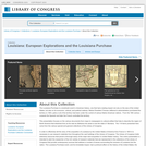
The Louisiana Purchase is a landmark event in American history, one that …
The Louisiana Purchase is a landmark event in American history, one that had a lasting impact not only on the size of the United States, but also on its economic, cultural, and political makeup. This presentation focuses on the various documents - from maps to newspapers to cultural artifacts - that help to describe the region of North America that stretched from as far east as Alabama into what is now the state of Montana.
The following map analysis worksheet was designed and developed by the Education …
The following map analysis worksheet was designed and developed by the Education Staff of the National Archives and Records Administration. You may find this worksheet useful as you introduce students to maps as primary sources of historical, social and cultural information.
The Trans-Atlantic Slave Trade Database has information on almost 36,000 slaving voyages …
The Trans-Atlantic Slave Trade Database has information on almost 36,000 slaving voyages that forcibly embarked over 10 million Africans for transport to the Americas between the sixteenth and nineteenth centuries. The actual number is estimated to have been as high as 12.5 million. The database and the separate estimates interface offer researchers, students and the general public a chance to rediscover the reality of one of the largest forced movements of peoples in world history.
This resource includes a database of Trans-Atlantic slaving voyages searchable by a wide range of variables in additional to essays, maps, and numerical estimates of the Trans-Atlantic Slave Trade, and K-12 lesson plans.
No restrictions on your remixing, redistributing, or making derivative works. Give credit to the author, as required.
Your remixing, redistributing, or making derivatives works comes with some restrictions, including how it is shared.
Your redistributing comes with some restrictions. Do not remix or make derivative works.
Most restrictive license type. Prohibits most uses, sharing, and any changes.
Copyrighted materials, available under Fair Use and the TEACH Act for US-based educators, or other custom arrangements. Go to the resource provider to see their individual restrictions.