The unit is focused on the examination of geography in terms of …
The unit is focused on the examination of geography in terms of “place.” Students dive into inquiry to answer the compelling question, What is unique about living in Washington? Through this question students will understand where and why people live in Washington State. Students will dive into the regions of Washington State and define it through many characteristics. Students will ultimately choose a region to become an expert on and communicate what makes that region unique. Each student’s performance task product will reflect choice and build upon student strengths according to their skill set.
A Personal Narrative Essay is a creative form of writing that explains …
A Personal Narrative Essay is a creative form of writing that explains a memorable event in a student's life. Like other types of essays, it follows a specific structure and includes an introduction, several paragraphs of body content, and a conclusion. The main purpose of a personal narrative essay is to convince the reader of why the applicant would be a good fit for the college or university they apply to.
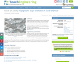
Students overlay USGS topographic maps into Google Earth’s satellite imagery. By analyzing …
Students overlay USGS topographic maps into Google Earth’s satellite imagery. By analyzing Denali, a mountain in Alaska, they discover how to use map scales as ratios to navigate maps, and use rates to make sense of contour lines and elevation changes in an integrated GIS software program. Students also problem solve to find potential pathways up a mountain by calculating gradients.
No restrictions on your remixing, redistributing, or making derivative works. Give credit to the author, as required.
Your remixing, redistributing, or making derivatives works comes with some restrictions, including how it is shared.
Your redistributing comes with some restrictions. Do not remix or make derivative works.
Most restrictive license type. Prohibits most uses, sharing, and any changes.
Copyrighted materials, available under Fair Use and the TEACH Act for US-based educators, or other custom arrangements. Go to the resource provider to see their individual restrictions.