Several new content pieces invite you to do hands-on work with web …
Several new content pieces invite you to do hands-on work with web GIS technology:
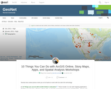
[1] 10 Things you can do with ArcGIS Online in education. These include: (1) Use web mapping applications. (2) Make your own map. (3) Get a school, club, or university organizational account in ArcGIS Online. (4) Use and modify existing curricular resources. (5) Explore the Living Atlas of the World. (6) Modify and ask questions of maps. (7) Conduct spatial analysis on mapped data. (8) Add multimedia to maps. (9) Explore your world in 3D, and (10) Map and analyze field-collected data.
[2] Introduction and Advanced Work with Story Maps: Slides and hands-on exercises. These include how to build a story map from a web map, and how to build map tours, map journals, swipe, series, and other types of story maps.
[3] Teaching with Web Apps. Set of resources and activities. These include examining Pacific typhoons in 3D, demographics of Zip Codes, creating viewsheds and buffers, and much more.
[4] Spatial Analysis in Human Geography. These include the 1854 cholera epidemic in London (activity), a Boulder County hazards analysis (map), and an examination of the Human Development Index around the world (map).
I created this content for the Esri mapping lab for the 2017 National Conference on Geography Education, but it can also be used to support your own professional development or for your own instruction.
As if they are environmental engineers, student pairs are challenged to use …
As if they are environmental engineers, student pairs are challenged to use Google Earth Pro (free) GIS software to view and examine past data on hurricanes and tornados in order to (hypothetically) advise their state government on how to proceed with its next-year budget—to answer the question: should we reduce funding for natural disaster relief? To do this, students learn about maps, geographic information systems (GIS) and the global positioning system (GPS), and how they are used to deepen the way maps are used to examine and analyze data. Then they put their knowledge to work by using the GIS software to explore historical severe storm (tornado, hurricane) data in depth. Student pairs confer with other teams, conduct Internet research on specific storms and conclude by presenting their recommendations to the class. Students gain practice and perspective on making evidence-based decisions. A slide presentation as well as a student worksheet with instructions and questions are provided.
This course combines a seminar format with fieldwork to examine strategies of …
This course combines a seminar format with fieldwork to examine strategies of planning and control for growth and land use, chiefly at the municipal level. Specific topics include growth and its local consequences; land use planning approaches; and implementation tools including innovative zoning and regulatory techniques, physical design, and natural systems integration. Projects are arranged with small teams serving municipal clients.
This subject explores the techniques, processes, and personal and professional skills required …
This subject explores the techniques, processes, and personal and professional skills required to effectively manage growth and land use change. While primarily focused on the planning practice in the United States, the principles and techniques reviewed and presented may have international application. This course is not for bystanders; it is designed for those who wish to become actively involved or exposed to the planning discipline and profession as it is practiced today, and as it may need to be practiced in the future.
To address the cost of resources for exercise manuals in GIS, I …
To address the cost of resources for exercise manuals in GIS, I have developed a series of class exercises that can be used with QGIS, a free and open source software. In addition, some class activities address more general ideas associated with cartography, such as color theory. To make these resources fully accessible to students, I have recorded publicly available videos documenting how these class activities can be completed. There is one video for each classroom lesson in this course offering, and links to all of the videos on the website Vimeo are linked to.
DESCRIPTION Develops skills needed to produce maps using ArcGIS Desktop software. Outlines cartographic principles and map use. Emphasis on mapping techniques within a GIS. Intended for students enrolled in GIS or UAS programs.
LEARNING OUTCOMES 1. Demonstrate knowledge and apply skills essential to the discipline. 2. Coordinate and manage the delivery of reliable, valid, GIS data including analysis and specialized user needs products. 3. Communicate effectively and appropriately within a professional setting in both written and oral form. 4. Utilize professional communication skills to achieve project outcomes in collaboration with GIS users across disciplines. 5. Research, interpret and apply data/information in the professional setting. 6. Develop and implement GIS services for users who may or may not be GIS knowledgeable.
This course examines the theory and practice of using computational methods in …
This course examines the theory and practice of using computational methods in the emerging field of digital humanities. It develops an understanding of key digital humanities concepts, such as data representation, digital archives, information visualization, and user interaction through the study of contemporary research, in conjunction with working on real-world projects for scholarly, educational, and public needs. Students create prototypes, write design papers, and conduct user studies.
Geographic information systems (GIS), once used predominantly by experts in cartography and …
Geographic information systems (GIS), once used predominantly by experts in cartography and computer programming, have become pervasive in everyday business and consumer use. This unit explores GIS in general as a technology about which much more can be learned, and it also explores applications of that technology. Students experience GIS technology through the use of Google Earth on the environmental topic of plastics in the ocean in an area known as the Great Pacific Garbage Patch. The use of this topic in GIS makes the unit multidisciplinary, incorporating the physics of ocean currents, the chemistry associated with pollutant degradation and chemical sorption to organic-rich plastics, and ecological impact to aquatic biota.
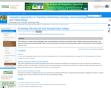
This activity has 3 maps with real stratigraphic data recorded adjacent to …
This activity has 3 maps with real stratigraphic data recorded adjacent to drill holes in the Illinois Basin. Students contour the structural data. They may also contour the associated thickness data or they can just look at the trends of the thickness data relative to the structures on their completed structure map.
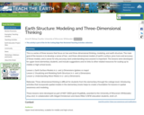
This is a series of three lessons that focus on two and …
This is a series of three lessons that focus on two and three dimensional thinking, modeling, and earth structure. The main goal of the lessons is to develop a sense of two- and three-dimensional models of earth's surface, pros/cons and accuracy of those models, and a sense for why accuracy (and understanding inaccuracies) is important. The lessons were developed for upper-level elementary students, and include suggestions and/or links to other related resources for scaling up to middle or high school levels.
Lesson 1: Earth Surface Models in 2- and 3-Dimensions (globes vs maps) Lesson 2: Visualizing and Modeling Earth Structure in 2- and 3-Dimensions Lesson 3: Understanding Wave Motion in 2- and 3-Dimensions
Rationale: Three-dimensional thinking is difficult for students from the elementary through the college level. Introducing activities that incorporate spatial models in the elementary levels helps to create a foundation for lessons in spatial awareness and modeling.
These lessons were developed as part of NSF CSEDI grant #1458184, awarded to the University of Wisconsin-Whitewater, 2014-2017, in collaboration with Abigail Christensen and Alexis Miller (UWW education students, 2016-17).
Is Energy and GIS your passion? If so, Energy Industry Applications of …
Is Energy and GIS your passion? If so, Energy Industry Applications of GIS provides students with an in-depth exploration of the complexities of siting decisions in the electricity market. The course introduces a variety of siting challenges that confront the energy industry and its customers and neighbors but focuses on the siting of electrical transmission lines. The course also provides hands-on experience with a common decision support technology, ArcGIS, and considers how the technology may be used to facilitate public participation in siting decisions.
This graduate seminar is taught in a lecture and lab exercise format. …
This graduate seminar is taught in a lecture and lab exercise format. The subject matter is tailored to introduce Environmental Engineering students to the use and potential of Geographic Information Systems in their discipline. Lectures will cover the general concepts of GIS use and introduce the material in the exercises that demonstrate the practical application of GIS.
Essentials of Geographic Information Systems integrates key concepts behind the technology with …
Essentials of Geographic Information Systems integrates key concepts behind the technology with practical concerns and real-world applications. Recognizing that many potential GIS users are nonspecialists or may only need a few maps, this book is designed to be accessible, pragmatic, and concise. Essentials of Geographic Information Systems also illustrates how GIS is used to ask questions, inform choices, and guide policy. From the melting of the polar ice caps to privacy issues associated with mapping, this book provides a gentle, yet substantive, introduction to the use and application of digital maps, mapping, and GIS.
ìExploring Imagery and Elevation Data in GIS Applicationsî (GEOG 480) focuses on …
ìExploring Imagery and Elevation Data in GIS Applicationsî (GEOG 480) focuses on the use of remotely sensed imagery and elevation data in GIS applications. Students enrolling in GEOG 480 should have a solid conceptual foundation in geospatial information science and technology. GEOG 480 is appropriate for those who are already working in the geospatial profession and wish to use imagery and elevation data in visualization and spatial analysis. Throughout the course, students confront realistic remote sensing problem scenarios that incorporate such skills and concepts as definition of data needs, metadata content standards, data formats and types, and analysis methods.
This activity is designed as both an introduction to GIS and an …
This activity is designed as both an introduction to GIS and an exploration of topographic steady-state. Students analyze DEMs from Taiwan to extract topographic profiles across the range. They reconstruct a series of datasets presented in Stolar et al., (2007), showing the progression of the range to steady-state as a space-for-time substitution from south to north. Students are expected to relate their observations from the topography to theoretical concepts discussed in class including accretion and uplift, steady-state, and critical wedge theory.
An extension involves developing a simple numerical model in Excel of a mountain range as it progresses to topographic steady-state landscape, allowing students to investigate the rise of a mountain range to steady-state both from Taiwan data and from their numerical model.
No restrictions on your remixing, redistributing, or making derivative works. Give credit to the author, as required.
Your remixing, redistributing, or making derivatives works comes with some restrictions, including how it is shared.
Your redistributing comes with some restrictions. Do not remix or make derivative works.
Most restrictive license type. Prohibits most uses, sharing, and any changes.
Copyrighted materials, available under Fair Use and the TEACH Act for US-based educators, or other custom arrangements. Go to the resource provider to see their individual restrictions.