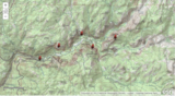
Interpret properties of the landscape using topographic maps of well-known national parks. …
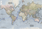
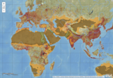
Interpret properties of the landscape using topographic maps of well-known national parks. Direct link on ArcGIs. THE EARTH SCIENCE GEOINQUIRY COLLECTIONhttp://www.esri.com/geoinquiriesThe Earth Science GeoInquiry collection contains 15 free, web-mapping activities that correspond and extend map-based concepts in leading middle school Earth science textbooks. The activities use a standard inquiry-based instructional model, require only 15 minutes for a teacher to deliver, and are device agnostic. The activities harmonize with the Next Generation Science Standards. Activity topics include:• Topographic maps• Remote sensing• Minerals / Mining• Rock Types• Landforms• Plate tectonics• Earthquakes• Volcanoes• Mountain building• Fresh water• Ocean features• Ground wind and temperature patterns• Weather• Storms• Climate change
The War of 1812 ensured the United States’ independence and created opportunities …
The War of 1812 ensured the United States’ independence and created opportunities for two future U.S. presidents to demonstrate their leadership qualities.
No restrictions on your remixing, redistributing, or making derivative works. Give credit to the author, as required.
Your remixing, redistributing, or making derivatives works comes with some restrictions, including how it is shared.
Your redistributing comes with some restrictions. Do not remix or make derivative works.
Most restrictive license type. Prohibits most uses, sharing, and any changes.
Copyrighted materials, available under Fair Use and the TEACH Act for US-based educators, or other custom arrangements. Go to the resource provider to see their individual restrictions.