Through this earth science curricular unit, student teams are presented with the …
Through this earth science curricular unit, student teams are presented with the scenario that an asteroid will impact the Earth. In response, their challenge is to design the location and size of underground caverns to shelter the people from an uninhabitable Earth for one year. Driven by this adventure scenario, student teams 1) explore general and geological maps of their fictional state called Alabraska, 2) determine the area of their classroom to help determine the necessary cavern size, 3) learn about map scales, 4) test rocks, 5) identify important and not-so-important rock properties for underground caverns, and 6) choose a final location and size.
The goal for this lesson is to increase student comprehension and problem-solving …
The goal for this lesson is to increase student comprehension and problem-solving skills by emphasizing real-world problems and encouraging students to be proactive in solving those problems. Description of classroom, grade level, and students: This assignment is for a 10th grade English II classroom, ranging from AP to standard student populations.Prior Knowledge of Subject: Students possess a prior knowledge about tornado activity, severe thunderstorms, and earthquakes due to living in Oklahoma.Length of Lesson: Students will be allotted 10 class periods of 45 minutes in class. They are also allowed to work on this assignment outside of class, if needed.
Student teams commit to a final decision on the location they recommend …
Student teams commit to a final decision on the location they recommend for safe underground cavern shelter for the citizens of Alabraska. They prepare and deliver final presentations to defend their final decisions to the class.
This class is designed to expose you to the cycles of disasters, …
This class is designed to expose you to the cycles of disasters, the roots of emergency planning in the U.S., how to understand and map vulnerabilities, and expose you to the disaster planning in different contexts, including in developing countries.
Students teams determine the size of the caverns necessary to house the …
Students teams determine the size of the caverns necessary to house the population of the state of Alabraska from the impending asteroid impact. They measure their classroom to determine area and volume, determine how many people the space could sleep, and scale this number up to accommodate all Alabraskans. They work through problems on a worksheet and perform math conversions between feet/meters and miles/kilometers.
Students learn of the impending asteroid impact scenario, form teams and begin …
Students learn of the impending asteroid impact scenario, form teams and begin to study the situation in depth. A simple in-class simulation shows them the potential for destruction and disaster. They complete worksheets and look at maps to help them define and understand the problem: What is the needed cavern size and depth? What are the geographical areas and natural features? A homework measurement assignment prepares them for the next lesson/activity.
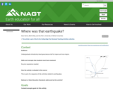
In small groups, students "invent" a way to figure out the location …
In small groups, students "invent" a way to figure out the location of a house, based on the walking times of two housemates to various locations near their house. This cover story is an analogy for using the arrival time differences between P and S waves to locate an earthquake epicenter. Students then create and compare graphs analogous to a Jeffreys-Bullen diagram and come up with a generalized way to use this type of graph to find distances. The activity prepares students for learning how to locate an epicenter and makes the relationship between distance and arrival times meaningful, since they have to figure out how to use arrival time differences to estimate distance.
No restrictions on your remixing, redistributing, or making derivative works. Give credit to the author, as required.
Your remixing, redistributing, or making derivatives works comes with some restrictions, including how it is shared.
Your redistributing comes with some restrictions. Do not remix or make derivative works.
Most restrictive license type. Prohibits most uses, sharing, and any changes.
Copyrighted materials, available under Fair Use and the TEACH Act for US-based educators, or other custom arrangements. Go to the resource provider to see their individual restrictions.