Updating search results...

Search Resources

13 Results

View
Selected filters:
  • coastal-hazards
Calculating sea level changes
Conditional Remix & Share Permitted
CC BY-NC-SA
Rating
0.0 stars

In this lab activity, students learn about the relationships between sea level and glaciers during glacial and interglacial periods. First the students need to calculate the maximum sea level rise assuming all water stored in glaciers and ice caps will melt. Then, they are asked to calculate the ice sheet distribution during the last glacial maxima based on the information that sea level dropped by 125 m.

(Note: this resource was added to OER Commons as part of a batch upload of over 2,200 records. If you notice an issue with the quality of the metadata, please let us know by using the 'report' button and we will flag it for consideration.)
Subject:
Atmospheric Science
Physical Science
Material Type:
Activity/Lab
Provider:
Science Education Resource Center (SERC) at Carleton College
Provider Set:
Teach the Earth
Author:
SHIMON WDOWINSKI
Date Added:
11/15/2016
Coastal Flooding Assessment
Conditional Remix & Share Permitted
CC BY-NC-SA
Rating
0.0 stars

Students are introduced to Spatial Analyst and 3D Analyst, and use these tools to perform a flooding analysis for the Long Beach area of California.

(Note: this resource was added to OER Commons as part of a batch upload of over 2,200 records. If you notice an issue with the quality of the metadata, please let us know by using the 'report' button and we will flag it for consideration.)
Subject:
Biology
Life Science
Material Type:
Activity/Lab
Provider:
Science Education Resource Center (SERC) at Carleton College
Provider Set:
Teach the Earth
Author:
Eric Grosfils
Date Added:
08/17/2019
Coastal Processes, Hazards and Society
Conditional Remix & Share Permitted
CC BY-NC-SA
Rating
0.0 stars

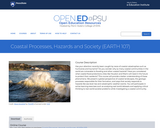
Has your attention recently been caught by news of coastal catastrophes such as hurricanes and tsunamis? Do you wonder why so many coastal communities in the world are vulnerable to flooding and other coastal hazards? Have you considered what coastal flood protections cities like Houston and Miami will need in the future to protect their residents? This course will provide a better understanding of these phenomena. We present a global perspective of coastal landscapes, the geologic processes responsible for their formation, and ways that society responds to hazards like sea level rise and catastrophic weather events. You will participate in active learning exercises such as analyzing real-world datasets and applying critical thinking to real-world societal problems while investigating a coastal community.

Subject:
Applied Science
Biology
Career and Technical Education
Ecology
Environmental Science
Environmental Studies
Life Science
Oceanography
Physical Geography
Physical Science
Material Type:
Full Course
Provider:
Penn State College of Earth and Mineral Sciences
Author:
Brent Yarnal
Dinah Maygarden
Tim Bralower
Date Added:
10/07/2019
Comparison of Two Hurricanes
Conditional Remix & Share Permitted
CC BY-NC-SA
Rating
0.0 stars

In this activity students synthesize ideas from lecture, reading, and viewing two PBS NOVA videos on hurricanes.

(Note: this resource was added to OER Commons as part of a batch upload of over 2,200 records. If you notice an issue with the quality of the metadata, please let us know by using the 'report' button and we will flag it for consideration.)
Subject:
Biology
Career and Technical Education
Environmental Studies
Geology
Life Science
Oceanography
Physical Science
Material Type:
Activity/Lab
Diagram/Illustration
Provider:
Science Education Resource Center (SERC) at Carleton College
Provider Set:
Teach the Earth
Author:
David Kobilka
Date Added:
11/15/2016
Hypoxia in Coastal Marine Ecosystems
Conditional Remix & Share Permitted
CC BY-NC-SA
Rating
0.0 stars

Aquatic ecosystems are home to a complex intersection of physical and biological factors and an intersection of natural and anthropogenic factors. In the Chesapeake Bay, low oxygen events have occurred periodically and may be connected with harmful algal blooms, fish kills, heavy flooding/runoff events, and warming temperatures. Careful monitoring of the system by the Chesapeake Bay Program since 1984 allows scientists and policymakers to evaluate the causes of the events and monitor improvements in the health of the ecosystem.

(Note: this resource was added to OER Commons as part of a batch upload of over 2,200 records. If you notice an issue with the quality of the metadata, please let us know by using the 'report' button and we will flag it for consideration.)
Subject:
Biology
Career and Technical Education
Environmental Studies
Geology
Life Science
Mathematics
Measurement and Data
Oceanography
Physical Science
Statistics and Probability
Material Type:
Activity/Lab
Provider:
Science Education Resource Center (SERC) at Carleton College
Provider Set:
Teach the Earth
Author:
Annette Brickley (NES-LTER Education & Outreach Coordinator), Kathy Browne (Rider University), Gabi Smalley (Rider University)
Date Added:
09/20/2022
Introduction to Hazard and Risk: Part 1
Conditional Remix & Share Permitted
CC BY-NC-SA
Rating
0.0 stars

Students are are introduced to Excel and its capabilities by building some simple spreadsheets.

Subject:
Applied Science
Environmental Science
Geoscience
Physical Science
Material Type:
Activity/Lab
Provider:
Science Education Resource Center (SERC) at Carleton College
Provider Set:
Pedagogy in Action
Author:
Tom Juster
Date Added:
11/06/2014
Introduction to Hazard and Risk: Part 2
Conditional Remix & Share Permitted
CC BY-NC-SA
Rating
0.0 stars

Students continue their introduction to Excel by building spreadsheets that estimate the risk of a major earthquake along the Cascadia Subduction Zone to Benton County, Oregon.

Subject:
Geology
Geoscience
Physical Science
Material Type:
Activity/Lab
Provider:
Science Education Resource Center (SERC) at Carleton College
Provider Set:
Pedagogy in Action
Author:
Tom Juster
Date Added:
11/06/2014
Rally Speeches for Coastal Optimism
Conditional Remix & Share Permitted
CC BY-NC-SA
Rating
0.0 stars

Storytelling is an effective way to communicate what is happening along our local-to-international coastal zones. However, most of the stories students hear are ones of "doom and gloom." Therefore, students are assigned to take storytelling to the next step and write/record energizing narratives that capture examples of adaptation and resilience along the coast.

(Note: this resource was added to OER Commons as part of a batch upload of over 2,200 records. If you notice an issue with the quality of the metadata, please let us know by using the 'report' button and we will flag it for consideration.)
Subject:
Biology
Life Science
Oceanography
Physical Science
Material Type:
Homework/Assignment
Lesson Plan
Provider:
Science Education Resource Center (SERC) at Carleton College
Provider Set:
Teach the Earth
Author:
Laura Guertin
Date Added:
09/18/2022
Student Lead Discussions: Articles from the Literature and Final Writing Assignment
Conditional Remix & Share Permitted
CC BY-NC-SA
Rating
0.0 stars

Assignment #1 Student-led discussion of articles from the literature
We assign one or two groups of two or three students to each of four or four or five topics related to climate change, and provide each group a set of related articles from the literature on their assigned topic. The group will lead a one-hour, in-class discussion on the topic, with up to a dozen students and one instructor in each discussion. In preparation for the discussion, the discussion co-leaders must collectively write a set of "Reading Questions" about each assigned article, which help readers focus on the key points made by the articles and can serve as points of discussion. The other students participating in the discussion must read the articles with the aid of these Reading Questions and annotate the portions of the articles that address the Reading Questions. We (instructors) evaluate the Reading Questions written by the co-leaders (they receive a shared grade for these), and we also check the annotated articles turned in by the other discussion participants to ensure that they prepared to participate in the discussion (they receive individual grades this). Discussion co-leaders each receive a grade for the quality of their discussion leadership.

The purpose of this assignment is in part to help students prepare for their final writing assignment by requiring that they read a set of articles closely enough to help other students discuss and understand the key points, and get feedback about their level of understanding, up to a month before the final paper on the topic is due. The immediate outcome that we expect from this assignment is a demonstration that students can read the assigned articles critically, identify and articulate the key points, and help engage other students in a discussion about the articles, including conceptually important or difficult aspects of them.
Assignment #2: Final writing assignment

For this assignment, which follows from the previous one, students are asked to:

locate two or more significant additional articles that relate closely to the articles on which they based the discussion that they co-led; and
write a 8-12 page (typed, double spaced) overview of the history and current state of our scientific understanding about the topic(s) covered by the set of discussion articles, based on the articles themselves plus relevant material presented in class or in assigned reading. In particular, wherever justified by the source material, students should try to include the following in the narrative:

initial observations/evidence;
initial hypotheses posed to account for initial observations/evidence (including external forcings and feedbacks);
subsequent observations/evidence that have confirmed or disproved earlier hypotheses;
technology that made making observations/gathering evidence possible and led to breakthroughs in understanding;
scientific controversies and how they played out historically or are currently playing out;
current understanding and remaining uncertainties.

The outcome should be a written demonstration of the student's ability to analyze and synthesize a set of articles from the literature and supporting materials provided in class to describe the history, current state, and unresolved aspects of our scientific understanding of an interdisciplinary aspect of climate change.

(Note: this resource was added to OER Commons as part of a batch upload of over 2,200 records. If you notice an issue with the quality of the metadata, please let us know by using the 'report' button and we will flag it for consideration.)
Subject:
Applied Science
Biology
Business and Communication
Communication
Composition and Rhetoric
English Language Arts
Environmental Science
Life Science
Oceanography
Physical Science
Material Type:
Activity/Lab
Homework/Assignment
Provider:
Science Education Resource Center (SERC) at Carleton College
Provider Set:
Teach the Earth
Author:
Dave Dempsey
Date Added:
08/21/2020
Tale of Two Cities (and two hurricanes): Miami
Conditional Remix & Share Permitted
CC BY-NC-SA
Rating
0.0 stars

Students use a spreadsheet to compute the hypothetical risk of an Andrew-like hurricane to downtown Miami.

Subject:
Geology
Geoscience
Physical Science
Material Type:
Activity/Lab
Provider:
Science Education Resource Center (SERC) at Carleton College
Provider Set:
Pedagogy in Action
Author:
Tom Juster
Date Added:
11/06/2014
Unit 2: Application of Concepts to Case Studies
Conditional Remix & Share Permitted
CC BY-NC-SA
Rating
0.0 stars

In Unit 2, students apply and evaluate foundational concepts about storm hazards and risk in the context of two cases studies: Superstorm Sandy (2012) and the Storm of the Century (1993). Through different activities and assignments, students develop skills for finding, evaluating, and relating data to case studies and build an understanding of preparedness, response, and resilience. The activities include: an analysis of hazard mitigation plans for their local community, examination of storm-related geophysical processes in the context of societal risks, preparation of a press release for community preparedness, and a peer review and revision opportunity for the press releases. Instructors may also end this unit by having students revise their concept maps from Unit 1, applying lessons learned in Units 1 and 2.

(Note: this resource was added to OER Commons as part of a batch upload of over 2,200 records. If you notice an issue with the quality of the metadata, please let us know by using the 'report' button and we will flag it for consideration.)
Subject:
Atmospheric Science
Physical Science
Material Type:
Activity/Lab
Module
Provider:
Science Education Resource Center (SERC) at Carleton College
Provider Set:
Teach the Earth
Author:
Lisa Doner
Lorraine Motola
Patricia Stapleton
Date Added:
04/05/2022
Unit 3: Culmination of Module in Town Hall Meeting
Conditional Remix & Share Permitted
CC BY-NC-SA
Rating
0.0 stars

Over the course of one week, students will apply and evaluate concepts in the context of their local community, culminating in the formulation and evaluation of Hazard Mitigation Plan recommendations presented in stakeholder position papers. These position papers, which will also serve as the summative assessment of the Major Storms and Community Resilience Module, will be presented and assessed during a Town Hall Meeting. In this role-playing activity, students apply and evaluate concepts in the context of assigned stakeholder positions from their local community. Over the course of the week, students formulate and evaluate Hazard Mitigation Plan recommendations for major storms, and then present those recommendations in a town hall-style meeting. These assignments demonstrate students' ability to develop strategies and recommendations to mitigate local community vulnerabilities to storms with specific emphasis on different sectors and/or stakeholders in that community. Instructors will assess student achievement of the learning goals through a formal oral presentation and a team policy position paper. As such, the culmination of Unit 3 in the Town Hall Meeting serves as the summative assessment for the Major Storms module.

(Note: this resource was added to OER Commons as part of a batch upload of over 2,200 records. If you notice an issue with the quality of the metadata, please let us know by using the 'report' button and we will flag it for consideration.)
Subject:
Social Science
Material Type:
Activity/Lab
Module
Provider:
Science Education Resource Center (SERC) at Carleton College
Provider Set:
Teach the Earth
Author:
Lisa Doner
Lorraine Motola
Patricia Stapleton
Date Added:
12/01/2021
Visualizing the impact of storm surge and sea level rise on coastal communities
Conditional Remix & Share Permitted
CC BY-NC-SA
Rating
0.0 stars

In this lab activity, students are given a data set that has been developed on sea level rise and storm surge for a coastal community in Maine. Students will gain experience in how to use cartography to select important variables that they want to communicate to local officials. The challenge is to distill a rich, local data set into an understandable visualization and how to effectively use cartographic principles to convey this information. This will provide experience on cartography early on in the class that will be applied later to their own data sets. It will also enable them to understand the complexity of natural and social impacts of sea level rise and in combination of storm surge

(Note: this resource was added to OER Commons as part of a batch upload of over 2,200 records. If you notice an issue with the quality of the metadata, please let us know by using the 'report' button and we will flag it for consideration.)
Subject:
Biology
Career and Technical Education
Environmental Studies
Geology
Life Science
Mathematics
Measurement and Data
Physical Science
Material Type:
Activity/Lab
Provider:
Science Education Resource Center (SERC) at Carleton College
Provider Set:
Teach the Earth
Author:
Eileen Johnson
Date Added:
11/15/2016