This is an introduction to the classic version of ArcGIS StoryMaps. It …
This is an introduction to the classic version of ArcGIS StoryMaps. It provides a walkthrough of the website functions and has tasks listed for students to build their first story map.
Is Energy and GIS your passion? If so, Energy Industry Applications of …
Is Energy and GIS your passion? If so, Energy Industry Applications of GIS provides students with an in-depth exploration of the complexities of siting decisions in the electricity market. The course introduces a variety of siting challenges that confront the energy industry and its customers and neighbors but focuses on the siting of electrical transmission lines. The course also provides hands-on experience with a common decision support technology, ArcGIS, and considers how the technology may be used to facilitate public participation in siting decisions.
Bill Gates is credited with saying he would \hire a lazy person …
Bill Gates is credited with saying he would \hire a lazy person to do a difficult job\" with the justification that \"a lazy person will find an easy way to do it.\" GEOG 485 doesn't teach the lazy way to get the job done, but it does teach the scripting way _ which is arguably even better. You've probably heard the \"give a fish\"/\"teach to fish\" saying? That's the gist of GEOG 485: to equip you, in an ArcGIS context, with the ModelBuilder and Python scripting skills to make your boring, repetitive geoprocessing tasks easier, quicker and automatic _ so you can focus on the more interesting (potentially more valuable) work that you (and your employers) really want you to be doing."
Geographic Information System (GIS) software manages data that represent the location of …
Geographic Information System (GIS) software manages data that represent the location of features (geographic coordinate data) and what they are like (attribute data); it also provides the ability to query, manipulate, and analyze those data. Because GIS allows one to represent social and environmental data on maps, it is a powerful tool for analysis and planning in various fields. This course is meant to introduce students to the basic capabilities of GIS.
User-friendly Geographic Information Systems (GIS) is the common thread of this collection …
User-friendly Geographic Information Systems (GIS) is the common thread of this collection of presentations, and activities with full lesson plans. The first section of the site contains an overview of cartography, the art of creating maps, and then looks at historical mapping platforms like Hypercities and Donald Rumsey Historical Mapping Project. In the next section Google Earth Desktop Pro is introduced, with lessons and activities on the basics of GE such as pins, paths, and kml files, as well as a more complex activity on "georeferencing" an historic map over Google Earth imagery. The final section deals with ARCGIS Online and StoryMaps with tutorials, basic exercises on pins, paths, and CSV import, and a lesson plan for creating a research project presentation on an historic building in StoryMaps. In addition to an xml file that has been uploaded here to Academic Works, the module is also a live website at https://libguides.brooklyn.cuny.edu/cs-x. The site was created with Libguides software, and is a Community Libguide that can be reused and imported into other LibGuides sites. The website also contains links to two live StoryMaps, one on an Introduction to ARCGIS StoryMaps (https://arcg.is/1SX1zH), and the second, a model assignment on the history of the Fairway building in Red Hook, Brooklyn (https://arcg.is/1nbHP).
Locating restaurants in an unfamiliar place, reporting potholes to the local DOT, …
Locating restaurants in an unfamiliar place, reporting potholes to the local DOT, obtaining real-time traffic conditions... All of these are examples of geospatial web apps that are revolutionizing how people obtain and share information about the world. In GEOG 863, you will learn how to build apps like these. You'll start with a quick look at the fundamentals of web programming (HTML and CSS) before diving in to using JavaScript and a mapping application programming interface (API) developed by Esri. Using this API, you'll create both 2D and 3D visualizations of your own data and learn how to develop a user interface to enable users to interact with your map.
Utiliser le logiciel Arc GIS pour la réalisation d’une carte thématique: Présentatiton …
Utiliser le logiciel Arc GIS pour la réalisation d’une carte thématique: Présentatiton de la carte;Utilisation des couches de données thématiques et des blocs de données; Utilisation de la table des matières; Affichage de la carte en mode Données et en mode Mise en page; Exploration des données sur une carte
Geospatial perspectives and technologies play a major role in planning for and …
Geospatial perspectives and technologies play a major role in planning for and responding to emergencies. Geospatial tools - from aerial mapping techniques to data acquisition, are changing rapidly as is emergency management as the frequency and magnitude of crises and disasters are increasing.
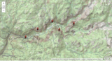
Interpret properties of the landscape using topographic maps of well-known national parks. …
Interpret properties of the landscape using topographic maps of well-known national parks. Direct link on ArcGIs. THE EARTH SCIENCE GEOINQUIRY COLLECTIONhttp://www.esri.com/geoinquiriesThe Earth Science GeoInquiry collection contains 15 free, web-mapping activities that correspond and extend map-based concepts in leading middle school Earth science textbooks. The activities use a standard inquiry-based instructional model, require only 15 minutes for a teacher to deliver, and are device agnostic. The activities harmonize with the Next Generation Science Standards. Activity topics include:• Topographic maps• Remote sensing• Minerals / Mining• Rock Types• Landforms• Plate tectonics• Earthquakes• Volcanoes• Mountain building• Fresh water• Ocean features• Ground wind and temperature patterns• Weather• Storms• Climate change
No restrictions on your remixing, redistributing, or making derivative works. Give credit to the author, as required.
Your remixing, redistributing, or making derivatives works comes with some restrictions, including how it is shared.
Your redistributing comes with some restrictions. Do not remix or make derivative works.
Most restrictive license type. Prohibits most uses, sharing, and any changes.
Copyrighted materials, available under Fair Use and the TEACH Act for US-based educators, or other custom arrangements. Go to the resource provider to see their individual restrictions.