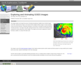
DATA: GOES Weather Images. TOOL: ImageJ. SUMMARY: Transform a time series of …
DATA: GOES Weather Images. TOOL: ImageJ. SUMMARY: Transform a time series of GOES images into an animation. Plot a storm track and determine storm speed.
(Note: this resource was added to OER Commons as part of a batch upload of over 2,200 records. If you notice an issue with the quality of the metadata, please let us know by using the 'report' button and we will flag it for consideration.)
This homework assignment is given in the first two weeks of class. …
This homework assignment is given in the first two weeks of class. Students receive one or two lectures that cover the topics of atmospheric layers, temperature and pressure profiles, concepts of atmospheric mass and pressure and measuring (i.e. dropsonde) instrumentation. At the beginning of each lecture I briefly show them the tropical update from the NOAA National Hurricane Center web site; if there is an active storm, I show where I go to get more info, such as the projected storm track and storm history (for example, from Intellicast Hurricane Tracking). Then, for this assignment, I reintroduce them to these hurricane information web sites and demonstrate how to find the historical data on tropical storms (such as from the Unisys Hurricane Data Archive), and how to copy and paste text data into word and/or excel, as a tab- or space-delimited file. I point out some problem areas with this data-grabbing method, such as headers that get lost from their associated data column or date information that may not format as dates. I then hand out the assignment, which asks them to:
Find data on a current or recent (this year) tropical system, provide the name and year of the storm and the reference web site, and plot the wind speed and pressure variables against time. Students should label the axes and give a descriptive title to the chart. Describe what they notice in the graphed data and if it seems believable (this allows students to decide if they have done the task correctly by using their understanding of the data). Predict what will happen if the storm a) intensifies or b) weakens. I then provide another data set (of any long-duration tropical storm that formed, weakened and later re-intensified) and ask them to go through the same process of plotting and interpretation. I tell them that some future climate predictions are for more storms with lower central pressures and ask which of the two charts best represents that future scenario, and why.
(Note: this resource was added to OER Commons as part of a batch upload of over 2,200 records. If you notice an issue with the quality of the metadata, please let us know by using the 'report' button and we will flag it for consideration.)
The assignment requires students to observe the weather map in the newspaper …
The assignment requires students to observe the weather map in the newspaper for four consecutive days. On the first day they are instructed to choose a location somewhere in the country. The will record the weather conditions there and observe any weather systems that exist elsewhere in the country. They then make predictions of how they expect weather in their location to change over the subsequent three days.
(Note: this resource was added to OER Commons as part of a batch upload of over 2,200 records. If you notice an issue with the quality of the metadata, please let us know by using the 'report' button and we will flag it for consideration.)
I gave this assignment so that students could relate real-time weather changes …
I gave this assignment so that students could relate real-time weather changes to mid-latitude cyclones and air mass movement. Basically, by the time I assigned the project, we have discussed all the necessary weather phenomena and this project gives the students a way to apply what we have discussed to "reality" by explaining why the weather occurred the way it did over a short time period. It also provides me with a way to assess how well they are able to tie all the major concepts together, which is one of the goals of the course.
(Note: this resource was added to OER Commons as part of a batch upload of over 2,200 records. If you notice an issue with the quality of the metadata, please let us know by using the 'report' button and we will flag it for consideration.)
No restrictions on your remixing, redistributing, or making derivative works. Give credit to the author, as required.
Your remixing, redistributing, or making derivatives works comes with some restrictions, including how it is shared.
Your redistributing comes with some restrictions. Do not remix or make derivative works.
Most restrictive license type. Prohibits most uses, sharing, and any changes.
Copyrighted materials, available under Fair Use and the TEACH Act for US-based educators, or other custom arrangements. Go to the resource provider to see their individual restrictions.