In this lesson, students learn that navigational techniques change when people travel …
In this lesson, students learn that navigational techniques change when people travel to different places land, sea, air and in space. For example, an explorer traveling by land uses different methods of navigation than a sailor or an astronaut.
Students use bearing measurements to triangulate and determine objects' locations. Working in …
Students use bearing measurements to triangulate and determine objects' locations. Working in teams of two or three, they must put on their investigative hats as they take bearing measurements to specified landmarks in their classroom (or other rooms in the school) from a "mystery location." With the extension activity, students are challenged with creating their own maps of the classroom or other school location and comparing them with their classmates' efforts.
Accuracy of measurement in navigation depends very much on the situation. If …
Accuracy of measurement in navigation depends very much on the situation. If a sailor's target is an island 200 km wide, sailing off center by 10 or 20 km is not a major problem. But, if the island were only 1 km wide, it would be missed if off just the smallest bit. Many of the measurements made while navigating involve angles, and a small error in the angle can translate to a much larger error in position when traveling long distances.
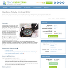
Students design their own logo or picture and use a handheld GPS …
Students design their own logo or picture and use a handheld GPS receiver to map it out. They write out a word or graphic on a field or playground, walk the path, and log GPS data. The results display their "art" on their GPS receiver screen.
Students familiarize themselves â through trial and error â with the basics …
Students familiarize themselves â through trial and error â with the basics of GPS receiver operation. They view a receiver's satellite visibility screen as they walk in various directions and monitor their progress on the receiver's map. Students may enter waypoints and use the GPS information to guide them back to specific locations.
Students go on a GPS scavenger hunt. They use GPS receivers to …
Students go on a GPS scavenger hunt. They use GPS receivers to find designated waypoints and report back on what they found. They compute distances between waypoints based on the latitude and longitude, and compare with the distance the receiver finds.
During a scavenger hunt and an art project, students learn how to …
During a scavenger hunt and an art project, students learn how to use a handheld GPS receiver for personal navigation. Teachers can request assistance from the Institute of Navigation to find nearby members with experience in using GPS and in locating receivers to use.
In this lesson, students will investigate error. As shown in earlier activities …
In this lesson, students will investigate error. As shown in earlier activities from navigation lessons 1 through 3, without an understanding of how errors can affect your position, you cannot navigate well. Introducing accuracy and precision will develop these concepts further. Also, students will learn how computers can help in navigation. Often, the calculations needed to navigate accurately are time consuming and complex. By using the power of computers to do calculations and repetitive tasks, one can quickly see how changing parameters likes angles and distances and introducing errors will affect their overall result.
In this lesson, students learn how to determine location by triangulation. We …
In this lesson, students learn how to determine location by triangulation. We describe the process of triangulation and practice finding your location on a worksheet, in the classroom, and outdoors.
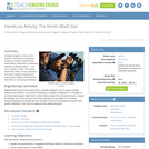
In this lesson, students will learn how great navigators of the past …
In this lesson, students will learn how great navigators of the past stayed on course that is, the historical methods of navigation. The concepts of dead reckoning and celestial navigation are discussed.
In past times, ocean navigators tossed a piece of wood over the …
In past times, ocean navigators tossed a piece of wood over the side of their ships and noted how long until the ship passed the wood. They used this time measurement and the length of the ship to calculate their speed and estimate how far they had traveled. In this activity, students act the part of a GPS signal traveling to the receiver to learn how travel time is converted to distance.
In this activity, students explore the importance of charts to navigation on …
In this activity, students explore the importance of charts to navigation on bodies of water. Using one worksheet, students learn to read the major map features found on a real nautical chart. Using another worksheet, students draw their own nautical chart using the symbols and identifying information learned.
For thousands of years, navigators have looked to the sky for direction. …
For thousands of years, navigators have looked to the sky for direction. Today, celestial navigation has simply switched from using natural objects to human-created satellites. A constellation of satellites, called the Global Positioning System, and hand-held receivers allow for very accurate navigation. In this lesson, students investigate the fundamental concepts of GPS technology trilateration and using the speed of light to calculate distances.
In this lesson, students will learn that math is important in navigation …
In this lesson, students will learn that math is important in navigation and engineering. Ancient land and sea navigators started with the most basic of navigation equations (Speed x Time = Distance). Today, navigational satellites use equations that take into account the relative effects of space and time. However, even these high-tech wonders cannot be built without pure and simple math concepts basic geometry and trigonometry that have been used for thousands of years. In this lesson, these basic concepts are discussed and illustrated in the associated activities.
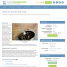
Normally we find things using landmark navigation. When you move to a …
Normally we find things using landmark navigation. When you move to a new place, it may take you awhile to explore the new streets and buildings, but eventually you recognize enough landmarks and remember where they are in relation to each other. However, another accurate method for locating places and things is using grids and coordinates. In this activity, students will come up with their own system of a grid and coordinates for their classroom and understand why it is important to have one common method of map-making.
Celestial navigation is the art and science of finding one's geographic position …
Celestial navigation is the art and science of finding one's geographic position by means of astronomical observations, particularly by measuring altitudes of celestial objects sun, moon, planets or stars. This activity starts with a basic, but very important and useful, celestial measurement: measuring the altitude of Polaris (the North Star) or measuring the latitude.
Students create and use their own simple compasses, which are each made …
Students create and use their own simple compasses, which are each made from a bowl of water, strong magnet, stick pin and Styrofoam peanuts. They learn how compasses work and about cardinal directions. They come to understand that the Earth's magnetic field has both horizontal and vertical components.
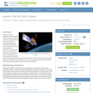
Students learn how engineers navigate satellites in orbit around the Earth and …
Students learn how engineers navigate satellites in orbit around the Earth and on their way to other planets in the solar system. In accompanying activities, they explore how ground-based tracking and onboard measurements are performed. Also provided is an overview of orbits and spacecraft trajectories from Earth to other planets, and how spacecraft are tracked from the ground using the Deep Space Network (DSN). DSN measurements are the primary means for navigating unmanned vehicles in space. Onboard spacecraft instruments might include optical sensors and an inertial measurement unit (IMU).
No restrictions on your remixing, redistributing, or making derivative works. Give credit to the author, as required.
Your remixing, redistributing, or making derivatives works comes with some restrictions, including how it is shared.
Your redistributing comes with some restrictions. Do not remix or make derivative works.
Most restrictive license type. Prohibits most uses, sharing, and any changes.
Copyrighted materials, available under Fair Use and the TEACH Act for US-based educators, or other custom arrangements. Go to the resource provider to see their individual restrictions.