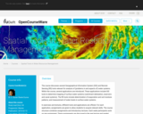
Students learn about the remote sensing radio occultation technique and how engineers …
Students learn about the remote sensing radio occultation technique and how engineers use it with GPS satellites to monitor and study the Earth's atmospheric activity. Students may be familiar with some everyday uses of GPS, but not as familiar with how GPS technology contributes to our ongoing need for great amounts of ever-changing global atmospheric data for accurate weather forecasting, storm tracking and climate change monitoring. GPS occultations are when GPS signals sent from one satellite to another are altered (delayed, refracted) by the atmosphere passed though, such that they can be analyzed to remotely learn about the planet's atmospheric conditions.
The purpose of this resource is to help students understand the connection …
The purpose of this resource is to help students understand the connection between remote sensing, computer imagery, and land cover assessment. Students translate their maps created in the beginning activity into digital code and exchange the digitized versions of their maps with students in another school.
The purpose of this resource is to familiarize students with the importance …
The purpose of this resource is to familiarize students with the importance of perspective and various scales of remotely sensed data. Students create a 3-D model of an area and develop a classification system for the landforms in their model. The maps can then be used to answer certain questions about the environment.
This course explores the detection and measurement of radio and optical signals …
This course explores the detection and measurement of radio and optical signals encountered in communications, astronomy, remote sensing, instrumentation, and radar. Topics covered include: statistical analysis of signal processing systems, including radiometers, spectrometers, interferometers, and digital correlation systems; matched filters and ambiguity functions; communications channel performance; measurement of random electromagnetic fields, angular filtering properties of antennas, interferometers, and aperture synthesis systems; and radiative transfer and parameter estimation.
This introductory book on Remote Sensing is intended to be the equivalent …
This introductory book on Remote Sensing is intended to be the equivalent of a textbook for an undergraduate-level university course. There is also a French version titled "Télédétection".
These guides offer different options for viewing remotely sensed data. They are …
These guides offer different options for viewing remotely sensed data. They are presented with some specific instructions on how to view data with common and freely available software. Information is also provided to process satellite imagery to make it easier to identify a variety of land cover features. All guides can be viewed online or downloaded in PDF format.
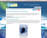
This article describes Katy Farness' work with the Byrd Polar Research Center …
This article describes Katy Farness' work with the Byrd Polar Research Center at the Ohio State University. Farness used remote sensing images and computer technology to create detailed images of Antarctica and the ice sheets of Greenland.
This site provides fun activities for children to do and make, while …
This site provides fun activities for children to do and make, while they learn about space and Earth science, and the technology that enables science. The Teachers Corner on the WWW site contains curriculum supplements originally published in the ITEA (International Technology Education Association) Technology Transfer Teacher magazine.
The course discusses several Geopgraphical Information System (GIS) and Remote Sensing (RS) …
The course discusses several Geopgraphical Information System (GIS) and Remote Sensing (RS) tools relevant for analysis of (problems in and aspects of) water systems. Within the course, several applications are introduced. These applications include GIS tools to determine mapping of surface water systems (catchment delineation, reservoirs and canal systems). The RS tools include determination of evaporation and soil moisture patterns, and measurement of water levels in surface water systems. In exercises and lectures, different tools and applications are offered. For each application, assignments are given to allow students to acquire relevant skills. The course structure combines assignments and introductory lectures. Each week participants work on one assignment. These assignments are discussed in the next lecture and graded. Each week a new assignment is introduced, together with supporting materials (an article discussing the relevant application) and lectures (introducing theoretical issues). The study material of the course consists of a study guide, assignments, lecture material and articles. The final mark is the average of the grades of the individual assignments.
This book provides an introduction, at academic level, into the field of …
This book provides an introduction, at academic level, into the field of surveying and mapping. The book has been compiled based on hand-outs and readers written for the third-year course Surveying and Mapping, in the bachelor program Civil Engineering at Delft University of Technology. This book covers a wide range of measurement techniques, from land surveying, GPS/GNSS and remote sensing to the associated data processing, the underlying coordinate reference systems, as well as the analysis and visualization of the acquired geospatial information.
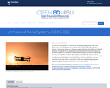
Unmanned Aerial Systems, or drones, are developing aggressively, and many government and …
Unmanned Aerial Systems, or drones, are developing aggressively, and many government and non-government agencies are considering acquiring such systems. This course will focus on the geo-spatial utilization of a UAS. It will cultivate students' knowledge of the capabilities and limitations of the UAS and data post-processing systems. It introduces fundamental concepts surrounding operating a UAS such as strategies for selecting the right UAS, assessing its performance, managing resulting products (i.e. imagery), selecting the appropriate commercially available processing software, assessing product accuracy, figuring ways and means of producing metric products from UAS, and understanding rules and regulations governing operating a UAS in the United States.
No restrictions on your remixing, redistributing, or making derivative works. Give credit to the author, as required.
Your remixing, redistributing, or making derivatives works comes with some restrictions, including how it is shared.
Your redistributing comes with some restrictions. Do not remix or make derivative works.
Most restrictive license type. Prohibits most uses, sharing, and any changes.
Copyrighted materials, available under Fair Use and the TEACH Act for US-based educators, or other custom arrangements. Go to the resource provider to see their individual restrictions.