Lab instructions for Environmental Geology students Word Count: 19773 (Note: This resource's …
Lab instructions for Environmental Geology students
Word Count: 19773
(Note: This resource's metadata has been created automatically by reformatting and/or combining the information that the author initially provided as part of a bulk import process.)
This class explores the foundations of the environmental justice movement, current and …
This class explores the foundations of the environmental justice movement, current and emerging issues, and the application of environmental justice analysis to environmental policy and planning. It examines claims made by diverse groups along with the policy and civil society responses that address perceived inequity and injustice. While focused mainly on the United States, international issues and perspectives are also considered.
This seminar introduces students to basic principles of environmental justice and presents …
This seminar introduces students to basic principles of environmental justice and presents frameworks for analyzing and addressing inequalities in the distribution of environmental benefits and burdens from the perspectives of social science, public policy, and law.
Students will practice planning for dates and discussing celebrations. Students will gain …
Students will practice planning for dates and discussing celebrations. Students will gain experience talking about how they celebrate different holidays.
It includes guidance on how the unit was structured and sequenced and …
It includes guidance on how the unit was structured and sequenced and can be used while interacting with the Ochre resources. The plan also allows teachers to see an example of planning for a sequence of lessons and reflect on their own teaching and effective practice. The unit plan is annotated to explicitly show some of the decisions that are made during the planning process.
This unit plan was developed by Ochre Education and science teacher Darcie …
This unit plan was developed by Ochre Education and science teacher Darcie Clarke. It outlines her approach to teaching a Year 8 unit of science on cells, organs and tissues. It includes guidance on how the unit was structured and sequenced and can be used while interacting with the Ochre resources. The plan also allows teachers to see an example of planning for a sequence of lessons and reflect on their own teaching and effective practice. The unit plan is annotated to explicitly show some of the decisions that are made during the planning process.
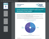
This checklist can be used to plan the implementation of your school’s …
This checklist can be used to plan the implementation of your school’s approaches for engaging with families to support student learning. It is based on work by Evidence for Learning, showing implementation in school as a series of stages relating to thinking about, preparing for, delivering, and sustaining change. This checklist can be paired with AERO’s Promising approaches audit tool – secondary school leaders, which will help schools determine the promising approaches areas requiring most attention.
Georgia Southern Team for IHE Accessibility in OER Implementation Guide. This is …
Georgia Southern Team for IHE Accessibility in OER Implementation Guide. This is a brief Landscape Analysis to uncover key structures and supports to help guide our work to support Accessibility in OER.
In this assignment, each student works in a group of 4-5 students …
In this assignment, each student works in a group of 4-5 students to have an in-depth reading of the two chapters from an Open Education Resource (OER) book https://pdx.pressbooks.pub/urbandevelopment/ (https://pdx.pressbooks.pub/urbandevelopment/). Each student applies the learned knowledge to a city of their choice. Students may continue to examine this selected city in later case study assignments.
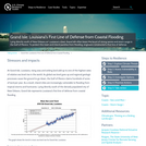
Lying directly south of New Orleans on Louisianas coast, Grand Isle often …
Lying directly south of New Orleans on Louisianas coast, Grand Isle often bears the brunt of strong waves and storm surge in the Gulf of Mexico. To protect this town and inland parishes from flooding, engineers constructed a first line of defense.
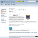
This module was developed at the School of Public Health, University for …
This module was developed at the School of Public Health, University for the Western Cape for the Postgraduate Certificate in Public Health which was offered as a distance learning module between 2001 and 2008. Health management is considered an important skill area for Public Health professionals. The module covers three key management areas: people management, planning and resource management. Through exploring these areas, the module aims to provide information and assistance at a practical level, continually referring the student to management issues within their own context.Ę As management is cross-cutting in relation to other Public Health fields, the student is also expected to relate much of the management study material to the contexts of the other Certificate modules.
Students teams determine the size of the caverns necessary to house the …
Students teams determine the size of the caverns necessary to house the population of the state of Alabraska from the impending asteroid impact. They measure their classroom to determine area and volume, determine how many people the space could sleep, and scale this number up to accommodate all Alabraskans. They work through problems on a worksheet and perform math conversions between feet/meters and miles/kilometers.
As the digital revolution brings with it radical changes in how and …
As the digital revolution brings with it radical changes in how and what we learn, people must continue to learn all the time. New technologies make possible new approaches to learning, new contexts for learning, new tools to support learning, and new ideas of what can be learned. This course will explore these new opportunities for learning with a special focus on what can be learned through immersive, hands-on activities. Students will participate in (and reflect on) a variety of learning situations, and will use Media Lab technologies to develop new workshops, iteratively run and refine the workshops, and analyze how and what the workshop participants learn.
Human resource or manpower planning is of great important in the general …
Human resource or manpower planning is of great important in the general development and growth of organizations. Thus personnel and Human resources experts, managers and practitioners have now made it known to management that adequate attention be given to it with a view to ensuring better use of other resources especially capital. Organisations have also realized that with increasing competition and complexity in business, more time should be devoted to effective human resources planning to achieve desired goals. Furthermore organisations have known that not only is the overall cost of human resources high , that human element is complex, unpredictable and sometimes difficult to develop or change unlike capital that is relatively easier to acquire, manager or control.
Word Count: 9676 (Note: This resource's metadata has been created automatically by …
Word Count: 9676
(Note: This resource's metadata has been created automatically by reformatting and/or combining the information that the author initially provided as part of a bulk import process.)
21.6–8.TL.4.1 Identify real-world issues and analyze technological resources for developing and refining …
21.6–8.TL.4.1 Identify real-world issues and analyze technological resources for developing and refining questions for investigation.This activity challenges students to sharpen their observation skills and ability to wonder. Know that virtually any source material/topic could be used. This activity uses the topic hunger as an example.
Word Count: 16123 (Note: This resource's metadata has been created automatically by …
Word Count: 16123
(Note: This resource's metadata has been created automatically by reformatting and/or combining the information that the author initially provided as part of a bulk import process.)
Short Description: A comprehensive manual describing the process of preparing the DJI …
Short Description: A comprehensive manual describing the process of preparing the DJI Phantom 3 Professional for photogrammetric image capture using a pre-programmed mission plan.
Word Count: 4215
(Note: This resource's metadata has been created automatically by reformatting and/or combining the information that the author initially provided as part of a bulk import process.)
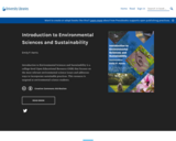
Short Description: Introduction to Environmental Sciences and Sustainability is a college-level Open …
Short Description: Introduction to Environmental Sciences and Sustainability is a college-level Open Educational Resource (OER) that focuses on the most relevant environmental science issues and addresses ways to incorporate sustainable practices. This resource is targeted at environmental science students.
Long Description: Introduction to Environmental Sciences and Sustainability is a college-level Open Educational Resource (OER) that focuses on the most relevant environmental science issues and addresses ways to incorporate sustainable practices. The text is designed for an introductory-level college science course. Topics include the fundamentals of ecology, biodiversity, pollution, climate change, food production, human population growth, and incorporating sustainable approaches in our communities, economies, and environments. This resource is targeted at environmental science students.
Students can print a PDF copy of this text as a hard copy (at the student’s expense). Electronic copies of a PDF or the ebook are available through UWF’s Library Pressbook.
Contributors: Chasidy Hobbs, M.S. and Kwame Owusu-Daaku, Ph.D
Word Count: 118178
(Note: This resource's metadata has been created automatically by reformatting and/or combining the information that the author initially provided as part of a bulk import process.)
No restrictions on your remixing, redistributing, or making derivative works. Give credit to the author, as required.
Your remixing, redistributing, or making derivatives works comes with some restrictions, including how it is shared.
Your redistributing comes with some restrictions. Do not remix or make derivative works.
Most restrictive license type. Prohibits most uses, sharing, and any changes.
Copyrighted materials, available under Fair Use and the TEACH Act for US-based educators, or other custom arrangements. Go to the resource provider to see their individual restrictions.