The course provides students with (1) an introduction to the geologic history …
The course provides students with (1) an introduction to the geologic history of western North America, with particular emphasis on our field camp location and (2) an introduction to both digital and traditional techniques of geological field study. The weather permitting, several weekend field exercises provide practical experience in preparation for Field Geology II (12.115). It presents introductory material on the regional geology of the locale of 12.115.
Students must be able to search for, find, download, display, query and …
Students must be able to search for, find, download, display, query and map hurricane and other relevant GIS data. Hurricane data spans 1851-2008 and is from: http://www.fgdl.org/metadataexplorer/explorer.jsp Countries data is from: http://www.diva-gis.org Learning outcomes: For students be able to successfully use GIS data to answer a basic spatial research question. Many skills are required for this seemingly simple question: creating a correct query that matches the data, understanding hurricane and weather patterns for example.
Geography 468 provides the geospatial information system professional an overview of systems …
Geography 468 provides the geospatial information system professional an overview of systems analysis and design with emphasis on the concepts behind the process, including: business use case modeling, business object modeling, requirements definition, analysis and preliminary design, and, finally, detailed design. The concepts of the geospatial software and database development process are introduced and the current modeling techniques are addressed within the geospatial systems development paradigm. In a series of related activities, students learn about the methods, tools and the concepts of the systems development process to document a portion of a geospatial system with Unified Modeling Language (UML), the standard graphical notation for modeling application needs.
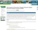
The Digital Shoreline Analysis System (DSAS) is a software extension for ArcGIS …
The Digital Shoreline Analysis System (DSAS) is a software extension for ArcGIS that allows for automated shoreline change calculations along the coast. The user must supply the shoreline data and the software helps the user create measurement locations (transects) and completes the shoreline change calculations at each location. The result is a visual representation of the shoreline change along a coastline. This representation is far more useful for analysis that one overall average. Unusually high rates of erosion/accretion are easily recognized from the resulting map. The study location is Rodanthe, NC. The data used in this exercise is the sample data provided by the USGS.
In GEOG 489, you will learn advanced applications of Python for developing …
In GEOG 489, you will learn advanced applications of Python for developing and customizing GIS software, designing user interfaces, solving complex geoprocessing tasks, and leveraging open source. The course consists of readings, walkthroughs, projects, quizzes, and discussions about advanced GIS programming concepts and techniques, and a final term project. It complements the material covered in GEOG 485: GIS Programming and Customization. Software covered in the course includes: Esri ArcGIS Pro/arcpy, Jupyter Notebook, Esri ArcGIS API for Python, QGIS, GDAL/OGR. Students will also use of the Git version control software for code management, and learn techniques for distributing Python applications to end users.
This is not a typical e-book; it is a free, web-based, open-source …
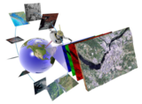
This is not a typical e-book; it is a free, web-based, open-source “textbook” available to anyone interested in using mapping tools to create maps. This e-text focuses primarily on Geographic Information Systems (GIS)—a geospatial technology that enables you to create spatial databases, analyze spatial patterns, and produce maps that communicate more effectively. While this GIS textbook is principally an introduction to GIS, most of the chapter’s concepts are applicable to other geotechnologies including remote sensing, global positioning systems (GPS), Internet mapping, and virtual globes.
Creating good maps and analyzing spatial data is a time consuming and challenging practice, but recently, a new set of powerful mapping tools has enabled almost anyone with a computer to make maps easily and to perform at least some low-level analyses. The results, however, are not encouraging. Most of the new mapmakers do not have adequate training in mapping concepts and spatial analysis principles, and their maps are often improperly designed and do not communicate easily nor effectively. This e-text—GIS Commons—seeks to help you analyze spatial data and communicate more effectively. In short, GIS education is our goal.
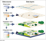
A geographic information system (GIS) is a computer system for capturing, storing, …
A geographic information system (GIS) is a computer system for capturing, storing, checking, and displaying data related to positions on Earth’s surface.
The concept of geocaching is introduced as a way for students to …
The concept of geocaching is introduced as a way for students to explore using a global positioning system (GPS) device and basic geographic information (GIS) skills. Students familiarize themselves with GPS, GIS, and geocaching as well as the concepts of latitude and longitude. They develop the skills and concepts needed to complete the associated activity while considering how these technologies relate to engineering. Students discuss images associated with GPS, watch a video on how GPS is used, and review a slide show of GIS basics. They estimate their location using latitude and longitude on a world map and watch a video that introduces the geocaching phenomenon. Finally, students practice using a GPS device to gain an understanding of the technology and how location and direction features work while sending and receiving data to a GIS such as Google Earth.
Bill Gates is credited with saying he would \hire a lazy person …
Bill Gates is credited with saying he would \hire a lazy person to do a difficult job\" with the justification that \"a lazy person will find an easy way to do it.\" GEOG 485 doesn't teach the lazy way to get the job done, but it does teach the scripting way _ which is arguably even better. You've probably heard the \"give a fish\"/\"teach to fish\" saying? That's the gist of GEOG 485: to equip you, in an ArcGIS context, with the ModelBuilder and Python scripting skills to make your boring, repetitive geoprocessing tasks easier, quicker and automatic _ so you can focus on the more interesting (potentially more valuable) work that you (and your employers) really want you to be doing."
This resource was created as part of a project to develop open-access …
This resource was created as part of a project to develop open-access lab notes for the University of Ottawa's "GIS and the Digital Earth" course and its French counterpart "SIG et la Terre numérique". It contains lab notes for five labs with exercises for this introductory course, as well as the data needed for students to work through the labs. All labs are based on ArcGIS Pro, and requires students to have access to this software.
The GeoTech Center, a National Science Foundation grant to support geospatial programs …
The GeoTech Center, a National Science Foundation grant to support geospatial programs at two-year colleges, developed Model Courses focused on building the skills, competencies, and abilities needed for entry-level occupations in the geospatial industry. Competencies covered in the Model Courses were identified using the Geospatial Technology Competency Model (GTCM) and outcomes from multiple DACUM (“Developing a Curriculum”) events. A panel of geospatial education experts parsed the competencies into the Model Courses for the Certificate and are listed in a Program Content Tool that can be used to see what competencies and depth should be in each course. You can also assess your program from the GTCM Program Assessment Tool tool. All material is distributed freely under a Creative Commons license and can be used with attribution to GeoTech.
This book is about using the power of computers to do things …
This book is about using the power of computers to do things with geographic data. It teaches a range of spatial skills, including: reading, writing and manipulating geographic data; making static and interactive maps; applying geocomputation to solve real-world problems; and modeling geographic phenomena. By demonstrating how various geographic operations can be linked, in reproducible ‘code chunks’ that intersperse the prose, the book also teaches a transparent and thus scientific workflow. Learning how to use the wealth of geospatial tools available from the R command line can be exciting, but creating new ones can be truly liberating. Using the command-line driven approach taught throughout, and programming techniques covered in Chapter 11, can help remove constraints on your creativity imposed by software. After reading the book and completing the exercises, you should therefore feel empowered with a strong understanding of the possibilities opened up by R’s impressive geographic capabilities, new skills to solve real-world problems with geographic data, and the ability to communicate your work with maps and reproducible code.
Essentials of Geographic Information Systems integrates key concepts behind the technology with …
Essentials of Geographic Information Systems integrates key concepts behind the technology with practical concerns and real-world applications. Recognizing that many potential GIS users are nonspecialists or may only need a few maps, this book is designed to be accessible, pragmatic, and concise. Essentials of Geographic Information Systems also illustrates how GIS is used to ask questions, inform choices, and guide policy. From the melting of the polar ice caps to privacy issues associated with mapping, this book provides a gentle, yet substantive, introduction to the use and application of digital maps, mapping, and GIS.
The objective of this assignment is to explore the application of GIS …
The objective of this assignment is to explore the application of GIS in the planning and implementation of renewable energy projects. Students, divided in a group of 3-4, will analyze the geographical suitability, environmental impact, and socio-economic factors involved in the deployment of renewable energy technologies using GIS tools and techniques.
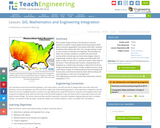
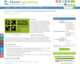
Students take on the role of geographers and civil engineers and use …
Students take on the role of geographers and civil engineers and use a device enabled with the global positioning system (GPS) to locate geocache locations via a number of waypoints. Teams save their data points, upload them to geographic information systems (GIS) software, such as Google Earth, and create scale drawings of their explorations while solving problems of area, perimeter and rates. The activity is unique in its integration of technology for solving mathematical problems and asks students to relate GPS and GIS to engineering.
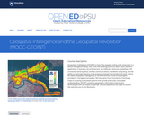
Geographic Intelligence (GEOINT) is more than people working with computers in a …
Geographic Intelligence (GEOINT) is more than people working with computers in a secure intelligence facility. Join us for this exciting journey to learn about GEOINT's application in business, law enforcement, and defense. Advances in satellites, GPS, unmanned aerial systems, wireless communications, handheld computing, and the ability to automate laborious map analysis processes has transformed what used to be called geographic intelligence, or GEOINT, and the nature of the insights provided to managers and leaders. We have gone from mountains of hardcopy maps to amazing automated systems that provide previously unavailable understanding. GEOINT combines geographic information science and technologies with an analytic tradecraft. You will experience the value of GEOINT. We welcome you to the Revolution.
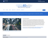
In GEOG 871, we'll take a critical look at geospatial project management. …
In GEOG 871, we'll take a critical look at geospatial project management. Project management is a broad discipline that encompasses technical methods such as system design and analysis and also interpersonal factors that affect professional relationships. Project management is also a discipline that has matured outside of, but can be incorporated into, geospatial technology. By the end of this course, you'll have devised a project plan from a scenario built upon a real-life project involving the city of Metropolis geodatabase. We'll work through each of the components in an organized and logical manner and will incorporate constructive peer review to help everyone achieve the best product possible.
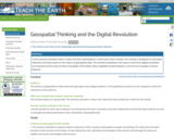
In this exercise students watch a video and then participate in a …
In this exercise students watch a video and then participate in a think-pair-share activity. The activity is designed to stimulate reflection and discussion on the nature of geospatial data. The activity emphasizes the ways in which the digital revolution has transformed the way we think and gather information about spatially located features, and how we navigate to those features.
This class is designed to expose you to the cycles of disasters, …
This class is designed to expose you to the cycles of disasters, the roots of emergency planning in the U.S., how to understand and map vulnerabilities, and expose you to the disaster planning in different contexts, including in developing countries.
No restrictions on your remixing, redistributing, or making derivative works. Give credit to the author, as required.
Your remixing, redistributing, or making derivatives works comes with some restrictions, including how it is shared.
Your redistributing comes with some restrictions. Do not remix or make derivative works.
Most restrictive license type. Prohibits most uses, sharing, and any changes.
Copyrighted materials, available under Fair Use and the TEACH Act for US-based educators, or other custom arrangements. Go to the resource provider to see their individual restrictions.